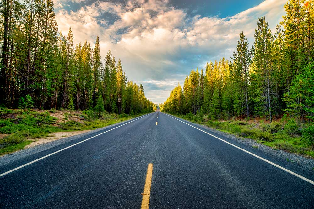
Oregon’s Cascade Lakes are a chain of mountain lakes and reservoirs southwest of Bend, reached along the Cascade Lakes Scenic Byway in the Deschutes National Forest. The full byway covers about 66 miles. For a first visit, choose two or three stops: Sparks Lake for mountain scenery, Hosmer for paddling, or Elk Lake for a beach-and-picnic day.
You don’t need to see every lake to have a good day here. A short shoreline walk, an unhurried lunch and time on the water usually beat a day spent chasing turnoffs. Start with the road status, then choose lakes that suit the people traveling with you.
Which Cascade Lakes should you visit?
| Your priority | Start with | What to consider |
|---|---|---|
| Mountain photos and a shoreline walk | Sparks Lake or Todd Lake | Check access-road conditions; keep to established paths. |
| Paddling and birdwatching | Hosmer Lake | Marshy shoreline limits bank access. Share narrow passages with anglers. |
| A beach day with resort services nearby | Elk Lake | Popular summer stop; confirm resort hours and rentals. |
| Powerboats and watersports | Cultus Lake | Expect motorized activity; paddlers should account for wakes. |
| A smaller-lake camping trip | Little Cultus or the Twin Lakes | Check the exact campground’s facilities and boat rules. |
| A fishing-focused trip | Lava Lake, Crane Prairie or Wickiup | Rules, water levels and usable ramps vary by lake and date. |
These are starting points, rather than promises of calm water or an empty beach. A windy day, low water, smoke or a full parking area can change the plan. Keep a second stop in mind and leave time to turn around.
Cascade Lakes Scenic Byway route and map
From Bend, follow Century Drive toward Mt. Bachelor and continue onto the Cascade Lakes Highway, commonly signed as Road 46. The southern approach connects with Highway 58 through Forest Road 61 near Crescent Lake. The advertised 66 miles describes the byway; it is not the mileage of every out-and-back day trip from your hotel.
Use the Forest Service byway map and interpretive guide to place the lakes, then check current road information. Todd, Sparks and Devils lakes are in the northern group beyond Mt. Bachelor. Elk and Hosmer lie farther south, followed by the Lava and Cultus lake areas. Crane Prairie, the Twin Lakes, Wickiup and Davis Lake give you more options toward the southern end. Some stops require side roads.
Budget roughly 3–5 hours for a scenic drive with brief stops, and a full day if you add a paddle, a substantial hike or several lake visits. That planning allowance excludes travel to and from the byway and cannot cover every activity. Download maps before leaving town, fill the fuel tank and bring food and drinking water.
Best season and Cascade Lakes Highway road status
July through September is a practical starting window for a first summer lake trip, subject to snow, smoke and local closures. Spring openings vary, and opening the main highway does not mean every campground, trail or lake access road is ready.
Check Deschutes County’s current road status before setting out. At this guide’s October 3, 2026 review, the county listed the highway as open following its May 7 opening. That is a dated observation, not a promise for your travel date. Seasonal gates close when winter conditions return; the lakes route beyond Mt. Bachelor is not a year-round driving loop.
Early summer can mean lingering snow and mosquitoes. Midsummer offers longer days but more competition for popular parking and campsites. Fall gives you less daylight and colder weather, and services may wind down before the road closes. For smoky or stormy weather, keep a Bend-based alternative instead of treating the full drive as mandatory.
Lake stops along the byway
Mt. Bachelor and the Deschutes River approach
The mountain views begin before the first lake. Mt. Bachelor and Broken Top are landmarks along the northern approach, and river-side roads near Bend offer a different kind of outing. Our Deschutes River guide explains how the river sections differ. Check Mt. Bachelor’s official site for the activities and operating dates available during your visit.
Todd Lake
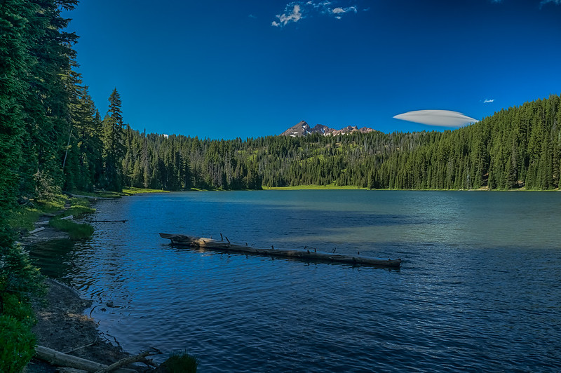
Todd Lake is a good choice when you want to leave the car and walk beside a small mountain lake. The Forest Service describes a 1.5-mile trail around the lake; allow for the approach from parking as well. Stay on established tread through the meadows rather than creating shortcuts for photographs.
Separate a lakeside outing from a hike farther into the Three Sisters Wilderness. The Todd wilderness trailhead appears in the limited-entry permit system, so check the route and boundary before extending your walk. A parking pass does not authorize wilderness entry.
Devils Lake
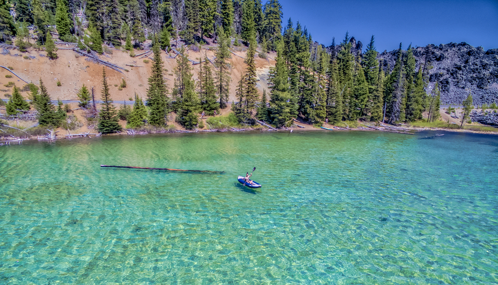
The turquoise water makes Devils Lake an easy stop to remember. Choose it for a picnic, a short shoreline visit or a paddle when conditions suit your ability. ODFW identifies it as a non-motorized boating lake. It is Central Oregon’s Devils Lake, not the lake beside Lincoln City on the Oregon Coast.
The nearby Devils Lake/Wickiup trailhead is also a starting point for South Sister. Visiting the lake and climbing South Sister are very different plans: check the wilderness permit, weather, snow and route requirements before committing to the climb.
Sparks Lake

Sparks Lake is the mountain-view stop many visitors picture when they think of the Cascade Lakes. The Ray Atkeson Memorial Trail offers a way to enjoy the landscape from shore, while paddlers get a different view from the water. Read our Sparks Lake story for more of its scenery.
Check access and water levels before arriving with a boat. Shallow water can change where you launch and how far you can paddle. Shoreline lava is uneven, so choose footwear for the walk and do not assume every viewpoint is wheelchair accessible. For fishing, check Sparks Lake’s named entry in the current regulations rather than applying a general trout rule.
Elk Lake
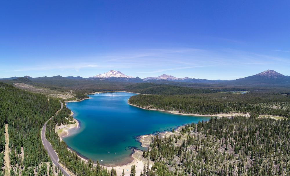
Elk Lake suits visitors who want to make one lake the center of their day: beach time, paddling, camping or a meal near the water. Resort services can make planning easier, but check Elk Lake Resort’s current visitor information for hours, reservations and seasonal access. The resort currently does not offer public day-use boat launching; choose an appropriate public access site rather than assuming you can launch at its dock.
It is a popular summer destination, so arrive with time to find legal parking. Wind can make an exposed lake outing much harder than it looked from shore. Winter resort access also needs advance planning; do not expect to drive the summer lake route after the gates close.
Hosmer Lake
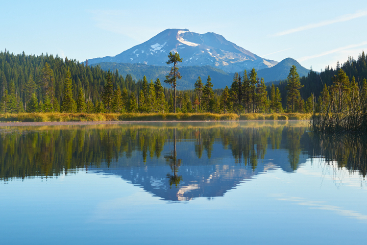
Hosmer is a strong choice for canoeing, kayaking and birdwatching among reed-lined water and mountain reflections. The Mallard Marsh campground description notes that marshy vegetation limits shore access. Give anglers room and avoid blocking the narrower passages with a group of boats.
ODFW’s current guidance restricts fishing to flies with barbless hooks, requires catch-and-release for all species and allows electric motors only. Confirm the rules before your trip. Mallard Marsh and South Campground serve this lake; South Twin Lake is a separate destination farther south.
Lava Lake and Little Lava Lake
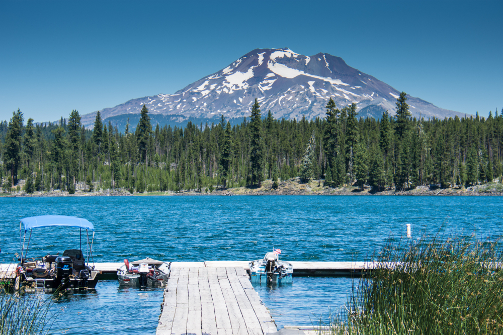
These are two neighboring lakes in the Cascade Lakes corridor, not the lakes inside Newberry’s caldera. Lava Lake is a fishing and camping stop; nearby Little Lava Lake is the headwaters of the Deschutes River. They work well as a slower-paced addition after the northern lakes.
Bring the supplies you need and verify any resort, rental or campground service before relying on it. ODFW reports rainbow trout at Lava Lake and rainbow and brook trout at Little Lava. Water conditions and fishing rules should come from the current lake report, not an assumed regional species list.
Cultus Lake and Little Cultus Lake
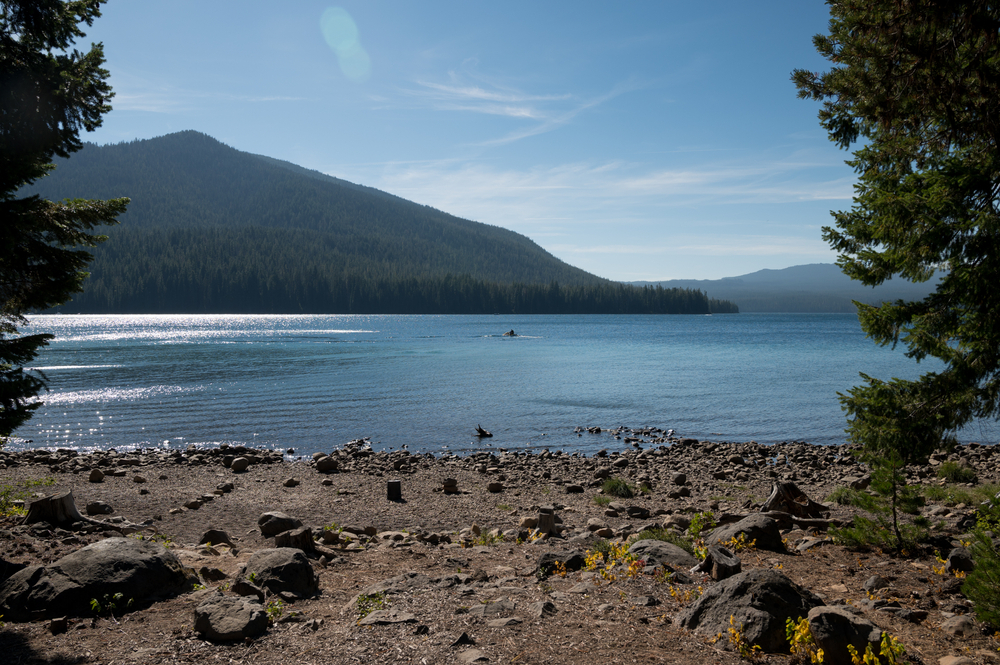
Choose Cultus when motorized watersports are part of the plan. Its official campground listing specifically describes high-speed motorized boating, swimming and waterskiing. That makes it a different experience from Hosmer’s slower paddling routes.
Little Cultus offers a smaller-lake alternative nearby. Check its own access and boating rules rather than assuming both lakes operate the same way. For an RV stay, verify the chosen site’s dimensions: the Cultus listing advises against larger RVs because roads and campsites are narrow. In fall, bring water even when a campground normally has a water system.
Crane Prairie Reservoir, the Twin Lakes and Wickiup
Crane Prairie and Wickiup are reservoirs, so their shorelines and launch access can change considerably as water is drawn down. They are better planned around a specific fishing, camping or boating goal than treated as guaranteed substitutes for an alpine beach day. Check current ramp conditions before towing a boat.
North and South Twin Lakes add smaller-water choices in this part of the corridor. Check each lake’s boat rules and campground facilities individually; a resort stay, a developed campground and a primitive campsite are different bookings.
For Crane Prairie and Wickiup fishing, consult ODFW’s lake entries and in-season updates, including seasonal closures and restrictions on particular arms of the reservoir. Do not assume the whole lake follows one year-round rule. The Marine Board’s access report is another useful check for boating conditions.
Davis Lake and the southern end
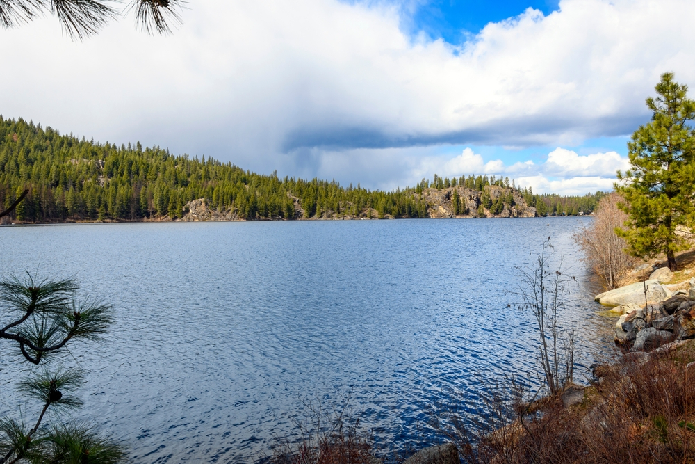
Davis is a shallow, lava-dammed lake near the southern end of the route. Its water and access conditions matter more to trip planning than a fixed depth claim.
ODFW identifies rainbow trout and largemouth bass here. Its current guidance requires fly fishing with barbless hooks and catch-and-release for trout. Check the latest conditions before making this your main stop; low water can change the experience substantially.
Two manageable day plans from Bend
First visit, mostly scenery: Start with the Mt. Bachelor approach, choose either a Todd Lake walk or a Sparks Lake shoreline visit, then spend the main part of the afternoon at Elk Lake. Return the way you came. This keeps the day focused instead of requiring every southern lake.
Paddling day: Choose Hosmer as the main outing, bring a picnic and leave one nearby lake as an optional stop. Put launching, time on the water, packing up and the return drive into your schedule. If wind or weather is unsuitable, switch to a shore-based day rather than trying to complete the itinerary at any cost.
For a longer camping trip, spread the northern lakes and southern reservoirs over separate days. Our Bend-area camping guide and Oregon lakes guide help compare this corridor with other options.
Parking passes, wilderness permits and boat permits
Parking: Designated Forest Service fee sites may require a recreation pass. The Northwest Forest Pass is $30 annually, and the National Forest Day Pass is $5. Check the exact site’s accepted passes and any concession-operated fees. Camping and resort charges are separate.
Wilderness hiking: During the June 15–October 15 permit season, limited-entry day permits apply at specified Central Cascades trailheads, including Green Lakes/Soda Creek, Todd and Devils Lake/Wickiup. Use the official day-use permit page to check your entry point. Overnight trips in the Three Sisters, Mt. Jefferson and Mt. Washington wilderness areas require the appropriate overnight permit during that season. Day hiking and overnight camping have different reservations; a developed lake campground booking is another separate arrangement.
Paddling: Oregon’s 2026 Waterway Access Permit rules removed the former under-10-foot exemption. Check the Marine Board’s current requirements and exemptions for your kayak, canoe, paddleboard or inflatable. Wear a properly fitted life jacket and clean, drain and dry equipment between waters.
Fishing: Carry the required license and consult the Central Zone regulations plus the current ODFW report. Lake-specific methods, harvest rules, seasons and emergency changes take priority over a general zone summary.
Camping, family visits and accessibility
Book the exact campground or resort you intend to use, and read its current facilities and alerts. Do not assume every lakeside campground has showers, drinking water, hookups or boat rentals. Mallard Marsh, for example, tells campers to bring their own water. Campground closing dates can differ from the highway’s gate dates.
For children, a short shoreline visit and picnic can be a more comfortable introduction than a long paddle or wilderness hike. Cold water, slippery banks and changing wind deserve attention even at small lakes. Choose a launch you can manage, supervise children closely and leave enough energy for the return trip.
Accessibility depends on the specific parking space, toilet, route surface and water level. A scenic drive offers views with little walking, but “lakeside” does not guarantee a step-free route to the water. Ask the land manager or campground operator about the facilities you need before reserving.
Use designated parking, keep access lanes clear and follow posted dog and leash rules. Stay out of fragile meadows, pack out litter and follow our Leave No Trace guide. Check forest alerts and current fire restrictions; a fire ring does not by itself mean campfires are allowed.
Winter visits require a different plan
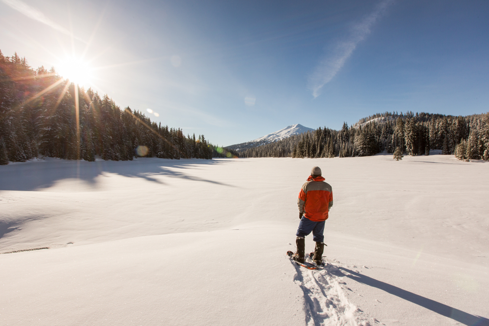
Winter trips focus on accessible sno-parks, Mt. Bachelor and planned snow recreation rather than the full summer lake drive. Check road gates, sno-park requirements, weather and the appropriate route before leaving Bend. Carrying snow equipment does not make a closed road open, and an attractive frozen lake is not proof of safe ice.
A little byway history
Volcanic activity and glaciers shaped this landscape, but the lakes do not all have the same origin. Davis is lava-dammed; North and South Twin are volcanic maar lakes. The road became a National Forest Scenic Byway in 1989 and a National Scenic Byway in 1998. Earlier red-cinder surfacing helped make Century Drive a recognizable Central Oregon road. The Forest Service interpretive guide above adds context to the scenery without needing a separate history detour.
Cascade Lakes: quick answers
Where are the Cascade Lakes in Oregon?
Southwest of Bend in the Deschutes National Forest, along and near the Cascade Lakes Scenic Byway on the east side of the Cascade Range.
How long is the Cascade Lakes Scenic Byway?
About 66 miles for the full byway. Allow several hours for a drive with brief stops, or a full day when you add lake activities. Your return drive and side roads add mileage.
Is the Cascade Lakes Highway open all year?
No. The high-elevation lake route closes seasonally for winter. Check Deschutes County’s current status; access to Mt. Bachelor does not mean the entire byway is open.
Do you need a permit just to visit a lake?
A lake visit, fee-site parking, a wilderness hike and boating have different requirements. Check the chosen day-use site, trailhead and boat rules rather than buying one pass and assuming it covers everything.
Which Cascade Lake is best for kayaking?
Hosmer is a good starting choice for reed-lined paddling and birdwatching. Sparks offers mountain scenery, while Elk can pair paddling with a beach day. Choose according to wind, water, launch access and your experience.
Planning information reviewed October 3, 2026 using the Forest Service, Deschutes County, Recreation.gov, ODFW and Oregon State Marine Board sources linked above. Road access, permits, water levels, services and restrictions can change; recheck the official pages for your travel dates.