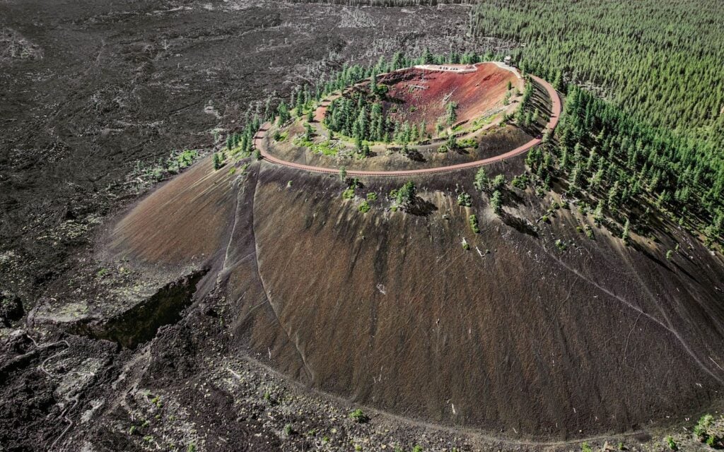
From the top of Lava Butte, the forest gives way to an expanse of broken black lava. A road curls around the red cinder cone below you, the Cascades line the western horizon on a clear day, and a short trail follows the edge of the crater that helped build this landscape.
It is an extraordinary amount of geology for a stop just south of Bend. You can look into a volcanic crater, walk through an ancient lava flow, and learn how an eruption changed the course of the Deschutes River—all without planning a backcountry expedition.
There is one detail worth getting right before you go: the quarter-mile crater loop begins at the summit. Getting there is a separate part of the visit, with access that changes by season. Here is how to plan Lava Butte, what the volcano actually is, and how to fit it into a trip using our Bend guide to things to do, places to eat, and where to stay.
Lava Butte at a glance
- Where: Lava Lands Visitor Center, about 11 miles south of Bend off U.S. Highway 97.
- What it is: A roughly 7,000-year-old cinder cone on the northwest flank of Newberry Volcano, within Newberry National Volcanic Monument.
- Height: About 500 feet above the surrounding landscape—not 500 feet above sea level.
- The crater walk: Approximately a quarter-mile loop on cinders, with uneven footing and changes in elevation.
- Our suggested visit: Allow two to three hours for the summit, visitor center, and a lava-field walk when services are operating. Add time if you walk up the summit road.
- Best fit: Travelers who want volcanic scenery and short interpretive walks close to Bend or Sunriver.
- Check first: The Forest Service’s Lava Butte page for access, fees, and alerts.
Yes, Lava Butte really is volcanic
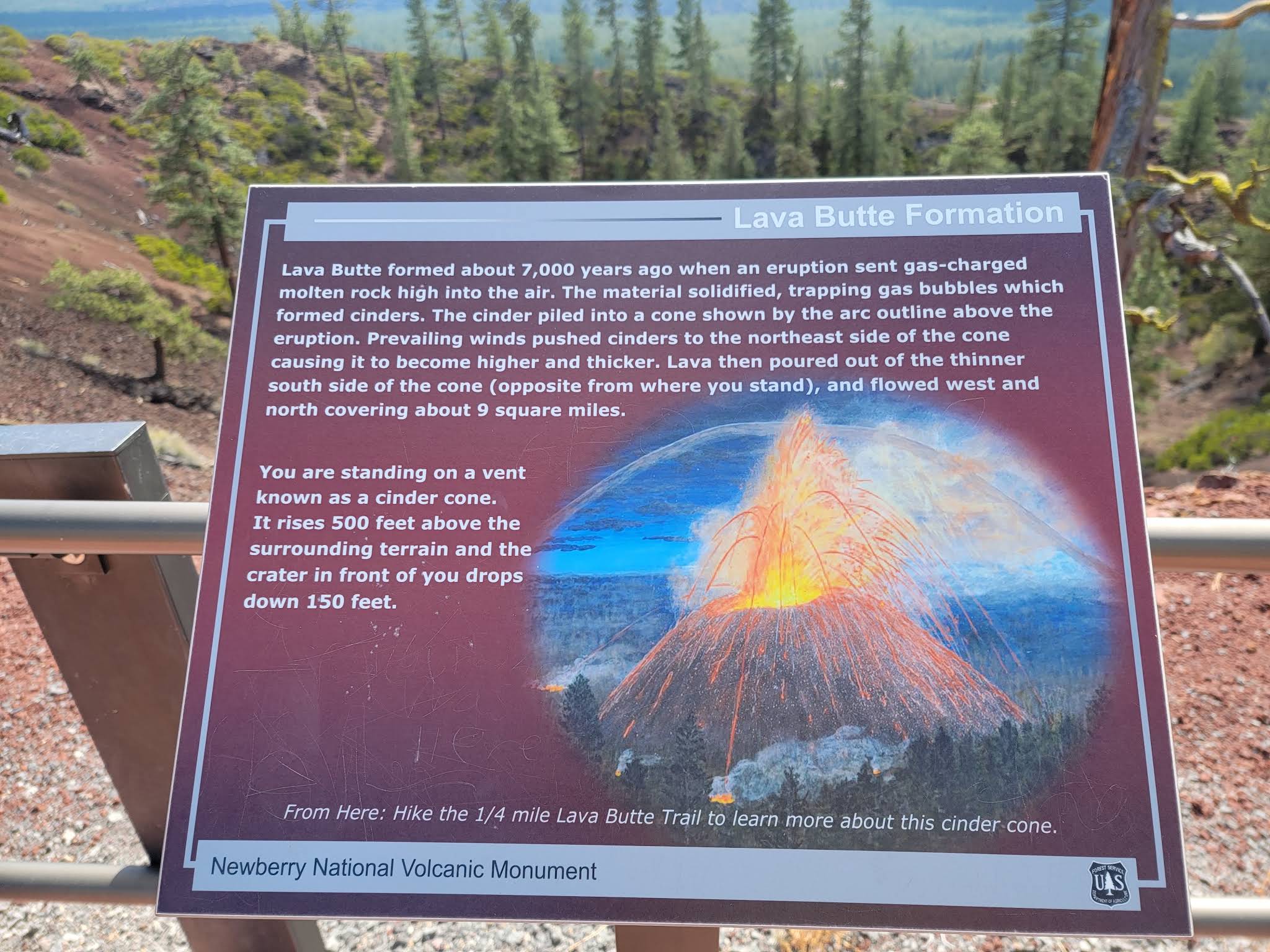
Lava Butte is a cinder cone: a hill built as fragments of lava erupted from a vent, cooled, and accumulated around it. Lava also escaped and spread across the surrounding terrain. The cone and the rough lava field beside it are related parts of the same eruption.
That makes “volcanic crater” an accurate description of the depression at the summit. It is not an impact crater or an ordinary hill that happens to sit near a volcano.
The larger setting matters, too. Lava Butte is one of the volcanic features associated with Newberry Volcano. It sits on Newberry’s northwest flank, outside the much larger summit caldera containing Paulina Lake and East Lake. Those lakes and Lava Butte belong to the same broader volcanic landscape, but they are separate destinations.
According to the U.S. Geological Survey, Lava Butte’s eruption about 7,000 years ago sent lava west to the Deschutes River, temporarily blocking it and permanently diverting its course. That connection gives the black rock a story beyond its unusual appearance: the eruption helped rearrange the country people now visit for river walks and outdoor recreation.
The age of Lava Butte should not be confused with the date of Newberry’s most recent eruption. A USGS field guide to Newberry places the younger Big Obsidian Flow eruption at about 1,300 years ago. Calling the entire volcano “quiet for 7,000 years” would miss that history.
What the crater-rim walk is actually like
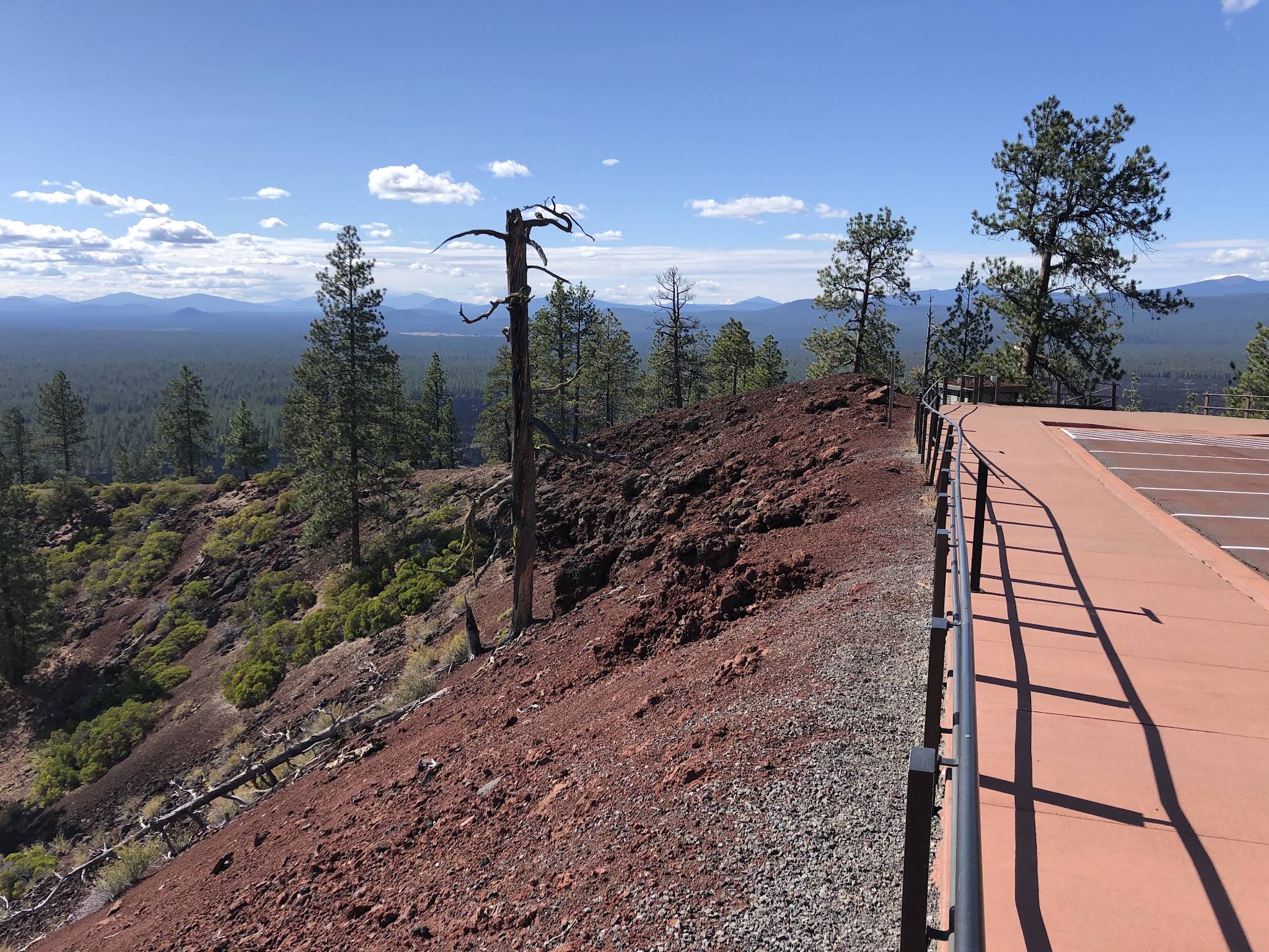
The summit loop is short enough to appeal to travelers who are not looking for a long hike, but its appeal goes well beyond distance. From different points along the rim, you can look into the crater, across the lava field, and toward the Cascade skyline. Move a little farther along and the relationship between the cone, the forest, and the flow becomes easier to read.
Expect a cinder surface rather than a continuous sidewalk. Loose material can shift underfoot, and the route includes rises and dips. The Forest Service’s Volcanic Vistas visitor guide lists the rim loop at about a quarter mile with 150 feet of elevation gain. A short trail can still require care, particularly for anyone with balance or mobility concerns.
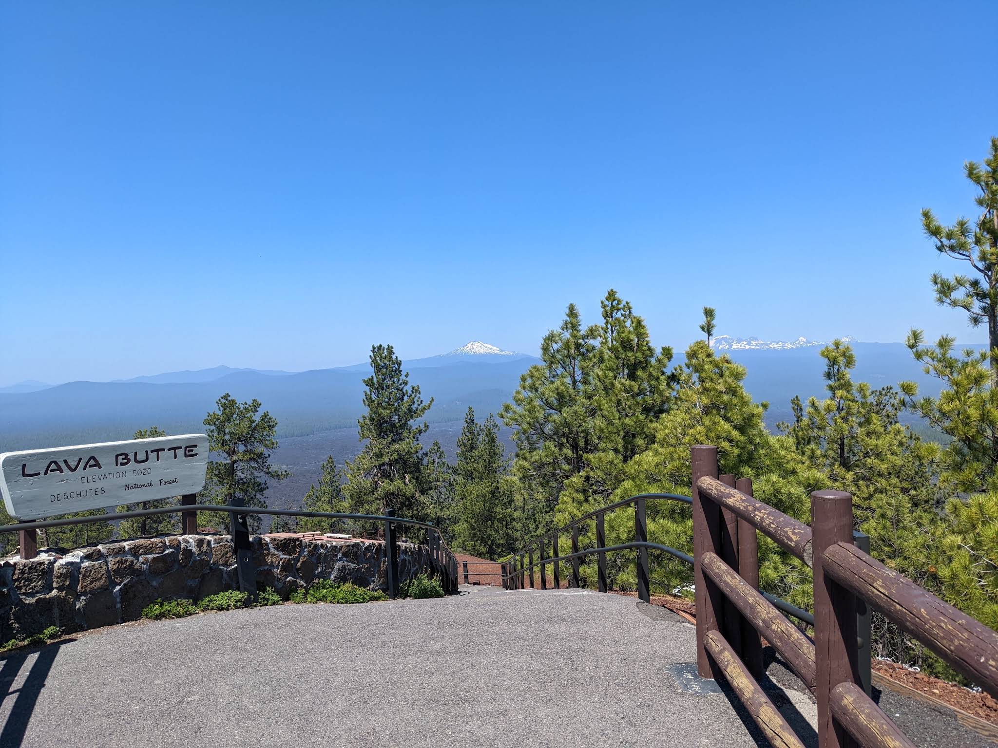
Give yourself permission to stop frequently. The view is the point. On a clear day, look for familiar Central Oregon peaks such as Mount Bachelor, Broken Top, and the Three Sisters. Clouds, haze, and wildfire smoke can limit the panorama, so do not judge the entire visit by whether every distant mountain is visible.
Stay on the established trail around the rim. There is no need to descend into the crater or scramble down the cone to appreciate it. For children, make the outing a slow walk with an adult close by, particularly where the trail edges feel exposed.
Getting to the summit: shuttle, vehicle permit, or walk
The access arrangements are the biggest planning variable at Lava Butte. A description that simply says “drive to the top” can leave you with the wrong expectations, especially during the summer shuttle season.
During the shuttle season
Seasonal service carries visitors from Lava Lands to the summit. For 2026, the advertised season ran from June 13 through September 7, with service generally between 10 a.m. and 4:30 p.m. and departures about every 20 minutes, subject to breaks and operating conditions. The listed fare was $5 per person, with children five and younger riding free.
Check Cascades East Transit’s Lava Butte service page for the current season and schedule before traveling. Tickets have been available through the Lava Lands bookstore and the CET Go app. Do not build a future trip around an old review’s fare, payment instructions, or departure time.
Private vehicles are prohibited on the summit road on shuttle operating days. If you want the summit without the uphill walk, organize the rest of your visit around the available transportation and leave room for a wait.
Outside the shuttle season
When vehicle access is available, the Forest Service issues free, first-come timed permits at the Lava Lands Welcome Station. The narrow road has limited capacity, so arriving outside shuttle season does not mean unrestricted access. Vehicles longer than 22 feet are prohibited.
Driving access is tied to visitor-center operating hours and conditions. An open parking area at the base is not proof that the summit road is open to cars.
Walking up the road
Walking changes the scale of the outing. The road climbs roughly 1.75 miles to the summit, according to the Forest Service’s visitor guide. That means about 3.5 miles out and back before adding the crater loop or any trails at the base.
Treat it as an uphill hike rather than a quick extension of the quarter-mile rim walk. Carry enough water for the climb and return, account for sun and weather, and watch for authorized road traffic. The Forest Service lists nonmotorized access from dawn to dusk, subject to closures and conditions; that is a different arrangement from staffed visitor services.
Do not skip the lava-field trails below
The summit shows the eruption’s footprint. A walk at the base puts you beside the rock itself. Pairing both gives a much fuller visit than riding up, taking a photograph, and leaving.
Trail of the Molten Land
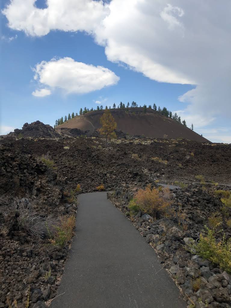
This paved interpretive route travels through the lava flow near the visitor center. The Forest Service’s trail guide lists an approximately one-mile loop with about 150 feet of elevation gain. From here, the cone becomes the backdrop while the angular lava takes up the foreground.
It is a useful choice for visitors who want to understand what they saw from above, or who decide against a summit trip. Take time at the interpretive stops and look at how little soil separates some of the plants from the lava. Do not assume pavement means the full route is flat or suitable for every wheelchair or stroller: only portions are identified as accessible.
Trail of the Whispering Pines
For a shorter forest walk, the guide lists the Trail of the Whispering Pines at about 0.3 mile with no elevation gain. It provides a different setting from the exposed lava field and can make a better addition when your group wants a brief walk among ponderosa pines.
Pick the routes that fit your group’s energy and the day’s weather. You do not need to complete every trail for the visit to feel worthwhile.
Start at Lava Lands Visitor Center
Lava Lands Visitor Center is the practical starting point for this part of the monument. Exhibits, a three-dimensional landscape map, films, and seasonal interpretation help connect the cone outside to the much larger Newberry story.
For families, a quick look at the map before going out can turn an abstract explanation of a volcano into something children can recognize on the ground. Ask staff which areas are open, how summit access is working that day, and which walk fits your group.
The center is seasonal. Its posted 2026 schedule ran daily from May 15 through September 15, then reduced to Thursday–Monday September 17–28 and Friday–Sunday October 2–11. The final fall dates listed hours of 9 a.m.–4 p.m. These are dated operating details, not a promise that the same calendar will repeat next year.
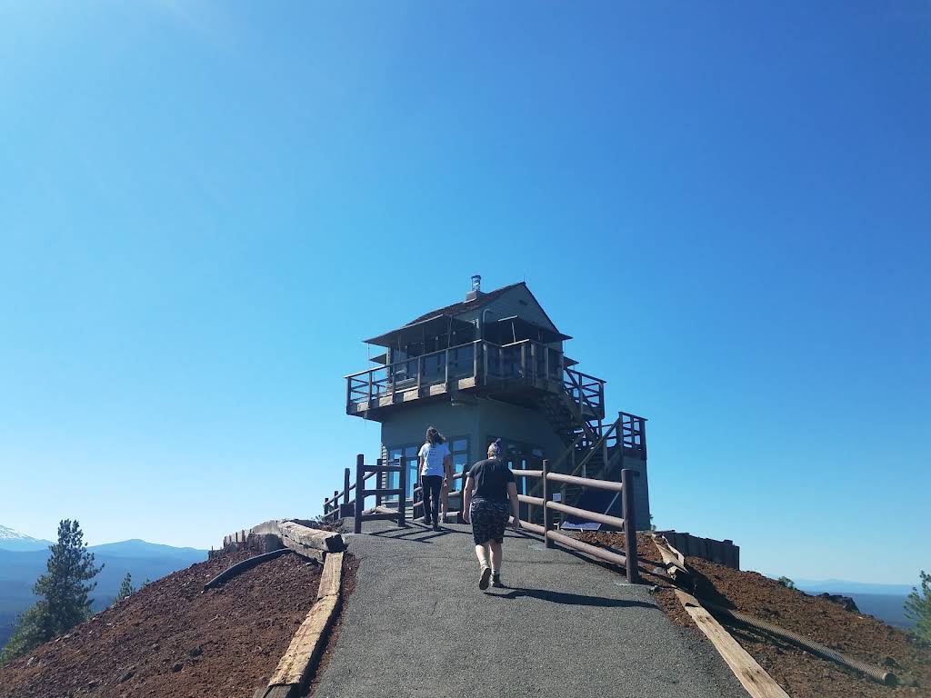
At the summit, the lookout is still a working fire lookout. Follow signs for public areas and respect staff at work. Do not assume that the upper observation cabin is a visitor attraction open for casual access.
Fees, water, accessibility, and dogs
Budget separately for parking and transportation. The current Forest Service listing gives a $5 vehicle day-use fee at Lava Lands, with accepted recreation passes such as the Northwest Forest Pass or qualifying interagency passes providing an alternative. The summit shuttle has its own fare; a parking pass is not a shuttle ticket.
Bring drinking water with you. At this article’s October 2026 check, the Lava Lands page listed potable water as unavailable, and the summit listing also identified no drinking water. Pack for the whole visit instead of counting on a refill.
Match the route to your mobility needs. The Forest Service identifies the seasonal shuttle as wheelchair accessible. That does not make the cinder rim trail accessible. Ask about boarding, the summit drop-off, grades, and the exact route you intend to use. For a paved outing at the base, the Sun-Lava Path is another option; its 5.5-mile length makes it a separate choice from the short interpretive loops.
Keep dogs leashed and consider the surface. The Forest Service allows leashed dogs on the shuttle. Exposed pavement and rough lava terrain deserve extra thought when deciding whether to bring a dog. Carry water for them, keep them on established routes, and check posted rules for buildings and individual trails.
When to go and what to bring
For the easiest visit to organize, choose a date when the visitor center and summit transportation are operating. Arriving with time to spare gives you options if the next shuttle is full or your group wants a longer stop at the exhibits.
Summer offers the broadest scheduled services, but the open lava field can be an uncomfortable place to linger in strong sun. A hat, sunscreen, water, and shoes with dependable traction are sensible additions even for a short visit. Bring a layer for a summit stop: standing still at an exposed viewpoint can feel different from walking below.
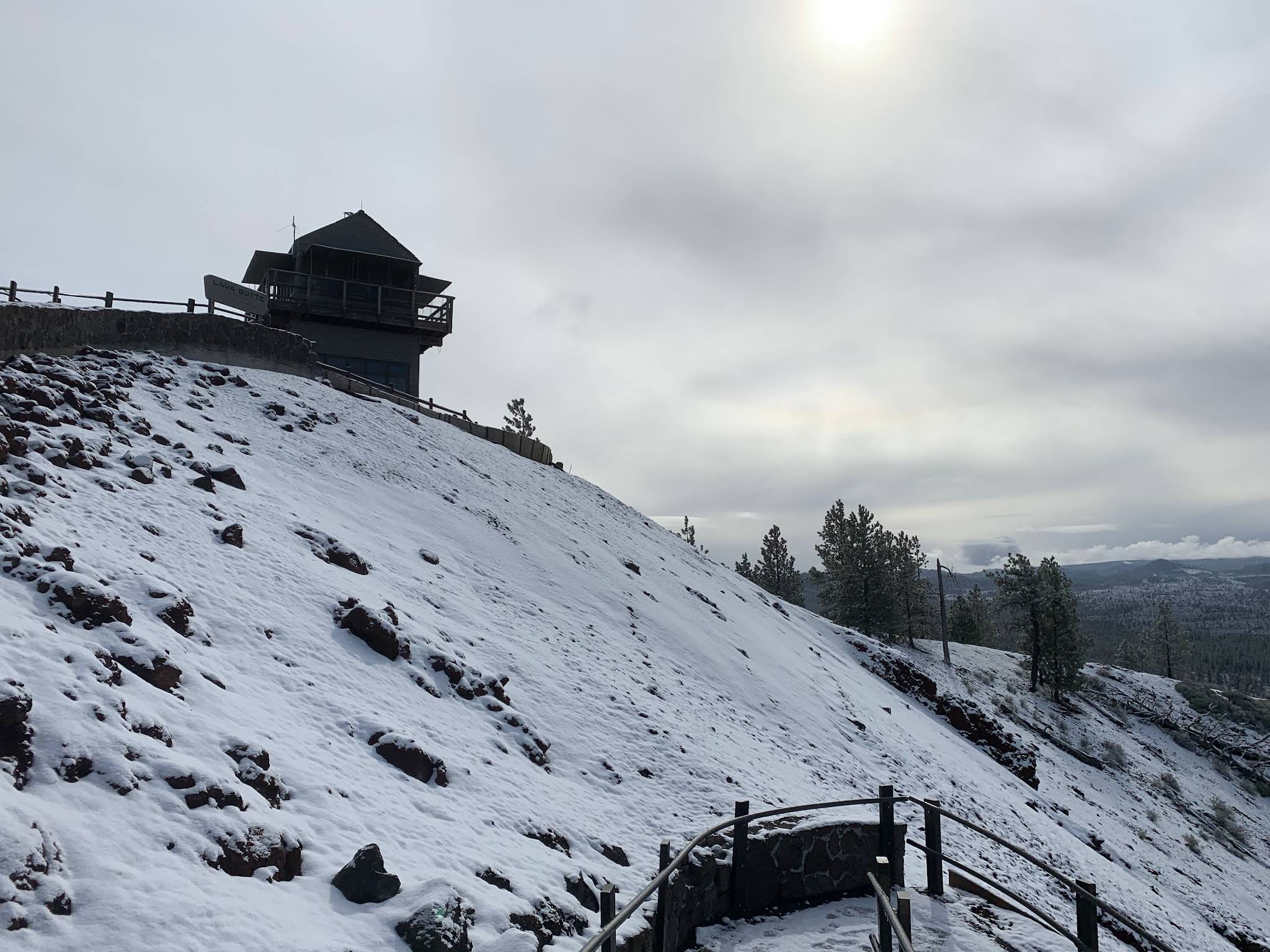
Spring and fall require more attention to opening dates, road conditions, and the shorter service calendar. Winter should be planned as a different outing altogether. The Forest Service says parking access depends on snow conditions and that the Lava Lands parking area is not plowed or maintained in winter.
For photographs, use the established viewpoints and trail edges. The crater, the transition from trees to lava, and the distant mountains offer very different compositions. You do not need to leave the trail or climb onto fragile rock formations for a useful view.
A realistic half-day from Bend
Our suggested plan is to start at Lava Lands, confirm summit access, and work around the next available ride or vehicle permit. Visit the summit and rim, then return for the exhibits and a walk through the lava field. Allow roughly two to three hours for that combination, plus travel and any queue. This is a planning estimate, not an official tour duration.
If you walk up the road, shorten the rest of the plan or give the outing a larger part of the day. A family with young children may be happier choosing the summit and one short base walk, then heading back for lunch.
For a second outdoor stop, explore the river connection with our Deschutes River guide. The Benham Falls area can pair well with Lava Lands, but it involves its own access and walking decisions. Check the appropriate trailhead instead of treating every nearby river stop as part of the Lava Butte parking area.
Lava River Cave is another nearby volcanic attraction, although it formed from a much older eruption. Check its separate Forest Service visitor information for seasonal access, reservations, and cave requirements before adding it. A cave trip deserves preparation of its own.
Paulina Lake, East Lake, and the Big Obsidian Flow are farther into the Newberry landscape. Save enough time for the drive and their own walks; seeing Lava Butte does not mean you have seen the entire monument.
Back in town, use our complete Bend guide to choose dinner, lodging, and the next day’s outing. Lava Butte works especially well as one focused part of that trip: a crater you can walk around, a lava flow you can examine up close, and a better understanding of how this corner of Oregon took shape.
Visitor information checked October 2026. Seasonal dates, fees, water availability, and road or shuttle operations can change. Check the linked Forest Service and transit pages before departure.