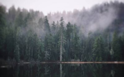
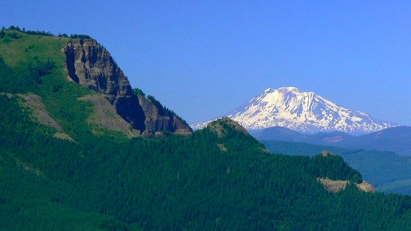
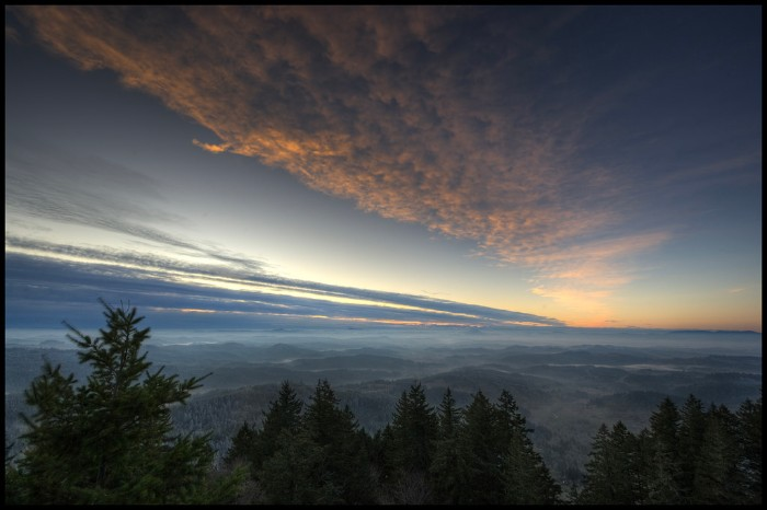
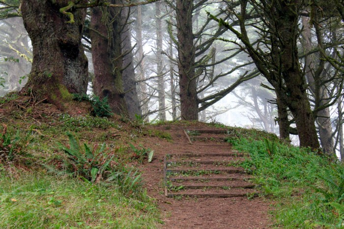
As this last year comes to a closure, life may have taken some unexpected turns. However, there are plenty of Oregon trailheads for a detour if you’re looking to reset and breathe some fresh air. I personally feel like there’s no better place than being in nature to reset and feel whole again. If you are living in the beautiful state of Oregon, there are endless choices of places to hike and explore.
Since we’re talking about nature, here’s a word you may not be familiar with. Research in a growing scientific field called ecotherapy has shown a strong connection between time spent in nature and how it correlates to reduced stress, anxiety, and depression. Studies show physical activity is one of the most effective ways to prevent chronic disease, and premature death, and improve health and immune function. And right now, I personally feel our natural immune systems are more critical than ever. It’s well-documented that people who regularly exercise feel better, live longer, and have a higher quality of life.
Are you trying to live a healthier lifestyle? How many of these hikes do you think you can accomplish this year? Soaking up nature is one of our favorite ways to reduce stress and get exercise for a healthy mind and body.
Being a Responsible Hiker in Oregon
First and foremost, I feel I would be doing our gorgeous state a disservice by not reminding our readers to be responsible when hiking in Oregon. So before we get to the best hikes in Oregon for the new year, we would like to remind everyone to always practice leave no trace principles and do your part in helping keep our trails, campgrounds, and beaches clean in Oregon.
Leave No Trace
Please, always be respectful of the environment along the way. Pack it in, pack it out as they say. Bring a garbage bag if needed. You can even do your part by picking up trash when slobs have left it behind! Leave No Trace is a measure to be a good steward of the land. Hit the link here to read about the seven principles of Leave No Trace. Help keep our beautiful land pristine and clean!
Stay On The Trails
Respect nature! Leave artifacts, rocks, plants, and everything else you see on your outdoor adventure in place. Not to mention, the last thing you want is to get lost in a forest and have to be rescued.
Southern Oregon Trails To Hike
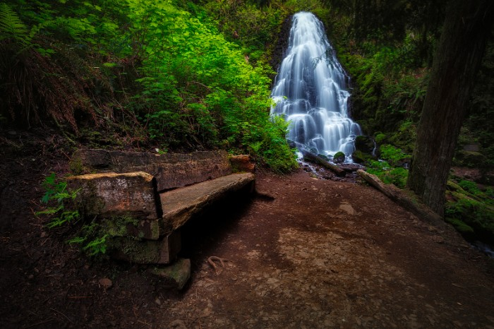
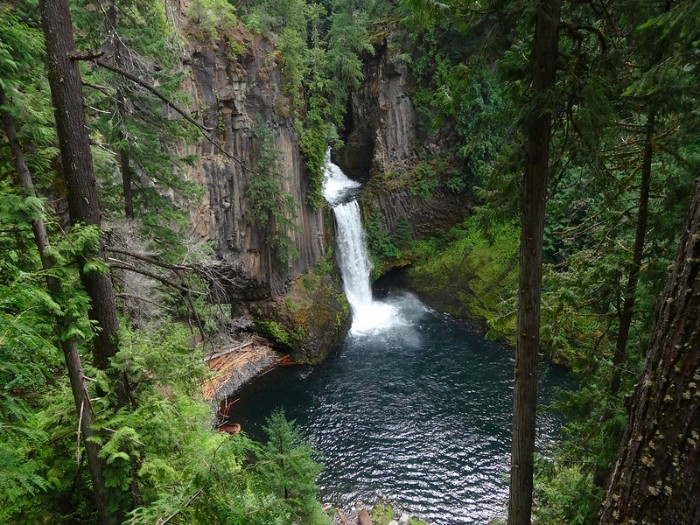
1. Falls Creek Falls
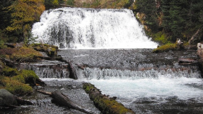
In beautiful Southern Oregon near Roseburg, you will find Fall Creek Falls — one of the more accessible waterfalls in the North Umpqua corridor. Dropping about 120 feet over 4 tiers, the falls spray into a small amphitheater before cascading down through a scenic gorge to the Umpqua. The falls consist of four tiers, of approximately 10, 40, 20, and 50 feet – with the uppermost tier only being visible from the top of the falls. The falls were apparently measured by the Oregon Fish and Wildlife Service at 197 feet tall. However, there is speculation that the measurement skews significantly higher than the falls actually are.
2. Watson Falls
The 272 feet, narrow stream of Watson Falls is the third tallest waterfall in Oregon. Dramatically contrasted by a considerable basalt amphitheater, these falls are guaranteed to throw your head back – remarkable scenery for only a 0.6-mile roundtrip hike, with a 300 feet elevation gain.
Watson Mountain in the Glide area was named for James Watson, who settled on the banks of Fall Creek near Glide in 1854. The name may have been carried over for the same individual. Watson Falls was likely named for the creek.
Getting there:
Watson Falls can be found along Fish Creek Road #37, just over 2 miles east of Toketee Falls and Lake, about 43 miles east of Glide or 16 miles west of Diamond Lake. The parking area is about 500 feet south of Highway 138 on the right side. The trail crosses Road 37 and climbs quickly but steadily up to the base of the falls in about 1/3 mile.
3. Clearwater Falls
While Clearwater Falls may be relatively unknown to some, and a little bit off the beaten track if you are willing to explore a bit, you will be amazed by this gorgeous place. You will find Clearwater Falls in south-central Oregon off the North Umpqua River, which flows 100 miles from its source in the Mount Thielsen Wilderness to the Pacific Ocean.
Clearwater Falls is said to be one of the most photographed waterfalls in southern Oregon. Access to both sides of the falls is possible, so don’t be afraid to move around.
This area is part of the Umpqua National Forest and is known for its great fishing and emerald-green waters. Managed by The Forest Service, they refer to Clearwater Falls as the area of “Thundering Waters,” as there are over seventeen waterfalls that can be visited in the region. Check out this map here to see the other waterfalls here.
Getting there:
Clearwater Falls is closest to Diamond Lake, off Highway 138. The Falls are located to the South on a Forest Service access road at mile-marker 69.5 along Highway 138. The Falls are clearly marked on both the East and West directions of Highway 138. From the parking area, it is a quarter-mile (.25) walk to the top of the falls, on a developed trail. The trail starts alongside the Clearwater River, and meanders up to the base of the falls, before ascending the remainder of the way to the top of the falls. Among the many things present to explore are a crossing at the Clearwater River near the parking area that allows access to both sides of the river; and a large pool at the top of the falls that partially feeds the falls themselves. Best of all, this is an area that is usually free of visitors, and one that provides a great amount of solitude.
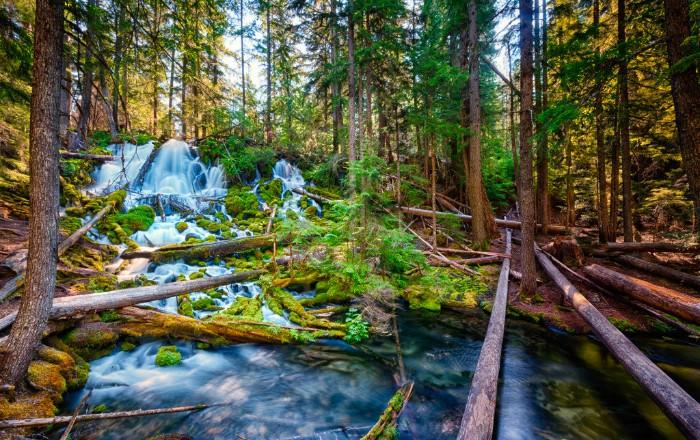
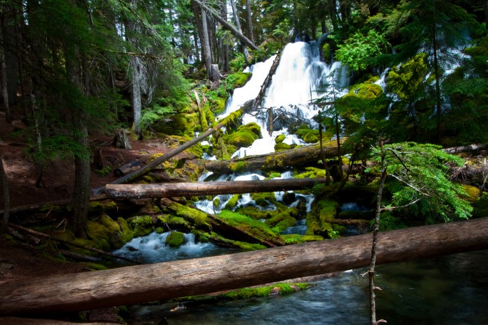
4. National Creek Falls near Prospect
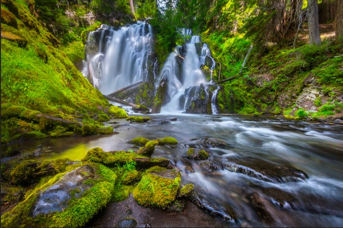
A 1/2-mile trail will take you from the parking area down to these stunning Southern Oregon falls in a cave with a mystical feel. The trail can get steep in places but is doable with children. We took our daughter when she was five, and she made it with help. We do not suggest crossing the river on the log down across it, as it is slippery from the mist (many spots are here, so watch your step). This is a great place to take a picnic, but many people site voracious mosquitos during summer, so be sure to bring some bug spray.
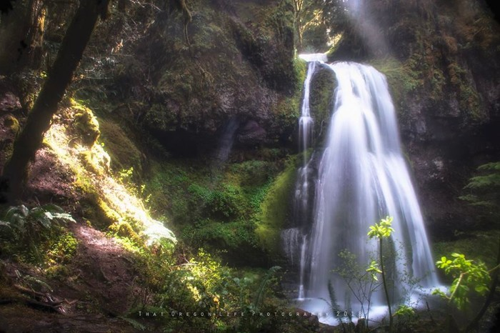
5. Moon Falls Near Westfir
An easy hike to start off the year is this one mile out and back trail not far from Westfir Oregon. The Moon Falls trail is easy and good for all skill levels, and features trees and a pretty waterfall at the end of the trail.
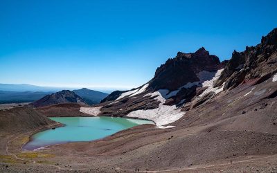
6. Sky Lakes Wilderness In Southern Oregon
Southern Oregon is home to a special wilderness area known as the Sky Lakes Wilderness. The Sky Lakes Wilderness is around 114,000 acres and includes three major lake basins. This wilderness area stretches from Highway 140 in the south to the edge of the Crater Lake National Park in the north.
If you’re looking to get away from people, this is the place. The Sky Lakes Wilderness area features grassy meadows, crystal clear alpine lakes, and icy springs all waiting to be discovered.
You can hike in the Sky Lakes Wilderness on the famous Pacific Crest Trail, and on other trails such as the Mount McLoughlin Trail, which is perfect for experienced backpackers. Here’s the full list of trails you can hike in the Sky Lakes Wilderness.
7. Southern Oregon’s Mountain Lakes Wilderness
Not far from the Sky Lakes Wilderness is the Mountain Lakes Wilderness in Southern Oregon. This is the caldera of what used to be one of Oregon’s larger volcanoes. Inside the caldera are several small, pristine alpine lakes.
This is one of the first “Primitive Areas,” created in 1930 in Oregon and Washington and is a great place to hike and explore. One of the more interesting trails to hike in the area is the Mountain Lakes Loop Trail, which is 8.2 miles and goes along the southern rim of the caldera.
This is rugged backcountry, and while you may see a few people out on the trail, it’s one of the best places in Oregon to find solitude and stunning views.
READ MORE: This Southern Oregon Waterfall Road Trip is The Perfect Getaway
8. Granite Creek Near Prairie City
The Granite Creek trail is an easy 7.3 mile out and back trail that goes along Granite Creek. This is the perfect trail for nature walks and easy hiking, and is a great place to get out into nature and relax.
Central & Eastern Oregon Trails to Hike
9. Mount Howard and the Wallowa Mountains
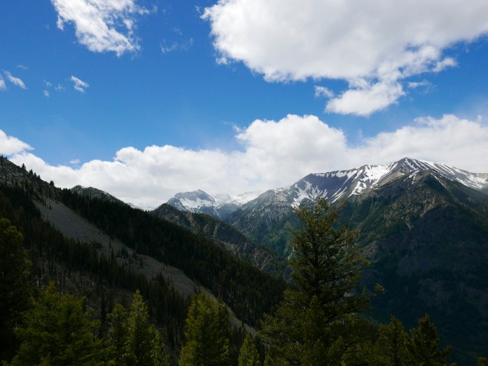
The Wallowa Mountains, commonly referred to as “The Swiss Alps Of Oregon”, are full of amazing hiking opportunities. One easy way to explore these peaks is to take the Wallowa Lake Tramway up to Mount Howard and hike the short nature trails you’ll find at the summit.
RELATED: Wallowa Lake, Oregon – Your Unofficial Travel Guide
10. Proxy Falls
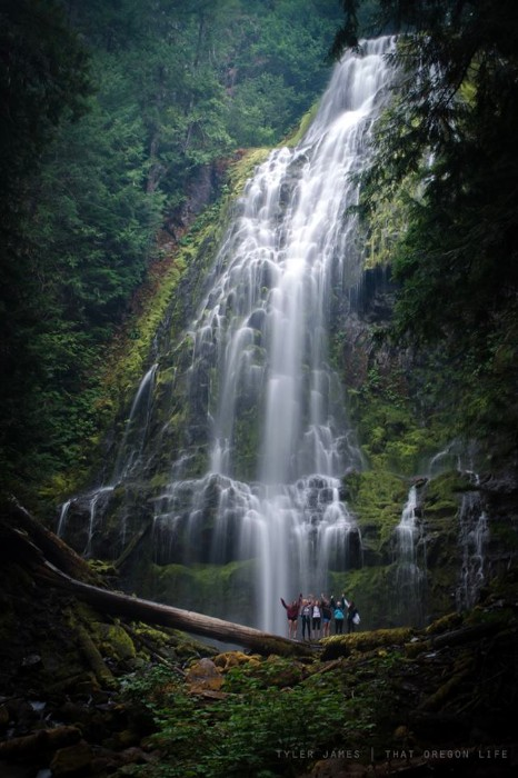
Proxy Falls has a well-deserved spot as one of the top 10 most photogenic waterfalls in the United States and respectfully earns a spot on our list for best Oregon trails. While I have already hiked this insanely gorgeous spot once, I can’t wait to get back this summer for more. It’s located approximately 60 miles East of Eugene, and as far as Oregon trails go, this is easily one of my most favorite.
NEARBY: The McKenzie River Trail – Hiking, Biking, Camping & More
11. Steelhead Falls
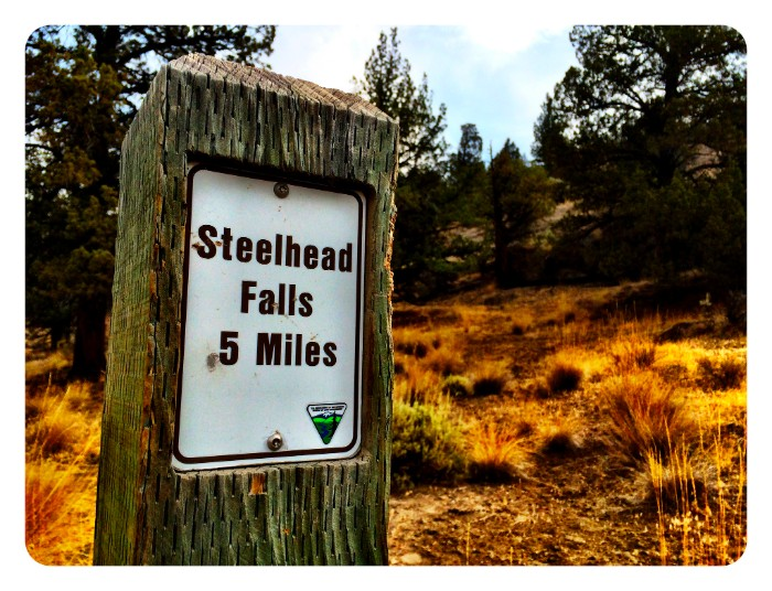
The long narrow canyon that surrounds the Deschutes River in the Steelhead Falls area pulls visitors away from nearby human influences and places them in a spectacular steep-sloped channel of unique character. Noise from human infrastructure is masked by the roar of the river at the falls, and hikers become entranced by the colors of the stream-side vegetation and the textured reds and browns of the cliff walls.
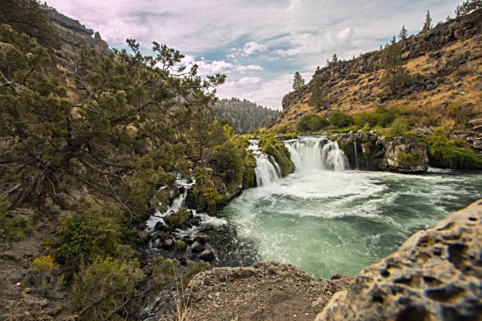
The Steelhead Falls Wilderness Study Area is a 3,240-acre area along the west side of Crooked River Ranch. While this beautiful place isn’t very easy to find, the destination provides an incredible payoff. This segment of the Deschutes River is designated “scenic” under the Oregon Wild and Scenic Rivers Act.
Getting there:
From Terrebonne, turn West on Northwest Lower Bridge Way. Proceed a little more than 2 miles, then turn right on Northwest 43rd Street. Take that about 1.8 miles to Chinook Drive. From Chinook Drive, proceed just less than a mile and then turn left onto Badger Road. In a little more than a mile, turn right on Sage Hen Road. After about a half a mile, turn left on Ermine Road. Soon afterward turn left on Quail Road. Take Quail less than half a mile to River Road and turn right. Proceed on River Road downhill to the Steelhead Falls Trailhead.
12. Green Lakes, Deschutes National Forest
The Green Lakes hike starts off about 30 minutes west of Bend, just near the Cascade Lakes Highway. Bring your Northwest Forest Pass, or pay a $5 fee for the day. The fee is meager for what awaits you; from views of the Three Sisters and Broken Top to waterfalls and green-tinted lakes.
Campsites abound here for backpackers. Coming in at around 9-miles out-and-back, this is a moderately easy hike with a gentle elevation gain of 1187-ft.

13. Blue Pool
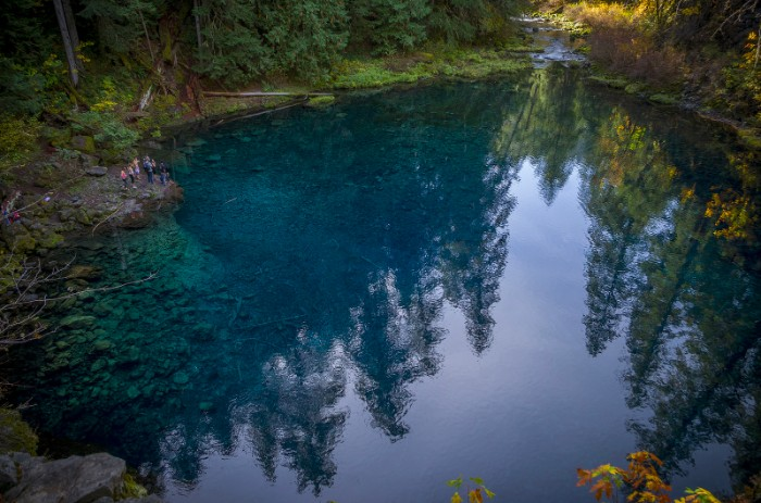
On the gentle hike up from the Trailbridge Campground turnoff on Oregon 126, one can’t help but wonder how the “Blue Pool”, also known as Tamolitch, is so damn blue. The beautiful view is 60 feet high, and the water temperature is a raw 37 degrees. As a part of the McKenzie River Trail, this is truly one of my favorite hikes in Oregon.
READ MORE: The Blue Pool Is One Amazing Place In Oregon You Need To See For Yourself
14. Smith Rock State Park
Smith Rock State Park is an Oregon gem. This park has miles of trails, stunning views, opportunities to see wildlife, and world-class rock climbing. One of many trails within the park that you might enjoy is the Misery Ridge Trail. This is a 3.7 mile loop trail for experienced hikers. This trail is challenging and has a steep climb, but rewards hikers with pretty ridge views.
For a more moderate hike, try the seven mile Burma Road Loop. One of the easier and shorter trails in Smith Rock State Park is The Chute, which is a .5 mile out and back trail good for bird watching and nature trips. This is more of a walking trail than a hiking trail.
15. The Strawberry Mountain Wilderness
East of John Day in the Malheur National Forest is the Strawberry Mountain Wilderness. This wilderness has over 68,000 acres to explore, and dozens of hiking and backpacking trails. Many of the trails here are difficult and will please experienced hikers and backers. The Strawberry Mountain via Strawberry Basin Trail is a difficult 12.1 mile out and back trail which will take you past a lake, and up a mountain, and features big views.
A more moderate trail in the area is the High Lake Trail, which is a 2.5 mile out and back trail. If you go at the right time of the year, this is the perfect place to see wildflowers. Those interested in a moderate hike will also want to check out the Strawberry Lake and Little Strawberry Lake Trail. This is a 6.2 mile out and back trail with beautiful views of the lake.
Western Oregon & Coast Oregon Trails to Hike
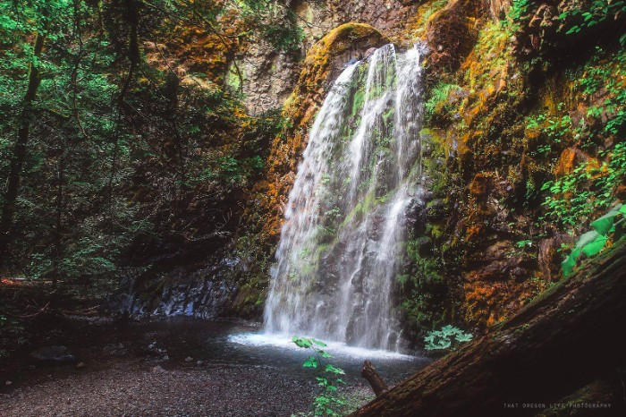
16. Trestle Creek Falls
Considered one of the 7 waterfall wonders in the Eugene, Cascades & Coast Region, this elegant fan waterfall near Cottage Grove is an absolute must.
“Trestle Creek Falls has two distinct separate trail heads, one to the lower falls and one to the upper falls. For a short family-friendly hike head to the lower falls. We like to bring our dog along on this jaunt. And she loves it too!” – Kelly Wilkes, Adventure Center Manager
Located in the Umpqua Nation Forest, you can access this trailhead about 25 miles from Cottage Grove. The trail is a moderate .75 mile hike over gentle terrain and is ideal for family hikes year-round. If you are looking for a more difficult hike with a great reward, you’ll definitely want to check out the Upper Trestle Creek Falls Trail #1403D for an additional 2.5 miles. On this portion, the trail goes behind the gorgeous waterfall itself! This hike peaks in the spring with snow-melt.
Directions: From Cottage Grove follow Row River Rd east for 19 miles. At the junction of Layng Creek Rd and Brice Creek Rd, stay right traveling onto Brice Creek Rd for another 8.2 miles (13.197 km). At the junction of Champion Creek Rd and Brice Creek Rd, park before the bridge. Follow the Brice Creek Trail across the footbridge. Hike west on Brice Creek Trail #1403 to the Trestle Creek Falls Trailhead.
READ MORE: Explore Brice Creek Trail to Trestle Creek Falls
17. Niagara Falls Trail
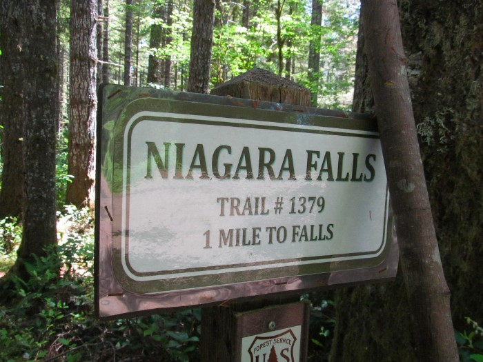
Despite the famous name, this spectacular hideaway isn’t as well-known in Oregon. Home to a pair of 120-foot waterfalls, this easy trail of 2 miles round-trip takes hikers into a remote box canyon where Pheasant Creek and Niagara Falls roar like neighbors attempting to outdo each other.
Just northwest of Willamina, Oregon, and about 10 miles east of Hebo Mountain, this drive from Salem requires navigating a series of county, BLM and Forest Service roads, although it can be reached in an hour-and-20-minute drive.
Trailhead coordinates:
44.434344, -123.929792. Information: Hebo Ranger District, 503-392-5100
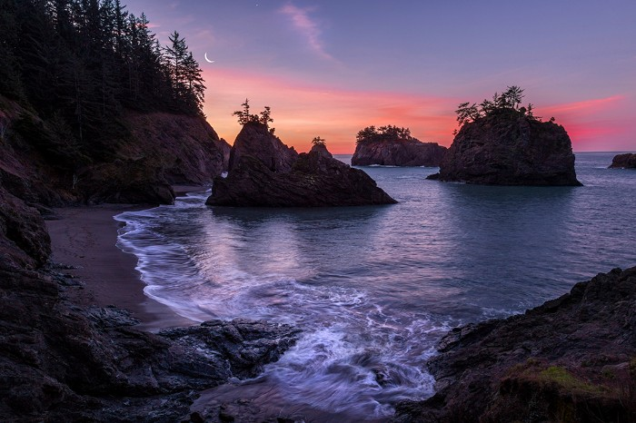
18. Natural Bridges Cove Trail
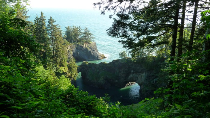
The Natural Bridge in Oregon at Samuel J Boardman State Park on the southern Oregon coast is but a part of several geological wonders on the Oregon coast. This bridge looks like it came straight out of a fairy tale. It’s absolutely incredible.
It’s located 5 miles north of Brookings, Oregon, and is included as a segment of the Oregon Coast Trail. The length of the park is 20 miles along the coast, which means 20 miles of spectacular beauty, coastal headlands, hiking trails and more. Included within the park are Arch Rock, Miner Creek and “Secret Beach,” Thomas Creek Bridge, Thunder Cove, House Rock, Whaleshead Beach, a herd of wild goats and so much more.
19. Golden And Silver Falls State Park Natural Area Near Coos Bay
The trail to Golden and Silver Falls state park is an easy 1.4 mile out and back trail that’s good for all skill levels. The trail leads hikers through giant old-growth cedar and fir trees, and features two beautiful waterfalls.
20. Sweet Creek Trail
Journey into the Suislaw National Forest near Florence, and you will find one of the locals most popular trails. The Sweet Creek trail is around 2.4 miles, and no matter what the season you will be in for a treat as you pass several waterfalls here. Last spring I had a chance to hike here, and plan to take my family here again in the near future.
21. Shellburg Falls
This easy hike is great for any skill level. While it’s a great place to cool off in the summer, keep in mind the flow is pretty low during this time of the year. Nonetheless, the 100-foot drop is worth the hike in. Just downstream a few hundred yards or so, the Lower Shellburg Falls may be visible from the Shellburg Road close to the picnic area.
Located in the Santiam State Forest along the Stout Creek Canyon, you will start the hike with private pastures on both sides of you, filled with livestock, for around a mile until you get to the forest. You will then come across a small side trail that leads to a fantastic viewpoint at the base of the tumbling waterfalls. Before leaving you may want to take some photos as this is a prime spot for it. You will then take the main trail behind the waterfall into a large, natural grotto.
You can enjoy a few other miles of hikes in the area as well, which start at the parking area at Lower Shellburg Falls Trailhead. Shellburg Falls at 2.8 miles total distance definitely deserves a spot on our Badass Oregon Trails list.
22. Hamilton Mountain Loop Hike In The Gorge
This very popular trail has a feast of features for hikers, including waterfalls, craggy cliffs, deep forests, superb vistas, and a loop option for the trek. The outing can done at any time of year although you will want to pay attention to icy spots in the winter. Hamilton Mountain is really the Missoula Flood-truncated end of a basalt ridge: there are higher points on the same ridge farther north. The summit itself is thicketed and offers limited views, but a bench a few yards back gives you a vista to the east of Table Mountain and the Oregon side of the Columbia River Gorge. Other views come from the trail on the way up and at the Hamilton Mountain Saddle as you continue on the loop.
23. Drift Creek Falls Near Lincoln City
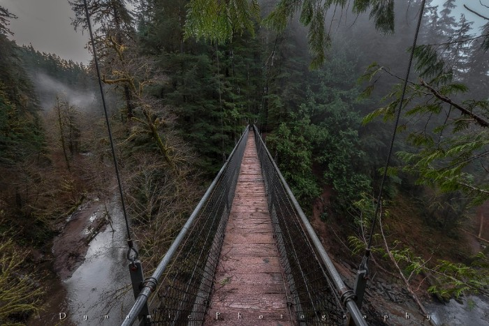
If you’re looking for an amazing easy hike on the Oregon Coast, you’ll definitely want to check out the Drift Creek Falls near Lincoln City. This one is easily one of my favorite Oregon trails to hike.
The best part about this hike? The impressive suspension bridge of course. The 240-foot long bridge spans across Drift Creek and is suspended about 100 feet in the air. The gorgeous waterfall, of course, is a nice bonus as well.
Two 29 foot towers support the bridge, which is anchored by bolts planted in rock on one side and concrete on the other. When crossing you will enjoy the beautiful view about 80 feet down to Drift Creek Falls. Hit the link here to read more.
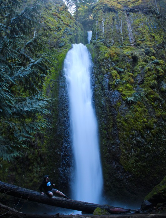
24. Fairy Falls
NOTICE: Many trails on the Oregon side of the Columbia River Gorge were closed until further notice because of damage from the Eagle Creek Fire. Please check the list of Columbia Gorge trail closures before you plan for a hike.
One of the most photographed locations in Oregon, Ferry Falls (also known as Ghost Falls) and the upper reaches of Wahkeena Creek are absolutely stunning. The creek cascades through a deep gorge, laced with beautiful mosses and ferns stretching 200 feet upwards.
At twenty feet high, it’s a bit small compared to dozens of its Gorge cousins – but it continues to have tremendous appeal for those looking to explore somewhere beautiful in Oregon. When the summer sun hits the falls just right, the falls are said to glow, hence its original name “Ghost Falls.”
Despite maintaining a fairly constant volume year-round, Fairy Falls can become a torrent after seasonal rains.
Incidentally, Fairy Falls has 700+ foot namesake in Washington State.
25. Spencer’s Butte
Living in Eugene, I have to admit I’m pretty spoiled. This hike is just a few miles from my house, and it definitely keeps me in good shape. Spencer’s Butte is a local favorite and the view from the top, overlooking Eugene, is absolutely incredible. You can even see Autzen. Stairs have been installed in recent years to make this hike that much better.
26. Hobbit Trail Near Florence
Just off the Oregon coast near Florence, you will find this short but gorgeous hike from Hobbit Beach to Heceta Head. The trailhead for the Hobbit Trail will begin at a humble parking pull-out just north of the Heceta Head State Park, and you will need to watch closely as you can easily miss it. You will basically park across the highway at the China Creek Trailhead (look for all the cars parked here on a regular basis as this is a popular one).
READ MORE: Here Are 5 Hikes on the Oregon Coast With Unforgettable Views
27. Meyers Beach to Pistol River
Located in the Samuel H. Boardman State Scenic Corridor near Gold Beach, this is a short but stunning beach hike along the Pacific Ocean. We recommend bringing a windbreaker and hat as it can get quite gusty here. Expect to see kite and windsurfers here, as well as horseback riders while you wind your way among huge rock formations near the shoreline. Family and dog-friendly.
28. Oxbow Regional Park
One of my go-to rainy day hikes close to Portland, Oxbow Regional Park is a moss-covered wonderland in the wet season, with trails that wind through dense forests and along the banks of the beautiful Sandy River. Oxbow is the kind of place where you can pick a trailhead and find your own adventure, but for a more complete excursion try the Oxbow Loop hike. You can also hike the wilder side of the park across the river.
During the summer you can find swimming holes to cool off in or try your hand at some kayaking. An infamous scene in the first “Twilight” movie was also filmed here, making it a great spot for fans looking to hike into that exact location.
29. Lost Lake Loop Hike Near Hood River
Lost Lake Loop (Lakeshore Trail) is a 3.1-mile easy trail located near Hood River, Oregon that’s great for all skill levels, kiddos, and leashed furry friends.
The trail offers a number of activity options and is best used from June until October. If you love stunning mountain views, bird-watching, and easy walks, this is a fantastic trail for you. Keep in mind that there is a $9 entrance fee to use this trail (and others nearby).
30. Spirit Falls
Spirit Falls is a short, well-maintained trail that leads to Spirit Falls through lush woodland. Combine this hike with hikes to nearby Moon Falls and Pinard Falls for a total of 2.8 miles and 600 feet of elevation gain.
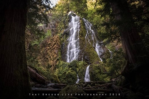
Spirit falls is around 40 feet and flows over moss-covered rock into Alex Creek near Cottage Grove, Oregon. You can access this beautiful spot all year round.
READ MORE: 13+ Jaw-Dropping Waterfalls Near Eugene, Oregon
31. Eagle Creek Trail In The Gorge
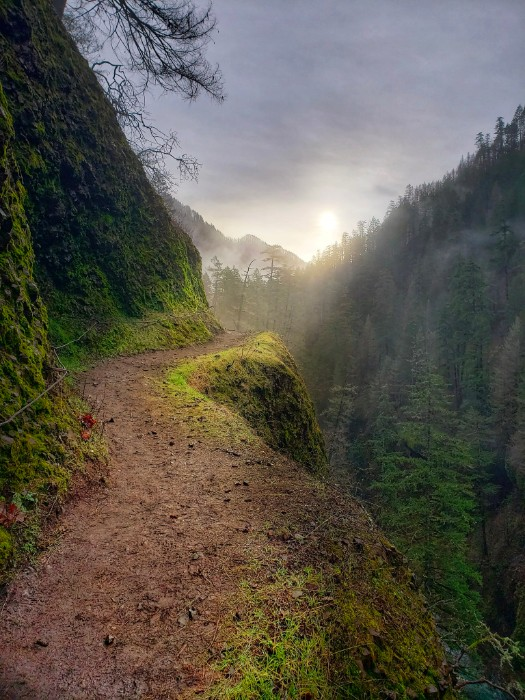
At the time of writing this, Eagle Creek Trail is open once again. The Eagle Creek Fire burned 48,000 acres in early September 2017, which caused several trails to close due to public safety issues. Due to the virus, others in the area had also been closed. This well-loved, heavily trafficked trail not far from the Cascade Locks is one of the most incredible places you can ever visit in Oregon.
After the fire, the Eagle Creek Trail and other nearby trails were closed due to danger from landslides. Now the entire length of the Eagle Creek Trail has been reopened, along with other trails and waterfalls such as Wahclella Falls, Ten falls, Elowah Falls, McCord Creek Falls, the Gorge 400 Trail, and part of the Larch Mountain Trail. You can get an updated list of what’s open and closed in the area here.
32. Secret Beach On The Oregon Coast
This short but moderate trail begins from an unmarked spot along Hwy. 101 and ends overlooking an idyllic ocean cove of sea stacks and pine. Going down the 374-ft. decline is the easy part, but I remember struggling a bit coming back up on the rocky and muddy trail. Round trip, this small hike comes in at just over 1.5-miles. Go at low tide for a chance to explore down the shoreline.
33. Toketee Falls
Toketee Falls is simply stunning, and the 0.8-mile round-trip trail that leads to the falls is very doable with children. At the trailhead, you’ll hike past the old wooden 12-foot diameter Toketee Pipeline, which diverts much of the volume of the North Umpqua River to a powerhouse downstream. There is a campground nearby at Toketee Lake, but you should check online first to see that it is open before planning to stay there. The campground is a meadow-like environment with opportunities to view Oregon wildlife where beaver and otter make their homes. Great blue herons and kingfishers are joined in fall and winter by ducks, geese, and bald eagles.
READ MORE: Hike To Toketee Falls, One Of Oregon’s Most Famous Waterfalls
34. Lewis and Clark Discovery Trail
The Lewis and Clark Discovery Trail is a 12.2 mile moderately trafficked out and back trail located near Seaside. The hike features beautiful seasonal wildflowers and is rated as difficult due to a 3000-ft. elevation gain, but so worth it for the views! The trail offers a number of activity options and is accessible year-round.
Bring Fido, but keep him on a leash, as you go walking in the footsteps of the Lewis and Clark expedition as they discovered stunning Tillamook Head. In 1806, Captain Clark and a group of 12 men hiked over the mountain to salvage blubber from a blue whale that washed ashore at the mouth of Ecola Creek. They met a group of Clatsop natives hiking back laden with large amounts of meat and blubber from the find.
35. Old Salmon River Trail, Mount Hood National Forest
This easy, 2.7-mile out-and-back trail takes you along the Salmon River near Welches, and is great for all skill levels and children. For never being more than 100′ from the road, it feels remarkably remote. Keep in mind that this trail can get rather muddy and can be heavily used in more popular months.
36. University Falls near Rogers Camp
This is hands down one of my favorite easy hikes for almost any time of year. The trailhead itself is simple to find in the Tillamook State Forest, and like so many of our other Oregon hikes, ends at a gorgeous waterfall. Be aware that you’ll be sharing trail-crossings with ATVs so don’t forget to look both ways when you hear that distinctive sound. The waterfall is at its peak during the rainy seasons, so best to visit in the winter and spring months.
RELATED: 23 Must See Waterfall Hikes Oregon You Can’t Miss
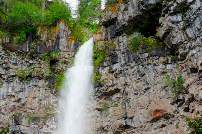
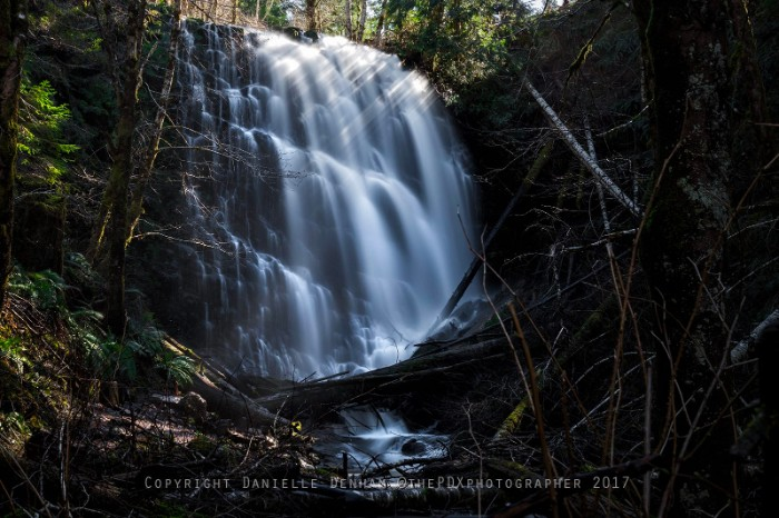
37. Gorton Creek Falls & Emerald Falls
This hike is said to be much easier to travel up the stream during summer when the creek is running low. A rough trail leads about 2/3 of the way to the falls, but the final climb to the base requires either scrambling directly up the mossy, boulder-strewn streambed or a precarious herd path along the side of the canyon.
Getting there:
To get to this hike take I-84 to Wyeth (exit 51). Take a right at the stop sign and then another right onto Herman Creek Road. Take a left into the Wyeth campground and follow the signs to the trailhead parking. If the campground is closed, you have to park outside the gates, along the street.
You will follow the trailhead a short distance until you reach a three-way junction. Take the trail straight ahead and follow the creek for over a quarter-mile until you reach Emerald Falls. It may not be the largest waterfall, but as you can see in the photo this place is gorgeous!
There are bathrooms at the trailhead, but only available when the campground is open and there is a $5 parking fee. This is not very family or pet-friendly due to the scramble. For a more in-depth review of this hike, check out Hikelandia.
Please Note: Hiking, backpacking, and exploring nature are at-your-own-risk activities. Research is so essential before setting out on unforgettable nature adventures. Ensure the area you want to visit is open before you go. Find out what permits are required, if any, research what kinds of things you need to bring to be prepared and know what the best time of year to explore the trails you want to hike is. Don’t forget to check the weather before you head out on your adventure.
Which of these trails do you want to explore this year? We hope this article helped inspire your next Oregon adventure. Hit the link here for more hiking trails to explore in Oregon.
Frequently Asked Questions (FAQs)
Q: What are the best hiking trails in Oregon?
A: It depends on your skill level and your desire. The most popular trails are Multnomah Falls, Eagle Creek, Zumwalt Meadow Trail, Mount Hood National Forest, Old Salmon River Trail, University Falls near Rogers Camp, and Gorton Creek Falls & Emerald Falls.
Q: How do I check to see if a trail is open before I go?
A: It's best to research the area and check for any permits required for the hike and what time of year it’s best to visit the trails. You can also contact the local authorities or park service for more information.
Q: What should I bring on my hike?
A: Before setting out on a hike, you should always be prepared. Pack plenty of water and snacks, wear the right clothes and shoes, know your route and terrain, and have a map or GPS with you. It’s also a good idea to bring a first-aid kit, flashlight, and other items that could be useful in an emergency.
Q: Are pets allowed on Oregon trails?
A: It depends on the trail and park regulations. Always check to make sure your pet is allowed before bringing them along. Some trails may require leashes, and some may not allow pets at all.
Q: Are there any fees or permits required for hiking in Oregon?
A: Some trails may require a permit, so checking with the local authorities or park service before you set out is best. Fees can also apply for parking and camping in some areas.
Bottom Line
Oregon has endless trails to explore, and we hope this article has inspired you to get out and discover these jaw-dropping hikes. With a little research, you can find the right trail for your skill level and enjoy an unforgettable outdoor experience in nature's backyard. So what are you waiting for? Get out there and start exploring! Happy hiking!