Central Oregon · Smith Rock State Park
Come for the cliffs, stay for the whole day
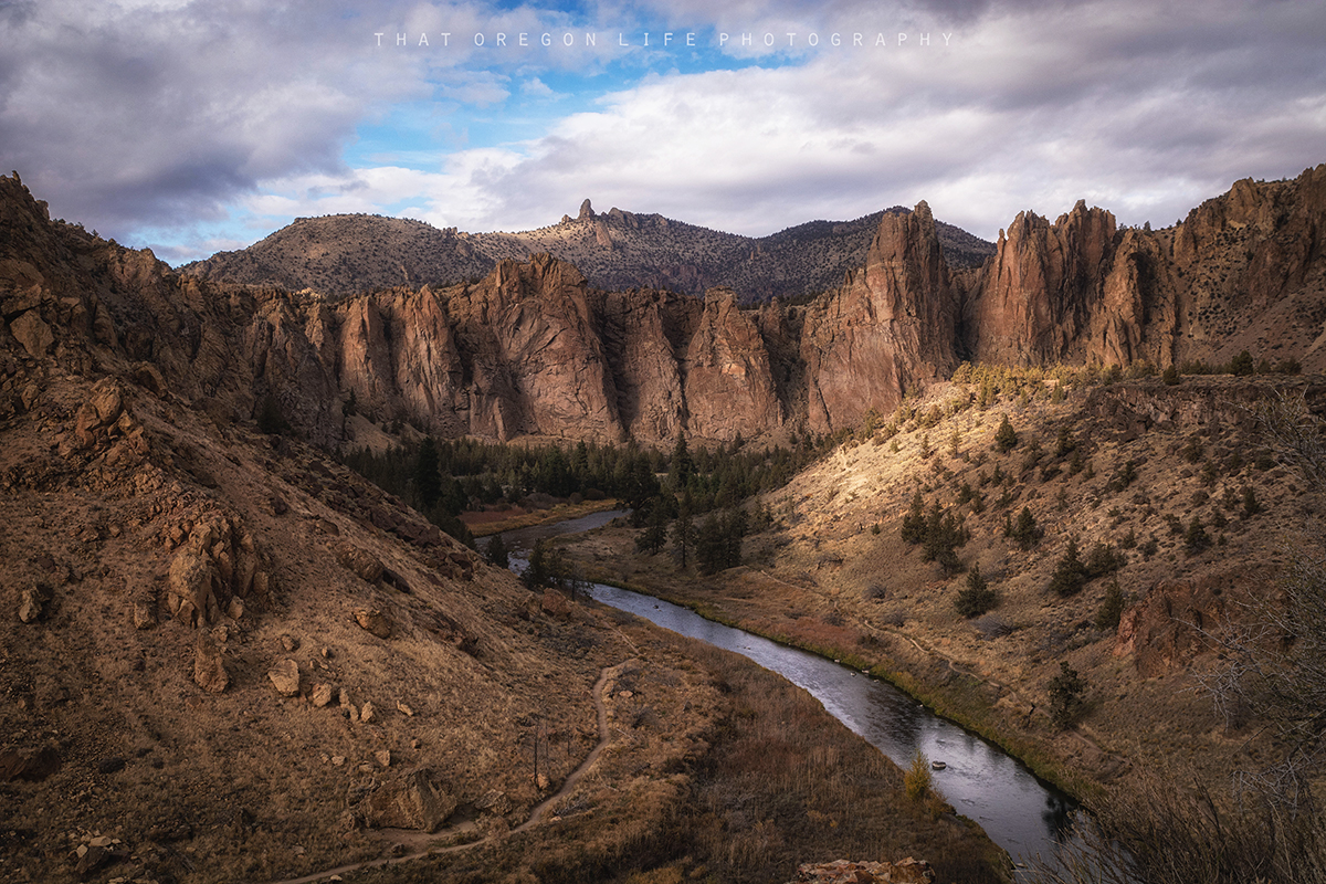
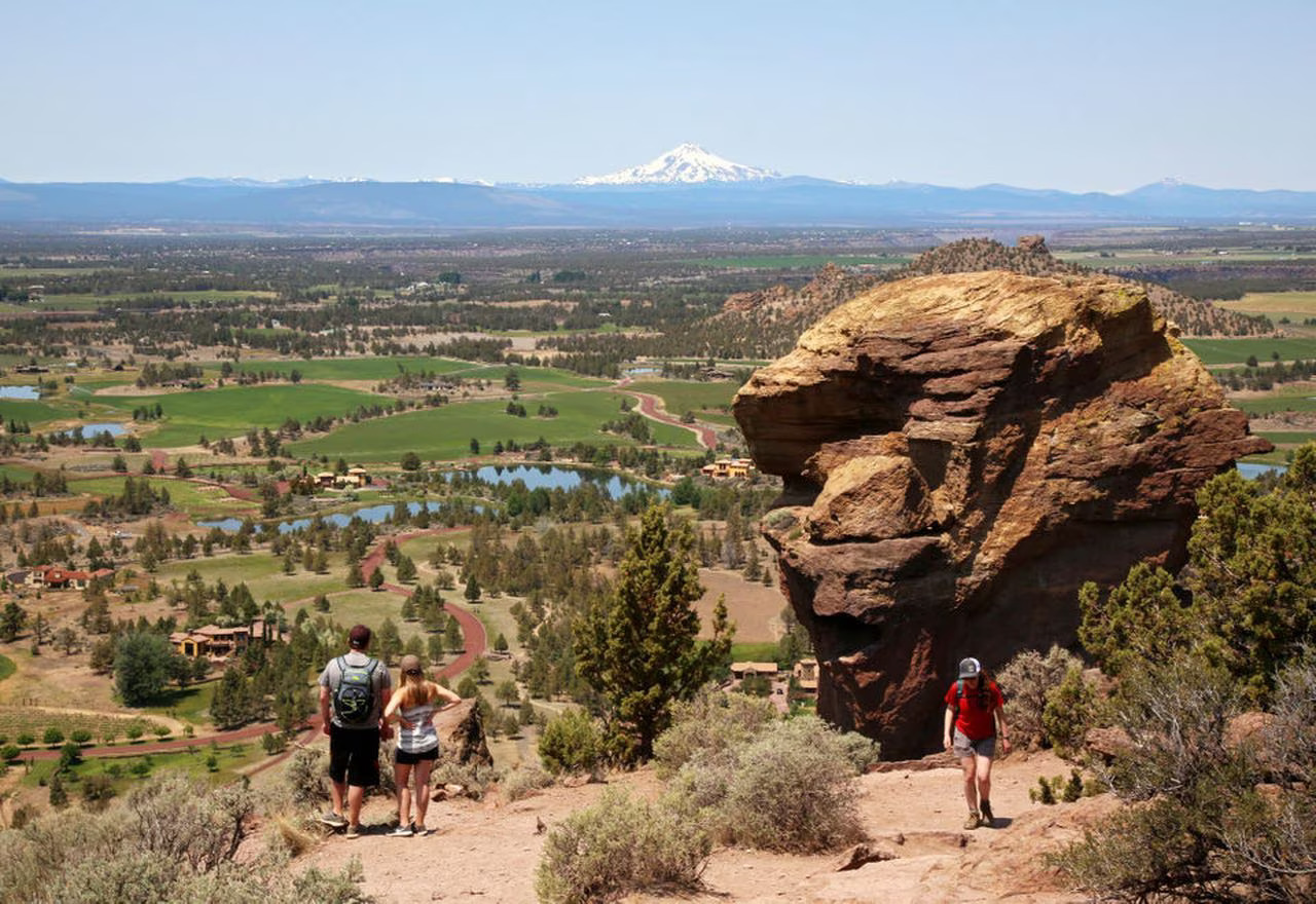
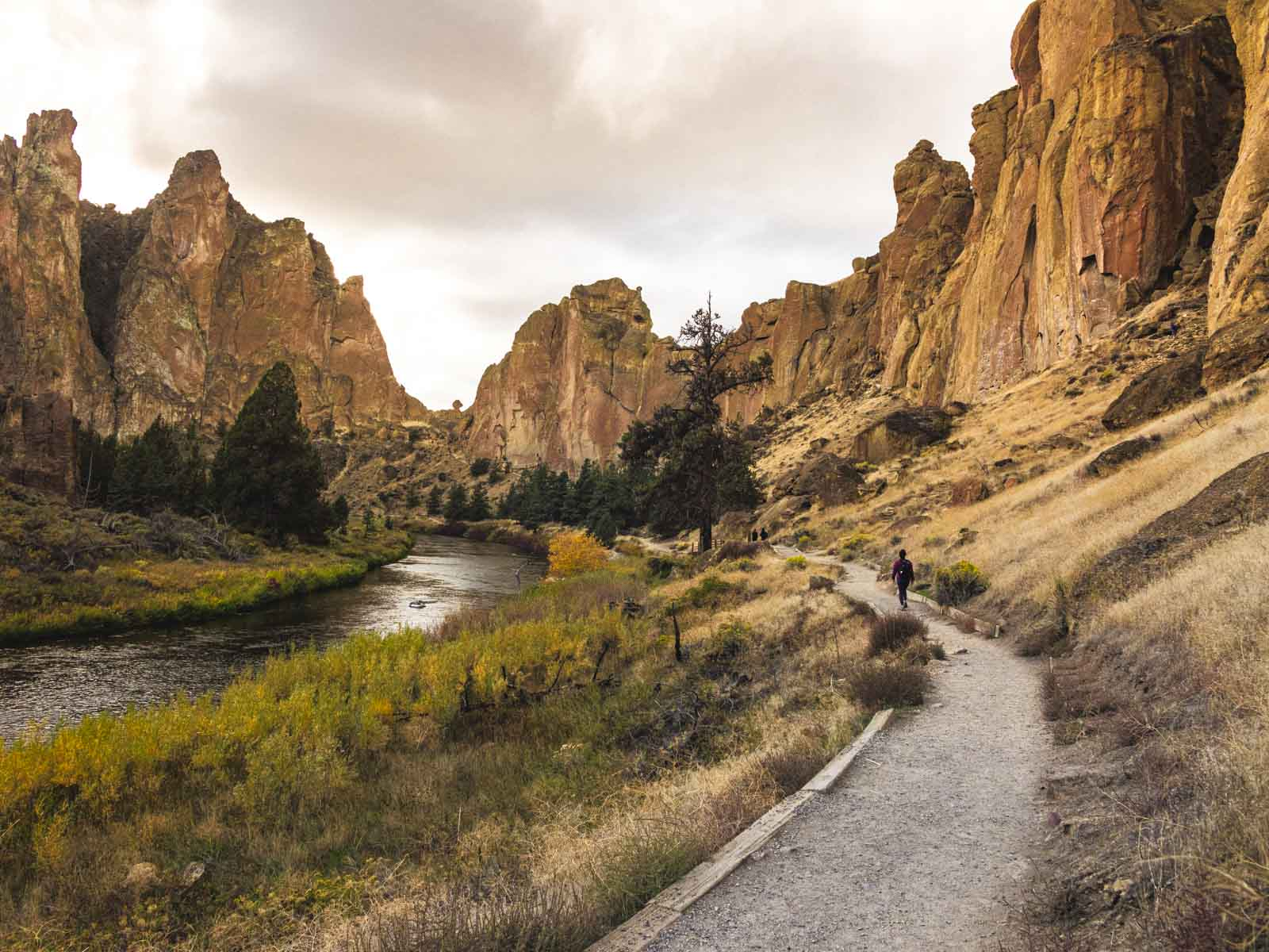
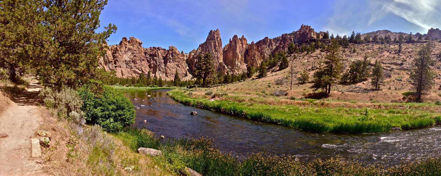
Smith Rock gets a lot of attention for what happens halfway up its walls. But you can have a wonderful day here with both feet firmly on the trail. The Crooked River curls beneath golden cliffs, junipers dot the canyon, and the views start long before the climb up Misery Ridge.
This little slice of high desert heaven sits near Terrebonne, north of Redmond and Bend. Come for a short look from the rim, a riverside walk, or a tougher hike past Monkey Face. The best visit is the one that fits your time, the weather, and the people coming with you.
Before you head out
Smith Rock at a glance
- Where it is
- Near Terrebonne in Central Oregon, north of Redmond
- From Bend
- Allow roughly 35–45 minutes by car, plus time to park
- Best for
- Big scenery, short viewpoint visits, hiking, climbing, and photography
- How long to stay
- About an hour for a first look; a half day for a walk and picnic
- Parking permit
- $10 a day for Oregon residents; $12 for nonresidents
- Hours
- Dawn to dusk, with a 30-minute allowance before sunrise and after sunset
- Easier starting point
- The rim and viewpoints near the developed day-use area
- Harder option
- Misery Ridge Loop: 4 miles on the official park map
- Dogs
- Keep pets leashed and on the trail
- What catches people out
- Exposed heat, steep canyon access, and the climb back to the car
Fees and park rules checked October 6, 2026. Visit durations and drive time are planning estimates. Check Oregon State Parks’ current Smith Rock notices before you go.
A good day without a harness
Yes, Smith Rock is worth visiting without climbing
The park’s cliffs are impressive from above and below. You don’t need a summit photo to make the trip worthwhile, and you don’t need to turn a family outing into an endurance test. Start at the rim, see how everyone feels, and decide whether to head down into the canyon.
That first decision matters more than it sounds. Once you descend toward the river, the return to the parking area is uphill. A gentle-looking riverside path can still be a tiring outing if the last climb comes during the hottest part of the day.
Short on time
Take in the rim views
Stay near the developed day-use area and follow open, signed paths to the viewpoints. This is a satisfying first visit when you’re passing through, walking with young children, or saving your legs for another hike.
Want a closer look
Walk beside the river
Head into the canyon if the approach and return suit your group. Choose a turnaround point instead of committing to a whole loop. You’ll see the cliffs from a different angle and may spot climbers overhead.
Bring a picnic
Let the scenery be the plan
A slow walk and lunch can be the whole outing. Use designated picnic areas, carry out every scrap, and leave space around climbing access paths. Bring what you need before arriving.
Have a camera
Watch the light change
The river bends, rock walls, and junipers offer plenty to work with from established paths. Early or late light adds depth to the cliffs. Leave enough time to return within day-use hours.
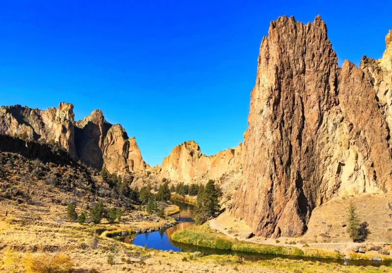
For a first visit, our choice would be a rim look followed by a manageable river walk, weather permitting. You can add distance if the group feels good. It is much harder to take miles back once you’re committed to a long loop.
Match the walk to your day
Which Smith Rock hike should you choose?
Trail names and route lengths can be confusing here. A named trail segment is not necessarily a complete hike from the parking area. The official Smith Rock trail map lists individual segments and a separate 4-mile Misery Ridge Loop. Build your outing around the actual start, connections, and return.
| Your day | Start with | Main tradeoff |
|---|---|---|
| Views with less walking | Rim Rock Trail and open rim viewpoints | Cliff edges still require care; closures can affect access |
| A flexible canyon walk | River Trail, with your own turnaround | You still have to climb back to the parking area |
| The classic hard hike | Misery Ridge Loop | Steep, exposed terrain and a bigger commitment |
| A longer hiking day | A planned Summit Trail circuit | More distance, water, route planning, and time |
| A different canyon direction | Wolf Tree Trail | Include the canyon approach in your total outing |
Rim Rock Trail: start here for a shorter visit
Rim Rock keeps you above the river and offers an introduction to the canyon without making the ridge climb your goal. The park map lists the named trail as 0.7 mile; the walk from your parking space and the way back determine your total distance.
Shorter does not mean hazard-free. Stay back from drop-offs and choose a turnaround that works for your group. Check the construction advisory, especially for visits in winter 2026–27. Do not assume every rim path is open or suitable for a stroller or wheelchair.
River Trail: an easier pace once you reach the canyon
The River Trail follows the Crooked River beneath the rock walls. It’s a good choice when you want the canyon experience without going over Misery Ridge. The mapped trail is 2.2 miles, which is a segment length rather than a promise that every River Trail outing is a 2.2-mile round trip.
A short out-and-back is often enough. Choose a landmark or time limit for turning around, and keep some energy for the climb out. Look up occasionally: the dots moving on the walls may be climbers, while a bird circling the rim can be easier to notice when you stop walking.
Misery Ridge: choose it because you want the climb
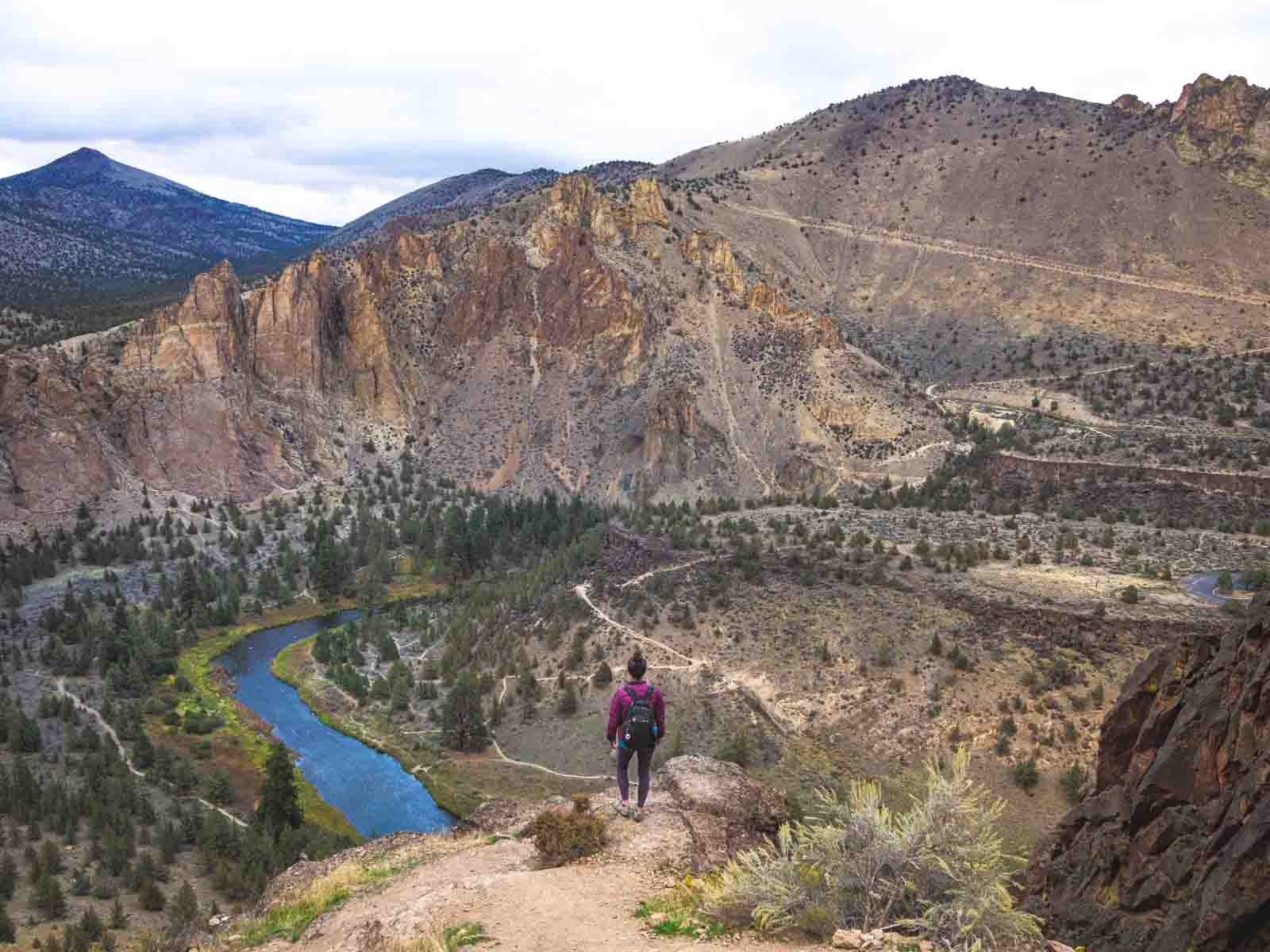
Misery Ridge is the park’s famous strenuous option, with a steep ascent, high views, and a route past Monkey Face. It makes sense for hikers who actively want a demanding outing and are comfortable with rough footing and exposed terrain. It is a poor default for a mixed group that only wants to see Smith Rock.
The official map names the full Misery Ridge Loop as 4 miles. Its separate 1-mile Misery Ridge Trail entry should not be mistaken for the whole circuit. For route details and trailhead planning, use our complete Misery Ridge Loop guide.
Summit Trail: leave room for a longer outing
A Summit Trail circuit is a different commitment from a quick canyon stroll. Connections can turn it into a much longer hike, so agree on the complete route before starting. Carry a downloaded map, allow time for breaks, and check that your chosen connections are open.
This is the option to save for a hiking day, not squeeze between a late breakfast and another reservation. Mileage varies with your start and connections; avoid treating a trail’s individual map length as the distance of the entire loop.
Wolf Tree and Canyon trails: useful options, with a return climb
Wolf Tree gives you another direction to explore along the canyon. Canyon Trail is part of the park’s access network, rather than an automatic easy, shady alternative. Both deserve a look on the map before you decide how far to go.
Watch the route as well as the scenery. A junction that looked obvious on the way down can be less obvious on the return, especially after a long day. Stay on signed trails and don’t substitute a climber’s access scramble for a walking route.
Make the arrival easier
Getting to Smith Rock, parking, and what it costs
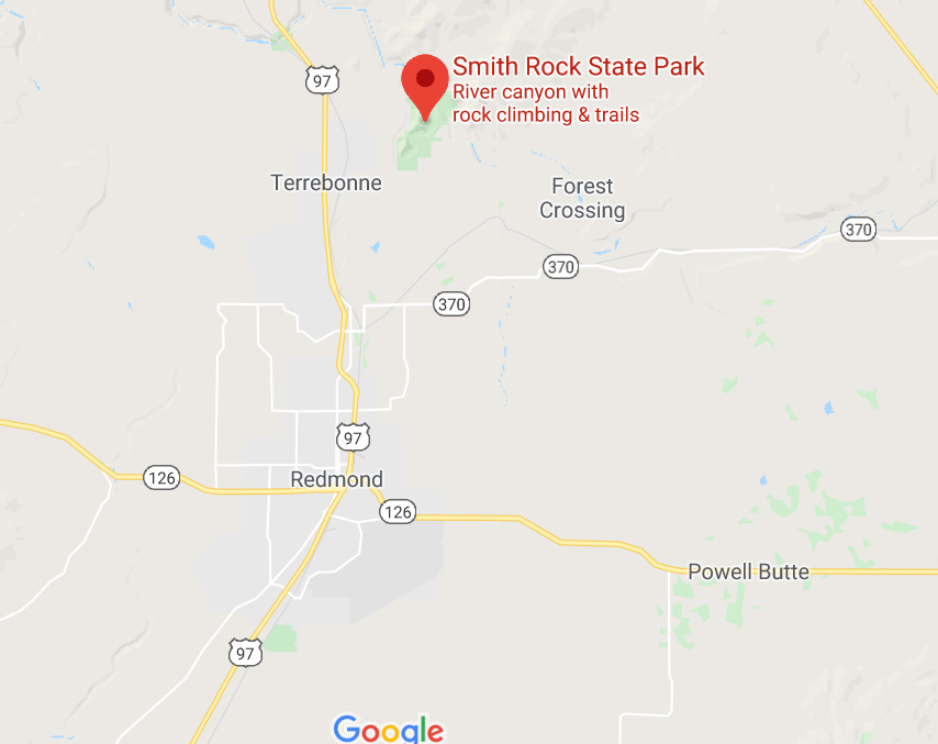
Smith Rock is near Terrebonne, north of Redmond. From Bend, travel north on US 97 and follow the signed approach through Terrebonne to the park. Use the park as your navigation destination rather than a pin on a rock formation or climbing wall.
Allow roughly 35–45 minutes from Bend in ordinary conditions, then add time for traffic and parking. Redmond is closer and can make a practical base if Smith Rock is the main reason for your trip. Our Redmond guide can help with the rest of the day.
Park only in designated spaces. If the lot is full, choose another time or another stop rather than making your own space along the road. A paid permit covers parking; it doesn’t reserve a stall.
The parking fee is per vehicle
Current daily permits cost $10 for Oregon residents or $12 for nonresidents. A 12-month Oregon State Parks parking permit costs $60 or $75 respectively. Walking, biking, or being dropped off does not incur the parking charge.
A Northwest Forest Pass or America the Beautiful pass does not replace the state-parks parking permit. Check Oregon State Parks’ permit guidance for purchase options and current rules.
On a busy day, arrive with a simple plan: which path you’re taking, how long you intend to stay, and where you’ll turn around. Sorting that out beside the car is easier than doing it in a crowded trail junction.
Timing makes a difference
When to visit Smith Rock
Spring and fall are usually the most comfortable seasons for a walking-focused visit. Summer can work well for a short early outing, while winter rewards flexibility. Check the forecast for the park area, not just the weather you left behind in Bend.
Spring
A good starting point for hiking plans, with cooler conditions than midsummer. Bring a layer for wind and a changing forecast. Comfortable weather can also mean busy trails and parking.
Summer
Choose an early start and a route you can shorten. Long exposed hikes become less appealing as the day heats up. Carry water for the whole outing and do not rely on river access as a way to cool down.
Fall
Often a good fit for a slower canyon walk and photography. Shorter days matter: leave enough daylight for the return climb and drive. A sunny afternoon can still follow a chilly morning.
Winter
Keep the plan modest when ice, snow, or wind affects footing. A rim look may be the better choice than a ridge hike. Check both weather and construction notices before leaving home.
For fewer people, a weekday and an early arrival are sensible bets, though neither guarantees quiet. Early and late light can be lovely for photographs; late arrival also gives you less margin for a longer walk.
The day-use area closes around dusk. If you want evening light, plan your return before closing rather than extending the outing into an after-dark visit.
Bring the right expectations
Visiting with kids, dogs, or limited mobility
Smith Rock can be a memorable family stop when the route fits the family. Start with a short rim visit, keep children close near drop-offs, and add a canyon walk only if everyone can manage the return. A picnic and a few viewpoints may be a better day than a long hike.
For a stroller, wheelchair, or anyone who needs a predictable walking surface, get specific advice from the park before committing to a route. The park’s adopted master plan notes that few existing trails meet accessibility standards. An easier route on a hiking map is not the same thing as a step-free or wheelchair-accessible route.
The biggest practical distinction is staying on the rim versus descending into the canyon. The latter adds a steep approach and an uphill finish. Call the park at 541-548-7501 about current surfaces, access, and closure effects for your needs.
Dogs belong on a leash and on the trail. Bring water for your dog as well as yourself, pick up waste, and choose a shorter visit in hot weather. Don’t assume a dog that enjoys an easy neighborhood walk will enjoy a sun-exposed ridge climb.
The other reason people come
Climbing, Monkey Face, and watching from the trail
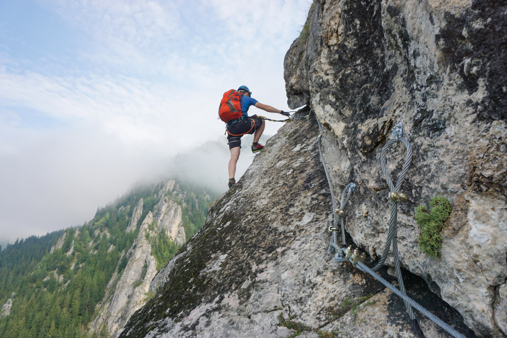
Smith Rock is an important American sport-climbing destination, and the sight of people moving up those walls is part of its appeal. You can enjoy watching without joining in. Give climbers and belayers room, keep clear of ropes and equipment, and avoid standing directly under an active climb.
Monkey Face is the formation many visitors recognize from photographs. Seeing it from a hiking route and climbing it are very different outings. Do not treat a route to a viewing area as instructions for reaching the top of the spire.
If you want to try outdoor climbing for the first time, look for an established local guiding service and discuss your experience and goals before booking. For experienced climbers, current route information and closure notices matter more than a broad visitor guide. Areas such as the Monument and Red Wall require their own route planning.
Follow posted raptor-protection closures and check current notices before choosing a climbing area. An open park does not mean every climb is available.
Other ways to enjoy the park
Bring binoculars for a quieter wildlife-focused visit, or pause beside the river and watch the canyon rather than racing through it. You may see birds of prey, deer, or animals along the water; sightings are a bonus, not a scheduled attraction.
Mountain biking is another option on permitted routes, but steep grades, loose terrain, and other trail users make it a separate planning decision. Check the map’s allowed-use symbols instead of assuming every hiking trail permits bicycles. For most first-time visitors, walking is the simpler way to get acquainted.
Keep photography on established trails. Drones are prohibited in the park, and commercial portrait sessions need advance contact with park staff. Protect the place by following Leave No Trace practices, respecting closures, and leaving plants and rocks where you found them.
Stay close or make it a day trip
Camping at Smith Rock and choosing a base
The park’s Bivouac Area is a walk-in, first-come tent campground. It is a useful option for visitors who want to spend more time here, but it is a different experience from an RV campground or a reserved campsite with a vehicle beside the tent.
The park profile lists a $12 per person, per night base rate. Out-of-state campers pay 25% more under Oregon State Parks’ overnight fee policy, so budget $15 and confirm the posted rate when you arrive. Sleeping in vehicles, RV camping, and open fires are prohibited. Camping operates seasonally as weather allows; check the park’s posted season and facilities before you arrive.
For an RV or vehicle-camping trip, investigate a permitted campground instead. The park directs visitors toward nearby Skull Hollow. Confirm that campground’s operating dates, availability, facilities, and current rules with its manager, and bring the supplies your setup requires.
If a bed and shower after the hike sound better, Redmond is a convenient starting point. Bend gives you more ways to combine the park with restaurants and other activities, with a longer drive to Smith Rock. Choose your base around the whole trip rather than a single exact drive-time estimate.
Use our Oregon camping guide to compare trip styles and our Bend guide to plan a broader stay.
A simple first visit
How we’d spend a half day at Smith Rock
- Arrive with the day ahead of you — park legally, sort your permit, and read the current notices.
- Start at the rim — take in the canyon and decide whether the weather and your group favor going down.
- Choose one walking plan — a short river out-and-back or a longer hike, with a clear turnaround and time limit.
- Leave room to stop — take photographs, watch the climbers from a respectful distance, and enjoy your picnic.
- Finish without a rush — return with energy for the uphill approach, then head into Terrebonne or Redmond for the rest of the day.
If Misery Ridge is the goal, give the hike its own time window and use the trail-specific guide. Trying to fit the ridge into a quick scenic stop is where an easy day becomes a pressured one.
A little context
The landscape has a longer story
Smith Rock’s rock walls, river corridor, and high desert setting are reason enough to slow down. The scene changes as you move from the rim to the water: distant views give way to the scale of the cliffs, and the river becomes the thread tying the canyon together.
The state acquired the park through purchases and gifts between 1960 and 1975. Its name has competing historical explanations; Oregon State Parks presents the origin as debated. That uncertainty is worth preserving rather than turning one account into a settled fact.
For more ideas nearby, use our Central Oregon guide. If you want another hiking day, our Oregon hiking guide can help you choose a route that fits your trip.
A few things people ask
Smith Rock questions, answered
Can you visit Smith Rock without hiking?
Yes. Start with the developed day-use area and open rim viewpoints for a shorter look at the canyon. The amount of walking depends on your parking space and chosen viewpoint; check access details if you need a specific surface or step-free route.
Is Smith Rock worth visiting if you aren’t a climber?
Yes. The rock formations, river scenery, walking routes, and photographs make it a worthwhile visit on their own. Watching climbers is an added interest, and you can enjoy the park without taking on Misery Ridge.
How much time do you need at Smith Rock?
As a planning estimate, allow about an hour for a first look and longer for parking on busy days. A half day gives you room for a walk, photographs, and lunch. A strenuous or extended hike needs its own schedule.
What is the easiest way to see Smith Rock?
Stay near the rim and choose open viewpoints rather than descending into the canyon. If you want a river walk, account for both the way down and the uphill return. Pick the route for your group’s needs, not just the trail’s difficulty label.
How far is Smith Rock from Bend?
It is a drive north toward Terrebonne via US 97. Allow roughly 35–45 minutes in ordinary conditions, plus time to park. Traffic, your starting location, and weather can change the trip.
Is Misery Ridge the same as the River Trail?
No. Misery Ridge includes a strenuous climb, while River Trail follows the canyon. The full Misery Ridge Loop connects multiple sections. See the route comparison above and open the official map before choosing your hike.
Can you bring dogs or a stroller?
Dogs must be leashed and stay on the trail. For a stroller, choose a route based on actual surfaces and slopes; don’t assume a trail called easy is stroller-friendly. Contact the park for current access advice.
Can you camp in your car at Smith Rock?
No. Vehicle camping is prohibited at the park. The Bivouac Area is for walk-in tents; use an appropriate permitted campground if your trip depends on sleeping in a vehicle.
Planning sources: Oregon State Parks’ Smith Rock profile and advisories, current parking permit rules, official Smith Rock trail map, and the adopted park master plan for accessibility context. Operating facts checked October 6, 2026. Trail conditions, fees, facilities, and closures can change.
The official That Oregon Life store
The Oregon you bring home.
Start the day with Oregon-roasted coffee, then find original gear inspired by the places, stories, and oddities that make this state ours.
Shop Oregon gear