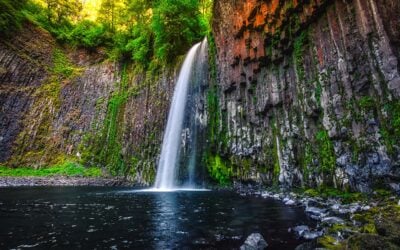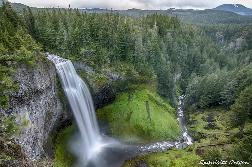
Salt Creek Falls and Diamond Creek Falls give you two very different waterfall experiences from one trailhead near Oakridge. The first is a 286-foot plunge you can see after a short, paved walk. The second rewards hikers who continue into the forest on the 3.2-mile Diamond Creek Falls Loop.
This guide is for the full Salt Creek Falls and Diamond Creek Falls hike: which route to choose, where the junctions go, how winter changes access, and what to check before you drive Highway 58. If you only want the overlook, start with our Salt Creek Falls visitor guide. You can also save our separate Diamond Creek Falls guide for the hiking destination itself.
Last fact-checked September 9, 2026: The Forest Service lists the observation site as open and does not name Trail #3598 in the current closure orders. Conditions can change after storms, fires, or early snow, so use the official links below on the day you go.
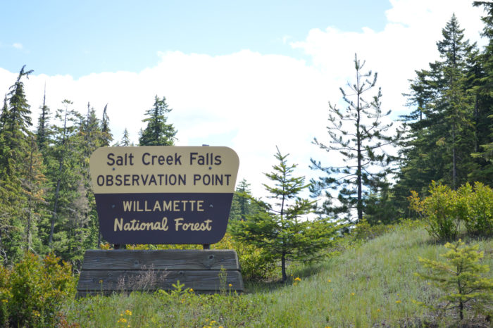
Salt Creek Falls hike at a glance
| Route | Distance | Difficulty | Best for |
|---|---|---|---|
| Upper observation platform | About 50 yards each way | Easy | A fast waterfall stop and accessible viewing when the main site is open |
| Short paved rim and picnic loop | Up to about 250 yards | Easy | More viewpoints without committing to the forest loop |
| Salt Creek–Diamond Creek Falls Loop | 3.2 miles | Moderate | The complete two-waterfall hike |
- Trailhead: Salt Creek Falls Observation Site, 23 miles southeast of Oakridge and about 5 miles west of Willamette Pass
- Pass or fee: $5 per vehicle per day, Northwest Forest Pass, or an accepted interagency recreation pass during the regular season
- Restrooms: Vault toilets at the observation site; in winter, use the facilities at the Sno-Park
- Water: No potable water at the site
- Dogs: At the developed site, dogs must be on a leash no longer than six feet or otherwise under physical control
- Winter: The observation site is normally closed; park at Salt Creek Sno-Park and travel about 0.4 mile along the road to the falls
Why you may see different mileage online: The Forest Service describes the main Diamond Creek Falls Loop as 2.5 miles from the footbridge, while its Salt Creek Falls trail page lists the connected visitor route as 3.2 miles. For planning, use 3.2 miles; your recorded distance may be longer if you walk every viewpoint and side trail.
The official That Oregon Life store
The Oregon you bring home.
Start the day with Oregon-roasted coffee, then find original gear inspired by the places, stories, and oddities that make this state ours.
Shop Oregon gear


Which route should you choose?
Choose the overlook for the easiest visit
The upper platform sits approximately 50 yards from the parking lot. The paved approach and platform are wheelchair accessible when the regular observation site is open, and the railing is designed with lower sight lines. This is the best choice for mixed-ability groups, road-trippers, or anyone who wants a dramatic waterfall view without a trail hike.
Do not extend that accessibility description to winter. The parking lot is not maintained for snow and ice, the observation site is normally closed, and access shifts to the Sno-Park. Snow travel is a different outing.
Choose the 3.2-mile loop for the full hike
The Diamond Creek Falls Loop is the better choice if you came to hike rather than make a roadside stop. It follows forest tread above the Salt Creek and Diamond Creek canyons, passes short viewpoint spurs, and reaches the trail to the base of Upper Diamond Creek Falls. The mileage is moderate, but roots, uneven tread, a steep waterfall spur, lingering snow, and seasonal blowdown make it meaningfully harder than the overlook.
Salt Creek Falls and Diamond Creek Falls trail guide
1. Start with Salt Creek Falls
From the signed parking area, follow the paved path to the observation platform. Salt Creek drops 286 feet over the canyon wall, making it Oregon’s second-highest single-drop waterfall. The top-down view is immediate, loud, and much bigger than the short approach suggests.
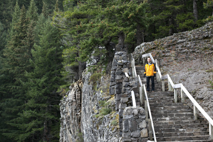
Stay behind the railings and keep children close. Wet basalt and cliff edges are unforgiving, even in clear weather. A separate trail descends from the platform toward the base of Salt Creek Falls, but it is steep and stair-heavy. It is not part of the Diamond Creek loop described here, and it is a poor add-on in snow, ice, or slick conditions.
2. Cross Salt Creek and begin the loop
Continue through the picnic area and cross the footbridge over Salt Creek. This is the practical start of Diamond Creek Falls Trail #3598. At the first loop junction, take the branch toward the canyon-rim viewpoints for the most scenic opening to the hike. Because it is a loop, the opposite direction also works, but trail conditions may make one side easier than the other.
A 0.25-mile spur leads to Too Much Bear Lake. Treat it as an optional forest side trip, not the main event. There is no need to repeat the old internet folklore about the lake’s name; the useful reason to go is a quieter pause away from the two waterfall viewpoints.
3. Follow the canyon rim toward Diamond Creek
The trail rolls through mountain hemlock, silver fir, rhododendron, and damp forest above the canyon. Openings reveal Salt Creek Canyon and partial views of Lower Diamond Creek Falls. Early in the snow-free season, mosquitoes can be intense; later in the year, dusty tread gives way quickly to wet roots after storms.
4. Take the steep spur to Upper Diamond Creek Falls
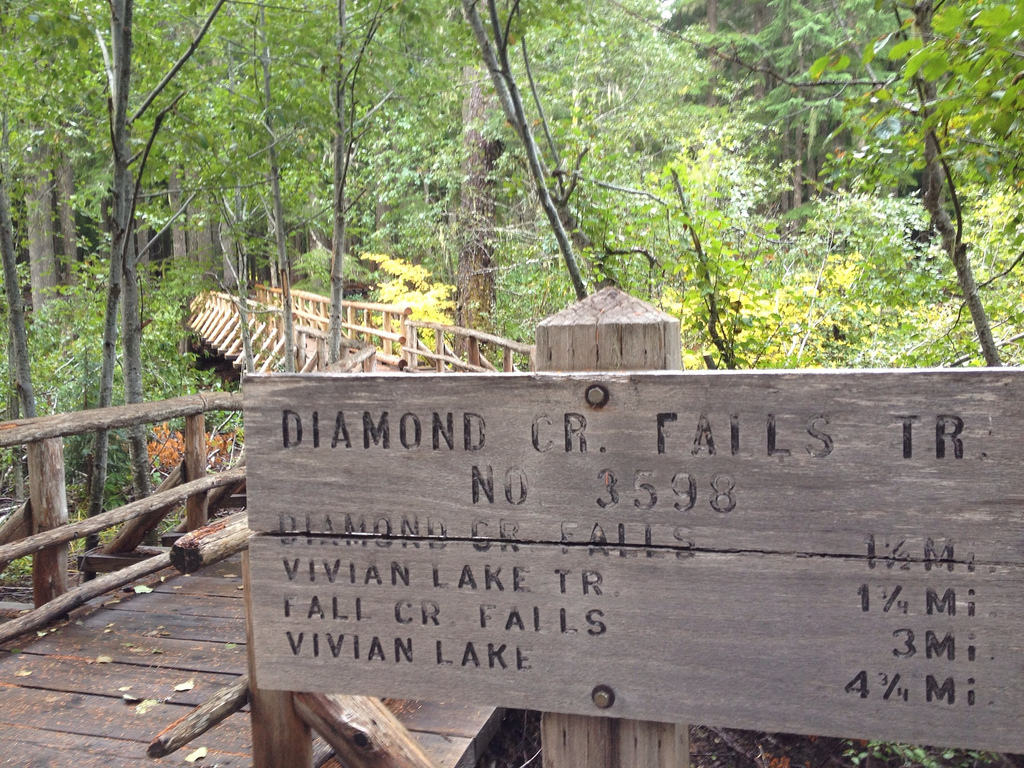
At the signed waterfall junction, the spur to the base of Upper Diamond Creek Falls leaves the main loop. This is the highlight of the hike, but it is also the section that deserves the most judgment. The Forest Service specifically notes a steep log stairway before the route crosses a large cedar-log footbridge.
Descend only if the tread is open, visible, and within your comfort level. Turn around if snow hides the stairs, ice coats the wood, high water affects the crossing, or downed trees obscure the route. Trekking poles can help on the return climb, but they do not make unsafe conditions safe.
5. Complete the loop instead of drifting onto Vivian Lake Trail
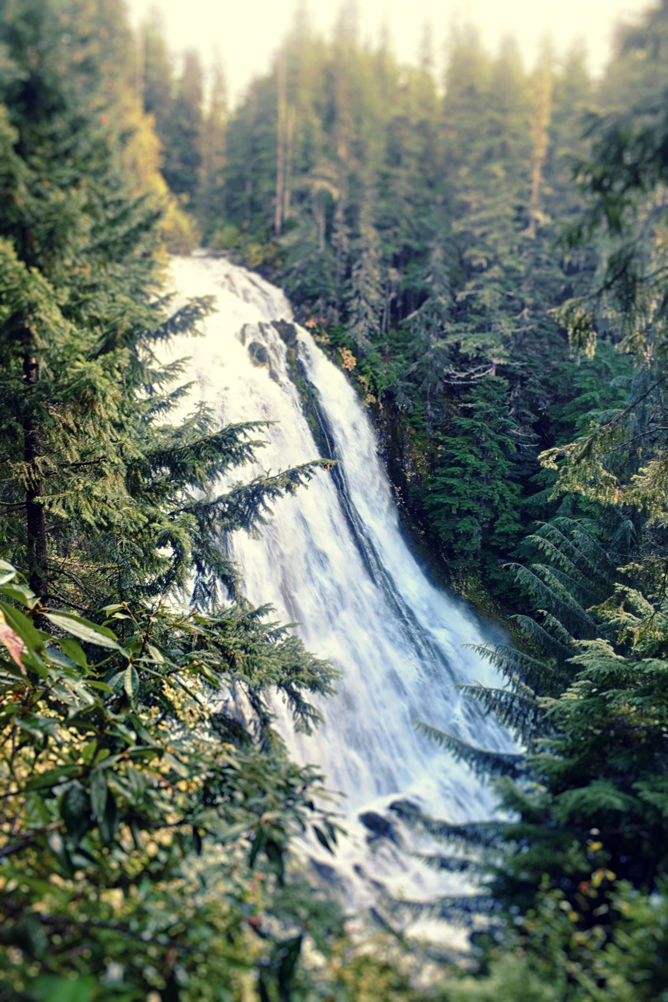
Return from the waterfall spur to the main junction. The Vivian Lake Trail #3662 continues south, while the Diamond Creek Falls Loop turns east to return toward Salt Creek. Follow the signs for the loop. The return crosses Forest Road 5893-420 twice before bending northeast to the observation site.
Do not rely on an old screenshot or a single GPS track at unsigned junctions. Carry an offline map, note the trail numbers, and match your route to current signs. Adding Vivian Lake or Fall Creek Falls changes the distance, difficulty, and time commitment and should be planned as a separate hike.
Parking, passes, and directions
The trail begins at the Salt Creek Falls Observation Site and Picnic Area, east of milepost 57 on Oregon Highway 58. Turn onto Forest Service Road 5893 and follow the signs. The Forest Service places the site 23 miles southeast of Oakridge and approximately 5 miles west of Willamette Pass.
The current regular-season charge is $5 per vehicle per day, or you can display a valid Northwest Forest Pass or accepted interagency recreation pass. Spaces for trailers are limited. If the lot is full, use signed overflow at Salt Creek Sno-Park about 0.4 mile up the road. Never improvise a shoulder space on Highway 58 or along the access road.
Cell service can be unreliable in the Cascades. Download directions and your trail map before leaving Oakridge or crossing Willamette Pass.
Best time to hike
Late spring through fall
The most straightforward hiking window begins after the loop melts out and runs until meaningful snow returns. Water volume is often strongest in spring, rhododendrons brighten the forest around early summer, and autumn can bring fewer bugs and crisp trail weather. Snow can linger at this elevation even when Oakridge is warm, so the calendar is not a substitute for conditions.
Winter access is a snow outing
In winter, the main observation site is normally closed. Park at Salt Creek Sno-Park and travel about 0.4 mile along the road to reach the falls. Oregon requires a Sno-Park permit at designated Sno-Parks from November 1 through April 30.
The loop is used for snowshoeing and cross-country skiing, but winter markers do not remove avalanche, creek-crossing, navigation, hypothermia, or tree-fall risk. Avoid waterfall-base spurs when snow or ice makes the stairways, bridges, and canyon terrain consequential.
What to bring
- Offline map showing Trails #3673, #3598, and the Vivian Lake junction
- Water, because potable water is not available at the observation site
- Grippy shoes for roots, wet rock, and the Diamond Creek spur
- Layers and rain protection; the Highway 58 corridor changes quickly
- Bug protection in late spring and early summer
- Traction, snowshoes, and winter navigation tools when conditions require them
- A leash no longer than six feet for dogs at the developed site
Check conditions before you leave
Open does not mean recently cleared or snow-free. Start with the Willamette National Forest alerts page, then review the official pages for Salt Creek Falls Trail #3673 and Diamond Creek Falls Trail #3598. If details are unclear, call the Middle Fork Ranger Station at 541-782-2283.
For more trip ideas, use our hand-built guides to Oregon waterfalls, Oregon hikes, and waterfalls near Eugene. Before any waterfall hike, review our waterfall safety guide.
Salt Creek Falls hike FAQ
How long is the Salt Creek Falls and Diamond Creek Falls hike?
Plan on 3.2 miles for the connected loop from the Salt Creek Falls visitor area. The Forest Service also describes 2.5 miles of loop trail beginning at the footbridge, which explains some of the shorter numbers online. Viewpoint and lake spurs can push a GPS recording higher.
Can you see Salt Creek Falls without hiking the loop?
Yes. The main observation platform is about 50 yards from the regular parking lot. When the observation site is open, the paved approach and platform are wheelchair accessible. Winter access is longer and not equivalent because visitors normally start at the Sno-Park.
Is the Diamond Creek Falls trail hard?
We rate the full loop moderate. Most of the mileage is manageable for prepared hikers, but the spur to the base of Upper Diamond Creek Falls is steep, with a log stairway and a cedar-log footbridge. Snow, ice, mud, blowdown, or high water can raise the difficulty quickly.
Is there a fee at Salt Creek Falls?
The Forest Service currently lists a $5-per-vehicle day-use fee or a valid Northwest Forest Pass or accepted interagency recreation pass. Winter parking at the Sno-Park requires an Oregon Sno-Park permit from November 1 through April 30. Verify fees before departure because agency rules can change.
Are dogs allowed?
Dogs are allowed, but at the developed recreation site they must be on a leash no longer than six feet or otherwise under physical restrictive control. Keep them away from cliff edges, fast water, and slick waterfall terrain.