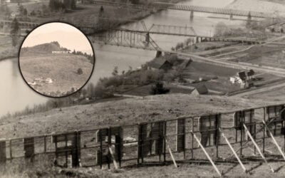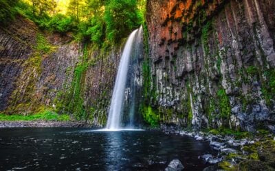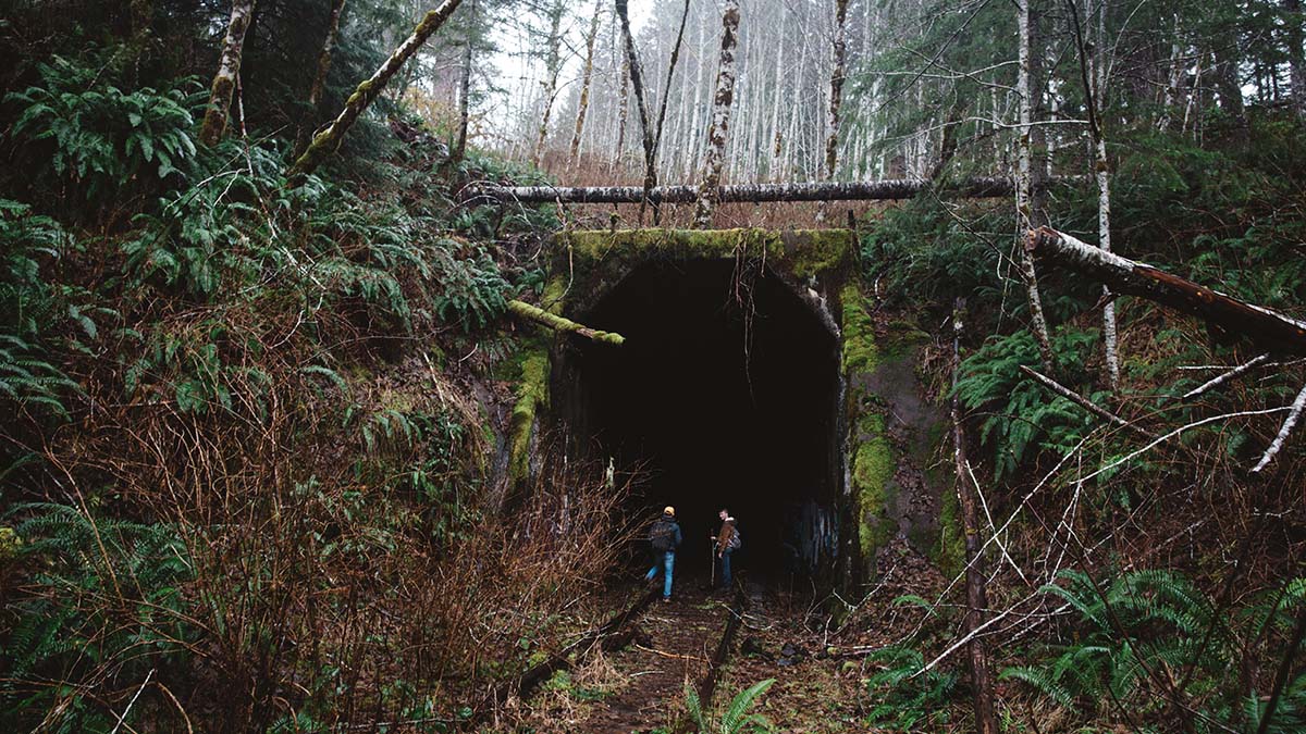
Ten years ago, That Oregon Life introduced readers to the Salmonberry corridor, a place that seemed to exist somewhere between Oregon history and an outdoor legend. Back in 2016, the old railroad through the Coast Range was known for rusting tracks, dark tunnels, towering trestles and sections where storms had washed the earth away beneath the rails. It fascinated photographers, railroad enthusiasts and experienced hikers, but much of the route was dangerous, officially closed and never intended to function as a public trail.
At the time, the possibility of turning the corridor into a hiking and biking route still felt distant. The idea existed, and supporters were beginning the long process of imagining what the railroad could become, but the obstacles were enormous. The route crossed remote forests, rivers, active railroad sections and some of the most challenging terrain in western Oregon.
A decade later, the Salmonberry Trail is no longer simply an intriguing proposal.
The vision has grown into an active, long-term effort to create an 82-mile multiuse trail extending from Banks to the Oregon Coast. The Salmonberry Trail Foundation and its partners are now advancing individual sections through planning, engineering, permitting, fundraising and construction preparation. Work has broken ground along the coast, volunteers have spent thousands of hours clearing and monitoring the corridor, and priority projects are moving closer to becoming usable public trail.
This is not an abandoned railroad suddenly opening as an 82-mile hiking route. The Salmonberry Trail remains a work in progress, and the historic corridor is not currently open for independent public use. Some portions are still used by the Oregon Coast Scenic Railroad, while storm-damaged sections remain unsafe. For now, the safest legal opportunities to experience the route come through guided hikes and organized volunteer events offered when access can be carefully managed.
Even with those important limitations, the progress is real. What makes the Salmonberry Trail so compelling is not simply its length or the scenery it will eventually reveal. This is a project that could reconnect rural communities, preserve one of Oregon’s most remarkable railroad corridors and create a continuous recreation route reaching from the Portland metropolitan area to the coast.
It is the kind of project that will take years to finish, but could remain part of Oregon for generations.
A Railroad Built Through an Unforgiving Landscape
The Salmonberry story begins long before anyone imagined bicycles or hiking shoes replacing locomotives.
The Pacific Railway and Navigation Company began building its railroad through the northern Oregon Coast Range during the early 1900s. The line was intended to connect inland communities with Tillamook and the Oregon Coast, creating a reliable route for passengers, timber, farm products and freight.
Construction workers faced a landscape that resisted nearly every effort to cross it. The Coast Range was steep, wet, heavily forested and prone to landslides. Crews had to blast tunnels through mountains, build bridges across rivers and erect trestles over deep ravines. Rain turned work areas into mud, swollen waterways damaged construction and unstable slopes repeatedly challenged engineers.
The workers who built the line came from a wide range of backgrounds. Immigrants from Japan and several European countries labored alongside other railroad crews to force a transportation route through terrain that had previously separated the coast from inland Oregon. The tracks were first laid more than a century ago, with the railroad reaching completion around 1911.
The line earned the memorable nickname “Punk, Rotten and Nasty,” a play on the initials PR&N. The name captured both the railroad’s rough character and the extraordinary difficulty of keeping it operating through the Coast Range.
Despite those challenges, the railroad became an important connection between communities. It linked places that had once been separated by mountains and difficult roads, carrying freight and passengers between the coast and the interior. Communities including Manning, Timber, Mohler, Wheeler, Rockaway Beach and Tillamook were tied together by a route that represented modern transportation in an era before Oregon’s current highway network.
The railroad was impressive, but it was never stronger than the landscape surrounding it.
Storms, flooding, landslides and wildfire repeatedly damaged the line. The Tillamook Burn fires scorched enormous areas of the Coast Range during the twentieth century, while heavy winter rains continued to threaten tracks, bridges and slopes. Keeping trains moving required constant attention and repair.
Then, in December 2007, the Great Coastal Gale delivered a devastating blow.
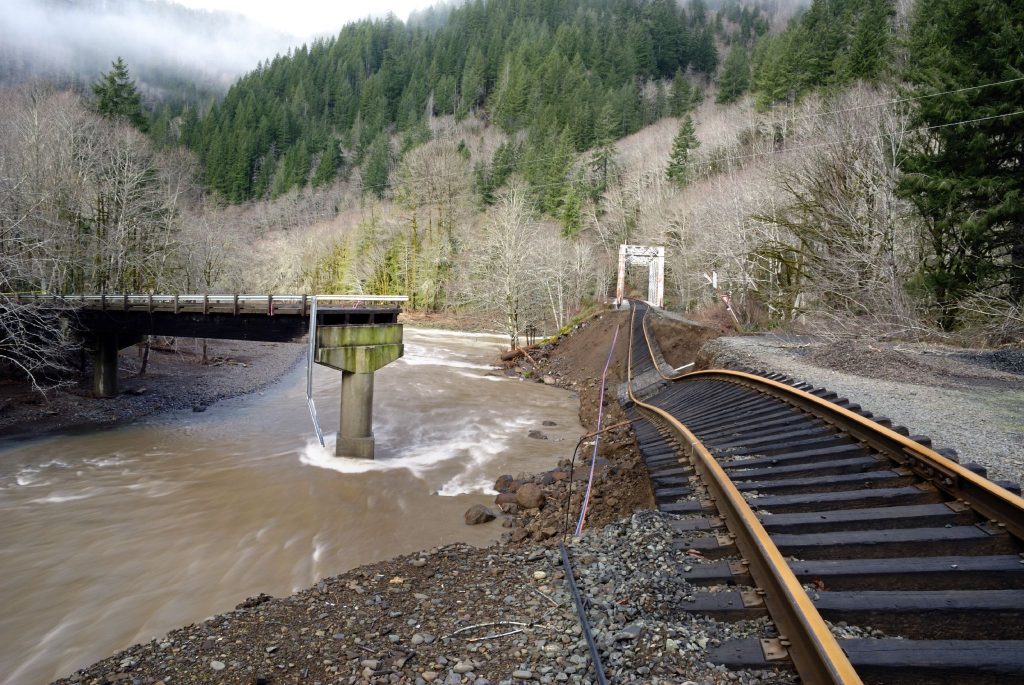
The storm brought intense rainfall and powerful winds to northwestern Oregon. Flooding and landslides tore apart sections of the railroad, washing away track beds and damaging infrastructure throughout the corridor. Some of the destruction occurred in remote areas where repairs would have been extremely difficult and expensive.
Regular rail operations through the storm-damaged canyon ended, leaving large portions of the railroad quiet for the first time in generations.
When the Forest Began Reclaiming the Tracks
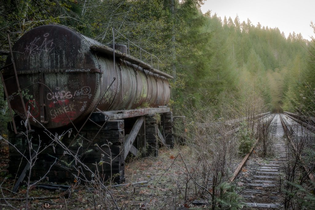
Once trains stopped moving through the most isolated sections, the railroad began changing quickly.
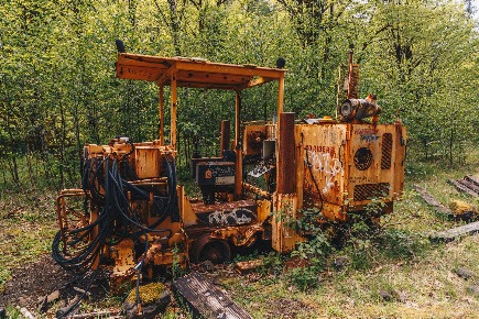
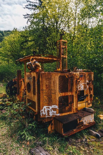
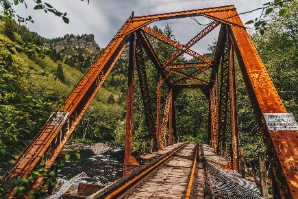
Moss spread across wooden ties. Ferns and shrubs pushed through the gravel. Mushrooms appeared between the rails, while fallen branches and young trees narrowed the corridor. Rust softened the surfaces of old track and equipment as the surrounding forest slowly reclaimed the ground.
The result was visually extraordinary. The abandoned sections looked less like a transportation corridor and more like a forgotten passage into another version of Oregon.
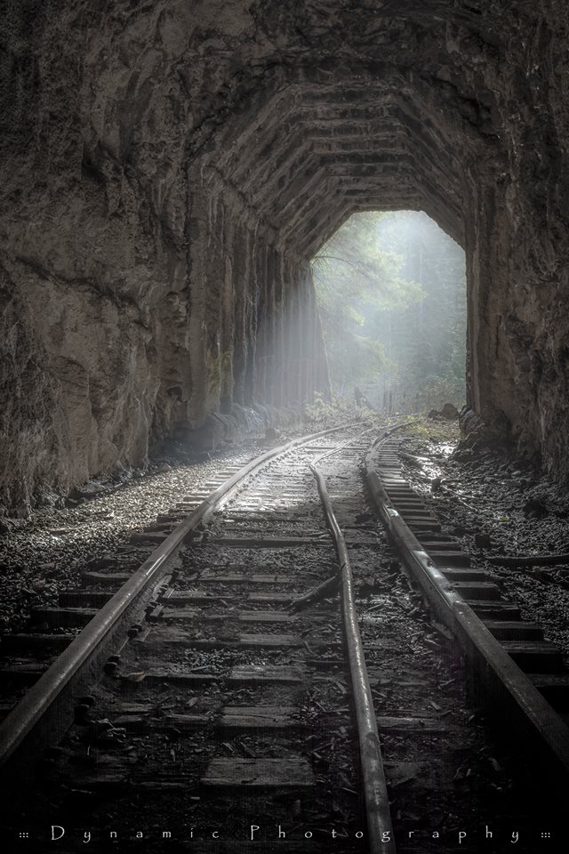
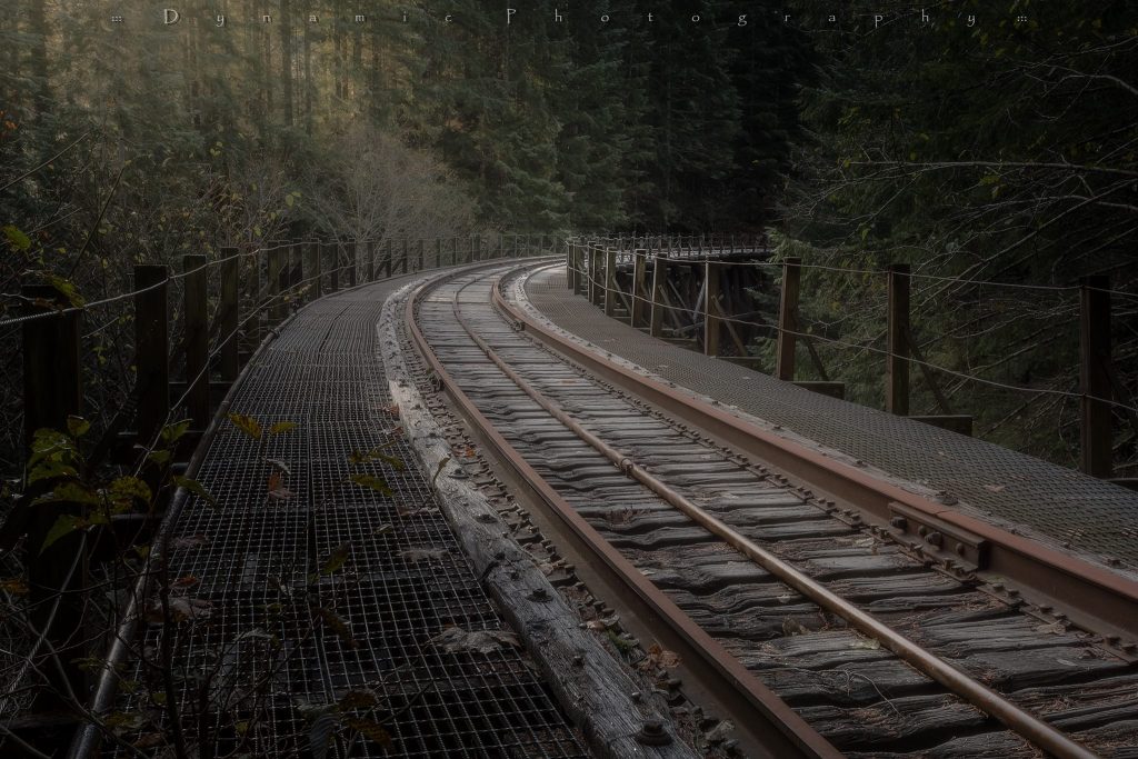
That appearance helped the Salmonberry develop a cult following. Images of rails disappearing into fog, tunnels opening into green forest and trestles suspended over deep canyons circulated among hikers and photographers. The route felt mysterious because it passed through places that most Oregonians had never seen from a road or established public trail.
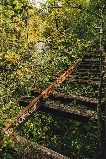
The isolation also made it dangerous.
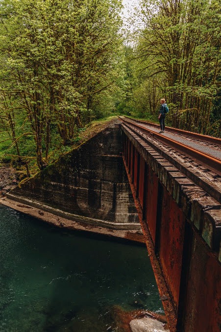
Sections of the old rail bed had washed away. Some trestles and bridges had not been designed or maintained for pedestrian use. The footing could be slippery and uneven, while cell service in the canyon was unreliable or nonexistent. Entering a tunnel or crossing an aging railroad structure was nothing like walking a maintained state park trail.
Our 2016 article reflected that strange moment in the corridor’s history. There was enormous interest in the railroad, but no safe, connected public path. The dream of a future trail was beginning to take shape, yet the route itself remained closed and hazardous.
Today, the Salmonberry Trail Foundation is trying to replace that unofficial and risky relationship with the corridor with something permanent, legal and carefully maintained.
The goal is not merely to clear vegetation and invite people onto the tracks. Every proposed section must move through land-use approvals, environmental review, engineering, bridge and trestle planning, emergency access considerations, construction funding and long-term maintenance agreements before it can safely open.
That careful approach may not move as quickly as trail supporters would like, but it is essential. An 82-mile corridor across the Coast Range cannot be treated like a short neighborhood path. Once a section opens, someone must be responsible for inspecting it, maintaining it and responding when storms, fallen trees or erosion cause damage.
The Foundation’s current message is clear: the objective is not simply to open miles of trail. It is to build sections that communities can support and care for over the long term.
What the Finished Salmonberry Trail Could Become
The complete Salmonberry Trail is planned to stretch approximately 82 miles from Banks to the Oregon Coast, following much of the historic railroad corridor toward Tillamook.
Beginning near Banks, the proposed route would connect with the larger regional trail network around the Banks-Vernonia State Trail and L.L. Stub Stewart State Park. From there, it would travel through forests and rural communities before following the Nehalem and Salmonberry river corridors toward the coast.
The western portion would continue through communities around Tillamook Bay, including Wheeler, before reaching Tillamook.
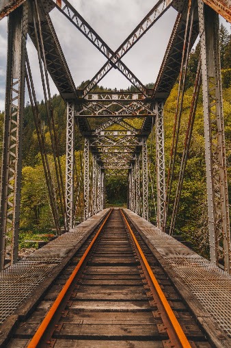
The route is expected to include ten historic railroad tunnels and more than 70 trestles, some rising high above the forest and waterways below. Those structures are among the most spectacular parts of the original railroad, but they are also among the most complex and expensive features to prepare for public use.
Some may require substantial repairs. Others will need engineering studies, new decking, safety railings or complete rehabilitation. Each structure must be evaluated individually rather than assumed safe simply because it is still standing.
When complete, the trail would carry hikers, cyclists, runners and other nonmotorized users through an unusually diverse cross-section of northwestern Oregon. The route would move from the edges of the Portland metro area into farms, small towns, thick Coast Range forest, river canyons, tidal areas and communities along Tillamook Bay.
That variety is part of what separates the Salmonberry from a typical rail trail.
Many converted railroad routes are relatively flat paths passing through towns or agricultural land. The Salmonberry would retain the gentle grades associated with railroad engineering, but the surrounding scenery could feel genuinely wild. Travelers would pass through remote canyons where the river, forest and remains of the railroad dominate the landscape.
It would also create a connection between trails and communities that already attract outdoor travelers. The Banks-Vernonia State Trail has demonstrated how a former rail corridor can become one of Oregon’s most beloved biking and walking routes. Linking the Salmonberry into that network could eventually allow people to travel from the Portland area toward the coast largely under their own power.
That would be a remarkable addition to Oregon’s outdoor recreation system.
More Than a Scenic Route
It is easy to focus on the tunnels, trestles and forest views, but the Salmonberry Trail Foundation sees the project as something larger than an adventure destination.
The railroad once connected a dozen communities along the route. When service ended through damaged sections, part of that physical connection disappeared. A completed trail could tie those places together again, this time through recreation, tourism, education and community use.
For towns along the corridor, the trail could bring visitors who stay overnight, eat at local restaurants, purchase supplies and spend time exploring places beyond Oregon’s busiest destinations. Cyclists and long-distance hikers tend to travel more slowly than motorists, creating opportunities for smaller communities that are often passed at highway speed.
Wheeler, Timber, Manning, Mohler, Rockaway Beach and other communities could each have a different relationship with the trail. Some may become stopping points for food or lodging. Others could offer access to short local segments, historical interpretation or outdoor education.
The trail could also give residents safer places to walk and bike. In coastal communities where Highway 101 carries heavy traffic, a separated path can be more than a tourism amenity. It can provide children, families and local residents with a practical alternative to walking along a busy roadway.
Supporters in Rockaway Beach were among those advocating for safer routes long before the current project reached this stage. Their concerns helped demonstrate that the Salmonberry could serve everyday community needs as well as visitors seeking a grand Coast Range adventure.
Educational opportunities are also part of the vision. Proposed areas such as a learning corridor near Manning and Williams Creek could give school groups a place to study art, science, ecology and Oregon history outside a traditional classroom.
A railroad corridor passing through forest, rivers, wetlands and rural communities offers nearly endless possibilities for field trips. Students could learn about salmon habitat, native plants, geology, engineering, railroad history, Indigenous culture and the complicated relationship between industry and the natural environment.
For adults, the trail could serve many of the same purposes. It could be a place for exercise, quiet walks, photography, wildlife observation or simply stepping away from daily routines.
That may sound less dramatic than crossing a 170-foot trestle or walking through a moss-covered tunnel, but it is central to the project’s value. Trails become enduring public spaces because they work for local residents on ordinary days, not only because tourists arrive for once-in-a-lifetime adventures.
Building 82 Miles One Practical Section at a Time
The Salmonberry Trail will not appear all at once.
The Foundation is focusing on priority areas where funding, public support, engineering and partnerships can produce tangible results. That approach gives communities sections they can eventually use while the far more complicated canyon portions continue through years of technical work.
The Wheeler Demonstration Project is one of the most visible signs of progress on the coast. Groundbreaking and corridor work have marked a shift from broad planning toward physical implementation. The segment is intended to connect Wheeler’s waterfront, community and businesses while demonstrating what the larger trail can look like.
The project’s current official information does not describe the Wheeler section as generally open for independent trail use. Although an earlier feature described a three-quarter-mile demonstration trail as open, the Foundation’s newer public-access guidance says the Salmonberry Trail is not yet open to the general public. Visitors should rely on the Foundation’s latest announcements before assuming any segment is available.
Farther inland, work around the Williams Creek Trestle is moving through design and permitting. That project could connect the Salmonberry corridor with L.L. Stub Stewart State Park while helping establish an outdoor learning area.
The proposed Catalyst Loop is another priority. It could connect the future Salmonberry Trail with the Banks-Vernonia State Trail and Stub Stewart, providing an early public connection in Washington County.
The remote river and canyon sections present the greatest challenges. These are also the portions that capture the public imagination, with tunnels, trestles, dramatic river views and deep forest. Yet their isolation makes construction, safety and maintenance exceptionally difficult.
Emergency access must be planned. Environmental impacts must be studied. Bridges and trestles require detailed inspections. Funding must be secured not only for construction but also for maintenance after the work is finished.
The Coast Range adds another layer of uncertainty. Heavy rain, landslides, falling trees and flooding are not historical problems that ended with the 2007 storm. They remain part of the landscape and must be considered in every design decision.
This is why the full trail is expected to take many years, potentially decades, to complete. That timeline can sound daunting, but large public projects often become possible by opening useful pieces rather than waiting until every mile is finished.
Each completed segment can build public confidence, support local communities and demonstrate that the larger vision is achievable.
The Volunteers Keeping the Project Moving
A project this ambitious needs more than engineers and public agencies.
Over the past three years, volunteers have contributed more than 21,000 hours to the Salmonberry Trail effort. Their work has included clearing vegetation, helping with guided hikes, monitoring conditions, assisting at events and keeping public attention focused on the corridor.
Those hours represent an enormous amount of labor for an organization with a small staff.
Volunteers arrive with different skills and reasons for participating. Some are retired biologists or experienced trail workers. Others are cyclists, hikers, railroad enthusiasts, local residents or families excited about what the corridor could become.
Even young students have taken part in learning activities connected with the project. That participation helps turn the Salmonberry from an abstract planning document into something communities feel responsible for building.
The Foundation is also working with public agencies, technical experts, donors, local governments and the Oregon Coast Scenic Railroad. The railroad’s involvement is especially important because portions of the route remain active.
The Salmonberry is therefore not a simple abandoned-rail conversion. It must account for present-day train operations as well as damaged and unused portions of the historic line. Trail planning must avoid conflicts, protect railroad safety and create agreements that work for everyone using or managing the corridor.
The project’s public partners are also transitioning away from the former Salmonberry Trail Intergovernmental Agency model toward a more streamlined structure involving the Oregon Parks and Recreation Department. The goal is to improve coordination and make decisions more efficiently while keeping core partners involved.
That administrative work may not produce dramatic photographs, but it is what allows permits to be issued, maintenance responsibilities to be assigned and construction projects to move forward.
A Landscape Worth Protecting
The Salmonberry corridor passes through a part of Oregon where the natural environment is impossible to separate from the trail’s history.
The railroad was built to overcome the landscape, yet the forest and rivers ultimately shaped what the line could and could not do. Storms repeatedly damaged it. Vegetation reclaimed it. Water continues to determine which structures survive and where future paths can safely travel.
The Salmonberry and Nehalem rivers support important habitat for fish and wildlife, including salmon and steelhead. Dense forests provide cover for elk, black bears, birds and many smaller species. Wetlands and tidal areas closer to the coast add another ecological layer to the route.
Building a public trail through these places requires restraint.
Environmental permits are not simply bureaucratic obstacles. They help determine how construction could affect streams, fish habitat, slopes, wetlands and vegetation. The goal is to provide access without damaging the qualities that make the corridor worth visiting.
That is particularly important in the canyon, where remoteness has protected the landscape from heavy public use. A completed trail would make the area available to more people, but it would also require clear expectations about staying on the route, packing out waste, respecting wildlife and avoiding damage to sensitive habitat.
The best version of the Salmonberry Trail will not feel as though the forest was pushed aside to make room for recreation. It will feel as though the trail was carefully fitted into a place that remains unmistakably wild.
Can You Visit the Salmonberry Trail Now?
At present, there is no single public trailhead where visitors can arrive and begin hiking the complete Salmonberry corridor.
The official project website states that the trail is not yet open to the general public. The Oregon Coast Scenic Railroad operates on active portions of the route, while damaged areas remain unsafe. Entering the railroad corridor independently can place visitors on active rail property or unstable infrastructure.
The Foundation does, however, offer guided hikes and volunteer events when safe access can be arranged.
Guided outings provide a legal way to see selected portions that would otherwise remain closed. Experiences vary in length and difficulty, with some offering shorter introductions and others venturing farther into the Coast Range. Participants travel with trained leaders who understand access restrictions and current conditions.
Volunteer work parties can provide another opportunity to experience the project while contributing to its progress. Tasks may include clearing vegetation, monitoring sections, supporting events or helping prepare priority areas.
Anyone interested in participating should check the Salmonberry Trail Foundation’s current event listings. Schedules, locations and access rules can change, so information from older articles or social media posts should not be treated as proof that a section is open.
For travelers simply trying to understand where the future trail will go, Banks is the eastern gateway. From there, the route will connect toward the Banks-Vernonia State Trail and Stub Stewart area before continuing west through the Coast Range.
On the coastal side, Wheeler and Tillamook provide a clearer sense of the route’s western landscape. Wheeler sits along Nehalem Bay and is home to one of the trail’s priority coastal projects. Tillamook is expected to serve as the western end of the completed corridor.
Visitors can explore those communities today, but they should not use them as starting points for entering closed railroad sections.
Why the Salmonberry Still Captures Oregon’s Imagination
Oregon has no shortage of beautiful trails. We have paths around waterfalls, across volcanic landscapes, through old-growth forest and along stretches of coastline that draw visitors from around the world.
The Salmonberry offers something different.
It tells a story that is still unfolding. The route carries the marks of railroad workers who built through nearly impossible terrain, the communities that depended on the line, the storms that tore it apart and the people now trying to give the corridor another purpose.
Ten years ago, we looked at the Salmonberry as an abandoned railroad with a narrow window between its working past and uncertain future. It seemed possible that the forest might swallow more of the route before an official trail could ever be built.
Now the corridor is moving into a new phase.
The work is not finished, and many of the most difficult questions remain. Funding must continue. Communities must be heard. Structures must be evaluated. Environmental protections and emergency plans must be developed. Every opened section will need someone committed to maintaining it.
Yet there is something deeply Oregonian about the effort.
It takes a battered railroad that once moved freight through the Coast Range and imagines a future built around walking, riding, learning and exploring. It connects inland communities with the coast while preserving evidence of the people who crossed these mountains more than a century ago.
The Salmonberry Trail may take another generation to complete. Some of the children learning about it today could be adults by the time every section is connected. That does not make the project less meaningful. It may be exactly what makes it special.
Many of Oregon’s greatest public treasures exist because people began working on them long before they could personally enjoy the finished result.
The Salmonberry is being built with that same long view. One section, one permit, one partnership and one volunteer work party at a time, an old railroad corridor is becoming something entirely new.
When the full 82-mile route finally connects Banks with the Oregon Coast, it will be more than another line on a trail map. It will be a living link between Oregon’s past and future, shaped by the communities, forests, rivers and people who refused to let this remarkable corridor disappear.
Want to follow the project’s progress? The Salmonberry Trail is still evolving, with new construction milestones, guided hikes, volunteer opportunities, and project updates announced throughout the year. The Foundation also offers guided hikes that give participants a rare opportunity to legally explore sections of the historic corridor that aren’t yet open to the general public, led by knowledgeable guides who share the area’s history, ecology, and future plans. To learn more, sign up for a hike, volunteer, or support the project, visit the official Salmonberry Trail Foundation website at www.salmonberrytrail.org. Whether you’re hoping to hike the trail one day or simply want to watch one of Oregon’s most ambitious outdoor projects take shape, it’s the best place to stay informed.