
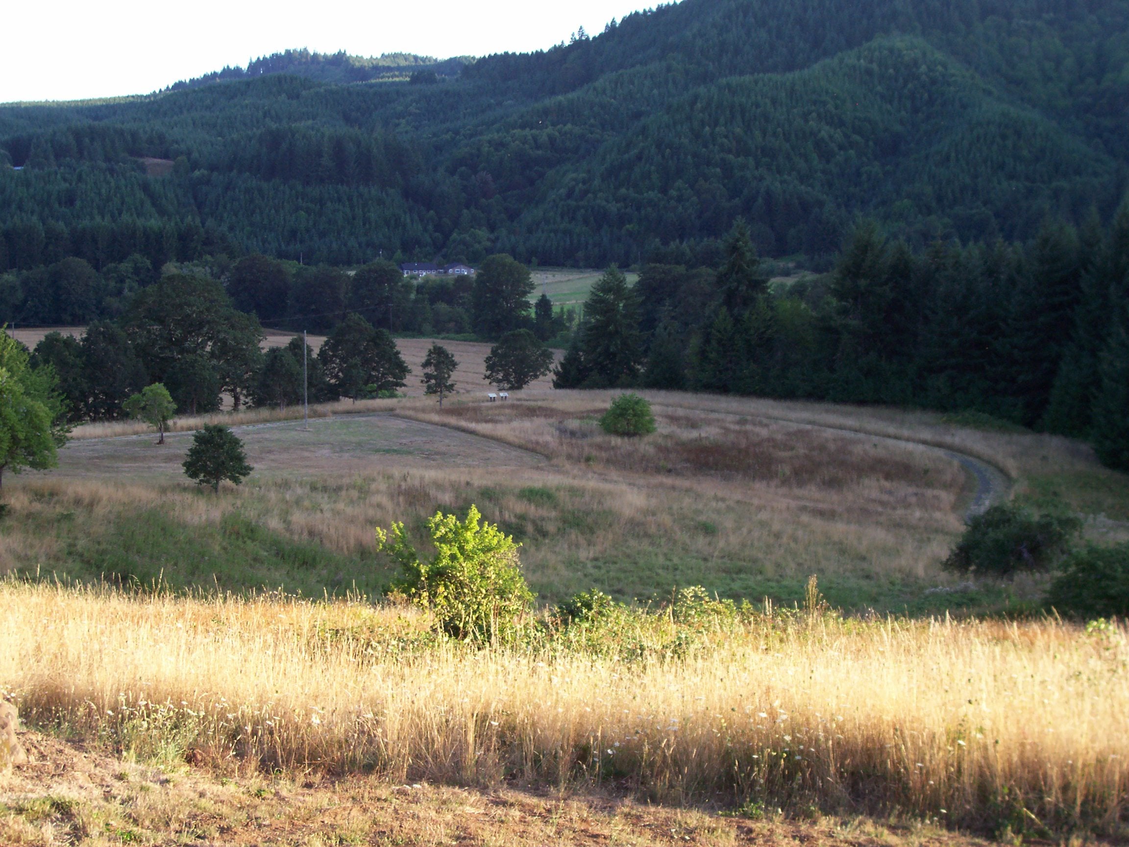
Fort Hoskins was an Army post without the defensive walls its name might lead you to expect. Soldiers lived and worked on this hillside near Kings Valley in the 1850s and 1860s, looking out over the Luckiamute River valley. Today, Benton County preserves the site as a 130-acre historical park. You can walk through the landscape, read the interpretation and trace a military community whose buildings mostly disappeared after the post closed.
The appeal is the combination of a country walk and a place with a complicated past. An open parade ground gives way to wooded surroundings, while the hills beyond help explain why this location was chosen. The fort’s purpose was tied to the Coast Reservation and federal control of Native people, rather than a famous battle fought here. Understanding that purpose changes how the quiet grounds look.
Fort Hoskins Historical Park is open for day use from dawn to dusk, with self-guided trails, interpretive displays, picnic facilities and an accessible restroom. It offers a manageable way to spend part of an autumn day outside without committing to a remote mountain hike. Check the county’s current notices before visiting and plan to finish while the gate is open. Historic photographs can introduce the site, but they cannot tell you today’s trail conditions.
Why the Army came to this valley
Construction began in 1856, when Oregon was still a territory. The Army placed Fort Hoskins near the eastern approaches to the Coast Reservation, one of three posts established to monitor that reservation system. Fort Yamhill and Fort Umpqua were the other posts. Together, they formed part of the federal government’s effort to control movement and maintain its authority in the region.
The reservation system followed violence and forced removals that displaced Native communities from their homelands. The Confederated Tribes of Grand Ronde’s history of Oregon’s forced removals describes the hardship imposed on Native communities during that period. That history belongs at the center of the fort’s story, alongside the soldiers’ lives. The Army’s presence cannot be understood solely as a picturesque chapter of frontier settlement.
The Grand Ronde account reproduces Indian agent George H. Ambrose’s diary of a forced removal from the Table Rock Reservation in southern Oregon. The journey covered 263 miles over 33 days in 1856, carrying people away from their homelands to Grand Ronde. At the outset, Ambrose counted 34 people unable to travel because of illness, in addition to the elderly and infirm. Wagons were needed, and he worried that the available teams would not be sufficient.
The diary follows the march through cold nights, difficult roads and increasing sickness. An entry for March 7 records a woman’s death that morning, while another describes threats from people along the route. These entries concern the removal to Grand Ronde, rather than an incident at Fort Hoskins, but they document the coercion and hardship behind the reservation system the Army posts served. Read together with the fort’s military records, the Tribal history brings the families being displaced into a story that can otherwise become a list of officers and buildings.
County and museum accounts describe a dual purpose of monitoring the reservation and preventing attacks between settlers and Native people. The language reflects the different responsibilities the Army claimed. For the Native communities living under the reservation system, however, the military post was also an instrument of restriction. A visit is an opportunity to consider those different experiences of the same place.
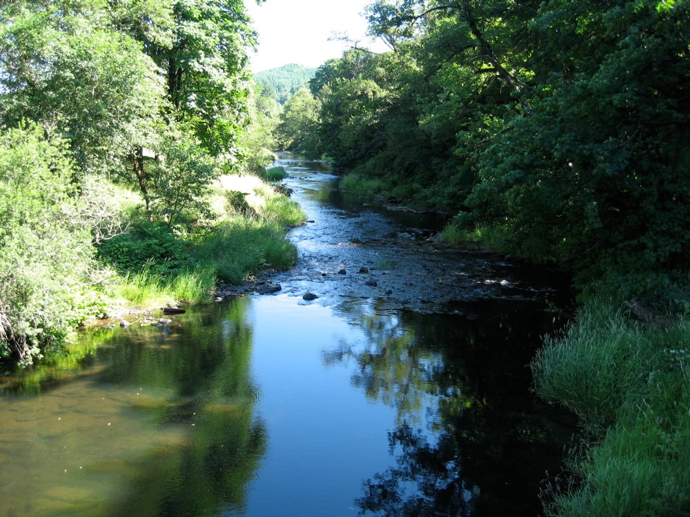
The fort stood above the Luckiamute valley, with access to local resources and routes across the Coast Range. Its setting connected a garrison with the reservation to the west and settlements to the east. Standing on the open ground makes the geography easier to understand. This was a working post positioned in a landscape people were already using and traveling through.
A fort with barracks rather than battlements
Captain Christopher C. Augur supervised the beginning of construction, and Philip Sheridan served at the post early in his military career. Both later became Union generals during the Civil War. The fort was named for Lieutenant Charles Hoskins, who died in the Mexican-American War in 1846. Its name commemorated a soldier rather than a local family who founded the surrounding community.
The post was completed in 1857 and included the ordinary necessities of an Army settlement. Officers needed quarters, enlisted soldiers needed barracks, and the garrison needed places to store supplies, prepare food and care for sick people. The Albany Regional Museum describes between fifteen and twenty buildings, including a bakery, hospital, guardhouse, barns and a corral. Those functions explain why a seemingly empty field once supported such a busy arrangement of structures.
There was no blockhouse or substantial defensive enclosure. A low picket fence was a very different thing from the heavy walls of a fortified military position. The name can therefore create a misleading mental picture before you arrive. Looking for the footprint of a settlement is more useful here than expecting a surviving fortress to climb through.
The parade ground provided an organizing space within that settlement. Buildings and daily routines related to it, even after the buildings themselves were sold or dismantled. The open area that remains helps visitors picture the scale of the post. The surrounding hills were part of the soldiers’ view long before the place became a public park.
The Albany Regional Museum’s account gives the parade ground a striking vertical feature: a flagpole about 100 feet tall, with a base two feet in diameter. Years later, a jar containing coins and a company roster was found buried at its base. Alongside the excavated building sites, that small cache connected the open ground with the people who had occupied it. The account also describes a parade ground covering roughly two acres.
The daily work included a great deal of waiting
Much of garrison life was less dramatic than the careers of its famous officers might suggest. Soldiers maintained the post, handled supplies and lived through the wet weather of western Oregon. The journals of Royal A. Bensell and William M. Hilleary preserve accounts from men stationed there during the Civil War era. Benton County’s history emphasizes how much boredom and dampness feature in those records.
The work of keeping a post functioning continued whether or not a military crisis developed. Food had to be prepared, animals tended and buildings maintained. A hospital and bakery were useful parts of that daily system, not decorative additions to an officer’s residence. Those buildings served a garrison that needed supplies and maintenance throughout the year.
The fort’s relationship with the Civil War is also different from what a battlefield visitor might expect. Regular Army personnel and volunteer soldiers served in Oregon while the larger war was being fought elsewhere. Local concern about Confederate sympathies became part of the post’s purpose. Fort Hoskins remained a western garrison rather than the site of a Civil War battle.
The Army abandoned the post in 1865. The buildings were subsequently sold, moved or dismantled, leaving the landscape to take on new uses. Its military life had lasted less than a decade. The name survived much longer than the garrison that brought it here.
A horse story survives with a question mark
One of the more colorful accounts associated with Sheridan concerns a horse the other soldiers expected to throw him. In a story preserved by the Albany Regional Museum, the newly arrived lieutenant accepted a ride and managed to stay aboard despite the animal’s efforts. A stirrup was said to have been lost during the ride. The tale later became associated with a stirrup donated to the old Horner Museum.
Museum board member Cathy Ingalls wrote about finding the donation connected to her grandfather, former Corvallis Gazette-Times publisher C. E. Ingalls. Her account carefully presents parts of the episode as a story passed down with the object. It is an entertaining piece of the fort’s remembered history, rather than a reason to treat every detail as an independently established event. The documented donation and the anecdote are related pieces of evidence.
The stirrup’s route into a museum collection is part of its appeal: an object connected with an Army officer turned up in a Corvallis publisher’s possession generations later. Ingalls could establish the family donation, while the account of the ride remained a story passed along with it. That leaves room to enjoy the anecdote without making it the foundation of the fort’s history. The surviving soldiers’ journals and the physical site offer other ways to understand life at the post.
The community continued after the soldiers left
Hoskins took its name from the military post, but its later history extended beyond the Army. Oregon State University’s local history guide records a post office established in 1891. Logging and rail transport later became important to the community. A place first associated with soldiers became part of another working landscape.
The Valley & Siletz Railroad carried lumber between the Valsetz area and Independence, with Hoskins serving as its headquarters. Agricultural products also moved along the line. Railroad equipment and the work around it gave the community an identity different from the short-lived fort. The historical park preserves one chapter within a place that continued to change.
The university’s guide also documents the decline of those services. The post office closed in 1958, and the railroad section through Hoskins was removed in 1979. Its covered bridge had already been lost following damage in the 1962 storm. These were separate changes across several decades, not a town disappearing all at once when the Army left.
For readers interested in that longer history, Oregon State University’s Hoskins collection guide points to photographs, manuscripts and oral histories. Those collections provide ways to investigate the community beyond the military years. A park visit can be the beginning of that curiosity rather than a complete account of everything that happened here.
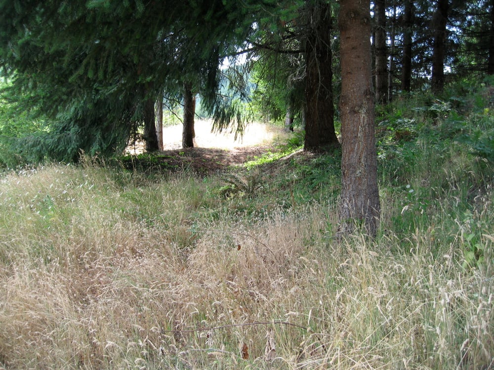
Archaeology helped recover the post’s layout
Archaeological work led by Oregon State University’s David Brauner began in the 1970s. Excavation gave researchers evidence that could be compared with written records and remembered locations. The site was added to the National Register of Historic Places in 1974. Recognition and research helped establish the importance of preserving the ground itself.
At a place like Fort Hoskins, the absence of a building does not mean the absence of evidence. Foundations, discarded objects and changes in the ground can help identify how people used a site. Their value depends on the context in which they are found. Leave anything you encounter in place and follow the park’s marked routes and posted rules.
Benton County opened the historical park for public day use in July 2002. Interpretation allowed visitors to connect the open landscape with the records of the post. The park also preserved room for walking and picnicking around that history. Its current purpose includes public recreation and education within the same property.
The former commander’s house returned to the fort site from Pedee in 2012, according to the Albany Regional Museum’s account. That return restored a physical connection that had been missing for generations. It does not mean all of the fort’s buildings have been reconstructed. Plan for an outdoor historical site and use current county information for any building access.
Walk the grounds at the pace of the landscape
The county describes a property with self-guided trails, views and varied vegetation. The open former post area and wooded edges offer different things to notice. One helps explain the arrangement of a garrison; the other gives the outing the feel of a country park. You can spend time reading the interpretation without making the visit entirely about covering distance.
Autumn shortens the daylight available for a walk, so the dawn-to-dusk schedule matters. Allow time for the drive and the return to your vehicle before the gate closes. Rain can also change how a natural-surface path feels underfoot. Current signs and county notices should guide the walk, rather than assumptions based on the summer photographs included here.
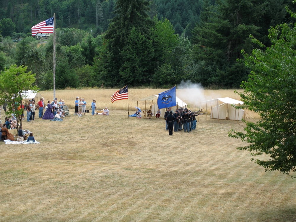
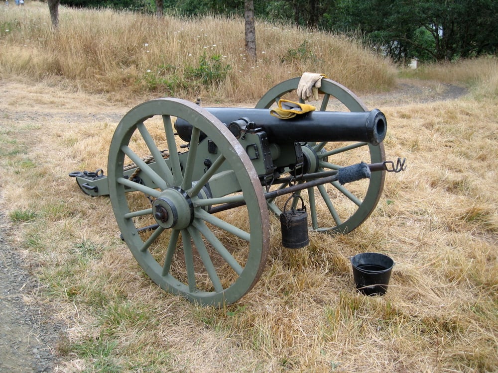
The 2006 anniversary photographs show historical reenactors commemorating the post’s 150th year. They are labeled as modern commemorative scenes, not nineteenth-century photographs or a promise of a program happening this season. Ordinary visitors should expect a self-guided park outing unless the county separately announces an event. The open grounds remain interesting without a uniformed demonstration.
Our Willamette Valley guide can help connect the trip with the surrounding region. The fort lies about nineteen miles northwest of Corvallis, in a rural area rather than the center of Philomath. Keep the actual route in mind when combining it with other stops. For other outings suited to the shorter days, our fall in Oregon guide connects regional walks with indoor alternatives.
Choose a route and look beyond the parade ground
The Willamette Valley Visitors Association’s park listing describes a 0.6-mile interpretive trail and a separate 1.2-mile loop. The interpretive route has gravel but can be rough, while the longer loop includes moderately steep grades. Those details make it worth choosing a route before setting off, particularly if someone in your group needs a gentler walk. Use the county’s current signs and information when deciding which path to follow.
The same listing identifies a farmhouse from the 1870s and remnants of a schoolhouse and farm buildings. They belong to the property’s later rural history rather than automatically being surviving Army structures. The military post had already closed in 1865. A building encountered on the grounds can therefore tell a different story from the fort whose name appears at the entrance.
The landscape has its own history of change. A 2010 management plan prepared for Benton County describes young Douglas-fir forest and open grassy areas shaped by earlier logging, grazing and farming. Its goals included maintaining open prairie and controlling invasive plants such as Scotch broom and false brome. Those are documented management goals from that plan, not a claim that every treatment is taking place today.
That report also drew on nineteenth-century survey notes to describe an earlier landscape of oak and Douglas-fir forest with smaller prairie areas. It gives the walk another subject beyond the location of the barracks. The vegetation around an old military site has changed along with its buildings and roads. Stay on the marked routes so the surrounding habitat and archaeological ground remain undisturbed.
What to know before visiting Fort Hoskins
Fort Hoskins Historical Park is at 38150 Fort Hoskins Road, Philomath, Oregon 97370. Benton County lists the park as open every day from dawn to dusk, with the access road gated overnight. Its current park page is the best starting point for visitor information and any changes to access. A Philomath mailing address should not be mistaken for a location within the town center.
The county lists an accessible restroom, picnic facilities and educational interpretation. The group picnic shelter can be reserved separately for exclusive use. An accessible restroom does not establish that every trail has the same grade or surface, so visitors with specific mobility needs should review the county’s information before choosing a route. Follow posted boundaries around any reserved gathering.
Come prepared for an outdoor visit, with shoes suited to the weather and enough time to read the displays. The fort’s history is tied to the shape of the valley and the people whose movements it was built to control. Walk the former post area first, then follow the marked paths into the rest of the park. Allow time for the gravel interpretive route before deciding whether to continue onto the steeper loop.