One of Central Oregon’s most important east-west highways remains shut down as firefighters continue working along the sprawling Rowe Creek Complex.
As of Thursday, August 6, U.S. Highway 26 was still closed between Prineville and Mitchell. Oregon Department of Transportation information showed the closure extending from approximately milepost 32 to milepost 66, beginning about 13 miles east of Prineville.
Drivers are being told to use another route and should not attempt to travel through the closure.
The shutdown cuts off a scenic but heavily traveled stretch of highway crossing the Ochoco Mountains. Highway 26 connects Prineville with Mitchell and communities farther east, making the closure a major disruption for residents, freight traffic and anyone traveling across this part of Oregon.
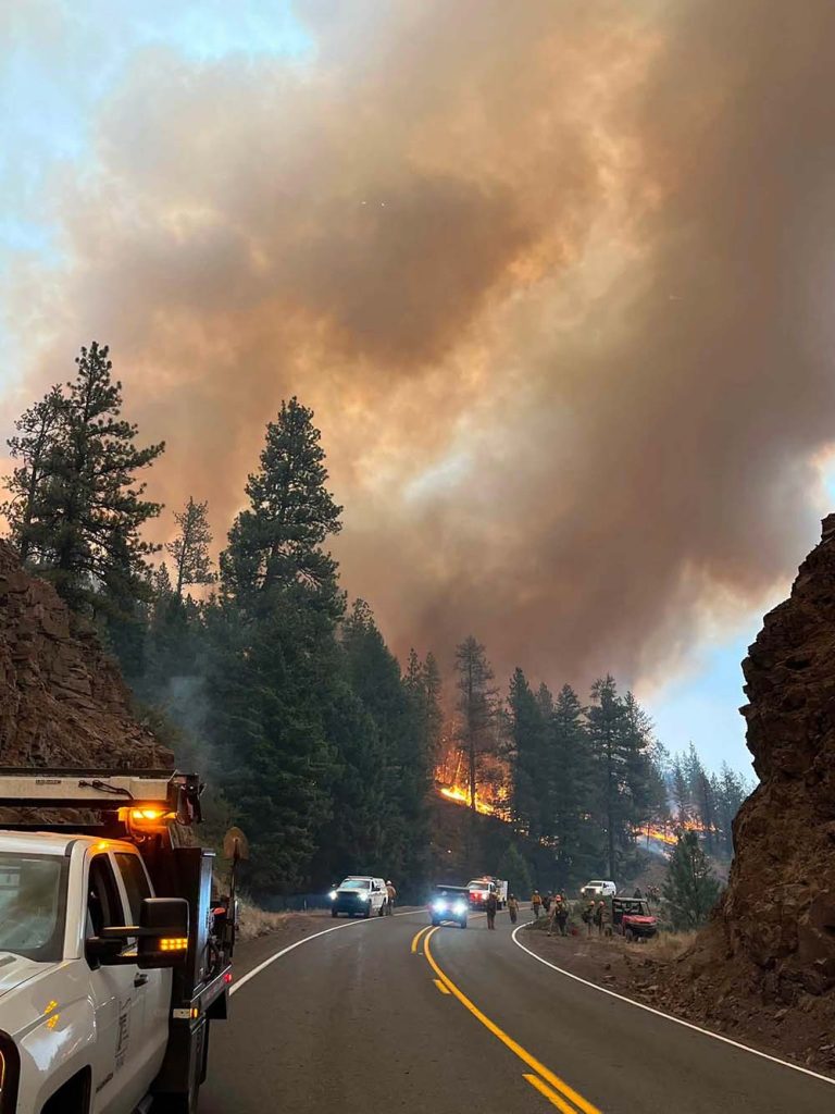
There was no firm reopening time announced Thursday morning.
Fire activity is only part of the concern. Crews must also evaluate trees weakened by flames, rocks that could fall onto the pavement, damaged roadside infrastructure and the continued movement of firefighting equipment through the corridor. Even when flames are no longer immediately threatening the road, those hazards can make reopening unsafe.
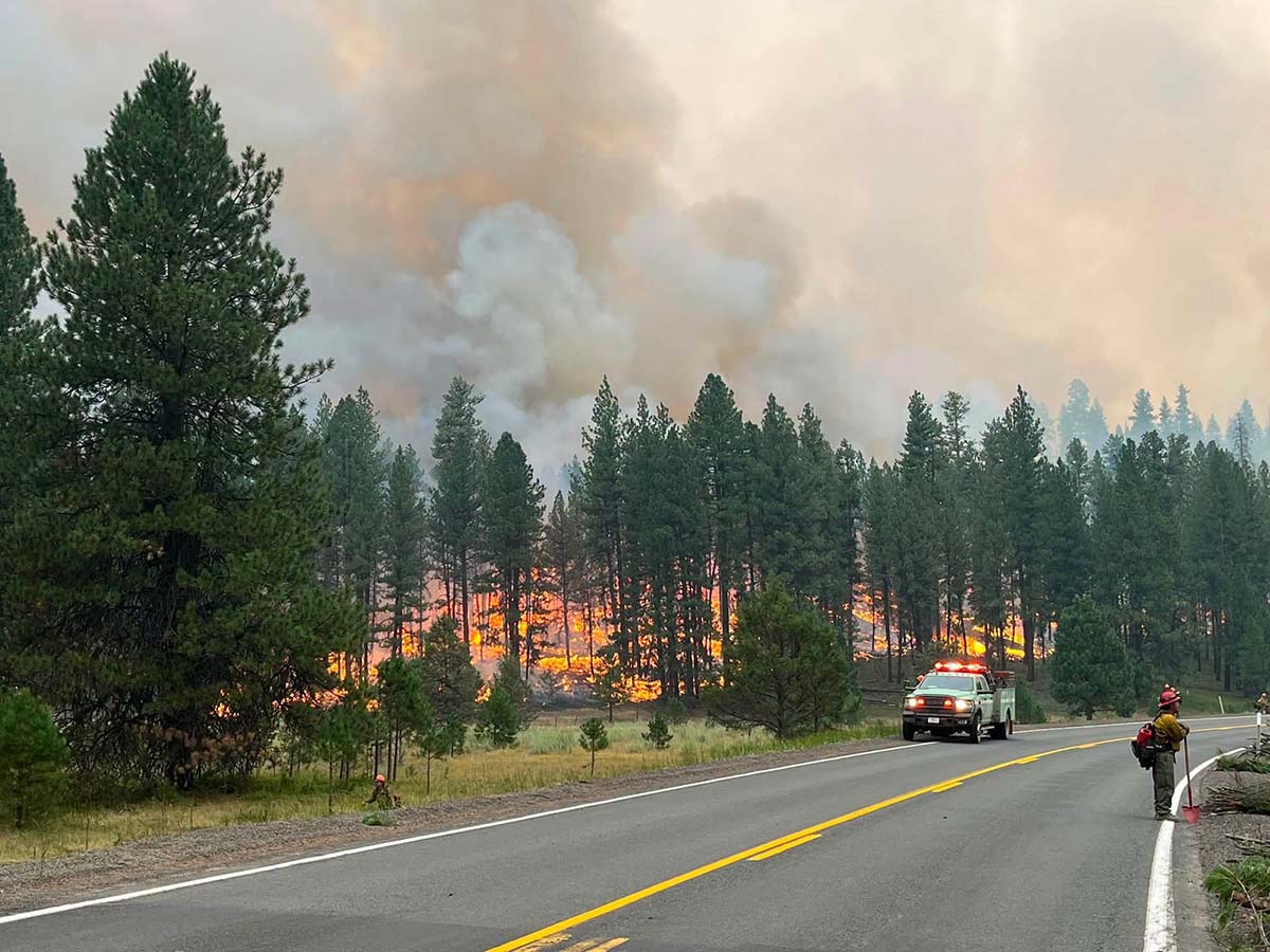
ODOT has been coordinating with fire officials to determine when traffic can safely return. Photos released by the agency showed flames and heavy smoke close to the highway, illustrating why the route has remained off-limits.
Rowe Creek Complex has burned across a huge area
The lightning-caused Rowe Creek Complex began July 15 after thunderstorms sparked several fires across the region.
Those fires eventually spread and merged across portions of Wheeler, Crook, Wasco and Jefferson counties. The complex has burned through grass, juniper and timber across rugged country surrounding Fossil, Mitchell and the Highway 26 corridor.
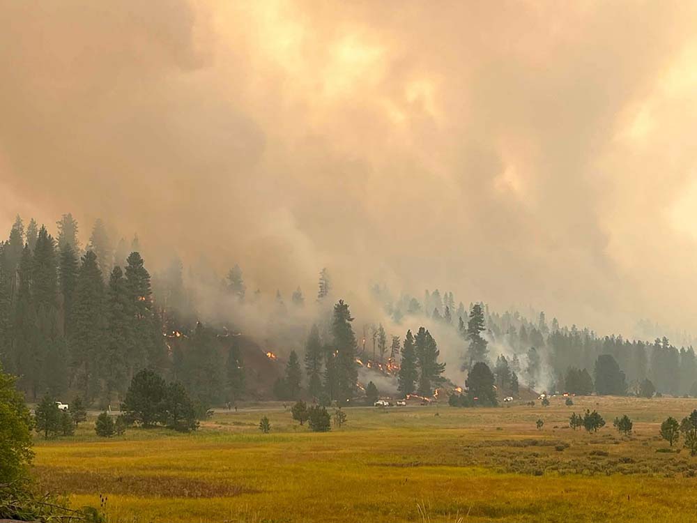
The latest widely reported incident figures placed the complex at nearly 326,000 acres with containment around 60 percent earlier this week. Containment does not mean that percentage of the fire has been extinguished. It refers to the portion of the perimeter where firefighters have established control lines expected to stop further spread.
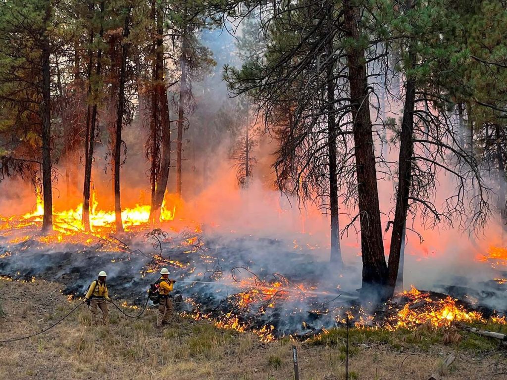
Crews have spent weeks reinforcing those lines, protecting homes, patrolling previously burned areas and putting out remaining pockets of heat.
Highway 26 has played an important role in that work. Firefighters have used the corridor as an access route and, in some areas, as part of their strategy for slowing the fire’s southern movement.
That means reopening the highway depends not only on visible fire activity, but also on whether crews still need the road as an active firefighting work zone.
Travelers face lengthy alternatives
There is no simple detour around the closure.
Drivers traveling between Prineville and Mitchell may have to make a substantial trip around the fire area using other state highways. The best route will depend on a traveler’s destination, and conditions can change quickly during Oregon’s wildfire season.
Anyone planning to cross Central or Eastern Oregon should check TripCheck immediately before leaving. Navigation apps do not always reflect emergency road closures as quickly as official state transportation sources.
Travelers should also avoid relying on forest roads or unfamiliar backcountry routes as shortcuts. Some surrounding public lands may be closed, and remote roads can become dangerous or impassable without warning.
Smoke remains a concern across Oregon
The Highway 26 closure comes as smoke from numerous wildfires continues to affect communities across much of Oregon.
The Oregon Department of Environmental Quality issued an air-quality advisory covering a broad portion of the state, including Crook, Deschutes, Wheeler, Wasco, Jefferson, Grant and several other counties. Central and eastern Lane County were also included in the advisory.
Smoke levels can vary significantly throughout the day as wind direction and fire activity change. A town with relatively clear air in the morning can experience unhealthy conditions only hours later.
Residents in smoky areas are encouraged to limit strenuous outdoor activity, keep windows closed when possible and use filtered indoor air. Children, older adults, pregnant people and anyone with heart or lung conditions may be affected sooner than otherwise healthy adults.
Closure remains in effect Thursday
For now, Highway 26 remains closed between Prineville and Mitchell, and officials have not provided a guaranteed time for reopening.
Motorists should continue to avoid the area, leave additional time for alternate routes and follow instructions from transportation workers and emergency personnel.
The highway will reopen only after fire officials and ODOT determine that the route is safe for both the public and the crews still working nearby.
Current road information is available through TripCheck. Evacuation notices should be checked directly through the sheriff’s offices in Crook, Wheeler and other affected counties, since evacuation boundaries may change with little notice.
Smoke over the whole Pacific Northwest, then Montana lights up. Top offenders:
— FireMap.live 🔥🌎 (@disaster_db) August 6, 2026
-Grasshopper and Rowe Creek Complex in OR,
-Little Giant and Sinlahekin in WA.
-New entries are Bobcat Lakes and Sand Creek in MT. pic.twitter.com/fS1UpPSNtU