Most Oregonians and tourists have driven right past them without a second thought.
You’ve fished and boated there.
Swam and picniced nearby.
Beneath the deep blue water of some of Oregon’s most familiar reservoirs lie hidden old roads, railroad grades, farm fields, building foundations and the places where entire communities once stood. Families raised children there. Farmers planted orchards. Loggers boarded trains. Kids walked to one-room schools. People were born, married and buried in valleys that, within a generation, would be covered by water.
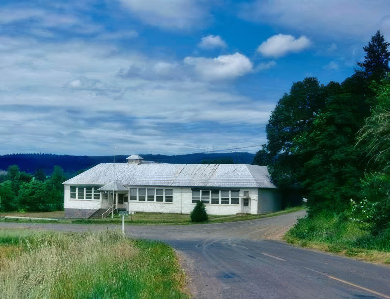
Image courtesy Dan Scott
In some places, even the dead had to leave, like in the case of Henry Hagg Lake in Washington County, where archived images of exhumations for reburial still exist in corners of the internet.
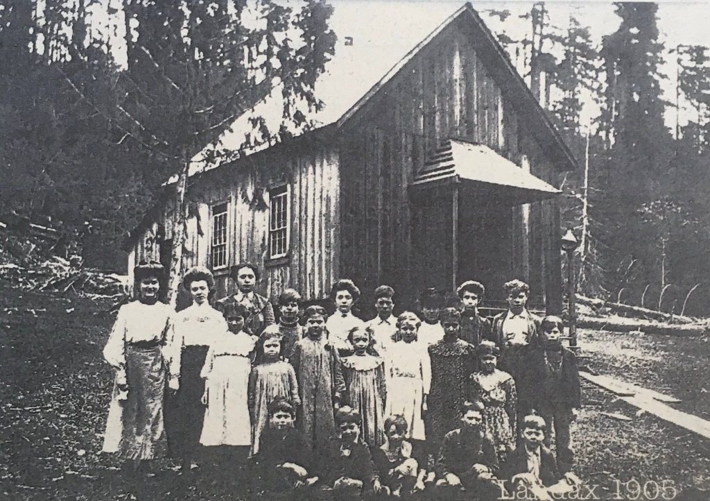
When the U.S. Army Corps of Engineers prepared the Middle Fork Willamette Valley for Lookout Point Reservoir beginning in 1948, cemeteries within the future inundation area were emptied and the people buried there were reentered at Mount Vernon Cemetery in Springfield. At the same time, the railroad was moved, farms and orchards disappeared, and the communities of Eula, Landax, Lawler, Signal, Reserve and Carter were razed.
It sounds almost unimaginable today, but the projects were born from a very real problem: mass yearly flooding.
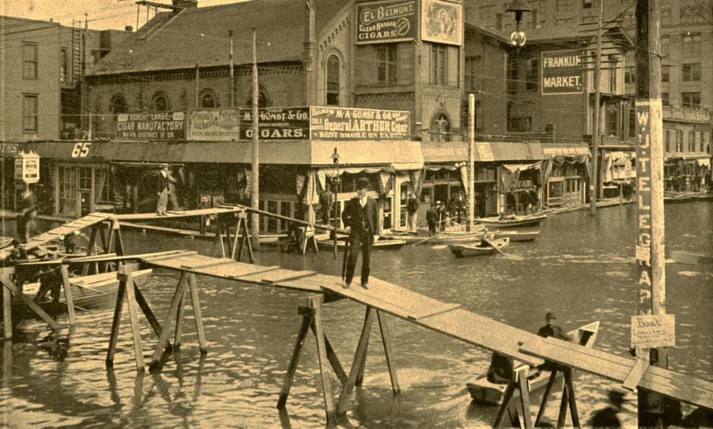
Image: Portland City Archives
For generations, flooding was part of life in western Oregon. The Willamette and its tributaries could swell dramatically during heavy winter rain, snowmelt and rain-on-snow events, spreading into farms and communities throughout the valley. By the twentieth century, the federal government was looking for a much larger solution.
Flood control became the principal force behind development of the Willamette River Basin after World War II. The Flood Control Act of 1938 laid the groundwork for what eventually became the Willamette Valley Project, beginning with Fern Ridge and Cottage Grove and ultimately expanding into a system of 13 Corps dams and reservoirs.
Those dams worked. The Corps says its Willamette system has prevented enormous amounts of flood damage, including billions of dollars’ worth during major events when converted to modern values. The reservoirs were also authorized for combinations of hydropower, irrigation, water supply, recreation, navigation, water quality, and fish and wildlife purposes.
But controlling rivers came with a price.
Some of that price is still sitting at the bottom of Oregon’s reservoirs.
In the language of engineering, all of that land became the “reservoir pool.”
To the people living there, however, it was simply home.
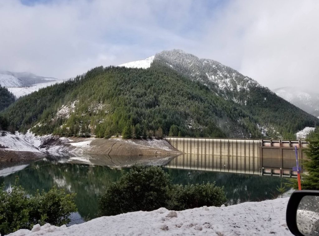
What follows isn’t a list of perfectly preserved ghost towns waiting beneath the water. Oregon’s drowned communities fall into several categories. Some townsites were almost completely inundated. Some communities were rebuilt on higher ground. In other places, the reservoir swallowed a loose collection of farms, schools, logging camps and crossroads rather than a traditional downtown.
Taken together, they offer a glimpse of an Oregon landscape that existed within living memory and then disappeared.
North Santiam River
Old Detroit
Category: Townsite substantially inundated
Dam: Detroit Dam, completed 1953
Long before tourists pulled boats into Detroit Lake, Detroit was a little railroad and logging community sitting down along the North Santiam River.
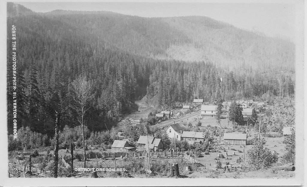
The community began in 1889 as a work camp along the Oregon Pacific Railroad and survived the railroad company’s collapse to become a small but established Cascade town. Timber, rail traffic, hunting and fishing all contributed to the local economy. Then, in 1946, the Army Corps of Engineers began acquiring property for Detroit Dam. The proposed reservoir would cover the community, and residents eventually established a new Detroit on higher ground. Today’s town sits about a mile north of the original site.
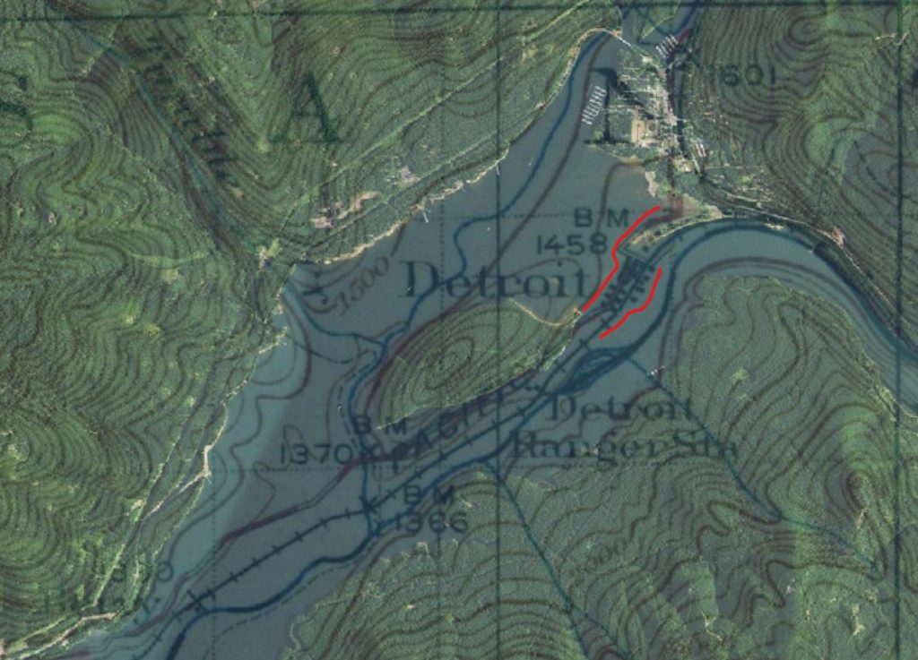
Nearly 200 residents were affected by the relocation. Highway 22 and portions of the North Santiam River corridor were altered as part of the enormous project, while thousands of workers poured into the canyon during construction. When Detroit Lake filled in the early 1950s, the old town was gone beneath it.
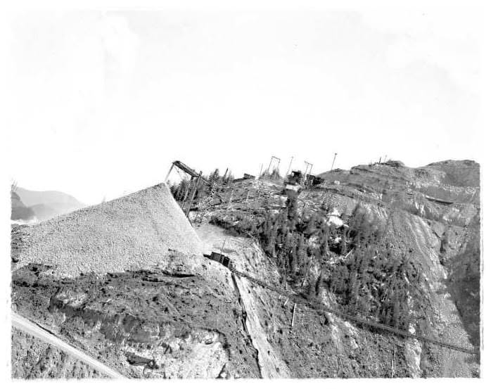
Old Detroit is also one of the best documented Oregon examples through the Atlas of Drowned Towns, a public-history project devoted to communities displaced by large dams. Its growing digital archive includes historical photographs, maps, documents and firsthand accounts from Detroit and other submerged communities. For more images and deeper information on the towns of old Detroit and Idanha, follow “Detroit “From The Beginning”” on Facebook.
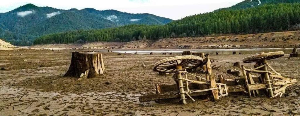
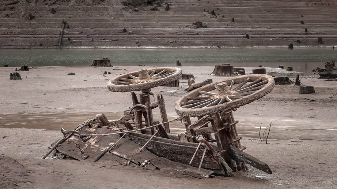
Drawdowns of the lake in recent years have exposed building foundations and even an old wagon, remnants of lives and a nearly forgotten era in Oregon’s history.
Middle Fork Willamette River
Eula, Landax, Lawler, Signal, Reserve and Carter
Category: Cluster of rural communities erased together
Dam: Lookout Point Dam, completed 1954
If Detroit shows what happened to one recognizable town, Lookout Point Reservoir reveals something even larger.
Before the reservoir filled, the Middle Fork Willamette valley between Lowell and Oakridge wasn’t an empty stretch of river country. Farms occupied the bottomland. Orchards grew near the river. Railroad stops and small communities appeared along the transportation corridor.
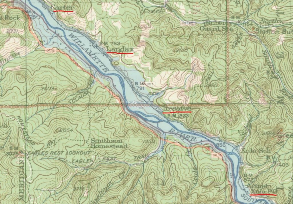
Construction on Lookout Point Dam began in 1948 and was finished in 1954. The Corps describes the dam today as a 246-foot-high structure built primarily for flood-risk management, but preparing the reservoir behind it meant remaking miles of valley.
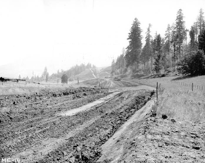
Homes and agricultural land disappeared. Railroad infrastructure was relocated. Cemeteries inside the reservoir area were cleared, with the dead removed and reburied outside the future lake. The West Boundary ranger station was moved to Lowell. Cemeteries were relocated. In a remarkably short period of time, an inhabited river valley was dismantled in preparation for the water that would eventually cover it.
That detail may say more about the scale of these projects than any statistic could.
Families weren’t simply being told that a highway was coming through or that the house next door would be demolished. In some cases, the place where their grandparents had been buried was about to disappear too.
These communities were small enough that their names now sound mysterious, but that doesn’t make them insignificant. A railroad stop with a store, a few homes and neighboring farms could still represent an entire person’s world.
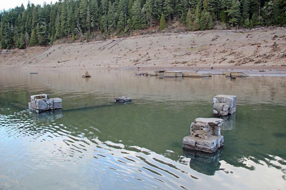
Today, when Lookout Point Reservoir is low due to drought or drawdowns, stretches of the old landscape become visible again.
Winberry and the Fall Creek Valley
Category: Populated rural landscape submerged
Dam: Fall Creek Dam, completed in the mid-1960s
Fall Creek Lake tells a slightly different story. Winberry wasn’t a compact town on the scale of Detroit, but people absolutely lived, farmed and traveled through the land now occupied by the reservoir. Logging and mining operations were important in the Winberry (originally called “Whimberry” or “Windberry” by early settlers) area. Millions of board feet of timber were harvested over the years, but despite a mini “gold rush” to the area, very little was actually ever found.
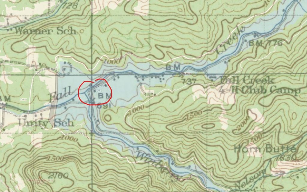
Fall Creek Lake has two principal arms, one following Fall Creek and another extending into Winberry Creek. The project became part of the larger 13-reservoir Willamette Valley system, with Fall Creek Dam completed during the final years of the federal dam-building era.
Fall Creek Dam was built during the last major phase of the Corps’ Willamette Valley dam program. Corps records give the construction period as beginning in 1964, with sources variously identifying completion as 1965 or the project becoming fully completed in 1966. The dam was intended primarily for flood control.
Fall Creek is particularly fascinating because portions of the old landscape don’t always stay hidden.
The reservoir is deliberately drawn down, sometimes dramatically, as part of modern operations designed in part to improve downstream passage for young salmon and steelhead. When the water retreats, roads and contours of the old valley begin to return.
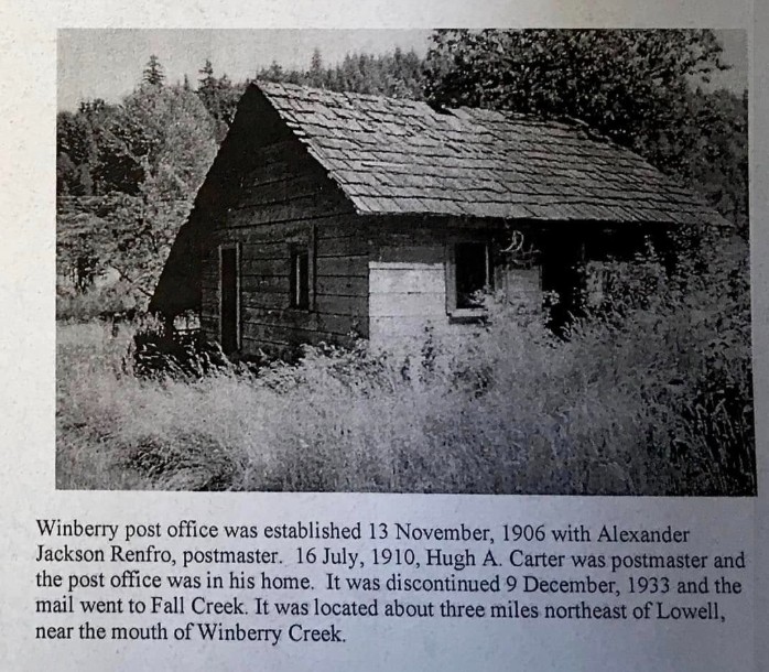
For someone who once lived there, that sight would probably feel less like discovering ruins and more like recognizing an old neighborhood.
It is also where Oregon’s dam history comes full circle. A reservoir originally built during the great era of river control is now periodically lowered in an effort to address ecological problems associated with those very dams.
Row River and Coast Fork Willamette
Old Dorena
Category: Townsite inundated and community relocated
Dam: Dorena Dam, completed 1949
Southeast of Cottage Grove, the townsite of Dorena once stood along the Row River in a place that’s now beneath the lake of the same name.
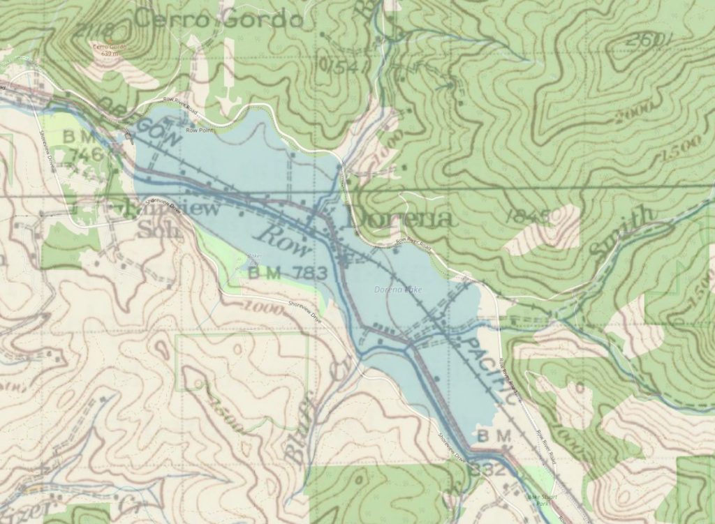
Settlement in the area dated to the 1850s. Agriculture supported the earliest residents, while logging and mining later became important parts of the local economy. Dorena had a school by the 1890s and a post office beginning in 1899.
Then flood-control plans came to the Row River.
Dorena Dam was completed in 1949, making it one of the earlier pieces of the Corps’ larger Willamette Valley system. The earthen dam stretches roughly half a mile across the valley and created the reservoir now known as Dorena Lake.
The old settlement obviously couldn’t remain where it was.
Roughly 100 homes were reportedly relocated as the valley was prepared for inundation, and the community of Dorena shifted farther upriver (southeast). The name survived, but the geographic center of people’s lives changed.
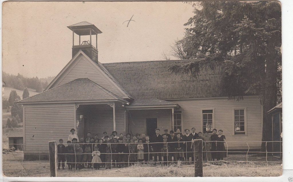
That’s an important distinction with these drowned towns. Dorena didn’t disappear in the sense that everyone left and the name vanished from Oregon. People rebuilt.
What disappeared was their Dorena.
The road they had always taken home was no longer the same road. Property lines vanished beneath water. Familiar landmarks became part of the lakebed. What had once been an ordinary Oregon valley became a recreational reservoir that later generations would assume had always been there.
Tualatin River Basin
Scoggins Valley
Category: Populated farming valley submerged
Dam: Scoggins Dam, completed 1975
Scoggins Valley is one of the later examples, and perhaps one of the easiest to imagine because the transformation happened only about half a century ago.
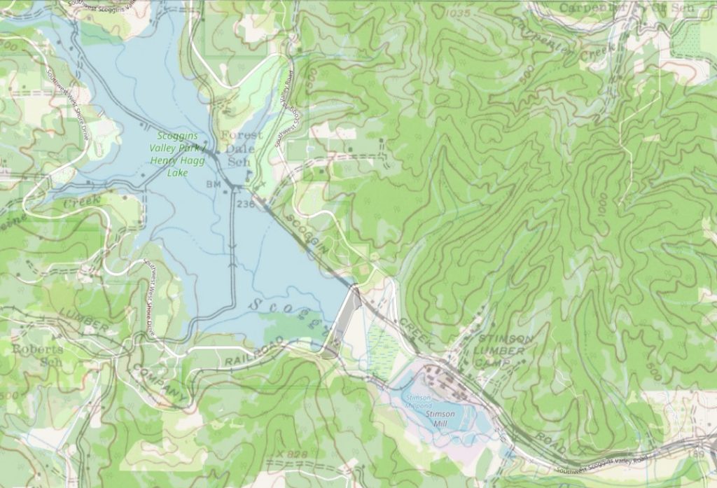
Scoggins Valley was not simply a single compact town. It was a settled rural landscape southwest of Forest Grove, with homes, farms, a school and generations of local history tied to Scoggins Creek. Today, much of that valley lies beneath Henry Hagg Lake behind Scoggins Dam. Washington County historical collections describe Scoggins Valley as being mostly underwater and preserve photographs of places like Forest Dale School, where many of my own family members attended as kids.
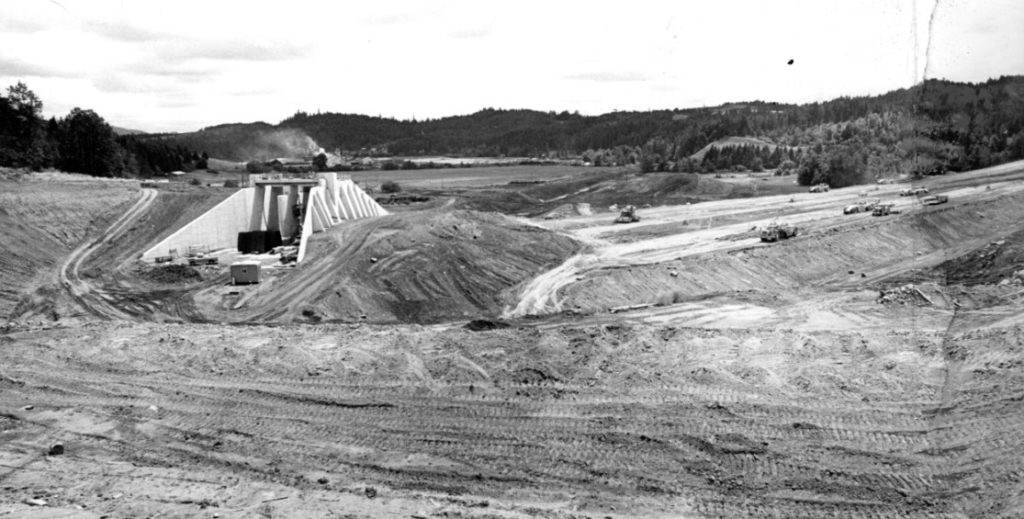
Scoggins Dam was constructed by the U.S. Bureau of Reclamation rather than the Army Corps of Engineers. Work began in 1972 and was completed in 1975 as part of the Tualatin Project. The resulting Henry Hagg Lake stores water for irrigation and municipal use while also supporting recreation and streamflow needs downstream.
The project submerged much of the old Scoggins Valley landscape.
This is where calling everything a “drowned town” becomes too simplistic. There wasn’t necessarily one Main Street waiting beneath the middle of Hagg Lake. What vanished was something broader: a rural community woven across an entire valley.
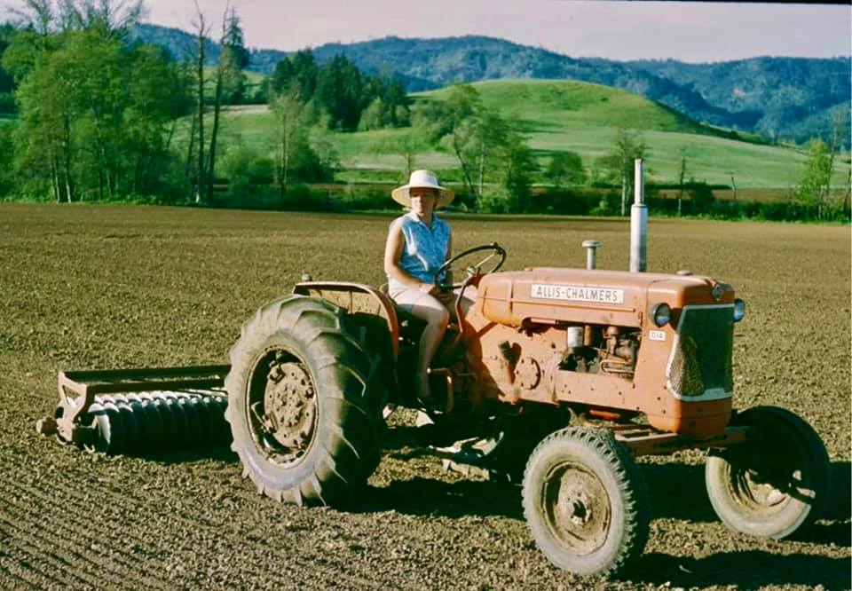
One family might remember a particular barn. Another might remember where a school bus stopped. Someone else might remember the farm where their grandparents spent their whole lives. The concrete slab where my Uncle Don’s cattle barn once stood is sitting near Boat Ramp C. My Uncle Hiram Scott, along with many others, protested the dam construction.
In the end, he lost.
Today, thousands of people visit Henry Hagg Lake without ever realizing that the bottom of the lake was once somebody else’s Oregon.
In 2021, I wrote a full article on my family roots, in and under Hagg Lake, Ghosts of Scoggins Valley.
South Santiam River
Old Foster
Category: Community partially displaced and landscape transformed
Dam: Foster Dam, completed 1968
The community wasn’t erased as completely as Detroit or Robinette. Foster still exists near Sweet Home. But the landscape that had defined it was heavily altered by the construction of Foster Dam.
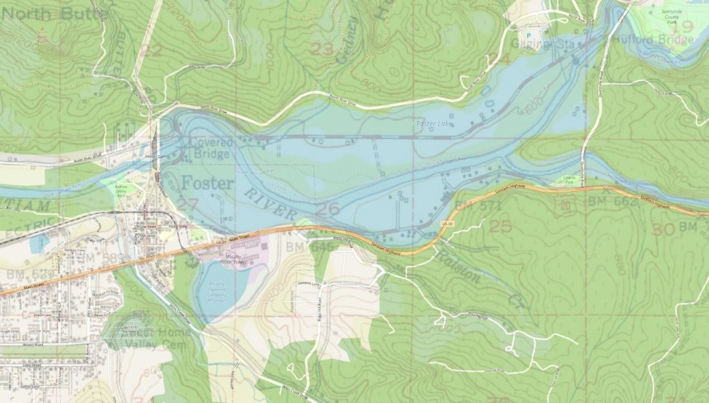
The Corps began construction in 1964 and finished the dam in 1968. Just upstream, Green Peter Dam had been completed two years earlier in 1966. Together, the projects transformed the South Santiam river system east of Sweet Home.
Homes, roads and riverfront property in the future reservoir area were affected, while Foster Reservoir replaced stretches of the old South Santiam landscape.
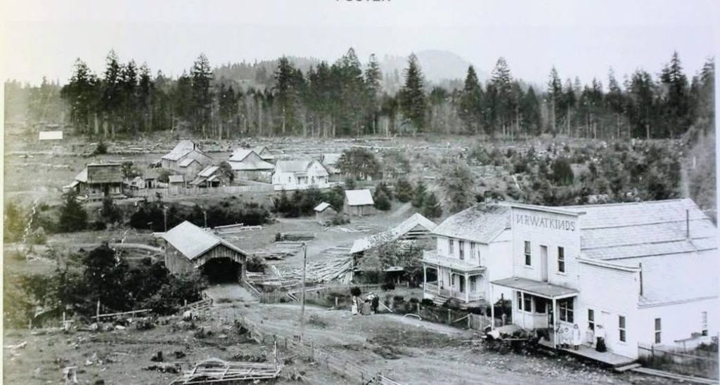
For longtime residents, that distinction matters. Their town’s name wasn’t erased from the highway sign, but a piece of the country they knew was.
Dam projects didn’t affect every community the same way. Some towns vanished entirely. Others were moved. Still others survived while their farms, roads, neighboring settlements and relationship with the river disappeared.
Applegate River, Southern Oregon
Copper
Category: Townsite inundated
Dam: Applegate Dam, completed 1980
Near the California border is one of Oregon’s best true underwater ghost towns.
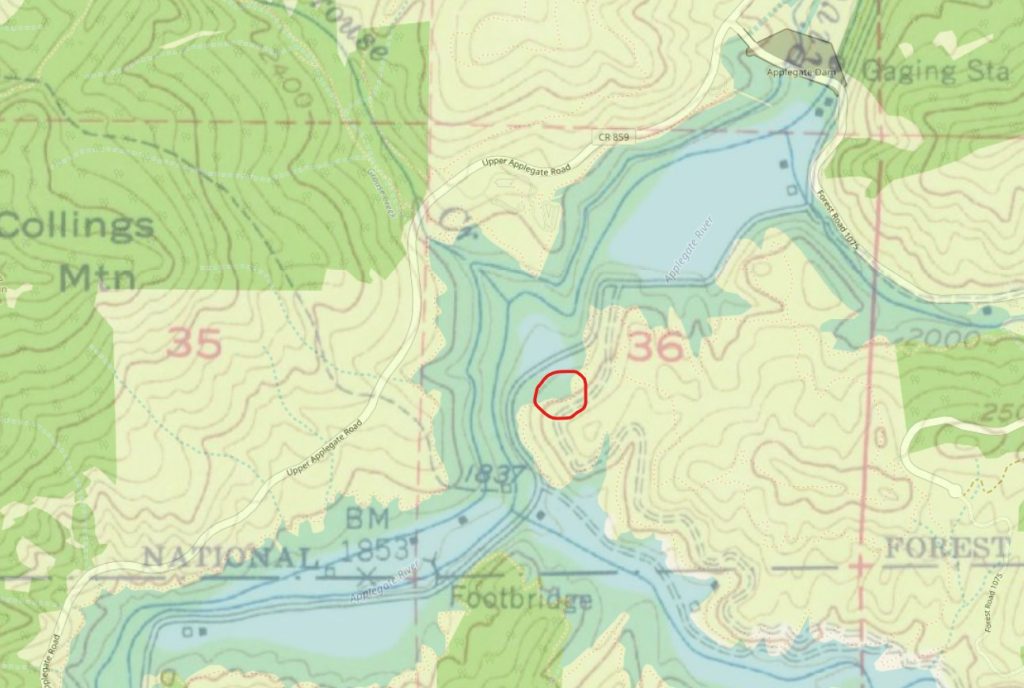
Copper grew near the mouth of Carberry Creek and took its name from mining activity in the surrounding mountains, including the Blue Ledge mining district just across the California line. The settlement was never large, but still established enough to have its own post office during the 1920s and early 1930s.
Decades later, the site found itself inside the footprint of a new federal reservoir.
The Army Corps began building Applegate Dam in 1976 and completed the 242-foot-high structure in 1980. The project was intended for flood control and water management in the Applegate River Basin.
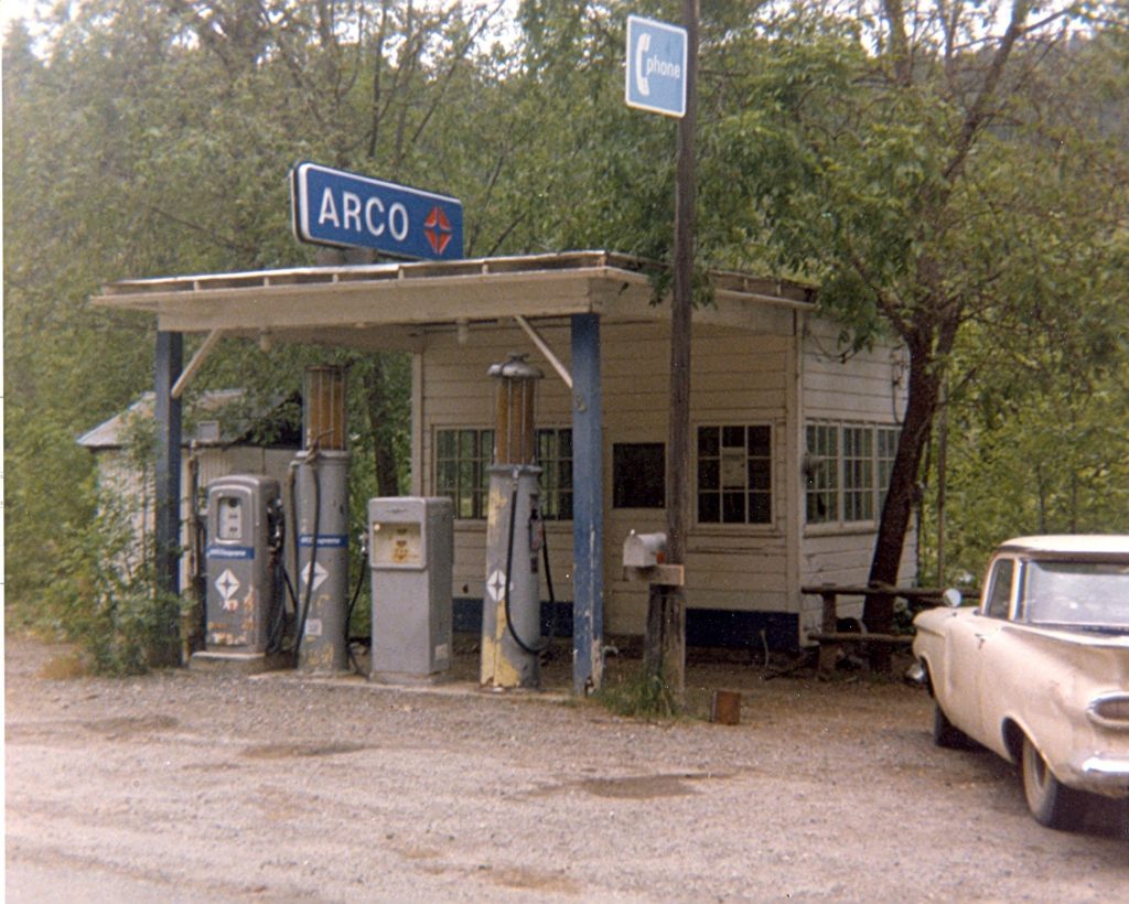
The remains of Copper disappeared beneath Applegate Lake.
During especially low water, just like the communities on the west side of the state, pieces of the old transportation network sometimes become visible. What’s now a boat-launch area was once part of a landscape people traveled through every day.
Copper is a good reminder that not every drowned community was thriving when the dam arrived. Some were already fading. But there’s a major difference between a town dwindling naturally and its physical location being erased beneath a reservoir.
Snake River
Robinette
Category: Townsite inundated
Dam: Brownlee Dam, completed 1958
Far across the state in Baker County, Robinette disappeared beneath Brownlee Reservoir.
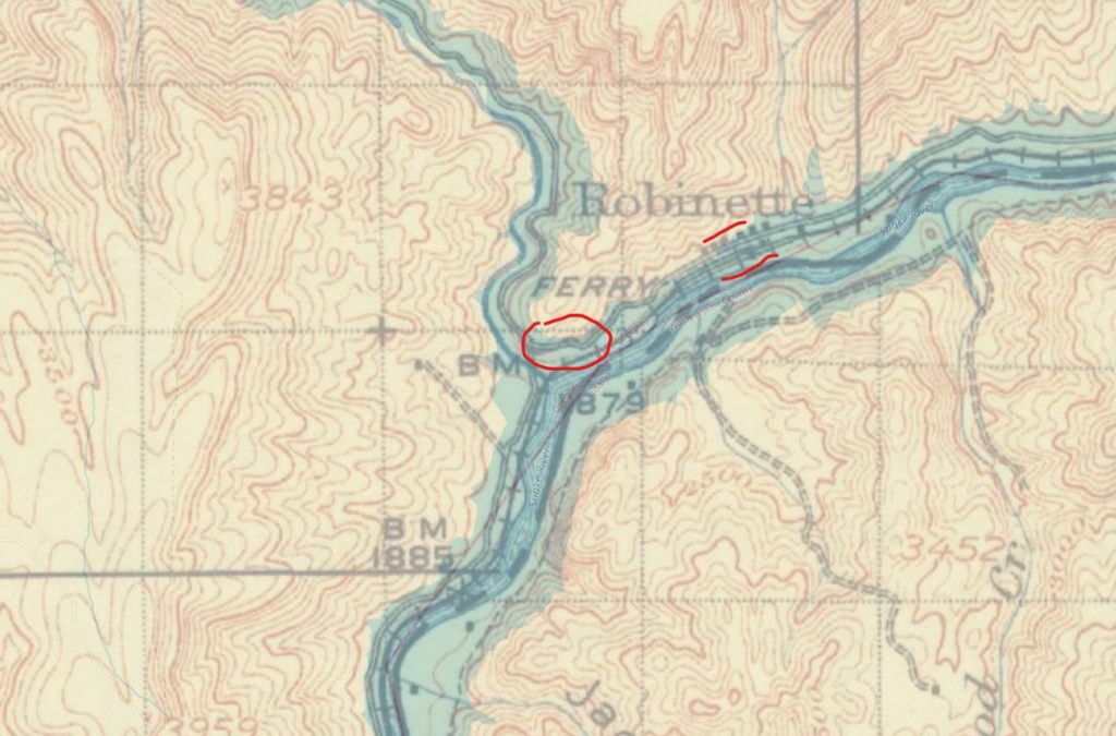
Robinette developed near the confluence of the Powder and Snake rivers and became an important little railroad and shipping point for surrounding agricultural and mining country. By 1940 it had a population of 46, along with a depot, store, school and other pieces of community life. A lumber operation later added another economic foothold.
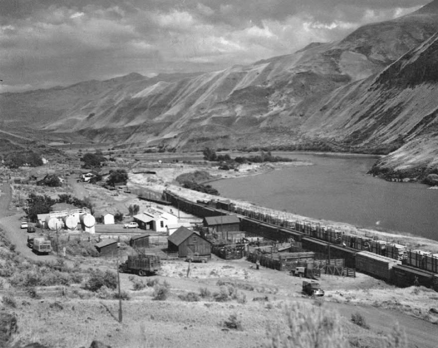
Idaho Power changed that permanently.
The Robinette post office closed in 1957, and the townsite was inundated when Brownlee Reservoir filled. One surviving piece escaped the water: the Robinette Store was moved to Richland.
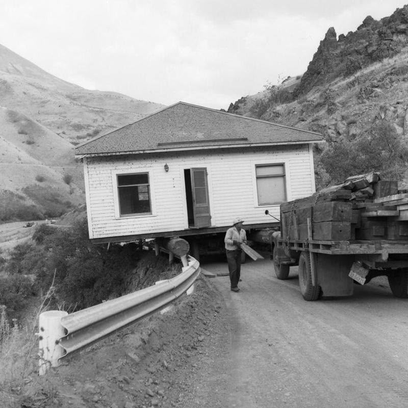
The old transportation corridor connecting the community to the surrounding country was also fundamentally changed by the reservoir.
Columbia River
Old Boardman
Category: Town relocated before inundation
Dam: John Day Dam, reservoir filled beginning in 1968
Boardman has the unusual distinction of being moved not once, but twice.
The original community was established in the early twentieth century, then shifted in 1952 to accommodate Highway 30 construction. A little more than a decade later, residents faced yet another move when construction of John Day Dam meant rising Columbia River water would soon cover the old location.
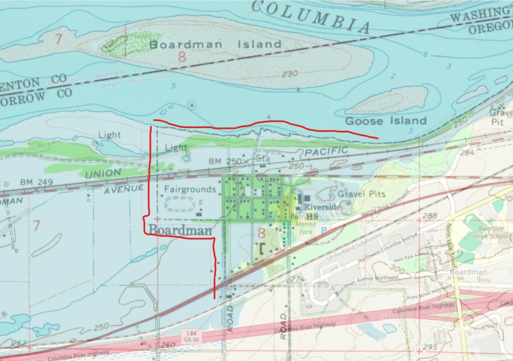
The town was relocated for the second time in 1965, and Lake Umatilla formed behind John Day Dam later that decade. The Oregon Encyclopedia preserves an aerial photograph of relocated Boardman in which the flooded location of the former town can still be identified.
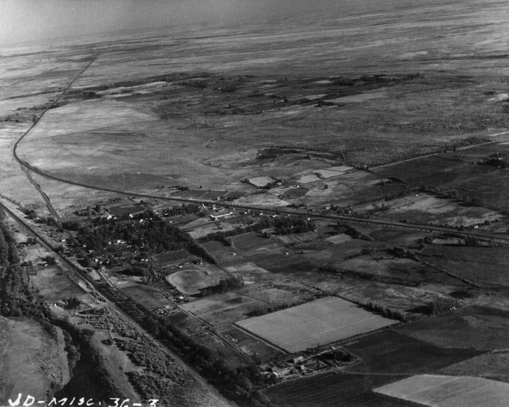
It is a remarkable illustration of how dramatically the Columbia was transformed during the twentieth century. Modern Boardman may look permanent, but its relationship with the river is very different from that of the town its earlier residents knew.
Old Arlington
Category: Town substantially relocated and riverfront inundated
Dam: John Day Dam, dedicated 1968 and completed 1971
Downriver (west) from Boardman, Arlington faced the same rising water.
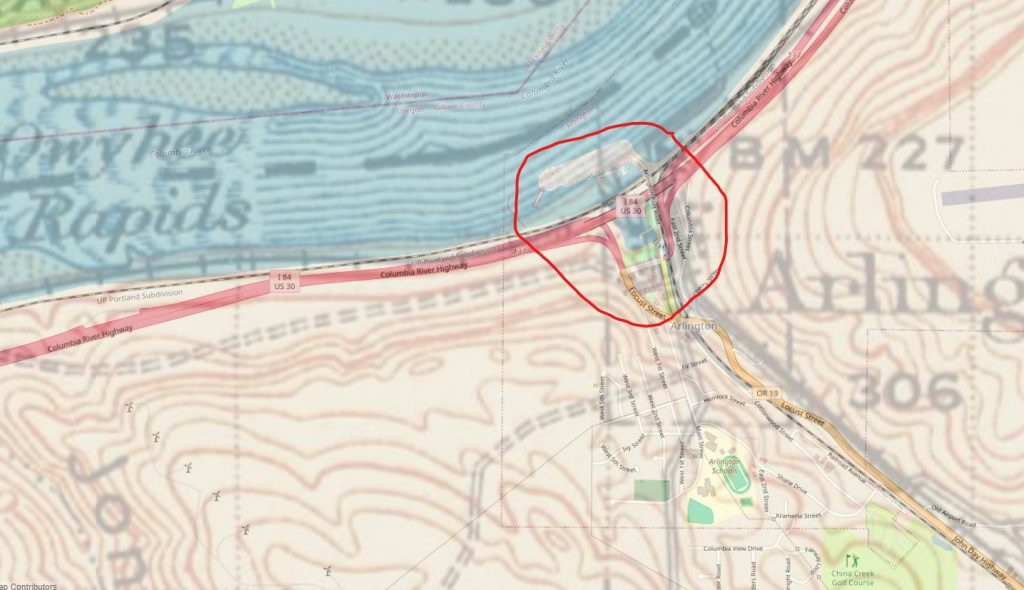
As the John Day Dam was constructed, much of the riverfront community had to move to higher ground. Homes, businesses and public infrastructure were relocated or rebuilt as the new town took shape above the area threatened by the future Lake Umatilla.
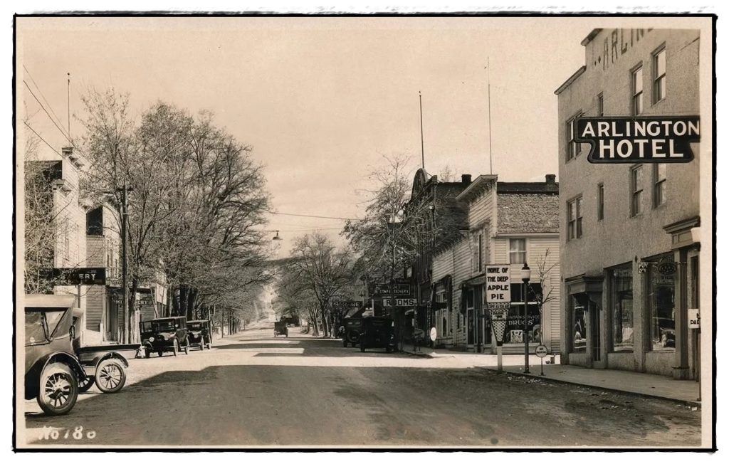
Historical accounts describe dozens of homes and businesses within the flood zone being moved, demolished or otherwise removed before the reservoir arrived.
Today, the shoreline around Arlington bears little resemblance to the original river town. The Columbia still runs past it, but the river itself has effectively become part of a long reservoir stretching upstream from John Day Dam.
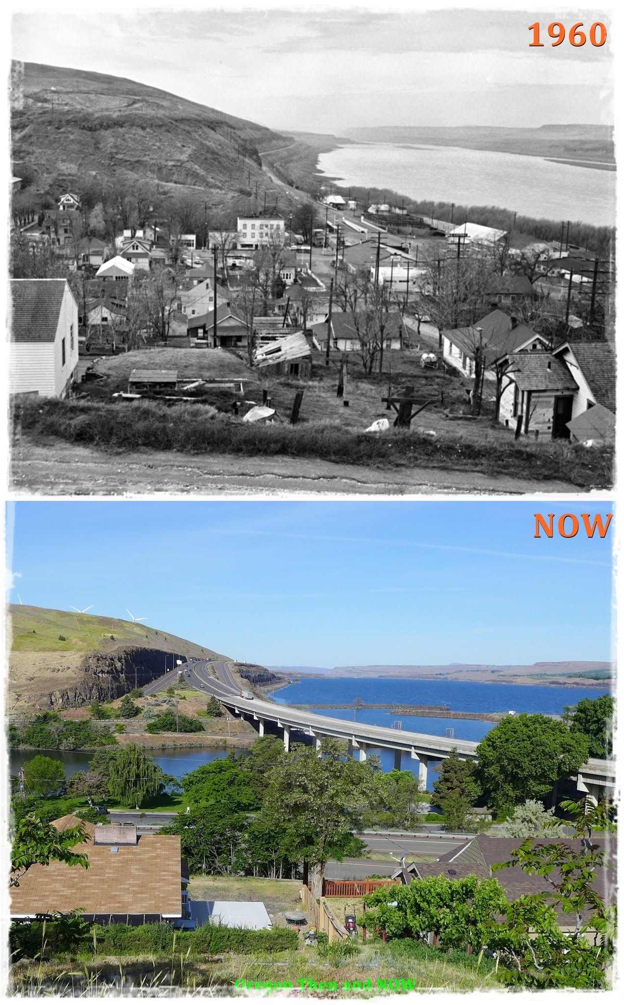
Boardman and Arlington remind us that a drowned town does not necessarily vanish from the map. Sometimes the name survives because residents picked it up and carried it uphill.
What Oregon’s Reservoirs Are Revealing Again
For decades, these places seemed permanently gone.
But reservoirs are not static. Water levels rise and fall with flood-control needs, drought, irrigation demands, maintenance and increasingly complicated requirements involving native fish.
In the Willamette Valley, the Corps intentionally keeps reservoirs lower during winter so they have space to capture storms and reduce downstream flooding. At Fall Creek, operations have gone much farther at times, lowering the reservoir specifically to improve downstream passage for young salmon and steelhead.
And when the water falls far enough, Oregon’s older landscape starts showing through.
An old road emerges from the mud. A bridge approach suddenly makes sense again. A railroad grade traces a straight line through a place that now looks wild. Concrete foundations appear where there shouldn’t seem to be anything at all.
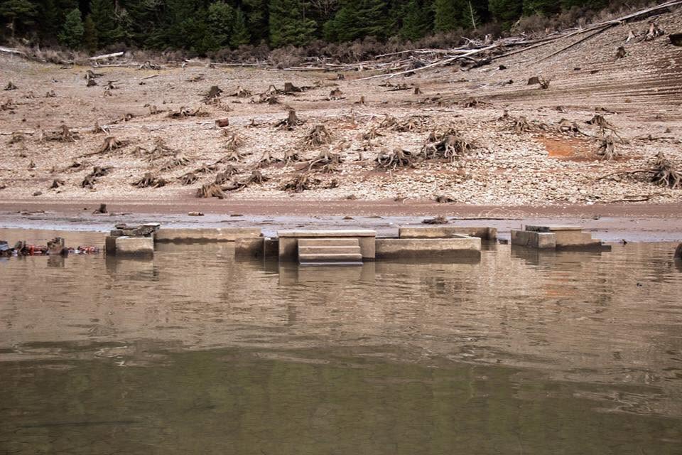
They are reminders that many of Oregon’s lakes didn’t simply appear in empty mountain valleys.
People lived there first.
For readers who want to go much deeper, the Atlas of Drowned Towns is building an extraordinary digital collection devoted to these communities and others displaced by dam construction. The project includes an interactive map, historical photographs, oral histories, documents and a searchable archive, with especially extensive work currently focused on Oregon and the Willamette Valley.
And this is only part of Oregon’s submerged history.
There is another story along the Columbia that deserves to stand entirely on its own: the drowning of Celilo Falls, the loss of ancient fishing places and cultural sites, and what disappeared beneath the water when The Dalles Dam closed its gates in 1957.
We’ll save that one for next time.