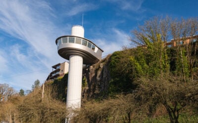
The Row River Trail is a paved walking and biking route from Cottage Grove toward Dorena Lake and Culp Creek. It follows an old railroad corridor through farm country, woods, and lakeside scenery, with covered bridges nearby and a connection to Stand By Me. You can enjoy a short section without taking on the entire trail.
That flexibility is its best feature. Come for a gentle walk, bring bikes for a longer outing, or make a covered-bridge stop part of a slow day around Cottage Grove. Pick your starting point before you leave: a downtown start and a lakeside start make for very different days.
Row River Trail at a glance
- Where: Cottage Grove, Dorena Lake, and Culp Creek in Lane County, south of Eugene.
- Surface and effort: Paved multi-use path with a mostly gentle grade. Choose a short out-and-back for an easier outing.
- Distance: Roughly 16 miles one way for the full corridor; your mileage depends on the start and finish. See the distance explanation below.
- Best for: Leisurely bike rides, flexible walks, lake views, covered bridges, and film-history fans.
- Starting choices: Downtown Trailhead Park, Mosby Creek Trailhead, or an access point along Dorena Lake.
- Facilities: Parking and restrooms at several access points. Bring your own drinking water and food.
- Hours and fees: BLM lists dawn-to-dusk use and no trail fee; check separate park charges where you park.
- Know before going: Road crossings interrupt the trail. The full Covered Bridges Scenic Bikeway includes roads and a steep hill.
Planning sources checked September 22, 2026. Check BLM’s Row River Trail page and posted notices for current access information.
Jump to: Distance · Where to start · Covered bridges · Stand By Me · Planning tips · Quick answers
The official That Oregon Life store
The Oregon you bring home.
Start the day with Oregon-roasted coffee, then find original gear inspired by the places, stories, and oddities that make this state ours.
Shop Oregon gear

How long is the Row River Trail?
Plan on roughly 16 miles one way for the full Cottage Grove–Culp Creek corridor, and double your chosen section’s distance if you return the same way. You do not need to walk or ride the whole route to enjoy it.
Published measurements differ. Travel Oregon’s Dorena Lake guide describes a 15.6-mile trail, while BLM describes its trail as 14 miles. The City of Cottage Grove describes the paved path as more than 15 miles. Those figures should not be treated as interchangeable distances from every trailhead.
For a casual first visit, choose a turnaround time instead of chasing the end of the trail. Walk out for 20 to 30 minutes, then return; allow extra time for stops. That is a suggested outing, not a measured route. For a full ride, use the official trail map to choose your endpoints and plan the return before setting off.
Where to start and park
Downtown Cottage Grove: combine the trail with town
Trailhead Park at 10th and Main is a useful choice if you want to begin in town and return for a meal. The city identifies parking and restrooms across Main Street at Bohemia Park. Starting here means including the town-to-lake approach in your distance; it is not the same outing as stepping onto the path beside the reservoir.
Mosby Creek Trailhead: make the bridge part of your outing
Mosby Creek is a good starting point when the nearby covered bridge is a priority. BLM’s driving directions lead from I-5 exit 174 east on Row River Road, then onto Layng Road to the junction with Mosby Creek Road. Follow the signed trailhead access and use the official map rather than navigating to BLM’s Springfield office address.
Dorena Lake access: begin with the scenery you came for
Access points include Dorena Dam, Row Point, Harms Park, and Bake Stewart Park. Starting around the lake makes sense if you want a shorter outing focused on reservoir views. Culp Creek provides an eastern-end option. These are separate access points, so confirm the name and location of the one you intend to use.
Before leaving the car, look at the return distance and the next road crossing. Photograph the trail map if it helps, and take water with you even on a short walk.
Covered bridges and the scenic bikeway
The Mosby Creek Covered Bridge sits just off the trail. Built in 1920 and restored in 1990, the white bridge is one of the places that gives this outing its Cottage Grove character.
The Row River Trail and the Covered Bridges Scenic Bikeway are not the same route. The trail forms part of the longer bikeway. The city’s route description includes a road return and a short hill with a grade above 8 percent. Riders who want to avoid that road section can return along the trail.
For families and riders who prefer separation from moving traffic, an out-and-back is the simpler choice. It still has road crossings, so slow down and check each one. Do not assume that a covered-bridge cycling itinerary stays on a protected path all day. See Travel Oregon’s bikeway description before committing to the longer ride.
Was Stand By Me filmed on the Row River Trail?
Yes. Parts of Stand By Me were filmed along the railroad corridor that is now the Row River Trail. The former tracks make this more than a pretty lakeside route for fans of the movie. BLM also documents the railway’s connections to The General and Emperor of the North.
The original That Oregon Life story included this then-and-now video of filming locations. Treat it as film-history context, not a current access map. Stay on public routes, respect private property, and avoid climbing onto structures to recreate a scene.
Planning a comfortable visit
Walking, bikes, strollers, and mobility needs
The paved surface and gentle former railroad grade make a short section worth considering for mixed-ability groups. Distance still matters: a long, mostly flat outing can be tiring. Keep the turnaround flexible, leave room for passing riders, and take breaks before the return feels like a chore.
Pavement alone does not establish wheelchair accessibility at every trailhead. Check the specific parking surface, restroom access, slopes, crossings, and recent pavement condition with the land manager before choosing a start for a wheelchair or mobility device. Do not assume every access point offers the same facilities.
Water, restrooms, dogs, and horses
Pack food and enough drinking water for the whole outing. BLM lists restrooms and parking at intervals along the route, but availability at an individual stop can change. Overnight camping on the trail is not allowed.
If bringing a dog, check the current rules for your chosen access point and keep your pet close and under control around passing bikes and horses. Horseback riding is among the uses BLM lists; riders should confirm appropriate parking and trail-use instructions before hauling a trailer. This guide does not assume every parking area suits every user.
Seasonal tradeoffs
Spring brings fresh growth and wildflowers; summer offers longer days; fall adds color to the wooded sections. Our original reporting highlighted the trail’s appeal across the seasons, and choosing a shorter section keeps a visit manageable when the weather is less inviting.
On hot days, carry extra water and choose your timing carefully. After rain, watch for slippery leaves and wet surfaces. Check conditions before a winter outing, and treat smoke, storms, or posted closures as reasons to change plans. Follow Leave No Trace principles and keep the route pleasant for the next person.
Quick answers before you go
How do you pronounce Row River?
“Row” rhymes with “cow,” rather than the word for paddling a boat.
Is this a loop around Dorena Lake?
No. The paved Row River Trail follows the north side of the lake and continues along the corridor. Returning on the same trail makes an out-and-back; a longer cycling loop can involve public roads.
Is it a good family walk?
A short section can work well when you choose a suitable starting point and supervise children at crossings. Set the distance around the least experienced person in your group, and leave room for cyclists to pass.
Can you visit without riding the entire trail?
Yes. Multiple access points let you choose a small section. Start near the feature you want to see, then turn around when you are ready.
Where can I find the current map and access information?
Use the BLM trail map and current recreation page. The map helps with route planning; posted notices and the land manager are the better sources for conditions on the day.
Make a day of Cottage Grove
Pair your walk or ride with downtown using our Cottage Grove guide. For a food stop, the Eugene and Lane County restaurant guide includes Cottage Grove choices. If you are staying farther north, our Eugene travel guide helps place the outing in a broader trip.
Want a different kind of walk next time? Browse our Oregon hiking guide for options by region and trip style.
Source note: This guide combines That Oregon Life’s original Row River Trail reporting with the linked BLM, City of Cottage Grove, and Travel Oregon planning resources, reviewed September 22, 2026. It is a desk-researched update, not a new on-site conditions inspection.