Another plume of smoke rose above the forests near Mount Hood on Sunday, adding one more fire to what has already become an extraordinary and exhausting wildfire season across Oregon.
The new blaze, called the Austin Fire, was reported Sunday in the Mount Hood National Forest. It is burning in Clackamas County on the north side of Forest Road 46, about two miles west of the junction with Forest Road 4650.
Initial reports Sunday afternoon estimated the fire at more than 30 acres as smoke climbed high enough to be clearly visible across the surrounding area. By Sunday evening, the Mount Hood National Forest reported the fire at approximately 35 acres and 50 percent contained. It is burning in timber on steep terrain, and the cause remains under investigation.
The Austin Fire was one of several new starts reported in the Mount Hood National Forest over the weekend, underscoring just how little margin for error exists across Oregon right now. KATU reported that firefighters were responding to three new fires in the forest over the weekend as hot, dry conditions continued.
For Oregonians who have spent the last several weeks watching smoke columns appear over ridgelines, checking evacuation maps and refreshing highway closures, it is another reminder that the 2026 fire season remains very much alive.
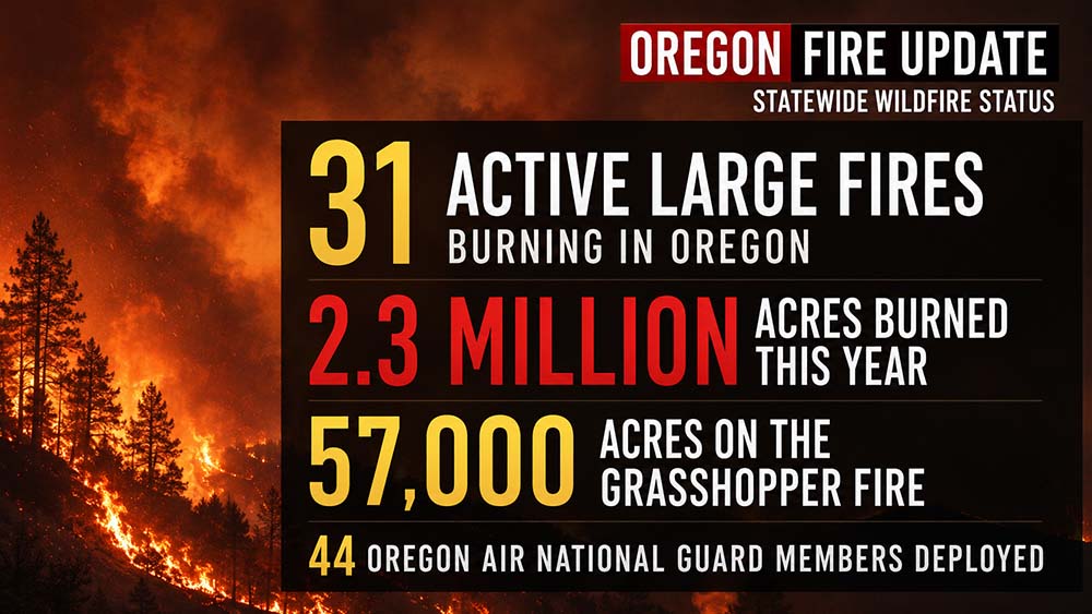
And the statewide numbers are becoming difficult to comprehend.
Oregon has now seen more than 2.3 million acres burn during the 2026 wildfire season, surpassing the record acreage burned during 2024. More than 30 large fires remain active around the state as firefighters continue working from the forests around Mount Hood to the high desert along the Idaho border.
Grasshopper Fire Remains a Major Concern Near Mount Hood
The Austin Fire is relatively small compared with the enormous wildfire already burning nearby.
As of Sunday, the Grasshopper Fire had grown to more than 57,000 acres in the Mount Hood National Forest and was approximately 23 percent contained. Firefighters reported some additional movement along the northern portion of the fire overnight, but containment lines elsewhere continued to perform well.
Much of the battle over the past several days has centered on Oregon Highway 35.
The highway is far more than another mountain road. It is one of the primary routes around the east side of Mount Hood, connecting the Highway 26 corridor with Hood River and the Columbia River Gorge.
For firefighters, it has also become a critical piece of the containment strategy.
Crews have been working to keep the Grasshopper Fire from establishing itself west of the highway, where forests, recreation areas and communities surrounding Mount Hood become increasingly important concerns.
Despite rumors circulating locally that the fire had crossed Highway 35, officials said that was not the case. Firefighters have instead been using the roadway as part of the western containment strategy.
A portion of Highway 35 remains closed because of the wildfire.
The closure has created another ripple effect during what would normally be one of the busiest periods of summer around Mount Hood. Highway 35 serves tourists heading toward Hood River, hikers exploring the mountain, campers, orchard visitors and people traveling between central Oregon and the Columbia River Gorge.
The wildfire has also affected businesses on both sides of the mountain, particularly around Hood River, where the highway closure has disrupted normal summer traffic.
Oregon Air National Guard Joins the Fight
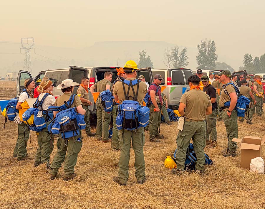
Among the crews now working the Grasshopper Fire are members of the Oregon Air National Guard.
A total of 44 Guard personnel were deployed in two 22-person hand crews, including members of the 142nd Wing in Portland and the 173rd Fighter Wing in Klamath Falls.
The deployment marked an unusual milestone for the Oregon Air National Guard, with Air Guard members taking the lead on wildland firefighting hand crews.
Before heading to the fire, the crews gathered in Salem and prepared for the assignment.
The deployment comes at a time when firefighting resources are stretched across Oregon and much of the western United States. The National Interagency Fire Center reported Sunday that firefighters were working on 94 large fires nationwide, with more than 30,000 personnel committed to incidents around the country.
On the Grasshopper Fire alone, the response has involved well over 1,000 firefighters and support personnel during portions of the incident.
The additional Guard crews give fire managers more people on the ground to strengthen containment lines, remove fuels and help protect areas threatened by the fire.
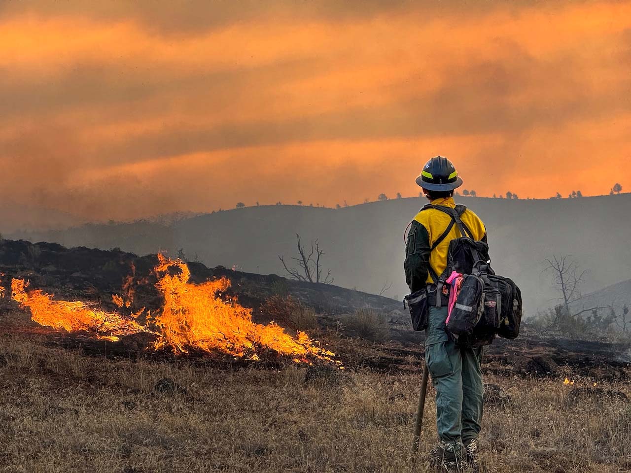
For anyone who has watched an Oregon wildfire from a distance, the dramatic air tanker drops and helicopter operations often get most of the attention. Much of the actual work of containing a wildfire, however, still happens one exhausting section at a time on the ground.
Hand crews cut vegetation, dig fireline, remove burning material and work steep terrain that engines sometimes cannot reach.
Around Mount Hood, that work has continued day after day.
Smoke Conditions Improve Around Mount Hood
The Grasshopper Fire has not only threatened roads and forests. Its smoke has also made life difficult around Mount Hood.
Last week, easterly winds pushed smoke westward across the mountain, bringing deteriorating air quality into areas that would normally be packed with visitors escaping the August heat.
One of the places affected was Mount Hood Kiwanis Camp, which suspended operations for the week because of smoke and poor air quality.
Conditions began looking more favorable as winds shifted back out of the west.
Camp officials said they planned to resume operations Monday after consulting with the Hoodland Fire District and reviewing the fire situation.
The change is a good example of how unpredictable wildfire smoke can be in Oregon.
A town buried beneath smoke one afternoon can wake to significantly cleaner skies the next morning after a wind shift. At the same time, another community dozens or even hundreds of miles away can suddenly find itself underneath the plume.
The fire itself does not have to move for smoke conditions to change dramatically.
Wrights Spring Fire Grows Near Upper Klamath Lake
Farther south, crews are facing a much more dangerous situation on the Wrights Spring Fire in Klamath County.
The fire had grown to approximately 34,000 acres by Sunday near Upper Klamath Lake after expanding rapidly since it was first reported Wednesday.
The fire has already taken a life.
Jason Ensign, 47, of Klamath Falls, died Thursday while operating a bulldozer on the fire near the Yahwee Plateau area.
According to the Klamath County Sheriff’s Office, Ensign was working with crews when extreme fire conditions prevented him from escaping the area.
His death has cast a heavy shadow over an already difficult wildfire season.
Gov. Tina Kotek invoked Oregon’s Emergency Conflagration Act for the Wrights Spring Fire on Friday, allowing the state to mobilize additional firefighting resources. The Oregon State Fire Marshal sent its Green Incident Management Team along with structural task forces to assist local agencies.
The terrain and fuels have made suppression particularly difficult.
Firefighters reported that retardant dropped from aircraft was struggling to penetrate the dense tree canopy in some areas, limiting its effectiveness against flames burning closer to the forest floor.
At times, extreme conditions have also forced crews to pull back rather than risk firefighters becoming trapped.
Evacuation orders remain in effect in portions of the surrounding area, including Level 3 “Go Now” areas near Sprague River Road.
For residents living in those rural stretches of Klamath County, the fire is not something happening on a distant mountain. It is unfolding close to homes, ranches and the roads people depend on every day.
Big Grass Fire Becomes One of Oregon’s Largest Ever
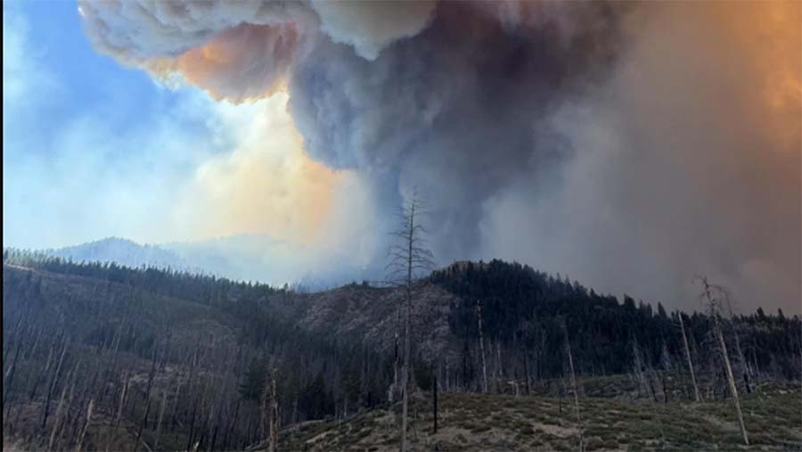
If the scale of Oregon’s wildfire season can be understood through a single fire, the Big Grass Fire might be the clearest example.
Burning across the remote country along the Oregon and Idaho border, the fire had grown to approximately 513,437 acres by Sunday and was listed at 39 percent containment.
That puts the Big Grass Fire among the largest wildfires ever recorded in Oregon.
The fire began July 23 about 25 miles southwest of Jordan Valley and was caused by lightning. What started in the wide-open rangelands of southeastern Oregon eventually pushed across the Idaho border, transforming into a massive two-state incident.
More than 1,000 firefighters and support personnel have been involved in the response.
The sheer size is difficult to picture.
More than half a million acres is an area vastly larger than most Oregon cities and communities combined. Yet much of this landscape is ranch country, where individual homes, grazing lands, fences, livestock and outbuildings may be spread across enormous distances.
Firefighters have been working to protect those scattered properties while constructing containment lines across grass and sagebrush country that can carry flames quickly when the wind rises.
As of Sunday, officials said 159 people had been evacuated, with hundreds of residential and other structures threatened.
Wind-driven runs and short-range spotting continued to challenge crews on the fire. Federal fire officials also reported threats to structures and critical infrastructure.
Even Small Fires Are Dangerous Right Now
The massive wildfires dominate the maps, but another incident this weekend showed why firefighters remain concerned about seemingly smaller starts.
On Saturday, multiple agencies responded to a mobile home fire in Lebanon.
By the time firefighters arrived, a double-wide mobile home was burning and wind had carried flames into heavy brush nearby. The fire began climbing a hillside, raising concern that it could spread farther into the surrounding vegetation and threaten another structure.
Crews were able to stop the forward movement of the fire within roughly 20 minutes.
Eight agencies ultimately assisted with the response.
The cause remains under investigation.
In another year, a structure fire spreading briefly into nearby brush might remain a relatively localized emergency. During a summer like this one, every spark that reaches dry vegetation carries a different level of concern.
Oregon’s forests, grasslands and high desert have endured weeks of summer heat and drying. Add afternoon wind, and a fire can quickly move beyond the place where it started.
That is why crews around the state continue emphasizing prevention even while thousands of firefighters are already committed to existing incidents.
More Than 2.3 Million Acres, and August Is Far From Over
Perhaps the most sobering part of Oregon’s current wildfire situation is the calendar.
It is only August 9.
Historically, some of Oregon’s most destructive wildfire conditions have occurred later in August and into September, particularly when prolonged summer drying combines with strong wind events.
Already, the acreage burned this year has climbed beyond the record-setting 2024 season.
The fires are also spread across dramatically different parts of Oregon.
Around Mount Hood, crews are trying to protect forests, highways, recreation areas and mountain communities.
Near Klamath Lake, residents are dealing with evacuations while firefighters mourn the loss of one of their own.
Along the Idaho border, crews are battling a fire so enormous that its footprint stretches across more than half a million acres of ranch and rangeland.
Elsewhere, dozens of additional fires continue to demand firefighters, engines, aircraft and incident management teams.
And Sunday brought another smoke column into the sky above Mount Hood.
The Austin Fire may ultimately become a small footnote in the 2026 season if firefighters continue making progress. By Sunday evening, reaching 50 percent containment on the roughly 35-acre fire was encouraging news.
But its sudden appearance during an already overwhelming summer illustrates the challenge Oregon faces every day right now.
Firefighters are not simply trying to finish one fire before moving to the next.
New ones keep starting while the old ones are still burning.
For Oregonians traveling through fire country, conditions can change quickly. Highway closures, evacuation levels, forest closures and smoke conditions should always be checked through official sources before heading toward an affected area.
And with weeks of summer still ahead, preventing the next fire matters just as much as fighting the ones already on the map.
Stay Updated on Oregon Wildfires, Evacuations and Road Closures
With fire conditions changing quickly across Oregon, residents and travelers should rely on official sources for the latest evacuation notices, highway closures, fire maps and air quality information.
Oregon Wildfire Response & Recovery:
https://wildfire.oregon.gov/
The state’s wildfire website includes current fire information, evacuation resources and links to Oregon’s statewide fire dashboard.
Oregon Emergency Alerts:
https://oralert.gov/
Oregonians can use OR-Alert to find their local county or emergency management notification system and sign up for evacuation and emergency alerts.
Oregon road closures and highway conditions:
https://tripcheck.com/
ODOT’s TripCheck provides current highway closures, traffic impacts and road conditions. Wildfire closures can change with little warning, so travelers should check conditions before leaving and avoid relying solely on GPS for alternate routes.
Oregon Smoke Information:
https://www.oregonsmoke.org/
The Oregon Smoke Information site provides wildfire smoke forecasts, advisories and a statewide fire and air quality map.
Current Oregon air quality:
https://oraqi.deq.state.or.us/
Oregon DEQ’s Air Quality Index provides current AQI readings from monitoring stations around the state.
Watch Duty:
https://www.watchduty.org/
Watch Duty provides frequently updated wildfire maps, incident information, evacuation areas and notifications. Residents under an evacuation notice should still follow directions from their local sheriff’s office or emergency management agency.
Evacuation levels can change quickly. Level 1 means Be Ready, Level 2 means Be Set, and Level 3 means Go Now. Anyone placed under a Level 3 evacuation notice should leave immediately and should not wait for another notification.
Current Evacuation Levels:
- Baker County: facebook.com/profile.php?id=100064434892363
- Crook County: Facebook.com/CrookCountySheriff
- Deschutes County: www.facebook.com/DeschutesCountySheriff
- Gilliam County: Facebook.com/GilliamCountySheriff
- Grant County: Facebook.com/profile.php?id=100068819321423
- Harney County: Facebook.com/HarneyCoSheriff
- Hood River County: www.facebook.com/hrcso
- Jefferson County: Facebook.com/JeffersonCountyORSheriff
- Sherman County Facebook.com/profile.php?id=100064318254818
- Umatilla County: Facebook.com/UmatillaCountySheriff
- Union County: Facebook.com/UnionCountyORSheriff
- Wheeler County: Facebook.com/WheelerCountySheriffsOffice
- Wasco County: Facebook.com/WascoCountySheriff
- Confederated Tribes of Warm Springs, Oregon: Facebook.com/CTWSO
For current Oregon fire conditions: Track current fire incidents, mapped evacuation areas, smoke, road conditions, and official resources on our Oregon Wildfire Map.