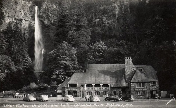
Multnomah Falls is Oregon’s tallest waterfall, dropping 620 feet in two main tiers in the Columbia River Gorge. You can see it from the developed lower plaza without taking a full hike; Benson Bridge is about 0.4 mile round trip, while the steep paved trail to the upper overlook is about 2.4 miles round trip. Finding a parking space is usually the hardest part of the visit.
Multnomah Falls quick facts
| Location | Columbia River Gorge National Scenic Area, about 30 miles east of Portland |
|---|---|
| Height | 620 feet total; two main drops |
| Lower viewpoint | Developed plaza near the lodge; the lower viewing area has an accessible route, though grades and crowds vary |
| Benson Bridge | About 0.4 mile round trip on a paved but uphill path |
| Upper overlook hike | About 2.4 miles round trip with roughly 700–750 feet of gain; paved, steep, and often crowded |
| Parking | I-84 Exit 31 is the main lot. A reservation never guarantees a space. The small Historic Highway lot is limited and privately operated |
| Permit now | The 2026 timed-use season ended September 7. Seasonal permits apply to private vehicles using the I-84 Exit 31 lot. Check the official page for the next season |
| Transit | Columbia Gorge Express runs seven days a week between Portland, Troutdale, Multnomah Falls, Cascade Locks, and Hood River |
| Best fit | First-time visitors, families who want a waterfall view without a long hike, and travelers who can plan around crowds |
| Allow | 30–60 minutes for the lower plaza and bridge; about 1.5–2.5 hours for the upper overlook hike |
Last fact-check: September 20, 2026. Confirm same-day access with ODOT’s Multnomah Falls permit page, Recreation.gov, and TripCheck.
Is Multnomah Falls worth visiting?
It’s a good choice for a first Oregon trip or a group that wants to see the falls without a long hike. The plaza, bridge path, and parking area can be packed on summer weekends and sunny holidays. Arrive early, take transit if the schedule works for you, and have another waterfall in mind if it’s too crowded.
Skip the crowds: quieter waterfalls near Multnomah Falls
If you’d rather skip the busiest stop, these nearby waterfalls are often quieter. They can still be busy. Check each guide and official alerts for parking, fees, construction, weather, and closures before you go.
| Choose this waterfall | Best for | What to expect |
|---|---|---|
| Latourell Falls | A dramatic waterfall with very little walking | About 0.3 mile round trip to the lower falls, with a longer loop available. Oregon State Parks parking rules or fees may apply. |
| Bridal Veil Falls | A short forest walk for families | About 0.6 mile round trip. The return is uphill, and Oregon State Parks parking rules or fees may apply. |
| Wahclella Falls | A two-mile canyon hike | About 2 miles round trip. Expect narrower trail sections and verify current Forest Service alerts and any trailhead fee. |
| Starvation Creek Falls | A low-effort stop farther east | A very short walk near Cascade Locks. A stop beyond the busiest central corridor. |
Use the Complete Oregon Waterfalls Guide to compare destinations by region, walking distance, and difficulty, or the Oregon Hiking Guide when the trail matters more than the roadside stop.
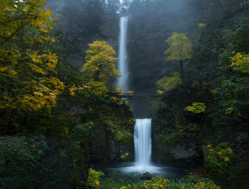
You can see both tiers from the lower plaza and lodge area. Early weekday mornings and the quieter shoulder seasons usually mean fewer crowds.
How tall is Multnomah Falls?
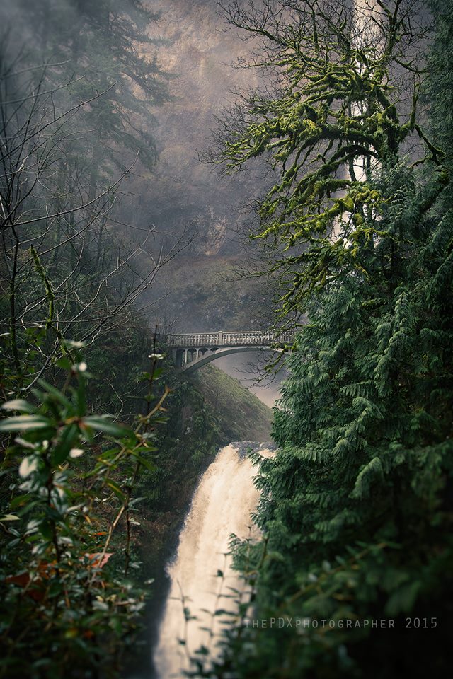
The U.S. Forest Service describes Multnomah Falls as Oregon’s tallest waterfall at 620 feet, with a 542-foot upper drop and a 69-foot lower drop separated by the ledge crossed by Benson Bridge. Height rankings vary when lists mix seasonal falls, single drops, and total multi-tier descents.
Related: 10 Breathtaking Waterfalls Near Portland, Oregon
How hard is the Multnomah Falls hike?
The trail from the lodge area to the upper overlook is about 2.4 miles round trip with roughly 700–750 feet of elevation gain. It is paved, but the sustained switchbacks make it a moderate hike rather than an easy stroll.
For the shortest option, walk only to the lower plaza. Benson Bridge is about 0.2 mile from the lodge area, or roughly 0.4 mile round trip, on an uphill paved path. Keep children close on the wet pavement and steep sections, especially near drop-offs and in heavy foot traffic. The route beyond the lower plaza is not a dependable wheelchair or stroller trail.
Wahkeena Falls is roughly half a mile west of Multnomah Falls. The lower-falls outing is about 0.5 mile round trip and climbs quickly; longer routes continue toward Fairy Falls or connect with the Multnomah–Wahkeena trail system. Its parking area is small, too. Don’t count on finding overflow parking here.
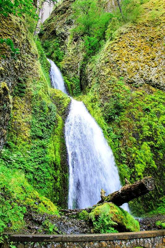
For a trail-focused alternative, compare the approximately 2-mile Wahclella Falls hike with the approximately 4.4-mile Dry Creek Falls hike. Both require more effort than the Multnomah plaza. Check current trail and parking conditions before heading out.
How do you get to Multnomah Falls from Portland?
Multnomah Falls sits beside the Historic Columbia River Highway east of Bridal Veil and Troutdale. For the main public parking area, take I-84 to Exit 31 and use the pedestrian tunnel beneath the freeway. The smaller lot directly in front of the lodge on U.S. 30 is limited, privately operated, and may be full even when the highway is moving. Never stop on the shoulder or wait in an active travel lane for a space.
What if the Multnomah Falls parking lot is full?
Keep driving if the entrance is closed or traffic staff direct you onward. Do not queue in a travel lane or park on the highway shoulder. Check the TripCheck parking camera before committing to Exit 31; a timed-use permit does not guarantee a space.
You can return at a quieter time, choose another waterfall, or use the Columbia Gorge Express schedule and rider alerts to plan a transit visit. The small lodge lot and nearby trailheads can also fill, so do not count on them as overflow parking.
Getting there without a car
Transit is often the least stressful option because it avoids the parking search. Columbia Area Transit’s Columbia Gorge Express serves Gateway Transit Center in Portland, Troutdale, Multnomah Falls, Cascade Locks, and Hood River.
The bus runs seven days a week, but it may skip a stop if traffic is too congested to stop safely. Check the current Columbia Gorge Express schedule and rider alerts before leaving. Riders using qualifying transit or shuttle service do not need the seasonal Exit 31 vehicle permit.
Multnomah Falls Historic Lodge
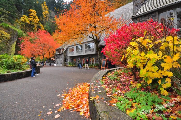
Built in 1925, Multnomah Falls Lodge is listed on the National Register of Historic Places and incorporates rock from around the Gorge. The restaurant, gift shop, snack bar, visitor services, and restroom availability can change by season or during renovation. As of September 2026, the official permit page says the indoor public restrooms are under renovation through November, with limited portable toilets available.
For meals, current menus, and reservations, check Multnomah Falls Lodge. Its September 2026 notice says the restaurant elevator is intermittently available during renovations; call ahead if you need it.
Best Times to Visit Multnomah Falls
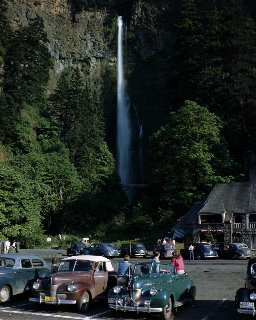
Multnomah Falls flows year-round. Winter and spring usually bring the strongest water; late spring and summer bring the biggest crowds; fall can offer colorful foliage and a calmer weekday experience.
In cold weather, ice can close or complicate the trail above the lower viewing area even when the plaza remains accessible. In warm weather, expect more competition for parking. Check weather, Gorge alerts, and TripCheck the morning of your visit.
For fewer crowds, try a weekday morning in fall or late winter, and be ready to change plans if conditions are poor.
How Multnomah Falls Was Formed
The repeated Ice Age Missoula Floods helped expose and shape the Columbia Gorge’s basalt walls. Multnomah Creek, fed by precipitation, snowmelt, and springs on Larch Mountain, now drops 620 feet over those resistant lava layers in two main tiers.
The Bridge Over the Falls
Benson Bridge was built in 1914 with funding from Simon Benson, a supporter of the Historic Columbia River Highway. The concrete footbridge spans Multnomah Creek between the upper and lower falls. The lodge’s bridge history credits the Pacific Bridge Company of Portland with its construction.

From Benson Bridge, you can look up toward the upper falls and down toward the lower plunge. Keep the crossing clear for other visitors, especially when stopping for photographs.
Where to Stay Near Multnomah Falls
Choose where to stay based on the rest of your trip.
Troutdale: A practical western-Gorge base if you want an early waterfall start without staying in central Portland. Use our Troutdale guide to combine the falls with a meal in town, Edgefield, or a stop by the Sandy River.
Cascade Locks: Choose it when your trip continues east through the Gorge or you want a smaller river town between waterfall outings. Compare the towns and routes in our Mt. Hood and Columbia Gorge guide.
Portland: A useful base when Multnomah Falls is one day of a trip built around restaurants, neighborhoods, and city attractions. Allow for the drive or transit connection rather than choosing a hotel on straight-line distance alone. Our Portland travel guide helps you choose an area.
Camping: Compare locations, seasonal access, and reservations in the Oregon Camping Guide. Mountain campgrounds such as Lost Lake are separate outings, not walkable overnight bases for Multnomah Falls.
Before You Go
Check the Columbia River Gorge National Scenic Area alerts, TripCheck, and the official permit page before the drive. Weather, ice, wildfire restrictions, construction, landslides, and parking operations can change your plans.
Multnomah Falls is Dog Friendly
Leashed dogs are generally allowed in the developed area and on the trail. Crowds, wet pavement, steep switchbacks, heat, and limited space on Benson Bridge make the upper route a poor fit for some dogs. Pack out waste and never let a leash block the trail.
Is Multnomah Falls open to the public now?
Multnomah Falls is generally open year-round, but a trail segment, parking approach, lodge service, or restroom can close independently. Check the Forest Service alerts and TripCheck on the day you go.
Do you need a ticket or permit for Multnomah Falls?
Permits are seasonal vehicle reservations, not per-person admission tickets. The 2026 system required one timed-use permit per private vehicle or motorcycle using the I-84 Exit 31 lot from 9 a.m. to 6 p.m., May 22 through September 7. That season has ended. ODOT says information about the 2027 season will be posted on its permit page and Recreation.gov.
During an active season, a permit controls the vehicle’s arrival window; it does not limit the visit to one hour and does not guarantee a parking space. Transit, qualifying shuttle service, and bicycle arrivals do not use the Exit 31 vehicle permit. Read our 2026 permit-season update, then verify the current rule on Recreation.gov.
Plan the rest of your trip
- Compare waterfalls across Oregon by region, access, and trail difficulty.
- Browse the Oregon Hiking Guide for longer walks and trail outings.
- Plan the Mt. Hood and Columbia Gorge region and decide how much time to spend along the river or on the mountain.
- Use Troutdale as a west-Gorge base for an early start and a meal after the falls.
If you’re staying in Portland, our Portland travel guide helps with hotel location, transportation, and how much you can realistically fit around Multnomah Falls.