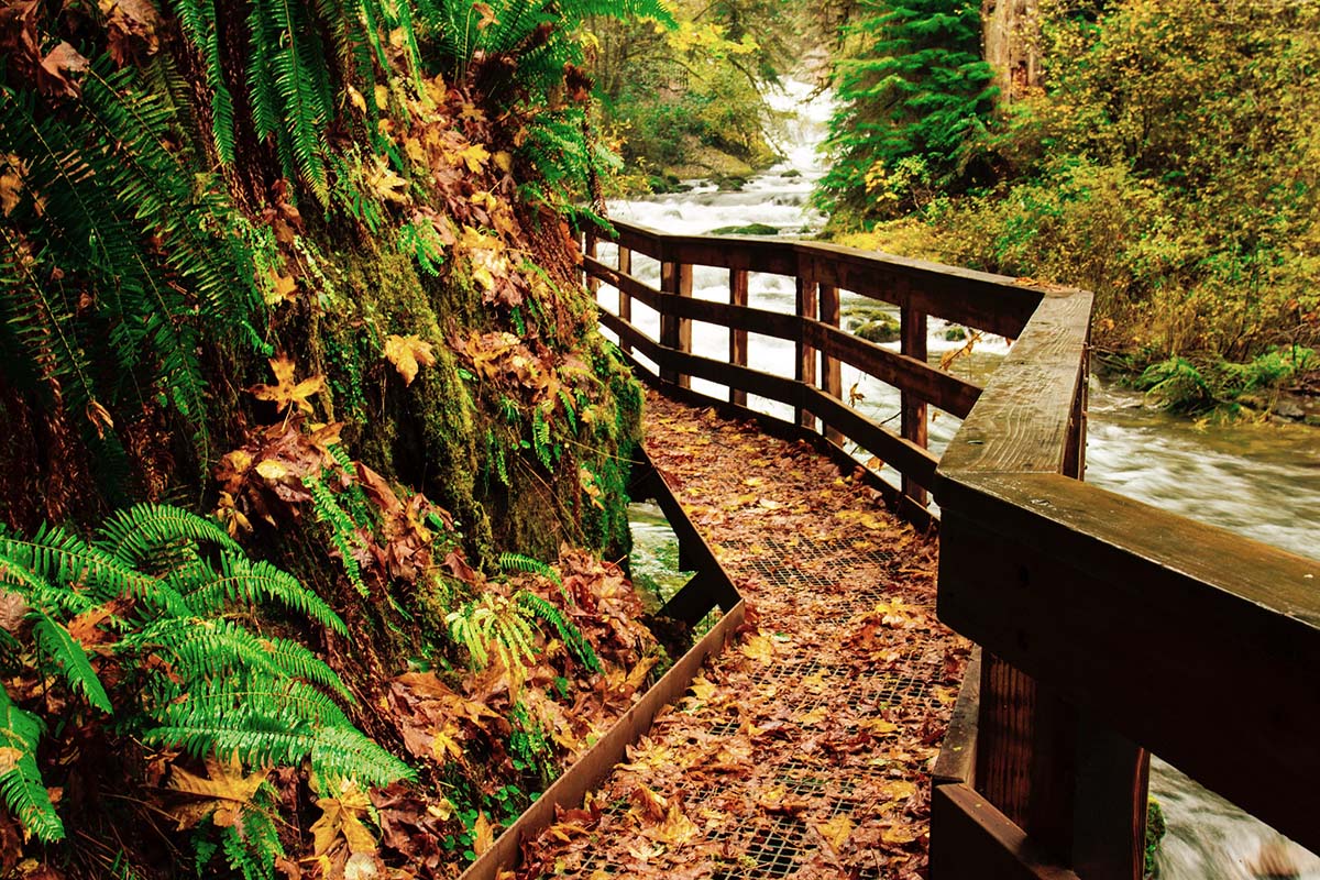
There is a moment every autumn when western Oregon seems to change overnight. The mornings grow cooler, the first real rain returns after months of dry weather, and the enormous green canopy of the Coast Range begins picking up flashes of gold. Fallen maple leaves collect along creeks and forest roads. Moss seems brighter. Water starts moving again through channels that spent much of August quietly waiting for rain.
And tucked into the hills east of Florence is a place where all of those things come together beautifully.
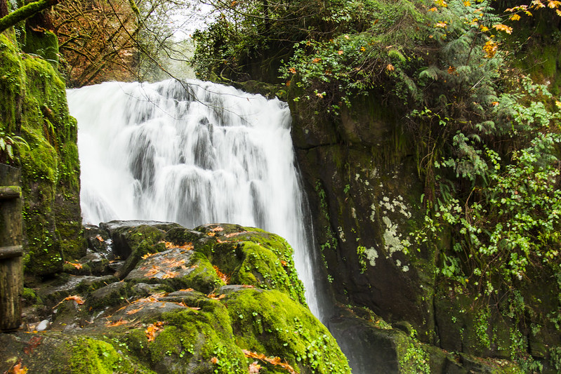
Sweet Creek Falls has long been one of our favorite waterfall hikes in this corner of Oregon, but fall may be the season when the trail shows off the most. Here, the forest is not simply something you walk through on the way to a waterfall. The forest, the creek, the changing leaves, the mossy canyon and the succession of small cascades are the experience.
Located in the Siuslaw National Forest south of Mapleton, Sweet Creek Trail follows its namesake stream through a narrow Coast Range canyon filled with waterfalls. Depending on which portion of the trail you explore, you’ll encounter wooden bridges, rocky paths, creekside forest and sections built tightly against the canyon walls. The larger Sweet Creek Falls waits farther upstream, but unlike plenty of waterfall hikes where the scenery is mostly a warmup for one big payoff, Sweet Creek gives you something to look at almost constantly.
There are reportedly 11 waterfalls throughout the Sweet Creek trail complex, while Sweet Creek Falls itself drops through four distinct tiers for a combined 70 feet. The entire trail system is broken into several sections with multiple access points, which also means visitors can tailor a visit depending on how far they want to walk.
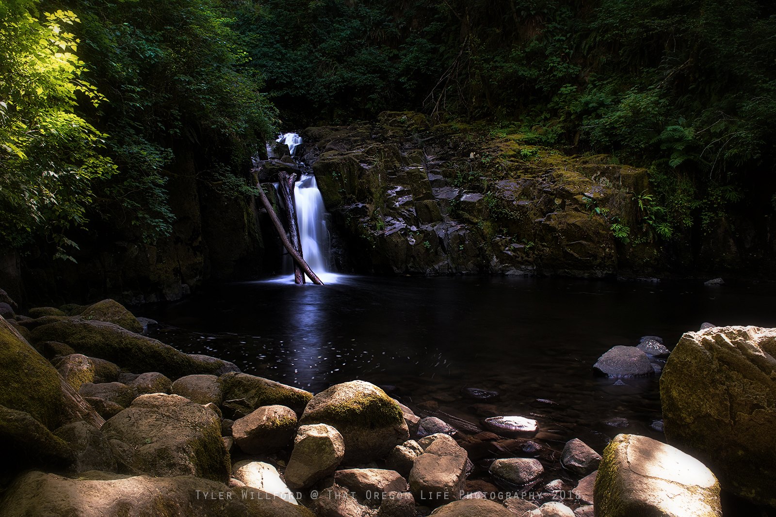
In autumn, add wet stone, bright maple leaves and that unmistakable smell of an Oregon forest after the rain, and this little canyon becomes one of the most rewarding seasonal hikes within easy reach of Eugene and the central Oregon Coast.
There is, however, an important change hikers need to know about before heading out in 2026.
Important 2026 Update: Do Not Start at Homestead Trailhead
For years, most guides to Sweet Creek Falls, including our original story from 2017, directed hikers to begin at the Homestead Trailhead. That route produced the familiar 2.2-mile round-trip hike that has been associated with Sweet Creek Falls for decades.
That information is currently outdated.
As of August 2026, the U.S. Forest Service says the boardwalk near Homestead Trailhead remains significantly damaged following a vehicle accident in 2025. Homestead Trailhead is closed until further notice, and visitors are being directed to access Sweet Creek Trail from the Sweet Creek Falls Trailhead farther south along Sweet Creek Road.
This matters because a surprising number of older trail descriptions, maps and search results still describe Homestead as the primary starting point. If you have hiked Sweet Creek before, your memory may also tell you to pull into the first major trailhead you encounter.
For a fall 2026 visit, don’t rely on an old screenshot or hiking article from several years ago. Continue to the Sweet Creek Falls Trailhead and follow all Forest Service signs and closure notices when you arrive.
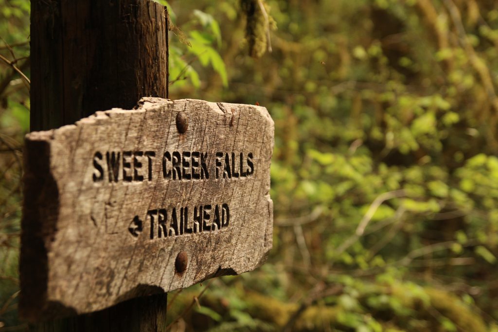
There is another useful update. Our older story stated that a Northwest Forest Pass was required. The Forest Service’s current information lists no recreation fee for the site, so that old $5 parking-pass information should no longer be used.
Because repairs and closures can change, it’s still smart to check the Siuslaw National Forest website shortly before leaving home, particularly once Oregon’s fall storms begin rolling through.
The official That Oregon Life store
The Oregon you bring home.
Start the day with Oregon-roasted coffee, then find original gear inspired by the places, stories, and oddities that make this state ours.
Shop Oregon gear


Why Sweet Creek Is Such a Great Oregon Fall Hike
Oregon doesn’t have to turn completely red and orange to put on a good autumn show.
Some of the state’s prettiest fall landscapes happen where deciduous trees are scattered through forests that remain intensely green. Bigleaf maples turn yellow and gold beneath towering conifers. Leaves land on dark basalt and moss-covered logs. Ferns remain green along the forest floor while the canopy changes overhead. It is a distinctly Pacific Northwest kind of autumn.
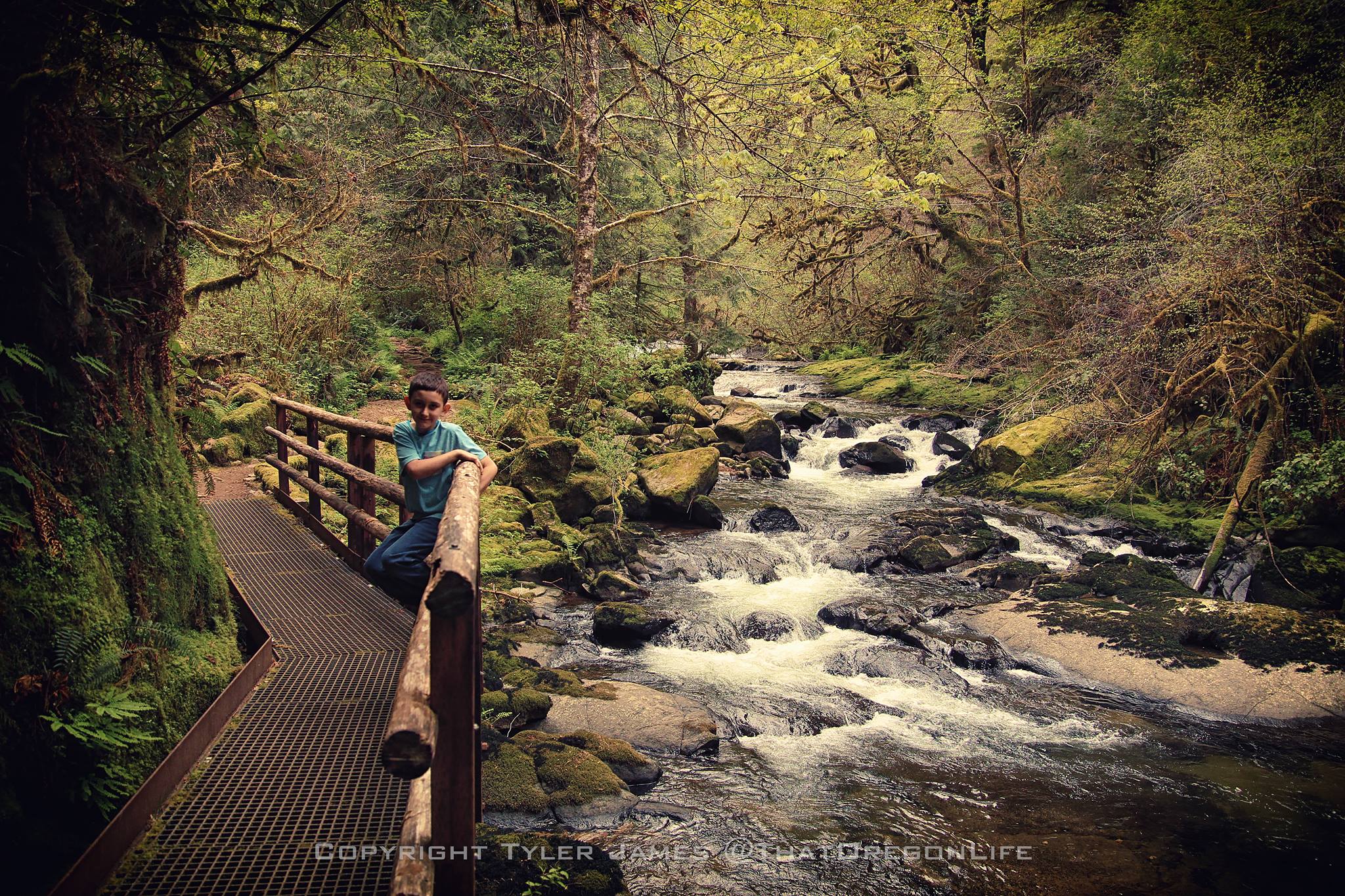
Sweet Creek is made for that contrast.
Bigleaf maple, alder and Douglas fir grow along the creek corridor, creating a forest that changes character as summer gives way to autumn. Regional fall-color guides point to the Coast Range and the Highway 126 corridor between Eugene and Florence as a particularly scenic place for autumn drives and waterfall stops. Oregon’s fall foliage generally reaches its strongest display sometime around the middle to latter part of October, although elevation, temperature, rain and wind can shift the timing from one year to another.
That uncertainty is part of the fun.
Visit in late September and you may find mostly green forest with only the first hints of yellow. Come back several weeks later and leaves may be scattered across the trail and piled against mossy rocks along the creek. By November, a Pacific storm can strip much of the canopy in a night and turn the trail into the moodier version of fall that Oregon does so well.
The water changes, too.
Sweet Creek tends to be quieter following the dry months of summer. Once the first sustained autumn rains arrive in western Oregon, the creek begins waking up. Cascades that were modest in September can become noticeably livelier later in the season. That combination of returning water and changing leaves gives October and early November an atmosphere entirely different from summer.
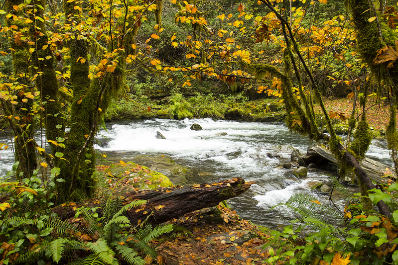
You don’t need brilliant sunshine for this hike either. In fact, a gray Oregon morning can be close to perfect here. The canyon softens the light, wet leaves deepen in color, and the creek seems brighter against the dark rock.
It is one of those rare places where waking up to clouds does not ruin your plans.
It might improve them.
A Waterfall Hike Where the Entire Trail Is the Attraction
Sweet Creek is sometimes described as a hike to Sweet Creek Falls, but that description undersells it.
This is really a hike alongside water.
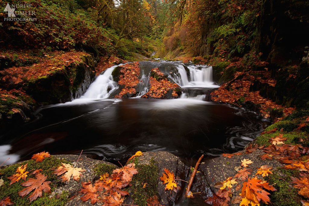
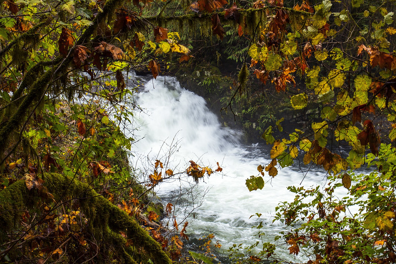
The creek slips, tumbles and pours through the canyon as the trail follows alongside it. Small ledges create short drops. Water curls around boulders and disappears into pools. Narrow sections of the canyon squeeze the creek through rock before it spreads out again beneath the forest.
There are waterfalls with individual names along the route, but you don’t need to keep score. Part of the charm is losing track.
Around one bend there may be a small curtain of water falling over a moss-covered ledge. Around another, the creek may spread across several steps of rock before dropping into a dark pool surrounded by ferns.
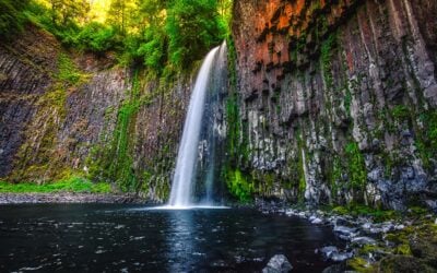
The trail complex has long been promoted as having 11 waterfalls, with the main Sweet Creek Falls serving as the centerpiece. Sweet Creek Falls consists of several tiers with a total drop of about 70 feet, although the canyon’s shape makes it difficult to stand in one place and see the entire waterfall at once.
That actually makes the waterfall more interesting.
Rather than arriving at a single postcard viewpoint, hikers discover it in pieces. Different angles reveal different sections, while the sound of the water bouncing through the narrow gorge can make the falls seem larger than they appear in photographs.
And because the walk from the currently recommended Sweet Creek Falls Trailhead to the falls is short, you don’t have to commit an entire day to reach it.
The Best Route for Fall 2026
Under normal circumstances, the classic Sweet Creek hike begins at Homestead Trailhead and travels roughly 1.1 miles upstream to Sweet Creek Falls, making for about a 2.2-mile round trip.
That is not the route we recommend in 2026 because Homestead Trailhead is closed.
Instead, continue farther along Sweet Creek Road to the Sweet Creek Falls Trailhead, sometimes referred to as the second trailhead in older guides. From here, Sweet Creek Falls is approximately 0.4 mile away, making the basic waterfall hike roughly 0.8 mile round trip.
That is considerably shorter than the classic route, but don’t mistake short for disappointing.
This is still a beautiful stretch of trail, particularly if your goal is to reach the main falls without a strenuous hike. It also makes Sweet Creek unusually friendly for a spontaneous autumn road trip. You can leave Eugene in the morning, hike beside the waterfalls, have lunch in Florence and still have time to walk the beach before sunset.
Hikers looking for more mileage have additional options farther along the Sweet Creek trail system.
The Wagon Road Trailhead provides access to the upper sections of Sweet Creek. From there, hikers can head downstream roughly 0.8 mile toward another perspective on Sweet Creek Falls, or explore the section toward Beaver Creek Falls. These sections can be treated as separate hikes, which is particularly useful now that the damaged boardwalk prevents hiking the traditional lower route as one continuous trip.
Keep in mind that some older route descriptions discuss crossing Sweet Creek near the main falls to connect different portions of the trail. There is no bridge at that crossing. In autumn, once rain increases creek flow, attempting to cross wet rocks and moving water can quickly turn a casual hike into a bad decision.
There is no reason to force it.
Enjoy the accessible section, return to your vehicle, and drive to the next trailhead if you want to explore more.
The Coast Range Has Its Own Kind of Autumn
Sweet Creek is often lumped into lists of Oregon Coast hikes, and geographically that makes sense from a travel standpoint. Florence is the nearest major coastal destination, and many visitors discover the trail while traveling Highway 126 between Eugene and the ocean.
But you’re not hiking beside the Pacific here.
Sweet Creek sits inland in the Oregon Coast Range, surrounded by the forested mountains that separate the Willamette Valley from the coastline. That distinction is worth making because it explains why the landscape feels so different from the wind-shaped spruce forests, dunes and headlands you encounter closer to Highway 101.
The Coast Range is wetter, darker and more intimate.
Instead of looking toward a distant horizon, you’re often looking into layers of forest. Streams have carved steep little valleys through the mountains. Ferns crowd the understory. Moss grows on trunks, rocks, logs and seemingly anything else that holds still long enough.
In summer, this can feel like a refuge from the heat of the valley.
In autumn, it becomes something else entirely.
The green remains, but yellow maple leaves begin hanging above the creek. Others collect in the eddies or stick to black rocks polished by water. The return of rain gives everything a sheen. If sunlight happens to break through the clouds, the whole canyon can light up for a few minutes before the shadows return.
This is Oregon fall without pumpkin patches or carefully planted ornamental trees. It is wild, wet and wonderfully imperfect.
A Little History Along Sweet Creek
There is human history tucked into the canyon as well.
The Sweet Creek valley was settled in 1879 by Zarah Sweet, and portions of an early wagon road were later incorporated into the trail system.
That detail adds an interesting layer to the hike because this landscape feels far removed from easy travel. Today, we drive a paved road into the valley and walk engineered trail sections over terrain that would otherwise be difficult to negotiate.
Earlier residents did not have that luxury.
The old wagon-road connection is a reminder that many of Oregon’s recreational trails weren’t born simply as places to hike. They follow pieces of the routes people once used for work, settlement and transportation through country that could be unforgiving.
Sweet Creek’s modern trail also contains some impressive engineering of its own. Walkways and structures have allowed hikers to pass through portions of the narrow canyon where there is little natural room for a conventional trail.
Unfortunately, the current Homestead closure also demonstrates how vulnerable those structures can be. The boardwalk damage from the 2025 accident has temporarily changed how visitors experience a route that generations of Oregon hikers have grown accustomed to walking.
Hopefully that section will eventually reopen.
Until then, Sweet Creek is still very much worth visiting.
Is Sweet Creek Falls an Easy Hike?
Generally, yes.
Sweet Creek has earned its reputation as one of the more approachable waterfall hikes in western Oregon. Elevation gain is modest, distances can be adjusted by choosing different trailheads, and reaching the main falls from the Sweet Creek Falls Trailhead requires less than a mile of round-trip hiking.
But “easy” should not be confused with “paved.”
Expect natural trail surfaces, roots, rocks, stairs and damp sections. The canyon environment holds moisture well, and fall rain can make wood, stone and fallen leaves exceptionally slick.
That matters more in October and November than it does during the dry part of summer.
A rock that looks harmless can be covered in a thin layer of moisture or moss. Fallen maple leaves can hide roots underneath them. Wooden surfaces become slippery. Daylight also disappears surprisingly early inside a heavily forested canyon.
None of this makes Sweet Creek particularly difficult for the average hiker, but decent shoes are a much better choice than smooth-soled casual sneakers.
Take your time and remember that autumn hiking in western Oregon rewards people who aren’t in a hurry.
When Is the Best Time to See Fall Color?
If autumn color is your main reason for visiting, October is generally your best bet, particularly from roughly the middle of the month onward.
But don’t circle one weekend on the calendar and assume nature has agreed to the appointment.
Travel Oregon notes that fall color across much of the state tends to peak in mid to late October, while local tourism officials point out that lower-elevation communities near the coast can change later than higher parts of the Coast Range and Cascades. Weather also plays a huge role. Warm temperatures can delay color, while strong rain and wind can suddenly knock leaves down.
For Sweet Creek, we like thinking of fall as a progression rather than one perfect weekend.
Late September into early October can bring crisp mornings, lighter crowds and the beginning of color while much of the forest is still green.
Mid to late October is your best chance for stronger yellows and golds among the maples, along with a greater possibility of rain increasing the creek’s flow.
Early November can be spectacular in a completely different way. Expect more leaves on the ground, a wetter forest, shorter days and the possibility that storms have already removed some foliage from the canopy.
Photography conditions can actually improve as the weather gets cloudier. Waterfalls are notoriously difficult to photograph in harsh midday sunlight because bright water and deep forest shadows create extreme contrast. Oregon’s familiar layer of overcast acts like a giant diffuser, softening the scene and bringing out the greens, yellows and rusty browns around the creek.
In other words, don’t cancel because the forecast says cloudy.
You are going hiking in the Coast Range. Clouds are practically part of the decor.
What to Bring for an Autumn Hike
Sweet Creek is short enough that you don’t need expedition gear, but a few basics can make a wet-weather visit much more comfortable.
Wear hiking shoes or trail runners with reliable traction. Bring a light rain jacket even if the forecast looks reasonable because Coast Range weather can change quickly. A warm layer is useful as well, especially late in the season when the shaded canyon can feel considerably colder than Eugene or Florence.
Carry drinking water. Potable water isn’t available at the Homestead recreation site according to Forest Service information, and with Homestead currently closed, visitors shouldn’t plan around its facilities anyway.
A small towel in the car isn’t a bad idea either. Neither is a dry pair of socks.
If you’re bringing a camera, consider some way to protect it from drizzle. A microfiber cloth is useful for wiping water droplets from a lens, which you will inevitably notice only after taking 37 otherwise perfect waterfall photographs.
And please don’t forget the most boring piece of advice in Oregon recreation: leave valuables out of sight when parking at remote trailheads.
Can Kids Hike Sweet Creek Falls?
For many families, yes.
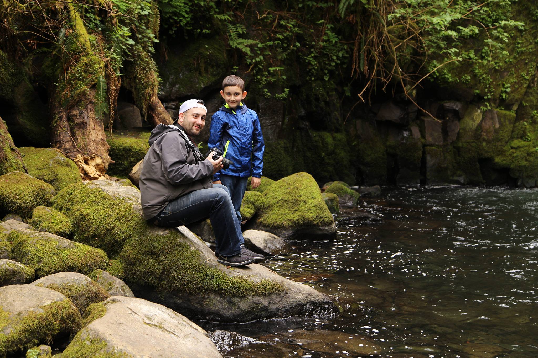
The short approach from Sweet Creek Falls Trailhead makes the main waterfall accessible without asking younger hikers to grind through miles of climbing. The constant presence of water also gives kids something new to look at every few minutes, which is usually a better formula than promising them that a viewpoint will eventually appear three miles later. And it of course as you can see in the photos, my son was probably about 10 years old in these photos and did just fine!
Parents should still keep children close.
This is a creek canyon with wet rocks, moving water and places where the trail travels beside steeper terrain. Fall conditions make surfaces more slippery, and children naturally want to climb on exactly the rocks adults have spent 20 minutes carefully avoiding.
Use the trail as intended, respect railings and barriers, and don’t assume shallow-looking water is harmless after several days of heavy rain.
Can Dogs Hike Sweet Creek?
Dogs are allowed, but this is one trail where knowing your dog matters.
Forest Service regulations require dogs within developed recreation sites to be leashed or otherwise physically restrained, and local tourism information notes that some of the catwalk-style portions of Sweet Creek can make dogs uncomfortable.
Metal or elevated walking surfaces can be unsettling to dogs that aren’t accustomed to them. Wet conditions can complicate things further.
If your dog freezes up on bridges, hates metal grating or has mobility problems, don’t assume the word “easy” means Sweet Creek will automatically be easy for them.
And as always, pack out the bag. Leaving it beside the trail with the intention of collecting it later does not transform it into a tiny biodegradable trail marker.
Turning Sweet Creek Into a Fall Coast Day Trip
One of the best things about Sweet Creek is its location.
From Eugene, Highway 126 heads west through the Coast Range toward Mapleton and Florence. By the time you reach Mapleton, the Siuslaw River has become a constant companion, winding through the mountains toward the Pacific.
Sweet Creek makes an easy detour from that route.
After hiking, head back through Mapleton and continue west to Florence. The transition is one of my favorite things about this part of Oregon. Within a relatively short distance, you go from a waterfall canyon surrounded by maples and Douglas fir to dunes, coastal wind and the Pacific Ocean.
That makes Sweet Creek especially well suited to fall.
Start with the forest in the morning, then spend the afternoon in Florence. Grab something warm to eat, wander through Old Town, drive out toward the beach or simply find a place to watch whatever weather the coast has decided to throw at you.
September and early October can still produce some spectacularly pleasant days along the central Oregon Coast. Later in the season, the odds of encountering classic Oregon weather increase substantially. If this hike is part of a longer trip, our best-time-to-visit Oregon guide compares Coast, valley, mountain, and high-desert conditions across all 12 months.
Personally, that’s not necessarily a downside.
There is something satisfying about finishing a damp Coast Range hike, climbing back into the car, turning the heater on and heading toward Florence while rain works its way across the windshield.
It feels like Oregon again.
Getting to Sweet Creek Falls
From Eugene, take Highway 126 west toward Florence.
Continue through the Coast Range to Mapleton. Near the Siuslaw River Bridge, turn south onto Sweet Creek Road, Forest Road 5036. The traditional Homestead Trailhead is about 10.2 miles down Sweet Creek Road, but remember that Homestead is closed as of August 2026.
Continue to the Sweet Creek Falls Trailhead, the next access point farther south, for the current recommended route to Sweet Creek Falls.
From Florence, take Highway 126 east approximately 15 miles to Mapleton, then turn onto Sweet Creek Road and continue south toward the trail system.
Sweet Creek is roughly 25 miles inland from Florence and about 55 to 60 miles from Eugene depending on your exact starting point, making it an easy day trip from either the coast or southern Willamette Valley.
Sweet Creek Road follows a winding rural corridor, so take your time. Fall can bring wet pavement, fallen branches, leaves on the roadway and occasional debris after storms.
Cell service can also become unreliable in Oregon’s Coast Range. Download directions before leaving Highway 126 instead of assuming your phone will continue cooperating once you are deep in the trees.
Sweet Creek Falls Quick Guide for Fall 2026
Location: Siuslaw National Forest near Mapleton, about 15 highway miles east of Florence before the turn onto Sweet Creek Road
Trail: Sweet Creek Trail #1319
Main attraction: Sweet Creek Falls plus numerous smaller cascades
Waterfalls: The trail complex features approximately 11 waterfalls
Sweet Creek Falls height: Roughly 70 feet through four tiers
Difficulty: Easy to moderate depending on which sections you explore
Current recommended starting point: Sweet Creek Falls Trailhead
Homestead Trailhead: Closed until further notice as of August 2026 because of significant boardwalk damage
Distance from Sweet Creek Falls Trailhead to main falls: Approximately 0.4 mile each way
Best fall-color window: Generally October, with timing varying by weather
Fee: No recreation fee currently listed by the Forest Service
Dogs: Allowed, but keep them leashed and be aware that some elevated or metal trail surfaces may make certain dogs uncomfortable
Restrooms: Do not count on facilities at the current Sweet Creek Falls starting point. Plan before arriving.
Best footwear in fall: Hiking shoes or trail runners with good traction
Open season: The trail system is generally used year-round, though temporary closures, storm damage and changing conditions are always possible
Frequently Asked Questions About Sweet Creek Falls
Is Sweet Creek Falls actually on the Oregon Coast?
Sweet Creek Falls is not directly beside the ocean. It lies inland in the central Oregon Coast Range within the Siuslaw National Forest, south of Mapleton and east of Florence. Because it is roughly a half-hour drive inland from the Florence area and sits within the Coast Range, it is commonly included among Oregon Coast hiking destinations.
How far is Sweet Creek Falls from Florence?
Mapleton is approximately 15 miles east of Florence on Highway 126. From Mapleton, Sweet Creek Road continues roughly another 10 to 11 miles into the forest to reach the Sweet Creek trail system.
How far is Sweet Creek Falls from Eugene?
The Forest Service places Mapleton about 46 miles west of Eugene, with another roughly 10 miles of driving down Sweet Creek Road. Depending on your starting point in Eugene or Springfield, expect the trip to be around an hour to an hour and a half.
How long is the Sweet Creek Falls hike in 2026?
The traditional hike from Homestead Trailhead is approximately 2.2 miles round trip, but Homestead Trailhead is currently closed. The currently recommended Sweet Creek Falls Trailhead provides a much shorter approach of approximately 0.4 mile each way to the falls.
Additional trail sections can be explored from the Wagon Road Trailhead if you want a longer outing.
Is there a fee to hike Sweet Creek Falls?
Current Forest Service information lists no fee for the site. Older articles, including previous versions of our own story, may still state that a Northwest Forest Pass is required, but that information is outdated as of 2026.
Is Sweet Creek Falls good in the rain?
Absolutely, within reason. Light rain and overcast skies can make the forest particularly beautiful, and rainfall helps replenish the creek after summer. Heavy storms are another matter. Strong wind can bring down branches and prolonged rain can make trails slippery and waterways dangerous.
Check current conditions if a major coastal storm has recently passed through.
Can you hike Sweet Creek Falls in November?
Usually, yes, and November can be gorgeous. Expect more rain, cooler temperatures, fewer leaves remaining in the canopy and potentially stronger waterfall flow. Days are considerably shorter, so start earlier than you would in summer.
Is Sweet Creek Falls worth visiting if the Homestead Trailhead is closed?
Yes.
You won’t currently get the classic uninterrupted 2.2-mile route from Homestead that many longtime Oregon hikers remember, but Sweet Creek Falls remains accessible from the second trailhead. The upper portions of the trail system provide additional hiking opportunities as well.
And if your real goal is to spend a fall morning beside waterfalls beneath the dripping forests of the Oregon Coast Range, the ingredients that made Sweet Creek special in the first place are still very much here.
Where To Eat After Your Hike
Once you’ve worked up an appetite at Sweet Creek, head back toward Highway 126 and stop at Frank’s in Mapleton. This unpretentious little local bar and grill is the kind of place that feels just right after a damp fall hike, with burgers, sandwiches, pizza and cold drinks. It’s roughly 11 miles from the Sweet Creek trail area, making it an easy stop before continuing east toward Eugene or west toward Florence.
If you are hiking earlier in the day, Mimi’s Cafe On the River is another good Mapleton option for coffee, breakfast or a lighter lunch, and it has a riverside setting.
One of Those Places That Feels Like Oregon
There are bigger waterfalls in Oregon.
There are longer trails, higher mountains and places where autumn color may be more dramatic.
Sweet Creek doesn’t need to win any of those contests.
What makes this place memorable is how much of western Oregon seems to fit into such a small canyon. There is the Coast Range forest, dark and dense above you. There are huge maple leaves turning gold against the evergreens. There are ferns beside the trail and moss covering the rocks. There is the sound of running water almost everywhere you go.
Then the rain returns.
The creek grows louder. Leaves gather beside the waterfalls. Mist hangs between the trees. Highway 126 winds west toward Florence, and somewhere beyond those mountains the Pacific is waiting.
Nearly a decade after we first wrote about Sweet Creek Falls, it remains the kind of Oregon place that doesn’t need much selling once you see it for yourself.
Just make sure you use the right trailhead in 2026.
Bring shoes that can handle a little mud.
And if the forecast calls for clouds, go anyway.
Around here, fall rarely waits for perfect weather.
Building a longer autumn trip? Start with the Fall in Oregon guide, then use the Oregon Hikes Guide to compare more routes.