For thousands of people traveling through eastern Oregon, one of the state’s most important highways became eerily quiet overnight.
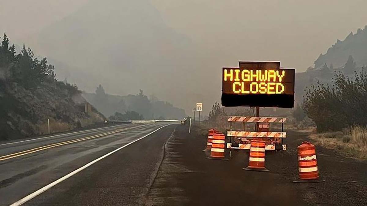
A roughly 70-mile section of Interstate 84 between Baker City and Ontario was closed in both directions for about five hours as the rapidly growing Fox Fire reached electrical infrastructure near the freeway.
The interstate reopened at approximately 5 a.m. Tuesday after conditions improved enough for Oregon Department of Transportation crews to inspect the highway and evaluate damage caused by the fire.
Even after the road reopened, drivers moving through the area encountered smoke, haze and the possibility that conditions could change again without much warning.
Flames Reach Power Lines Near the Interstate
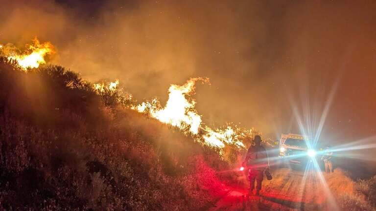
The overnight closure happened after the Fox Fire burned into power poles and electrical lines crossing the I-84 corridor.
Before allowing traffic to return, ODOT crews needed to determine whether the roadway was safe and whether damaged infrastructure created additional hazards for travelers.
The closure was the second major disruption along the same section of interstate in less than 24 hours.
On Monday, I-84 was closed between Baker City and Ontario from approximately 6:30 a.m. until 2 p.m. as the fire advanced through the region.
The stretch is a critical transportation route connecting communities across eastern Oregon while carrying travelers and commercial traffic toward Idaho. Closing it for 70 miles can quickly create backups and leave drivers searching for alternatives across a part of the state where alternate routes are limited.
The Fox Fire Continues to Grow
The Fox Fire was first reported Thursday and spread rapidly through grasslands and timber northeast of Huntington.
By Tuesday morning, the fire was estimated to have burned more than 58,000 acres. It remained at zero percent containment, with 233 people assigned to the incident.
I-84 has re-opened. https://t.co/SsqxkwGpZQ https://t.co/PhQ0mxVeEF
— OregonDOT (@OregonDOT) July 28, 2026
Fire officials have described active and sometimes extreme behavior, including quick uphill runs through dry grass. Those conditions can allow flames to cover significant ground in a relatively short time, particularly when winds begin pushing the fire into new terrain.
After moving south on Monday, the fire was expected to be driven toward the northwest Tuesday.
That shifting direction remains an important concern for firefighters, nearby communities and transportation crews watching the fire’s proximity to the interstate.
The Fox Fire also prompted a Level 3 “Go Now” evacuation order for Huntington, a small Baker County community located near the Oregon-Idaho border. Firefighters worked to defend homes and other important infrastructure as flames approached the area.
There May Not Be a Safe or Practical Detour
ODOT has urged travelers not to assume they can simply leave I-84 and follow a navigation app through nearby backroads.
Other important routes across central and eastern Oregon have also been affected by wildfire. Sections of U.S. Highway 20 and U.S. Highway 26 were closed, reducing the number of realistic alternatives available to drivers.
Small county roads and rural highways are not designed to absorb the amount of traffic normally carried by an interstate. A sudden rush of cars, RVs and commercial trucks could quickly clog those routes or leave travelers trapped if fire conditions change.
Drivers should also remember that phone service can be unreliable in remote parts of eastern Oregon. Fuel stations, restaurants and safe places to turn around may be separated by considerable distances.
This is not a situation where travelers should blindly follow a suggested shortcut through unfamiliar country.
More Closures Could Happen
latest satellite imagery captures the scale of what is unfolding across eastern oregon, southeastern washington, and western idaho as multiple wildfires continue to burn.
— Michael Rusch (@weeddude) July 27, 2026
dozens of large fires. more than a million acres burned already this season.
smoke stretching hundreds of… pic.twitter.com/E1EIJZyFqf
Although I-84 reopened Tuesday morning, ODOT warned that additional closures remain possible.
Wildfires can move quickly, and decisions about highway access may depend on wind direction, visibility, damaged utilities, firefighter activity and flames approaching the road.
A highway that appears open when someone begins a trip could be restricted or closed before they reach the affected area.
Anyone planning to travel between Baker City and Ontario should check Oregon’s TripCheck website immediately before leaving. Travelers should continue checking conditions during the trip whenever they can safely do so.
Drivers heading through the region should carry extra water, keep their gas tank filled and be prepared for delays. Those who do not need to travel through eastern Oregon may want to postpone the trip until fire activity and highway conditions become more predictable.
Smoke may also reduce visibility even when the interstate remains open. Motorists should slow down, turn on their headlights and give other vehicles additional space.
A Difficult Fire Season Continues Across Oregon
The repeated closure of I-84 is another reminder of how deeply Oregon’s wildfire season can affect daily life.
A fire does not need to burn directly through a city to disrupt communities. It can close highways, damage utility lines, interrupt deliveries, force evacuations and isolate rural areas that depend on a small number of transportation routes.
For eastern Oregon residents, firefighters, road crews and utility workers, the Fox Fire remains an active and dangerous incident.
The interstate may be open for now, but travelers should remain cautious and expect conditions to change. Before heading east, check TripCheck, follow official evacuation notices and never drive around a highway closure or barricade.
Current Evacuation Levels:
- Crook County: Facebook.com/CrookCountySheriff
- Gilliam County: Facebook.com/GilliamCountySheriff
- Grant County: Facebook.com/profile.php?id=100068819321423
- Harney County: Facebook.com/HarneyCoSheriff
- Jefferson County: Facebook.com/JeffersonCountyORSheriff
- Sherman County Facebook.com/profile.php?id=100064318254818
- Umatilla County: Facebook.com/UmatillaCountySheriff
- Union County: Facebook.com/UnionCountyORSheriff
- Wheeler County: Facebook.com/WheelerCountySheriffsOffice
- Wasco County: Facebook.com/WascoCountySheriff
- Confederated Tribes of Warm Springs, Oregon: Facebook.com/CTWSO