The Illinois River Trail in the Siskiyou Mountains has finally opened to the public after two decades of closure. A volunteer group has spent years trying to restore the path after it was blocked by the Biscuit Fire in 2002.
Trailblazing Through the Ashes: The Restoration of the Illinois River Trail
The Biscuit Fire was the second largest wildfire in the state's modern history. It devastated more than 500,000 acres (780 sq mi) of land in both northern California and southern Oregon, and it completely destroyed the Kalmiopsis Wilderness, where the Illinois River Trail is located, in the Siskiyou Mountains. Pictured below, the fire itself could be seen from space in satellite pictures taken by NASA at the time.
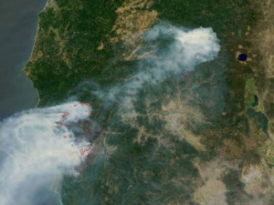
Image courtesy Jacques Descloitres, MODIS Land Rapid Response Team at NASA GSFC
Firefighters were completely overwhelmed by the inferno, making it impossible for them to put it out. It started in July of 2002, but it wasn't contained until December 31, six months later.
The destruction caused by the Biscuit Fire was unimaginable, especially to many who live in areas where the forest is a constant presence. It doesn't seem possible that it could be gone--but it was.
U.S. Forest Service- Pacific Northwest Region / Flickr
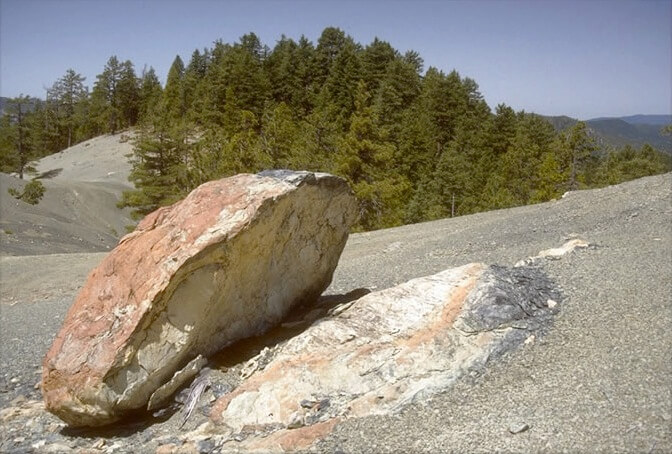
The Kalmiopsis Wilderness Area was established because of its diverse range of life. In fact, it was the namesake of the Kalmiopsis leachiana, a species of small pink flowers discovered by botanist Lilla Leech in 1930. When she announced her discovery, people flocked to the region, hoping to get a sample or perhaps make a discovery of their own. The area is wild and remote, and back then there were still secrets hidden within the relatively untouched stretch of land.

Photo Courtesy of Lee Webb, Wildlife Biologist, US Forest Service - US Forest Service
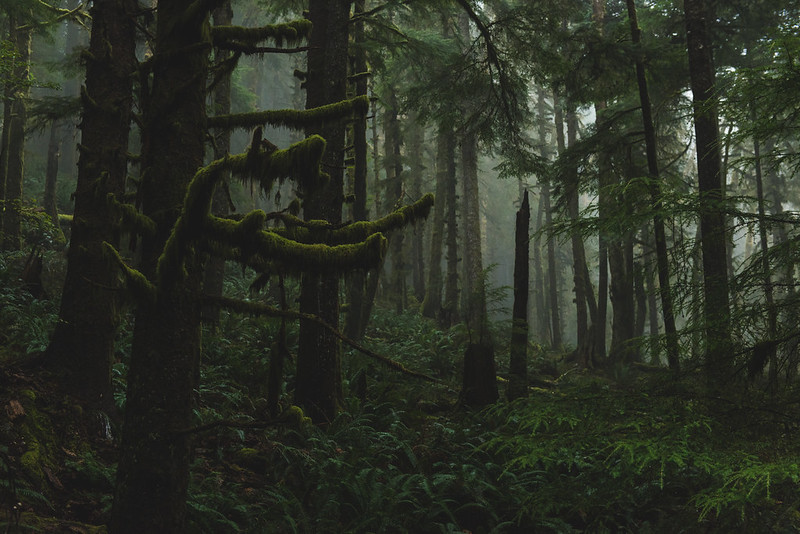
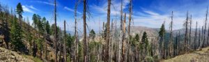
What was once a fresh example of biodiversity has become a place to observe how forests react to wildfires. It's desolate and unwooded, dominated by shrubs and the bare remnants of the trees.
Officials said that there were no deaths in the fire. But the devastation can't be measured with a human body count--not when so much more was lost. Death is a part of the air there, found in the emptiness, the open spaces, the sun's light cutting through to the forest floor. It seems unnatural. Yes, there are new shrubs and some greenery left on a few of the trees. Baby pine and spruce are starting to sprout. You can even see the wilderness's characteristic pink flowers, but the loss is still pervasive.
A Labor of Love and Stubbornness
In 2006, four years after the fire, backpackers Jill Stokes and Gabriel Howe came to explore the Kalmiopsis and found themselves overwhelmed by the state of the trail. As they walked, they began clearing it, partially because they were tired of having to step over the same obstacles again and again. They were completely incapable of creating an open path, and at times they had trouble finding the one that had been laid out before them. But they were stubborn, and they began to fall in love with the land, so they came back with tools.
There was no agreement between them and the forest service--not until they arrived. It was a DIY operation, based entirely on their unsolicited initiative. Due to federal regulations, they weren't allowed to bring in machinery or trucks, so everything had to be done by hand, using old-fashioned tools and manual labor.
They had their work cut out for them. The Illinois River Trail is more than 25 miles long. It runs across ridges, up unstable hills and down gravelly slopes, through ravines, along creeks and riverbeds--all in remote country, where nature runs free. There's wildlife to contend with. The area is known for extreme weather, and new obstacles are constantly springing up on the path.
Erosion and fallen logs have been a serious issue. The fire in 2002 exacerbated that problem, and it's only gotten worse. The Chetco fire in 2017 and the Klondike fire in 2018 affected the entire trail, forcing them to work even harder. The job has been likened to herding cats or pushing a boulder uphill.
What they thought would be a one-year project took them five years to complete, and the work is ongoing. Jill and Gabe eventually started their own public charity, the Siskiyou Mountain Club, which now maintains the trails in the area, along with other parts of northwestern California and southwestern Oregon.
The mountain club's goal is to keep backwoods trails from disappearing, allowing others to experience the wilderness. They do so by adopting trails and promising that they will maintain them no less than once every three years. It's a daunting task, but it's one that they seem to enjoy. Since forming the organization in 2010, they have grown to 50 volunteers and more than 1400 members maintaining 380 miles of trails.
Zachary Collier / Flickr
Braving the Wild
The Illinois River Trail is a difficult, 3-4 day hike, requiring food and water, toiletries, safety gear, a machete--and everything else you could imagine. Bears are known to make appearances. In fact, in some areas of the Kalmiopsis, they are to be expected. Rattlesnakes are common as well, and there's also the chance that you might come across a cougar. This is definitely an at-your-own-risk experience, but it is rewarding.
The fresh air, the chance to experience nature--it's the real deal, and it's still a thriving, natural ecosystem. You won't necessarily feel like you're walking through a charred wasteland. There are parts of the wilderness that are green, even lush. You might find yourself at the base of a creek or stream, surrounded by tall grass, or at the top of a ridge looking down at the world.
If you do decide to strike out on your own, go prepared but don't overpack. The Siskiyou Mountain Club mentions that they often find waste in the area from people who can't carry everything they brought with them. They also suggest that you bring a map to find your way, which they've posted here. Visitors are discouraged from using maps from social media.