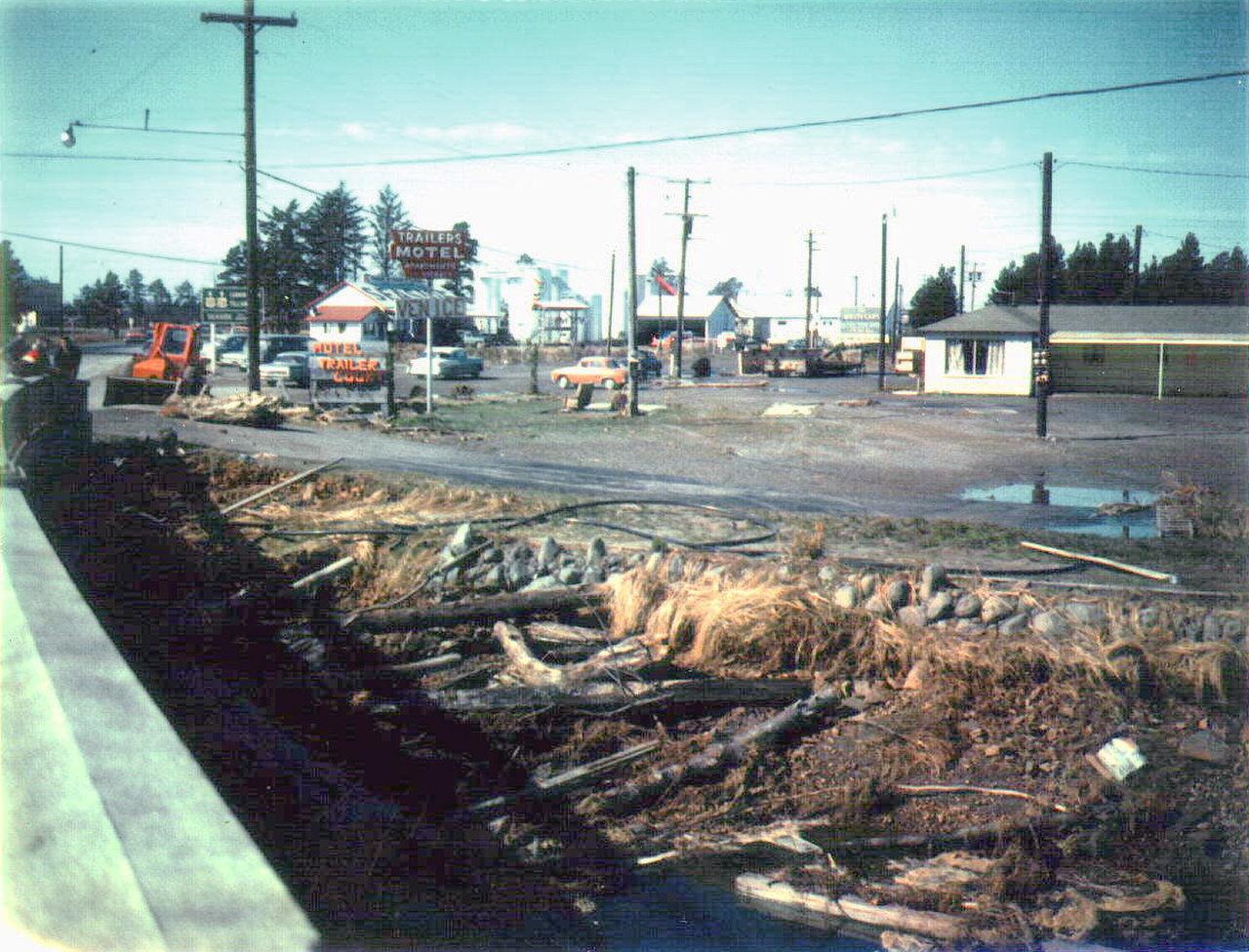
When people on the West Coast start talking about the Big One, the conversation usually runs straight to California and the San Andreas Fault. It is the famous one. The one most of us grew up seeing in disaster movies and hearing about on the news.
But Oregon has its own nightmare sitting offshore. The Cascadia Subduction Zone is a massive fault that runs roughly 600 miles from northern California to Vancouver Island. When it breaks, Oregon emergency officials say it could produce a magnitude 9 range earthquake and send a local tsunami toward the coast in as little as 10 to 20 minutes.
No one can predict the date of the next rupture. The state’s new guidance uses several probability models, including one that estimates about a 15 percent chance of a full magnitude 9 rupture in the next 50 years. That is not a countdown clock. It is a reminder that the question is not whether we know the day. It is whether we will be ready when the ground finally starts moving.
And the danger is not spread evenly along the coast. In Seaside, current state modeling estimates that only 25 percent of people inside the tsunami inundation zone would reach safety under current conditions. In Cannon Beach, the model estimates 90 percent of residents could survive because high ground is closer for much of the town. A few miles can change everything.
For four years, from 2020 to 2024, my family of four lived near Taft in Lincoln City, on a cliff overlooking the ocean. Most days, that view felt like the whole reason people dream of living on the Oregon Coast.
But every so often, usually late at night, I would think about the other side of it.
I had nightmares about tsunamis. Not constantly, but enough that I still remember waking up and wondering how quickly we could get our two children to safety if the ocean suddenly stopped being beautiful and became something else entirely. My mom worried about us living so close to the water, too. She would bring it up more than I liked to admit, because underneath the concern was a question none of us could really answer. What would happen if the Big One hit while we were there?
Living high above the ocean gave us a sense of security that many Oregon Coast residents and visitors do not have. For people on low ground, this is not some distant disaster movie scenario. It is a race against distance, time, and water.
The Official Numbers Behind the Fear
Oregon Emergency Management and the Oregon Department of Geology and Mineral Industries released Tsunami Vertical Evacuation Structure Guidance in September 2026. It is not a disaster movie script. It is a planning guide built around evacuation modeling, real geography, and one brutal question. Can people reach safety before the water arrives?
In Seaside, the answer under current conditions is frightening. The guidance says only 25 percent of people inside the tsunami inundation zone are expected to survive. One vertical evacuation structure could raise that modeled survival rate to 50 percent. Adding more structures could raise it to 85 percent.
That is the story we should be talking about. The difference between 25 percent and 85 percent is not fate. It is distance, time, bridges, routes, and whether a community has somewhere high enough and strong enough to go when natural high ground is too far away.
This is not a prediction that 75 percent of Seaside will die. The model measures survivability under present day conditions and specific assumptions. It uses a ten minute delay after the earthquake starts and a realistic walking speed of 4 feet per second for a mixed population. The state calls these numbers a tool for emergency planning, public awareness, and funding life saving infrastructure. That context matters just as much as the number itself.
Why Seaside and Cannon Beach Tell Two Different Stories
Seaside and Cannon Beach are close on a map, but the official modeling shows why each Oregon Coast town has its own evacuation story.
In Cannon Beach, the guidance says 90 percent of residents are expected to survive because nearby high ground is easier for much of the community to reach. But even there, danger is not evenly spread. Downtown Cannon Beach is separated by Ecola Creek. Under current conditions, the report estimates only 2 percent of people in that downtown area would survive. Retrofitting the Fir Street Bridge could raise that to 77 percent. Strategically placed vertical evacuation structures could save up to 100 percent of residents in some locations.
That is why an Oregon Coast tsunami cannot be reduced to one scary statewide percentage. Where you sleep, which side of a creek you are on, whether a bridge stays passable, how quickly you leave, and whether safe elevation exists nearby can change everything.
Oregon Coast Tsunami Risk Is a Race Against the Wave
The Cascadia Subduction Zone lies offshore, where the Juan de Fuca Plate moves beneath the North American Plate. A major rupture could produce a magnitude 9 range earthquake, prolonged shaking, and a local tsunami.
The new guidance says residents and visitors in Oregon coastal communities may have less than 20 minutes from the start of shaking to leave tsunami hazard zones. Depending on location, the first waves could arrive in as little as 10 to 20 minutes. The report also makes an unnerving point. A tsunami is not one wave. It can arrive as multiple surges and remain dangerous for many hours.
In some communities, even people who begin moving immediately may not be able to reach natural high ground before the first surge. That is the reason vertical evacuation structures matter. They create elevated places of refuge inside areas where running inland is simply not realistic for everyone.
Three Offshore Earthquakes Are a Reminder Not a Forecast
People pay close attention whenever the ocean floor shakes. KOIN recently reported three offshore earthquakes recorded off the Oregon Coast. That is worth watching, especially for anyone who lives on or visits the coast. But smaller offshore earthquakes do not tell scientists when the next Cascadia event will happen.
There is no credible countdown clock for the Big One. Scientists cannot name the day, month, or year of the next major Cascadia earthquake. What Oregon can do is prepare for the consequences of one. The official guidance turns that preparation into something tangible: safer routes, stronger bridges, clear signs, regular drills, and vertical evacuation structures where high ground is out of reach.
Oregon Has Seen the Ocean Turn Dangerous Before
The Oregon Coast has already seen what a tsunami can do. In 1964, waves generated by the Great Alaska Earthquake reached Oregon and caused damage along the coast. It was a distant tsunami, which gave officials more time than a local Cascadia event would allow. Even so, the consequences were real.
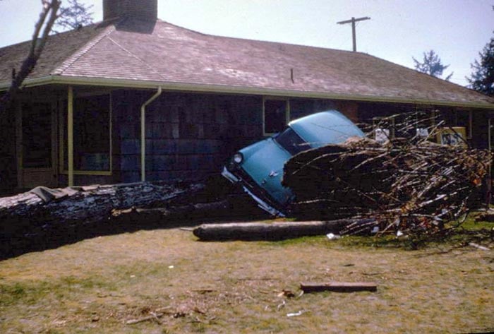
Read our account of the deadly 1964 Oregon tsunami and one lesson becomes impossible to ignore. The ocean does not have to look wild before a tsunami arrives. A tsunami can arrive as a series of surges, and the first wave may not be the largest.
A Cascadia event would be much closer. Coastal communities could face severe shaking, landslides, damaged roads, fires, broken water systems, and tsunami flooding at the same time. That is why a car may not be the answer and waiting for perfect information can be dangerous.
The Neskowin Ghost Forest and the 1700 Cascadia Earthquake
At Neskowin, weathered tree stumps surface at low tide in what is known as the Ghost Forest. It is one of those Oregon Coast sights that feels almost too strange to be real, but it needs a little context. The trees are roughly 2,000 years old and are generally understood to have been preserved after sand dunes buried an ancient forest. They are not confirmed proof of the January 26, 1700 Cascadia earthquake.
That 1700 rupture was nevertheless real. It was a magnitude 9 range event that shook the Pacific Northwest and sent an orphan tsunami across the Pacific to Japan. The Neskowin stumps do not belong to that single day, but they are a striking reminder that this coastline has never been still. For the full story, read our look at the 1700 Cascadia earthquake that changed the Oregon Coast.
What to Do If You Feel Strong Shaking on the Oregon Coast
Do not wait to decide during an emergency. If you are on the Oregon Coast and feel long or strong shaking, protect yourself during the shaking. Drop, Cover, and Hold On.
When the shaking stops, move on foot toward high ground and inland as quickly as you safely can. Do not wait for a siren, a phone alert, or a text from someone else. Do not drive toward the beach to see what the ocean is doing. Do not return until officials say it is safe.
The state says other natural warnings can include a sudden rise or draining of ocean water or a loud roar from the ocean. But the safest rule is the simplest one. Long or strong earthquake shaking at the coast means it is time to go up and out.
How Residents and Visitors Can Prepare Now
You do not need to turn every Oregon Coast trip into a disaster drill. But every person staying near the coast should know the basics before settling in for the night.
- Check whether your hotel, rental, campground, or home is inside a tsunami evacuation zone.
- Find the nearest route to high ground and walk it once if you can.
- Keep shoes, warm layers, a flashlight, water, and essential medications easy to reach.
- Make a family plan that does not depend on cell service.
- Teach children that long or strong shaking near the ocean means it is time to go up and out.
- Do not assume a familiar road, bridge, or car will be available after a major earthquake.
For local evacuation maps and additional Oregon Coast tsunami resources, explore DOGAMI’s HazVu map viewer and Oregon Emergency Management’s tsunami safety guidance.
The View Is Still Worth It
I still think about those years near Taft and the view from our cliff. I think about how often the ocean gave our family joy, comfort, and a sense of wonder. I also think about my mom’s worries, and how easy it is to brush off something frightening because we do not want it to spoil a beautiful place.
But knowing the risk does not take away the Oregon Coast. It gives us a better way to love it. Learn the route. Talk with your family. Pay attention to the signs. If the ground shakes long and hard, do not wait for someone else to tell you what to do.
Go up. Get out. Help others if you safely can. Then stay away from the coast until officials say it is safe to return.
Oregon Coast Earthquake and Tsunami Questions
How fast can a tsunami reach the Oregon Coast after an earthquake?
Oregon’s new guidance says the first tsunami waves from a local Cascadia event could reach parts of the coast in 10 to 20 minutes. People in coastal hazard zones may have less than 20 minutes from the start of shaking to evacuate.
What does the 25 percent Seaside survival figure mean?
It is a modeled survival estimate for people in Seaside’s tsunami inundation zone under current conditions. The model assumes a ten minute delay after an earthquake begins and a realistic walking speed. It is a planning tool, not a prediction of individual outcomes.
Why would vertical evacuation structures matter?
They give people an elevated place of refuge when natural high ground is too far away. The Oregon guidance says one structure could raise modeled Seaside survival to 50 percent, while several could raise it to 85 percent.
Do smaller offshore earthquakes mean the Big One is coming?
No. Offshore earthquakes deserve attention, but scientists cannot use them to predict the date of a Cascadia earthquake. Preparedness matters because the timing cannot be forecast.
This article draws on the 2026 Oregon Emergency Management and DOGAMI Tsunami Vertical Evacuation Structure Guidance. It is intended to help readers understand risk and preparedness, not replace official emergency instructions.