There have been 21 tsunamis on the Oregon Coast since 1854. The last two damaging tsunamis were in 1964 as a result of the Great Alaskan Earthquake, and in 2011 as a result of the Great Tohoku Japan Earthquake that caused severe damage and contributed to the deaths of four people on the Oregon Coast.
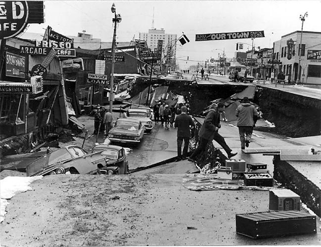
On Good Friday, March 27, 1964, at 5:36 p.m., the largest earthquake to be measured in North America occurred at a magnitude of 9.2, creating a tsunami that, a few hours later, left an unforgettable tract of damage and destruction along the Oregon coast. This March, it will have been 58 years since the tsunami hit.
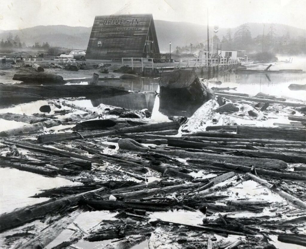
Charlie Jacksonâs car trapped against Creal residence at 25th and Neawanna Creek in Seaside by several large driftwood logs that were rolled by the 1964 tsunami currents. (Photo by Herb Schlappi)
“I lay in bed thinking to myself, ‘Why doesn’t that fellow at the fire station get his big thumb off the siren button so we can all go back to sleep, and let the firemen take care of the fire?’” she recalled later in an Oregon Historical Quarterly article. “In just a few seconds the cars started zipping up our street toward the highway like the devil himself was on their tail. I thought it must be a tremendous fire, so I figured I’d get dressed and go watch it.”
Gammon quickly learned that it wasn't a fire. It was a tsunami - and it was almost upon her.
“When I got as far as the 12th Avenue bridge over the Necanicum River, the water was right under the decking, black and ominous, and covered with great chunks of white foam floating on the surface like huge ice cakes,” she wrote. “I learned later that I had crossed over the 12th Avenue bridge at the very height of the tsunami.”
She didn't realize how fortunate she'd been until the next morning. Her neighborhood was high enough to stay out of the waves. Others were not.
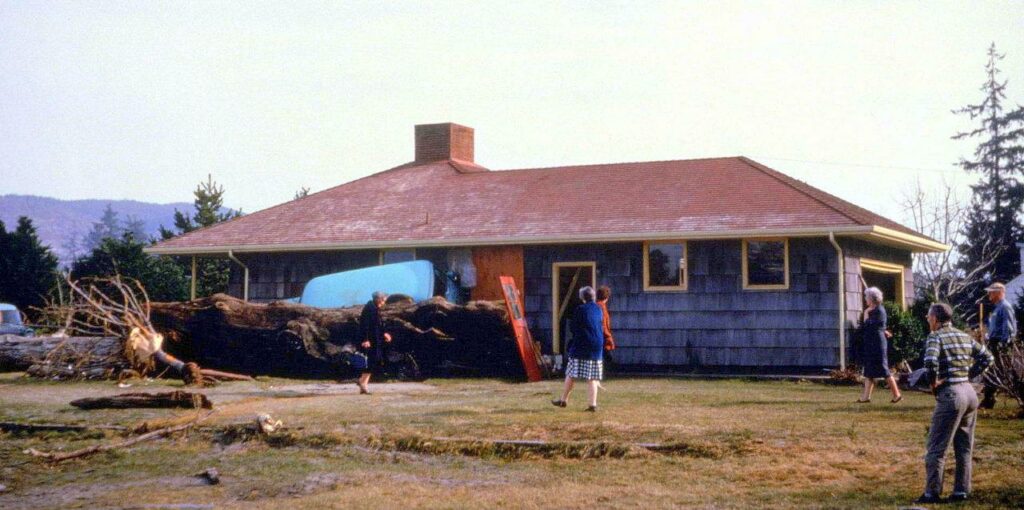
“Venice Park, a residential area just north of us and right on Neawanna Creek, had been hardest hit,” she wrote. “Several houses had been wrecked completely by the more than four feet of water that swept through them. It tumbled autos like matchsticks, leaving them pinned against houses when the water receded.
A tsunami caused by the 1964 Alaskan earthquake caused logs to jam at the mouth of the D River near Lincoln City.
I noticed hundreds of tiny fish still alive and wriggling frantically in their efforts to get back into the tiny creek, now within its banks and more than 50 feet away from them. Water perhaps two feet deep had surged over Highway 101 north of Seaside at the junction of City Center route and the through route south.”
As a result of a huge earthquake that occurred off Valdez, Alaska, in 1964, the tsunami was launched. At 9.2 on the Richter Scale, the quake was the strongest ever recorded in the United States, and the second strongest ever worldwide (the strongest was in Chile in 1960). Anchorage, as well as Southeast Alaska, was shook for almost five minutes as a result of the quake. You can hit the link here to see more of the devastating photos from the earthquake in Alaska.
Damage to Fourth Avenue, Anchorage, Alaska, caused by the Good Friday Earthquake. (Photo by U.S. Army)
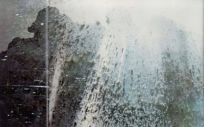
As for the quake itself, only nine people were killed. However, the tsunami that the earthquake launched was quite the story. It was up to 220 feet high near the epicenter. Although not completely destroyed, Valdez was badly damaged enough that its residents opted to move and rebuild the whole town farther inland on higher ground. It wiped out whole towns and Indian villages, including Valdez. Alaska suffered 120 deaths from the tsunami.
There were smaller waves along the West Coast, but they were still dangerous. Twelve people died in Crescent City, California.
Martial law was declared in Crescent City, Calif., after the tsunami caused by the 1964 Alaskan earthquake destroyed businesses and killed 10. (Image courtesy of The Oregonian)
When the tsunami struck in Oregon, Monte and Rita McKenzie and their four children were camping in a driftwood shelter on Beverly Beach State Park. You'll find this popular park near Newport, Oregon - a hop and a skin away from Lincoln City. As Monte and Rita McKenzie struggled against the churning waves and flying driftwood, their four children were ripped away and carried out to sea when they could not hold on. Among the only tsunami deaths in Oregon were Louie, Bobby, Ricky, and Tammy McKenzie (ages 8, 7, 6, and 3). Sadly, only Bobby's body was recovered from the sea.
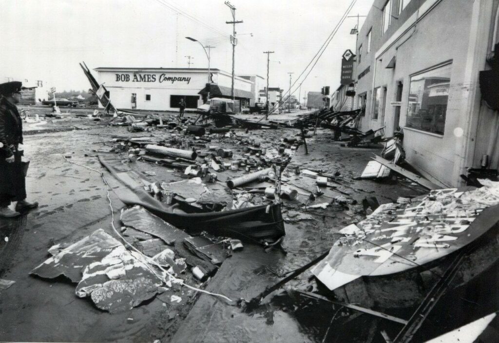
This photo from the Lincoln County Historical Society in Newport shows debris on the beach near Waldport, on the central Oregon coast, the day after the storm.
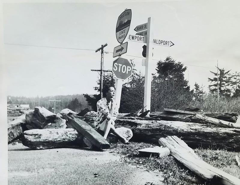
Nevertheless, property damage was widespread along the coast.
While staying in a vacation rental with her brother and boyfriend in Neskowin, Kathleen Clark got a terrifyingly complete view of the tsunami cycle from the front window.
As Clark told The Oregonian's Lori Tobias, the three young people had the window open and were enjoying the sounds of the surf when suddenly the sounds disappeared. They looked at each other, baffled, then got up and looked out to sea.
There was a vast expanse of wet sand in the moonlight. A vast expanse of the ocean had receded, literally beyond their sight.
“And then as we were watching, there was this wall of water coming at us,” Clark told Tobias. “Just a straight wall. Like the ocean had become vertical. It was a tremendous roar coming in. The water came into the little yard out front. We were just flabbergasted, just frozen in place. If the wave had been a foot higher, I bet it would have taken out the plate glass window.”
The earthquake and tsunami caused $2.8 billion in damage (in 2023 dollars) and killed 136 people. But scientists soon saw it could have been much worse.
As a result of the 1964 tsunami, Alaskan communities were the majority of those who died. Hundreds of feet of waves hit the beaches there within minutes of the earthquake that launched them. The waves in Oregon were much smaller and more attenuated hours later.
Flooded downtown Cannon Beach after the 1964 Tsunami.
#cbhcm #pnw #pacificwonderland #pacificnorthwest #tsunami #beachlife pic.twitter.com/78ShfbHFui
— CB History Center (@CannonBeachHC) June 5, 2017
1700, however, was different. As a result of the quake, waves of hundreds of feet high came ashore within 15 minutes of the quake, washing entire villages out to sea. The epicenter of the quake was right off the coast of Oregon, in what we call the Cascadia Subduction Zone today. The earthquake was said to be a magnitude 8 or 9 which occurred on the Cascadia Subduction Zone, a 600-mile stretch between Vancouver Island, British Columbia and Cape Mendocino, California. Off Neskowin, a whole "ghost forest" of tree stumps was snapped off in the tsunami of 1700, plunging below the sea level by the slumping land beneath, drowned, and preserved in the surf as sections of land dropped dozens of feet in an instant. Today at low tide, visitors can explore among them.
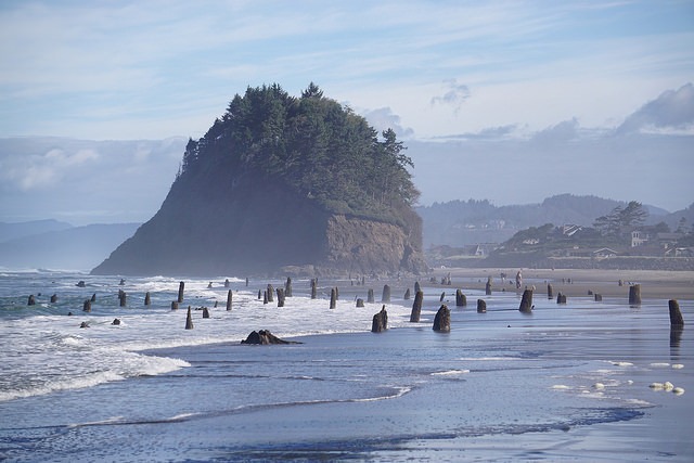
Incredible shot from Peter Roome / Flickr
According to scientists, similar earthquakes typically occur off the coast every few hundred years, with a 37 percent chance of occurring in the next 50 years.
Oregon has two tsunami warning systems today to address such events: One for distant events that send waves around the world, and one for the bigger, more deadly local ones. But the best advice is the most intuitive: Get off the beach as soon as you can and go to high ground if the ground shakes! Here is an interesting documentary from Oregon Field Guide, which goes into more detail about the tsunami in Oregon.