Do you love Oregon history? Maybe you want to take the kids on an interactive and educational experience. I'm already thinking of fun spring break activities for our family, and learning about early pioneer history may just be the perfect bonding experience. This Oregon Trail road trip will send you back in time on an epic journey (and you won't even have to die from dysentery).

If you're scratching your head at the dysentery reference, it comes from the Oregon Trail game I played as a kid. In it, you traveled by wagon from Independence, Missouri to The Dalles, Oregon just as 80,000 people did in the 1840s. The number of pioneers is actually around 200,000, but many settlers on the Oregon Trail chose to make their homes elsewhere, like Utah and California. For this road trip, we'll focus on the Oregon leg of the trail from near the Idaho border to The Dalles, Oregon.
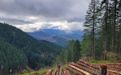
Expect to spend anywhere from four days to a week of travel time for this road trip. It really depends on how much or how little you want to see, and that's the brilliant part of this journey. What would have taken over a month to pioneers we can now plug away at our own pace. You will experience parts of the historic trail, walk in the ruts of pioneer wagon trains, and explore carefully curated museums.
We highly recommend that you take this road trip anywhere from late spring to early fall for the best odds that locations will be open and the weather will be accomodating.
Do you love Oregon?
Sign up for monthly emails full of local travel inspiration and fun trip ideas. In each newsletter we'll share upcoming events, new things to do, hot dining spots and great travel ideas.
Your epic adventure begins at:
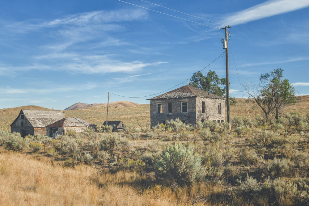
Keeney Pass Interpretive Site, Vale, Oregon
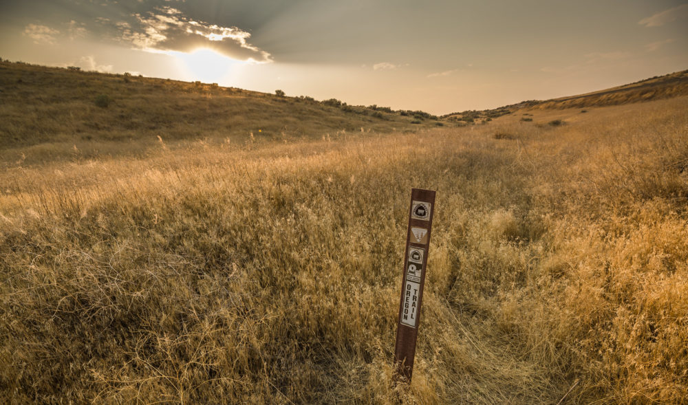
After a rather harrowing time crossing the Snake River from Old Fort Boise in modern-day Idaho, pioneers found themselves setting foot for the first time on what would come to be the state of Oregon. Some travelers actually chose a more southerly route that bypassed the Snake River crossing altogether, but both trails rejoined each other at the juncture of Keeney Pass.
The site offers a 2/3-mile round-trip hike along a section of the original Oregon Trail and visible wagon ruts near an interpretive shelter. Wayside exhibits tell the stories of the overland experience and the native peoples of the area.
From Keeney Pass, head north on Lytle Blvd to Vale, Oregon. Take a moment to view the Stone House Museum, then take US-26 West and continue several miles north to take a right on 5th Avenue East. Go left on Hill Rd./Old Oregon Trail. The first site you'll arrive at is:
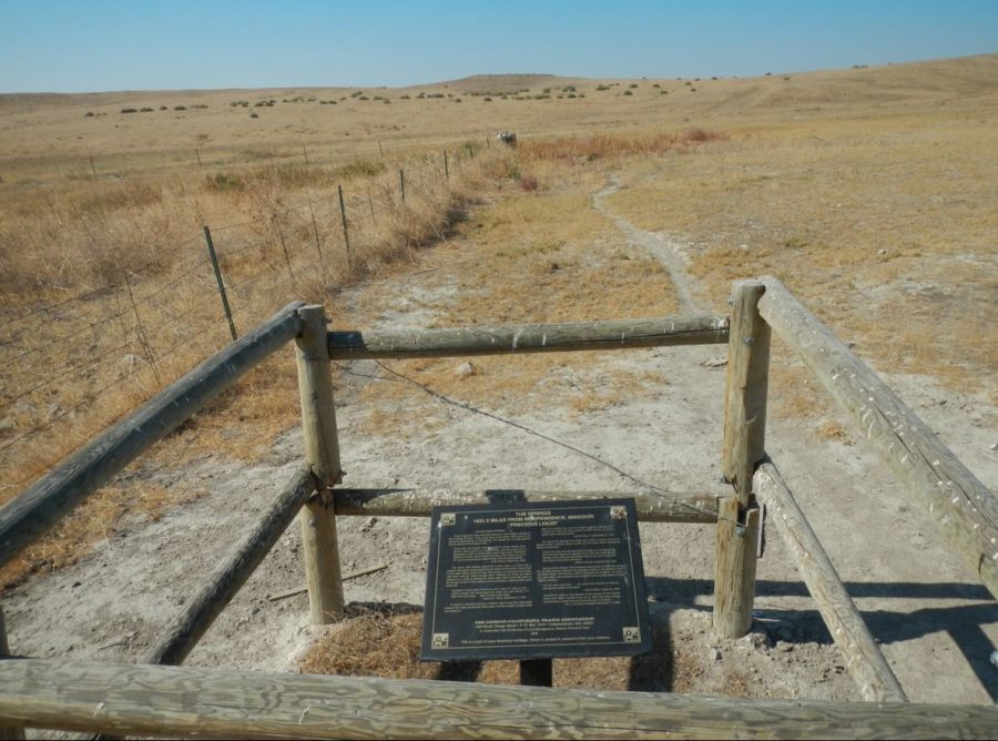
Alkalai Springs and Tub Springs Interpretive Site
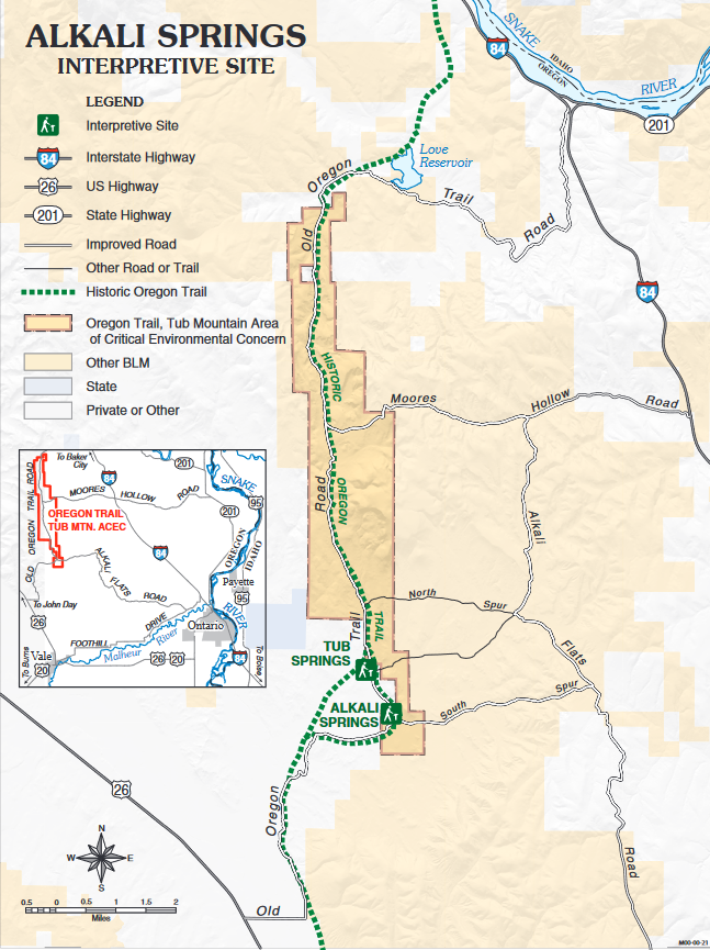
The springs laden with Alkali were a major hazard for the Emigrant's livestock which often died if they drank too much of it. Humans as well fell victim to the bad water. Tub Springs, on the other hand, was a critically important water source on this leg of the journey.
Continue north on Hill Rd./Old Oregon Trail to:
Birch Creek Interpretive Site
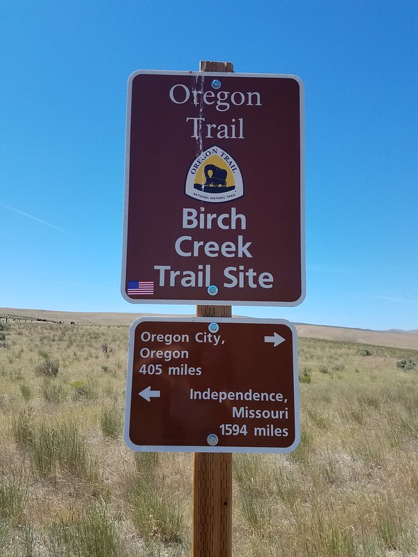
According to the Bureau of Land Management, Birch Creek provided much relief to emigrants after the hot, dusty, and parched segment of the Oregon Trail from Alkali Springs. In the early years of the Oregon Trail, there was plenty of grass for livestock and fresh water for animals and people. Emigrants often held over at this location for one of two reasons: some were sick from drinking the stagnant water at Alkali Springs, while others rested for the long haul up the Burnt River Canyon - the roughest part of the trail to come.
The site contains a 300-foot gravel trail that leads to interpretive panels. The trail is not barrier-free. The actual Birch Creek crossing and emigrant camp is located on private land and is not accessible to the public.
The road to the site can be rough, particularly going uphill.
Go north on Lockett Rd. and cross over I-84 onto Old Hwy. 30. to:
Farewell Bend State Recreation Area, Snake River, Ontario, Oregon
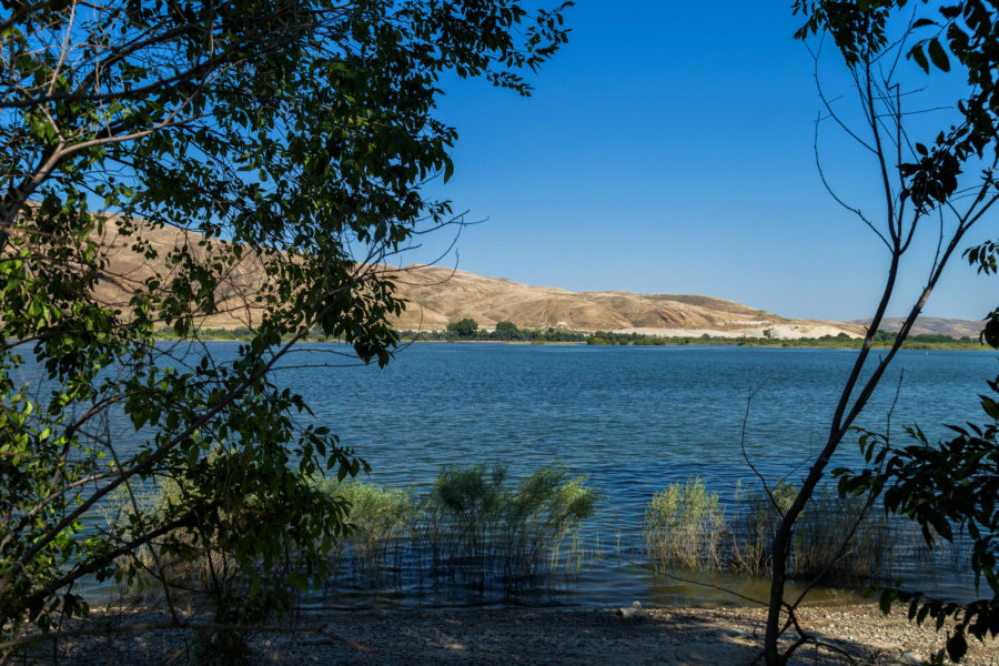
Pioneers named it "Farewell Bend" as they would be saying goodbye to the Snake River before turning their wagons northwest and overland. Today's Farewell Bend finds a lovely State Recreation Area with camping facilities (April 15 - Oct. 31), fishing, sand volleyball and basketball courts, as well as picnic areas. Settlers would have spent a few days here, resting and watering their livestock.
From Farewell Bend, the choice is yours to follow the more historically accurate Hwy. 30, or the faster I-84 W.
While Interstate 84 follows the basic route of the old Oregon Trail, Hwy. 30 is the more accurate route to follow in the footsteps and wagon ruts of the early pioneers.
From I-84, take Exit 302 to US-86 toward Richland/Hells Canyon. Follow signs to:
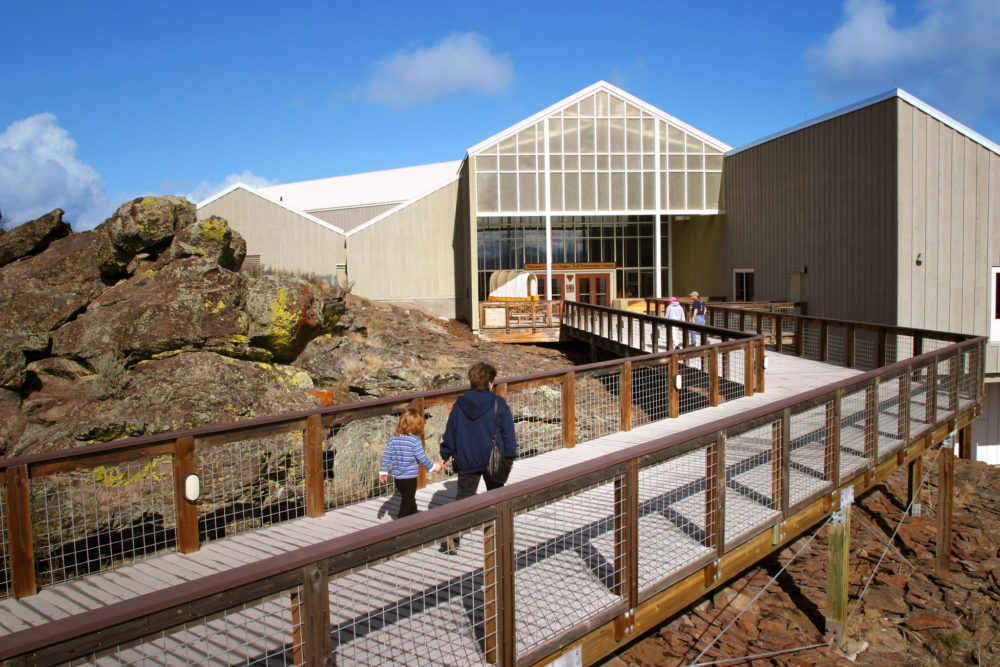
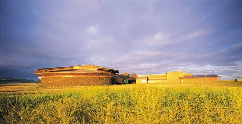
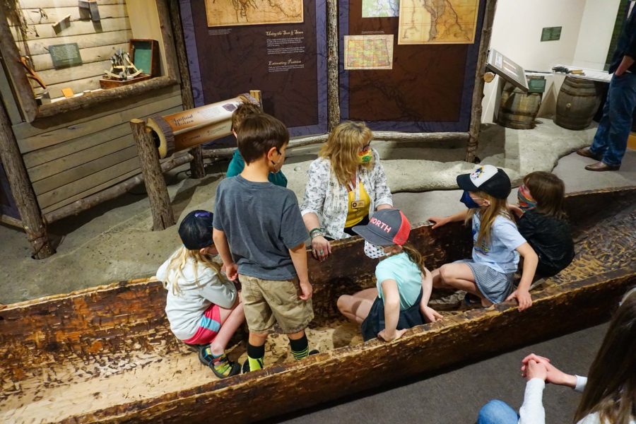
National Historic Oregon Trail Interpretive Center, Baker City, Oregon
The Interpretive Center offers much to do, from the museum to a replica of a pioneer gold mine, and the opportunity to walk in the real Oregon Trail wagon ruts at Flagstaff Hill.
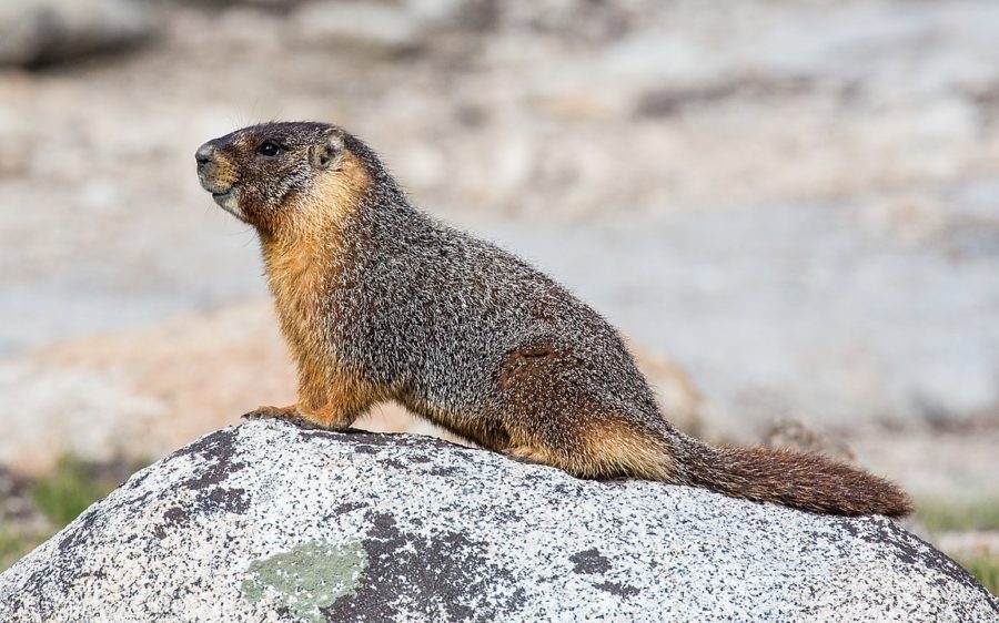
After exploring the museum, try the 2.4 mile out-and-back Panoramic and Stamp Mill Trail. You'll end up on an overlook with views of the Powder River. Wildflowers start blooming in the spring, and you may catch a glimpse of local wildlife like Marmots and Prarie Dogs.
According to the National Park Service, the Oregon Trail reached Flagstaff Hill by going through the small valley, known as Virtue Flat, that lies just south of the interpretive center. Traveling through this valley was no easy task. Emigrants had to fight their way through shoulder-tall sagebrush just after spending four or five difficult days ascending Burnt River. The trek across Virtue Flats created 13 miles of still visible Oregon Trail ruts. Approximately one mile of these ruts lies on the interpretive center's grounds. The ruts can be reached by following hiking trails from the interpretive center or by driving a half-mile west of the center's entrance on Highway 86 to a turnout.
Head back to Baker City and hop on I-84 W. Travel through La Grande and continue west on I-84 for 10.5 miles to Exit 248. Turn onto the Spring Creek Road/Kamela then right on Old Emigrant Hill Scenic Frontage Road (Highway 30). Take the first right, follow signs and go 2.4 miles to Park on Forest Road 1843. You'll be at:
Oregon Trail Interpretive Park at Blue Mountain Crossing
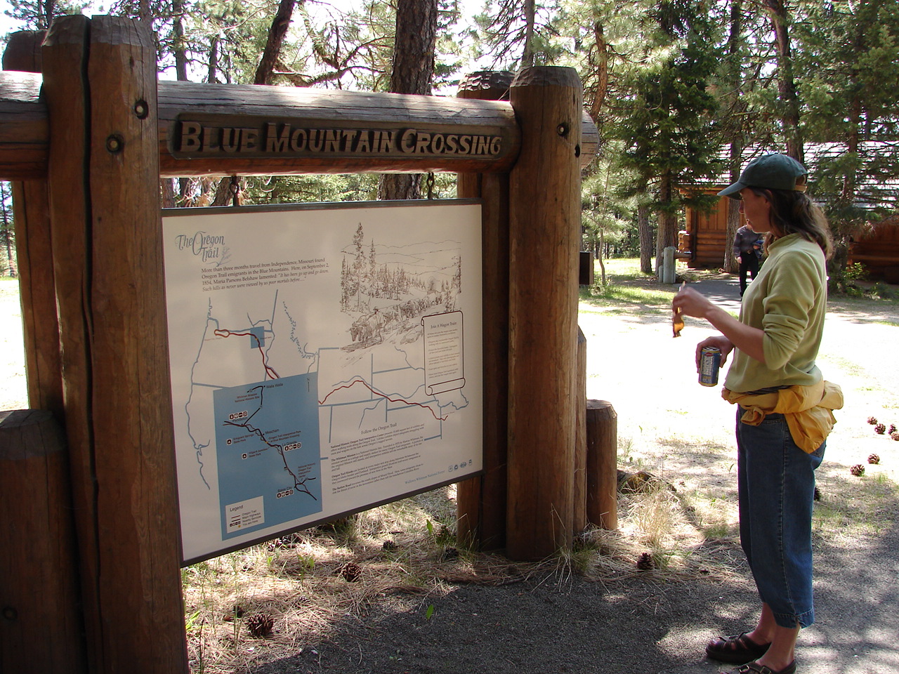
The Interpretive park is only open during the summer months, so if you're wanting to add this stop to your road trip, please plan accordingly.
Here you'll find some of the best-preserved evidence of Oregon Trail travel, from "wagon scars" on the trees to depressions made in the ground by livestock and prairie schooners. This area was a pioneer rest stop on what was a harrowing journey into the Blue Mountains. Choose a discovery trail and walk in the footsteps of Oregon Trail emigrants.
Retrace your driving route back to I-84 W. Again, here you can choose to take the more historical Old Highway 30, or the faster Interstate route. Your next destination is several miles up at:
Emigrant Springs State Heritage Area
Just as the pioneers did, you've now summited the Blue Mountains and it's all downhill from here.
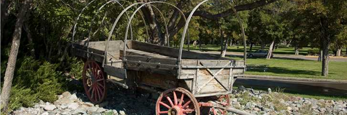
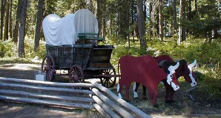
Wagon trains would have camped in the vicinity for several days and replenished their water barrels from the spring. Today you'll find camping areas, cabins, and yurts for rent year-round. Bring your horse for camping and trail rides, or learn about the adventures of early settlers from the park’s Oregon Trail interpretive shelter and covered wagon display.
Continue 7 miles on I-84 W or the Old Emigrant Road (Hwy. 30) to the Deadman's Pass Rest Area.
Deadman Pass, Pendleton, Oregon
Oregon Trail emigrants typically reached Deadman Pass, then known as Crawford Hill, after three days travel over what Edward Evans Parrish, emigrant of 1844, called "the worst road yet." The name, "Deadman’s Pass", was actually the result of an accident during the Bannock War when a teamster driving a wagon through the pass was killed.
The wagon ruts can be found near the rest area, and the viewpoint is a bit further down I-84/Hwy. 30.
From Deadman Pass, continue down the hill into Pendleton and follow signs for the Wildhorse Resort and Casino.
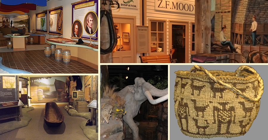
Tamástslikt Cultural Institute, Pendleton, Oregon
This beautiful museum explores the history of the Oregon Trail from the perspective of the Native American tribes who owned this land for thousands of years. Audio, artistry and historic images, rare and beautiful artifacts create a broad sensory experience depicting the Tribal world. The Institute is an incredibly immersive experience.
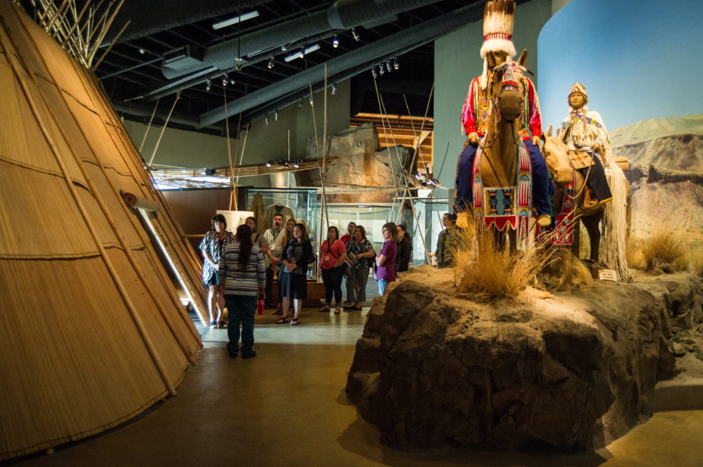
From their website: "Come to Tamástslikt Cultural Institute and experience the storied past, rich present, and bright future of our tribes through interactive exhibits, special events, and informative programs. More than just a museum, Tamástslikt celebrates the traditions of Cayuse, Umatilla, and Walla Walla Tribes. With dramatic exhibits, renowned artwork, and interesting — and yes, fun — events year-round, Tamástslikt Cultural Institute offers a 10,000-year journey in a single afternoon."
Backtrack to I-84 Westbound. Here, Old Hwy. 30 merges with the Interstate for this portion of the journey. Take I-84 W to exit 207 and follow signs toward Reith, Oregon. Keep on Reith Road, following the Umatilla River to:
Corral Springs Oregon Trail Site
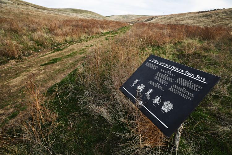
The Corral Springs site is on private land owned by the Ramos family. The family has given permission for public access to the 1.4 miles of two parallel sets of Oregon Trail ruts that descend into the canyon. Approaching the site you will see No Trespassing signs, but a closer look reveals the land graciously allowed by the owners. Please be respectful.
Continue west on Reith Road to reach the town of Echo, Oregon. Make a right on S Thielsen St, drive three blocks, and take a left on Oregon Trail Rd.
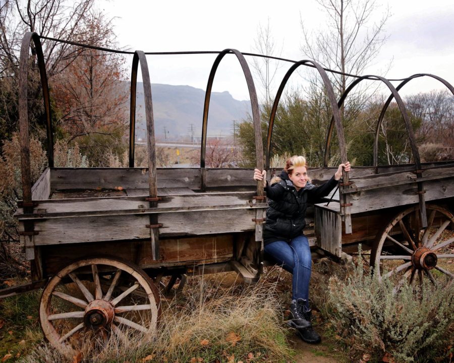
Fort Henrietta Park / Umatilla River Lower Crossing, Echo, Oregon
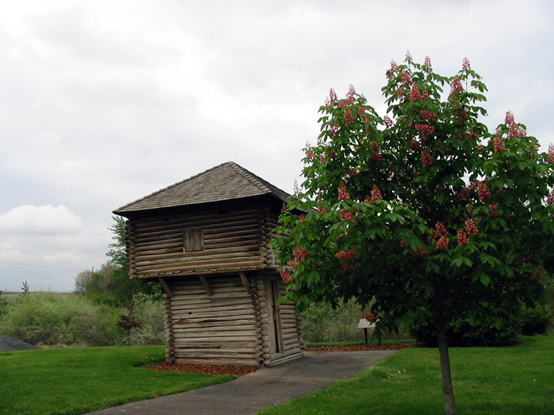
The National Park Service has listed Fort Henrietta as a National Historic Trail Site because it was a campsite and river crossing for Oregon Trail emigrants. The river ford known, as the Lower Crossing (Pendleton was the site of the Upper Crossing), was located at the south end of the park.
The park includes several historic displays including a covered wagon museum and antique fire equipment museum. The museums are unmanned with push-button recorders that provide information to visitors. The first Umatilla County jail is in the park as is a replica blockhouse. Interpretive panels provided by the National Park Service and storyboards with information on Echo history are also located in the park.
Continue southwest on Oregon Trail Rd. and follow Oregon Trail Site signs to take a right on a gravel road.
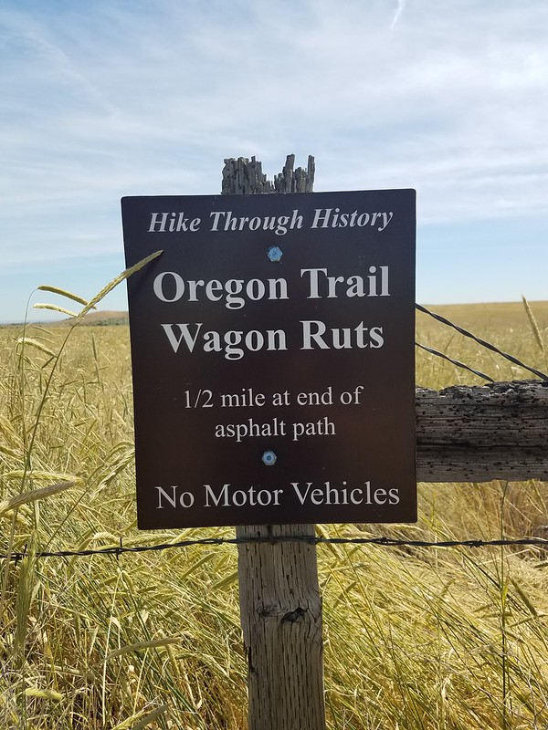
Echo Meadows
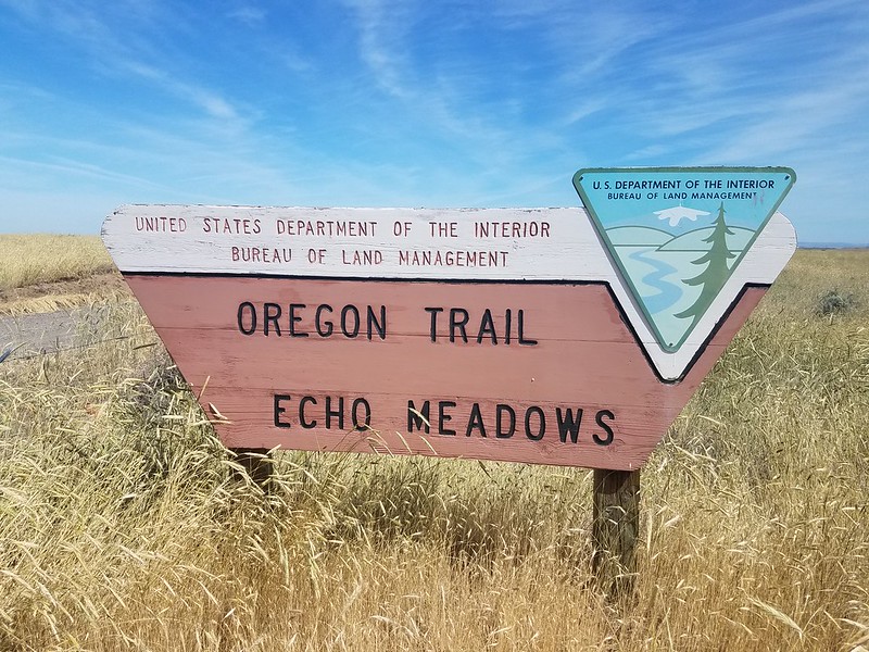
Echo Meadows is a 320-acre site managed by the Bureau of Land Management. Walk the site's half-mile (one way) paved path to visit the remaining one-mile-long stretch of swales. If you walk the wagon ruts, stop at the property line; do not trespass onto the adjacent farm. A pavilion near the parking lot contains interpretive exhibits that tell the stories of the trail and the area's native people.
BLM.gov: When travelers along the Oregon Trail began using a more direct route to The Dalles from the Umatilla Crossing, Echo Meadows became a rest stop to prepare for the windy, hot, and dusty trek to Butter Creek and Wells Spring. Some chose to camp here based on the availability of feed for livestock. Some remarked the grass was “hip-high to a horseman.”
The sandy sagebrush-covered interpretive site is a fair representation of what emigrants encountered in late spring and early fall after crossing the Umatilla River. The interpretive site is a stark reminder of what the Columbia River plain was like before water was pumped from the ground. A trace of the trail is barely discernible in nearby farm fields where thousands of wagons compacted the soil.
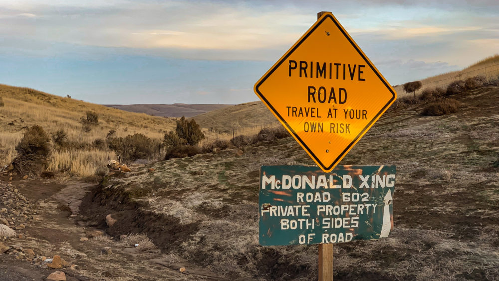
From Echo Meadows, return to Oregon Trail Road and take a right. Make a left on US-207, Lexington/Echo Highway. There are many backroads that will lead you to the Wells Spring site. If you're feeling adventurous, Google Maps will take you there. For a more reliable route, follow US-207 to Lexington, then make a right on US-74, Heppner Highway to Ione, Oregon. Make a right on Ella Road, and continue north to veer right on Ione-Boardman Road. Several miles up you will make a left turn onto Immigrant Lane and follow the signs to Wells Spring.
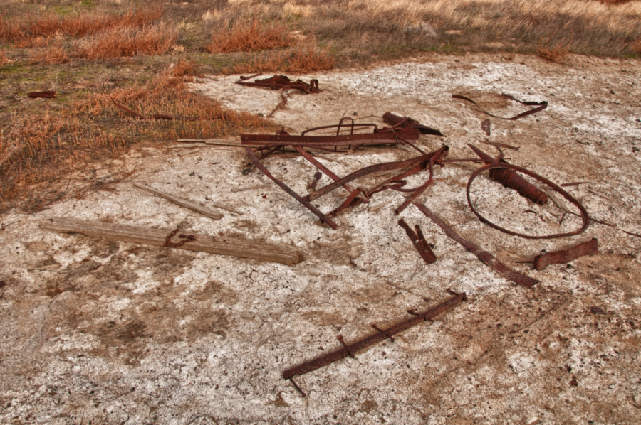
Wells Springs, Boardman, Oregon
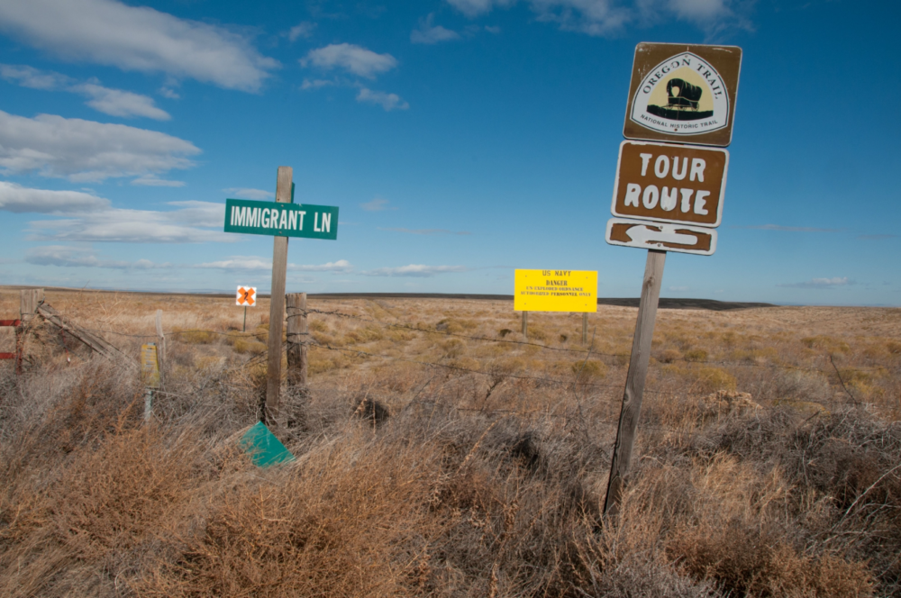
The Wells Spring segment of the Oregon Trail is an extremely isolated section that traverses what was the Boardman Bombing Range during WWII. This location includes a pioneer cemetery, stage station, and rusted wagon remains. The public access point is available to everyone, however, to hike the 7-mile segment within the old bombing range you must obtain permission from the Naval Weapons Station by calling 541-481-2565.
The road to reach this site is long and graveled, so plan accordingly with water, snacks, and a reliable vehicle.
From Wells Spring, head west on Immigrant Lane and follow it as it bends around to the hamlet of Cecil, Oregon. Pioneers crossed Willow Creek near here. In Cecil, make a right onto Heppner Highway, then a quick left onto Cecil Lane. Take another quick left onto Cecil Road/Fairview Lane and follow it a few miles to make a right on Fourmile Canyon Road. Follow the signs to:
Fourmile Canyon Historic Site
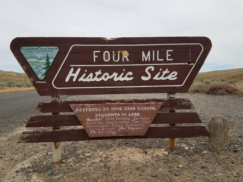
This segment of the Oregon Trail was part of the difficult transit of the Columbia Plateau. Interpretive panels explain the site’s deep rut scars and the emigrants’ ascent out of the canyon. North is the modern city of Arlington on the Columbia River, but historically it was named Alkalai after the canyon that runs south of it.
Pioneers could choose to continue overland to the Fourmile Canyon site, but others chose to pack up their wagons at Arlington and head down the Columbia to The Dalles. Settlers would raft down the river in Hudson's Bay Company boats or Native American canoes.
While you can take McDonald's Ferry Road from the Fourmile Canyon site, the next area can only be accessed from the west bank of the John Day River. Two travel options are:
1. To closely experience the Oregon Trail route, follow Fourmile Canyon Road north to make a left and follow US-19 John Day Highway south to Cedar Springs Lane where you will turn right. Keep on Cedar Springs Lane for several miles to the locale of Rock Creek where you'll make another right on Lower Rock Creek Lane. Keep heading east to take a right on McDonald Ferry Road. This turns into Klondike-John Day Road. At the point where the road first meets the river is where McDonald Crossing was. Continuing north along the river will lead to the primitive Hoag Road and an eventual left on Heritage Lane, then Quinton Canyon Road to I-84.
2. For a more reliable paved (mostly) highway drive, follow Fourmile Canyon Road north to make a right on US-19 John Day Highway. Follow signs to Arlington and onto I-84 Westbound. Take Exit 104 to US-97 Bend/Yakima and keep left to US-97 South/Sherman Highway. After several miles, take the exit to US-206/Wasco. Stay on US-206 through the town of Wasco, then make a left on Klondike Road. Keep on the gravel Klondike Rd. as it turns into McDonald Ferry Lane and follow it all the way to the John Day River.
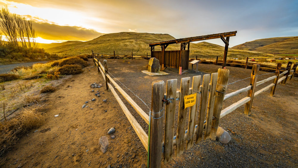
McDonald Ford / McDonald's Crossing
Where Klondike Road changes from east-west straightaway to meandering gravel road you will be driving on the actual Oregon Trail all the way to the river.
Today this area of Sherman and Gilliam Counties is encompassed by windfarms. In the 1850s, this was a shallow ford on the John Day where it was safe to make the river crossing. Here you'll find an interpretive monument and gorgeous views of the wild and scenic John Day River.
Retrace your path back down Klondike Road to Wasco, and US-97 to Biggs Junction where you left I-84. This time you'll be taking a left on Biggs-Rufus Highway just before the freeway interchange.
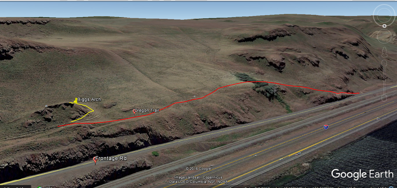
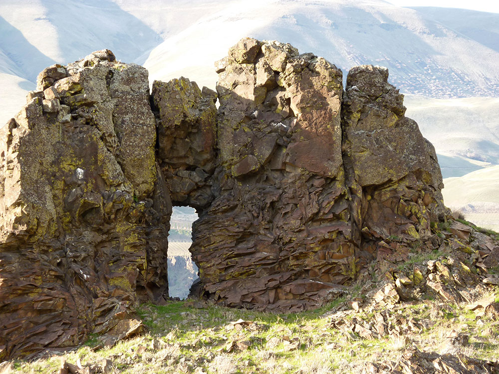
Biggs Junction to The Deschutes River
If you love interesting and less well-known places to hike you're in for a treat here. As you travel this last part of the overland Oregon Trail journey you'll be overlooking the Columbia River as pioneers did 175 years ago. It's a bit tricky to find the trail as it's not well marked, but check the Google Map below for the location you're looking for. There will be two Oregon Trail markers on the left and an inclining path between them. This goes up to Biggs Arch, a stunning natural rock formation with incredible views of the Gorge. There are wagon ruts along the path, so be on the lookout.
From Biggs Arch, continue west on Biggs Rufus Highway, which becomes US-206.
Heritage Landing / Deschutes River State Park
At this point, you're almost at your journey's end. The mouth of the Deschutes River is where pioneers made the crossing to the last leg of the trip that would bring them to The Dalles and the fertile Willamette Valley beyond.
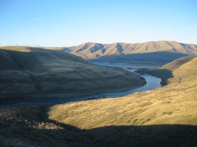
Travelers frequently camped at the mouth of this large tributary of the Columbia River before crossing. In order to cross, some emigrant parties used the rocky islands near the river's mouth as stepping stones, while wagons were floated across and stock animals swam. Others forded the river using rafts.
Pioneer Joel Palmer wrote on September 28, 1845:
"The river is about one hundred yards wide, and the current very rapid; the stream is enclosed by lofty cliffs of basaltic rock. Four hundred yards from the Columbia is a rapid or cascade. Within the distance of thirty yards, its descent is from fifteen to twenty feet. The current of this stream was so rapid and violent, and withal of such depth, as to require us to ferry it. Some of the companies behind us, however, drove over at its mouth by crossing on a bar."
Today you can camp, hike, and fish at the Deschutes River State Recreation Area.
Keep going on US-206/Celilo-Wasco Highway until it merges with I-84 W. Continue to The Dalles and take Exit 82 toward Columbia Gorge Discovery Center/Wasco County Museum.
Columbia Gorge Discovery Center and Wasco County Historical Museum
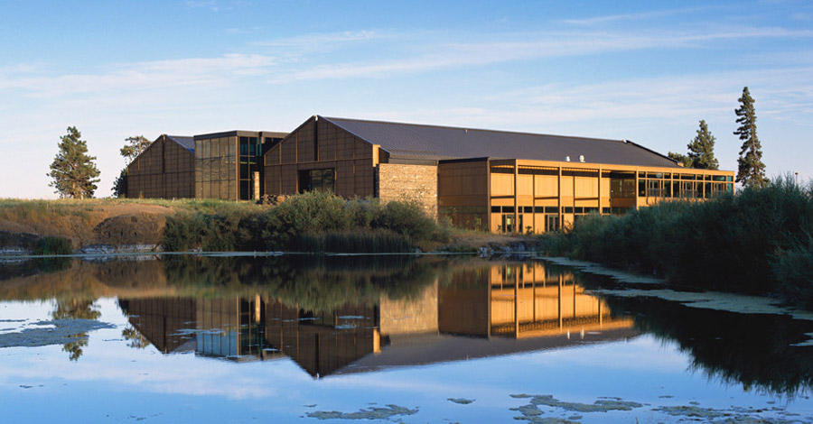
Not only will visitors experience Wasco County and Oregon Trail history here, but the Discovery Center has so much more to offer. From exhibits on the ancient origins of the Columbia River Gorge to Native American history and raptor shows. If you love history you'll really enjoy a visit.
Follow the Columbia Gorge Discovery Center on Facebook to keep in touch with all of their goings-on.
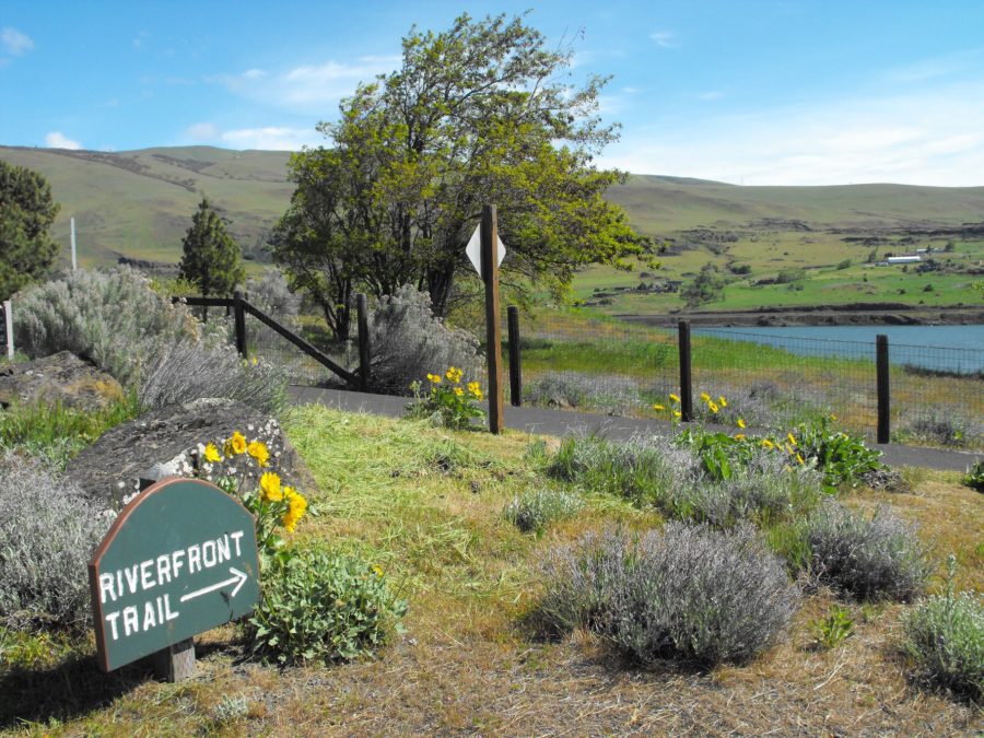
From the SE corner of the Columbia Gorge Discovery Center parking lot, you may hike the paved Riverfront Trail to the last destination on our list, or drive there if you like.
By car, take US-30 south to the River Road Exit and make a left. Park between River Road and River Trail Way, and take the trail toward the Columbia River.
Crates Point
And now Pioneers, you have reached the end of your journey. Where Chenowith Creek meets the Columbia River you will be standing at the very last point of the true overland Oregon Trail. From 1843-1845, this was the only way to Oregon City and beyond.
From OCTA-trails.org: At Crates Point, a protected harbor at the mouth of Chenowith Creek, the Oregon Trail pioneers put into the river. John McLoughlin, despite orders from his superiors, sent bateaux and food here to assist (and occasionally rescue) weary emigrants. Nearby were many pine trees to cut for building immense rafts that could hold up to six wagons. Writing in 1843, explorer John C. Fremont described them as “ark-like rafts, on which they had embarked their families and households, with their large wagons and other furniture, while their stock were driven along the shore.”
After 1843, many emigrants chose to take the newly-explored Barlow Road Trail which avoided the extremely dangerous Columbia River journey. We will cover a Barlow Road Trip in a future article.