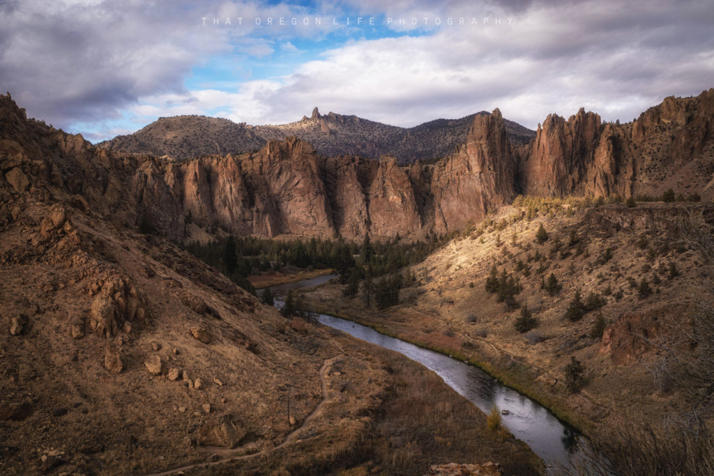
Smith Rock State Park: Climbing, Hiking, and High-Desert Views
Use our park-wide Smith Rock guide for climbing context, nearby towns, and broader trip ideas around this loop.
Read the guide
Central Oregon and the Cascades · Near Terrebonne
Misery Ridge Loop is the named 4.0-mile circuit on the official Oregon State Parks Smith Rock trail map. It combines canyon, river, and high rim above the Crooked River. The map also lists Misery Ridge Trail as a 1.0-mile segment; this page uses the full named loop, not that segment alone. The park is open dawn to dusk. A day-use parking permit is required and can be purchased on site. Rangers enforce the leash law and ask all users to stay on trails. Drones are prohibited year-round.

The place
Misery Ridge Loop is the named 4.0-mile circuit on the official Oregon State Parks Smith Rock trail map. It combines canyon, river, and high rim above the Crooked River. The map also lists Misery Ridge Trail as a 1.0-mile segment; this page uses the full named loop, not that segment alone.
The park is open dawn to dusk. A day-use parking permit is required and can be purchased on site. Rangers enforce the leash law and ask all users to stay on trails. Drones are prohibited year-round.
From the day-use area near the Welcome Center, the loop typically includes a steep scree climb, rim views, a descent past Monkey Face, and a return along the river. The official map does not publish loop elevation gain, so this guide does not invent one. Treat the ridge as strenuous. Heat, loose rock, and crowded trails are routine.
Climbing-route closures to protect nesting raptors typically run about January 15 to August 1 and do not close this hiking loop. Stay on marked trails. Do not scramble Asterisk Pass unless you are prepared for a rock scramble that is not this featured hike.
The That Oregon Life Smith Rock article is park-wide coverage. This page is the trail-specific planning URL.
From our Oregon archive: Read That Oregon Life’s full story about this trail.
Trailhead map
Coordinates: 44.365891, -121.137377 · Open in Google Maps
The coordinates identify the documented public parking area or trailhead—not a summit, waterfall, or off-trail feature.
Know before you go
No star ratings
The hard rating reflects 4 mi round trip where steep grades, exposure, heat, or remoteness require stronger preparation and a willingness to turn around.
Protect the place
Trails, meadows, and viewpoints wear down quickly when people cut switchbacks, wander off the route, or leave waste behind. Keep this outing on durable, legal ground.
Trail questions
The official Oregon State Parks trail map labels the named Misery Ridge Loop as 4.0 miles. The 1.0-mile Misery Ridge Trail shown on the same map is only one segment of the loop.
A hiking permit is not normally required, but Smith Rock State Park requires a day-use parking permit that can be purchased on site.
Dogs must be leashed and visitors must stay on trails. Oregon State Parks prohibits drones at Smith Rock year-round.
The day-use area is open from dawn to dusk. Check posted notices for seasonal climbing closures and other current restrictions.
From our Oregon archive
Continue planning with That Oregon Life’s existing trail reporting, photography, regional guides, and nearby trip ideas.
Use our park-wide Smith Rock guide for climbing context, nearby towns, and broader trip ideas around this loop.
Read the guideMore in the region
Trail lengths are shown below; these are regional suggestions, not distances from this trail.
Official Oregon State Parks Smith Rock profile and OPRD trail map (Misery Ridge Loop 4.0 miles) reviewed September 15, 2026.