Travel conditions are slowly improving east of Prineville as portions of U.S. Highway 26 reopen following weeks of wildfire activity from the massive Rowe Creek Complex.
The highway is not fully open yet, but the closed section has become considerably shorter than it was just several days ago. As of early Tuesday, August 11, TripCheck listed Highway 26 as closed from approximately milepost 29 to milepost 49, beginning about 10 miles east of Prineville. Drivers are still being told to use an alternate route through the remaining closure.
That marks a major change from last week, when the closure extended much farther east toward Mitchell. On August 9, Highway 26 remained closed from milepost 29.2 to milepost 66. By August 10, fire officials reported that the closure had been reduced to milepost 59.8 before TripCheck shortened the affected section again later that day.
The gradual reopening comes as firefighters report substantial progress on the Rowe Creek Complex, although parts of the enormous fire remain active.
Rowe Creek Complex reaches 84% containment
The latest official fire update listed the Rowe Creek Complex at approximately 371,549 acres and 84 percent contained. The lightning-caused complex began July 15 about 10 miles south of Fossil and has grown into one of the largest wildfires burning in Oregon this summer.
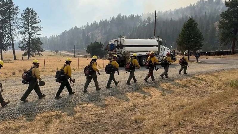
More than 1,600 personnel remained assigned to the incident as of Monday.
Containment has increased quickly in recent days. On August 9, the complex was estimated at 367,847 acres and 79 percent contained, with 1,615 personnel assigned. By August 10, acreage had increased by roughly 3,700 acres while containment climbed another five percentage points to 84 percent.
That is significant progress, but 84 percent containment does not mean the fire is 84 percent extinguished. Containment represents the portion of the fire perimeter where crews have established control lines expected to prevent further spread.
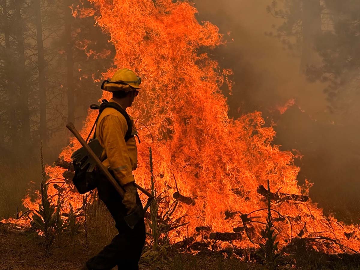
Firefighters are still dealing with active fire behavior along portions of the massive perimeter.
Highway 26 corridor was still seeing active fire Sunday
The shrinking highway closure is particularly notable considering what firefighters were dealing with near Highway 26 only two days earlier.
On August 9, some of the most active firefighting was taking place near the southern tip of the complex around Highway 26, Salmon Creek Road and County Road 23, also known as Ochoco Creek Road and Ranger Station Road.
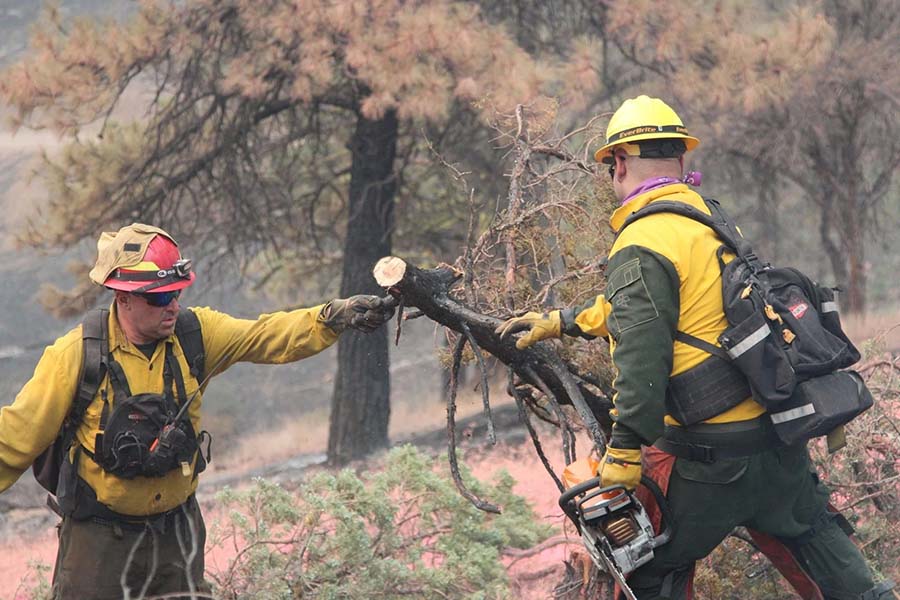
Fire officials reported spot fires and areas where flames had crossed existing control lines during the night. By Sunday afternoon, spot fires south of Ranger Station Road had grown to about 10 acres, but firefighters had already cut dozer line to connect the area with the road.
The fire also crossed Salmon Creek Road. Crews used dozers to establish line around that section before working to extinguish the remaining spots. Ground crews were supported by aircraft dropping both water and retardant.
North of Ranger Station Road, firefighters used heavy equipment to prepare Forest Service Roads 2610 and 2670 as containment lines designed to connect that section of the fire back to Highway 26.
Those conditions help explain why Highway 26 could not simply reopen all at once, even as overall containment on the Rowe Creek Complex continued to improve.
Firefighters still battling spot fires
Crews spent Sunday night taking direct suppression action along Ochoco Ranger Station Road, where spot fires continued jumping containment lines.
On the south side of the road, firefighters worked to contain spot fires and areas where flames had crossed existing lines. North of the road, the fire expanded toward the northeast but remained constrained by Ochoco Ranger Station Road to the south and the scar from the earlier Mark’s Creek Fire to the north.
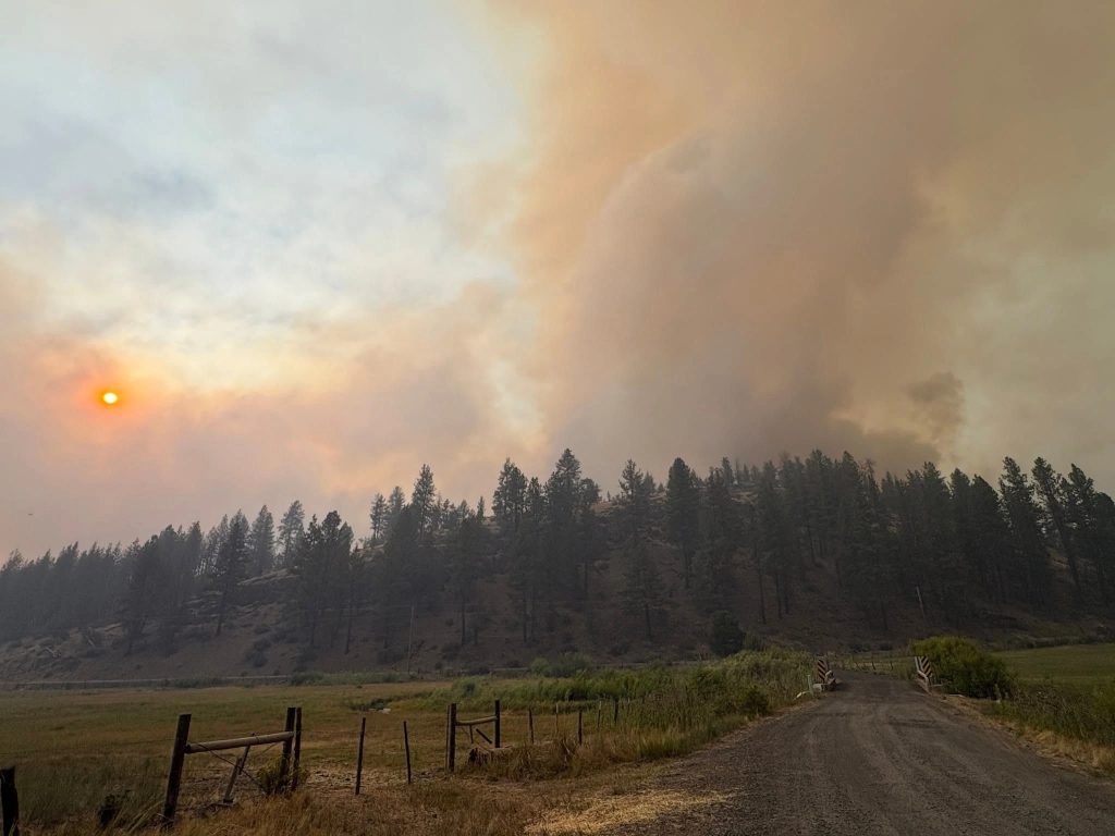
Fire managers said burning juniper has presented an additional challenge because lightweight pieces of burning bark can travel across containment lines and ignite vegetation on the other side.
Firefighters have also been preparing Forest Service Roads 2610 and 2670 as containment lines designed to connect that portion of the fire back to Highway 26. Wolf Creek Road was being prepared as an additional contingency line if conditions require it.
Despite those trouble spots, crews have successfully held other important sections of the fire. A hotshot crew working near Cherry Creek and Tompkins Pass kept flames within planned containment lines, while contained areas on the west and northwest portions of the complex remained under observation.
Crews continue protecting homes and communities
Structure protection has also remained an important part of the firefighting effort.
On August 9, structure protection groups built and maintained defenses around buildings in the Mill Creek and Cougar Mountain communities. Another structure protection team detected and suppressed a spot fire near Hamilton Creek.
Crews were also working to defend structures in the community around Ochoco Ranger Station as fire activity continued near the southern end of the complex.
That same morning, the Oregon State Fire Marshal Red Team joined Southwest Complex Incident Management Team 2 in unified command. The two teams divided responsibilities, with Southwest Complex Incident Management Team 2 focusing primarily on wildland firefighting while OSFM resources concentrated on protecting homes and other structures.
Oregon Department of Forestry Team 2 also accompanied the OSFM Red Team, bringing additional resources to the incident.
Why Highway 26 is reopening slowly
The changing closure along Highway 26 illustrates how reopening a highway through a major wildfire area involves more than simply waiting for flames to move away from the pavement.
Fire officials have specifically warned about fire-weakened trees, stressed roadbeds and bridges, and loosened rocks above the highway. Some of those hazards may not be immediately obvious to motorists traveling through a burned area.
Highway 26 has also served as part of the firefighting operation itself. Crews have used roads throughout the area for access, containment and movement of personnel and equipment.
Because of those hazards, sections of the highway may remain closed even where there is no obvious wall of flames nearby.
The latest TripCheck information shows the closure between mileposts 29 and 49. The highway east of that closure toward Mitchell is no longer included in the wildfire closure listed by ODOT, representing a considerable improvement for travelers in the region.
Drivers should still avoid trying to bypass the closure using forest roads or unfamiliar rural routes. Wildfire closures may affect surrounding public lands, and remote roads can be dangerous or inaccessible to ordinary vehicles.
A huge fire despite growing containment
Even with containment reaching 84 percent, the scale of the Rowe Creek Complex remains difficult to overstate.
The fire perimeter stretches across hundreds of miles of rugged Central and North Central Oregon terrain, creating an enormous workload for crews who must continue patrolling containment lines, extinguishing hot spots and responding when fire escapes into unburned vegetation.
Resources are also stretched across the West.
The National Wildland Fire Preparedness Level has reached PL5, the highest level in the national system. Fire officials said 94 large fires were being actively suppressed around the country as of Monday, creating intense competition for specialized resources including hotshot crews, aircraft and Type 1 engines.
Fire managers have said the Rowe Creek Complex itself has a perimeter approaching 500 miles, illustrating the enormous amount of ground firefighters must continue to patrol even as containment increases.
Oregon Department of Forestry officials have also announced another management transition for the Rowe Creek Complex. ODF Complex Incident Management Team 2 is expected to assume command at 6 a.m. Sunday, August 16, as the current Southwest Complex Incident Management Team reaches the end of its assignment.
Smoke can still change quickly
Smoke from the Rowe Creek Complex and other large Oregon wildfires continues to affect portions of Central and Eastern Oregon.
Fire officials have said air quality around the incident has recently ranged from Good all the way to Hazardous, depending on fire activity, wind and location.
Conditions can change rapidly throughout the day. Communities that begin the morning with relatively clear skies may experience significantly worse conditions later as smoke settles into valleys or winds shift.
Anyone living or traveling near active fires should check current air-quality readings before spending extended periods outdoors, particularly people who are sensitive to wildfire smoke.
Highway 26 remains partially closed
For travelers, the important news is that the Highway 26 closure is getting smaller, but the route between Prineville and Mitchell should not yet be treated as completely reopened.
As of early Tuesday morning, August 11, Highway 26 remained closed from approximately milepost 29 to milepost 49 east of Prineville because of the wildfire. TripCheck instructs drivers to use an alternate route.
That is considerably less highway than was closed only days ago and is another sign of the progress firefighters have made around the Rowe Creek Complex.
On August 9, the closure stretched all the way to milepost 66 while crews were battling spot fires near Ranger Station Road, working around fire that had crossed Salmon Creek Road and protecting structures around communities near the southern edge of the complex.
Still, with more than 371,000 acres burned and active firefighting continuing along portions of the southern perimeter, conditions can change quickly.
Travelers heading through Central Oregon should check TripCheck immediately before leaving, rather than relying solely on GPS or navigation apps. Residents near the fire should continue checking evacuation information directly through their county sheriff’s office and Oregon’s official emergency alert system.
As of Tuesday morning, the most recent official Rowe Creek fire figures available remained approximately 371,549 acres and 84 percent containment, while firefighters continued working toward the point when the remaining stretch of Highway 26 can safely reopen.
Sources and Further Information
Information in this article was compiled from official Oregon transportation and wildfire agencies. Conditions can change quickly, so readers should check the latest updates before traveling through the area.
- Oregon TripCheck: Current Highway 26 road conditions and closures
- Central Oregon Fire Information, August 10: Rowe Creek Complex Update
- Central Oregon Fire Information, August 9: Rowe Creek Complex Update
- Oregon State Fire Marshal: Rowe Creek Complex wildfire updates
- Oregon Department of Forestry / FlashAlert: Latest Oregon wildfire information
- AirNow Fire and Smoke Map: Current smoke and air-quality conditions
- Ochoco National Forest: Current closures and alerts
For current Oregon fire conditions: Track current fire incidents, mapped evacuation areas, smoke, road conditions, and official resources on our Oregon Wildfire Map.