For most of us, Oregon exists as a collection of familiar things. Highways winding toward the coast. Farm fields stretching across the Willamette Valley. Neighborhood streets in Portland. Tiny eastern high desert towns. Fences separating properties. Addresses stamped on mailboxes. Property lines that seem like they have always been there.
But what if all of that began with a single point?
Not a city.
Not the state capitol.
Not even the Oregon Trail.
Do you love Oregon?
Sign up for monthly emails full of local travel inspiration and fun trip ideas. In each newsletter we'll share upcoming events, new things to do, hot dining spots and great travel ideas.
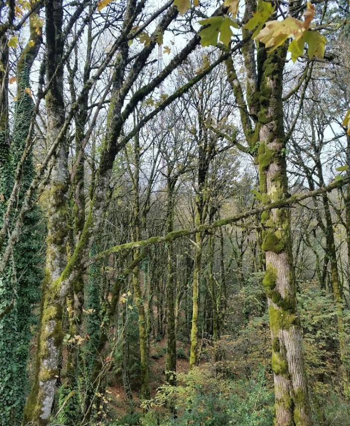
Just one small marker hidden in the woods of Portland's West Hills.
Most Oregonians drive past it without realizing it's there. Some spend their whole lives here and never hear its name. Yet the quiet little landmark known as the Willamette Stone helped shape Oregon and Washington in ways that still affect us every single day.
It may be one of the most important places in Oregon history that almost nobody talks about.
The Place Where Oregon Started Measuring Itself
The Willamette Stone sits at what surveyors call an "initial point." That may sound about as exciting as reading instructions for assembling furniture, but stick with me, because this gets surprisingly fascinating.
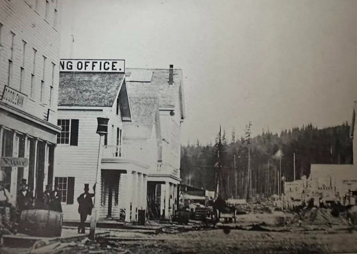
Back in the mid-1800s, Oregon Territory was changing quickly. Settlers were arriving in large numbers, drawn west by opportunity and encouraged by the Donation Land Claim Act, which offered land to settlers willing to build a life here.
There was one problem.
Nobody had an organized way to divide and measure all that land.
Imagine trying to hand out thousands upon thousands of acres without a standardized system. Chaos would have followed quickly. People would argue about boundaries, overlap claims, and end up with endless disputes.
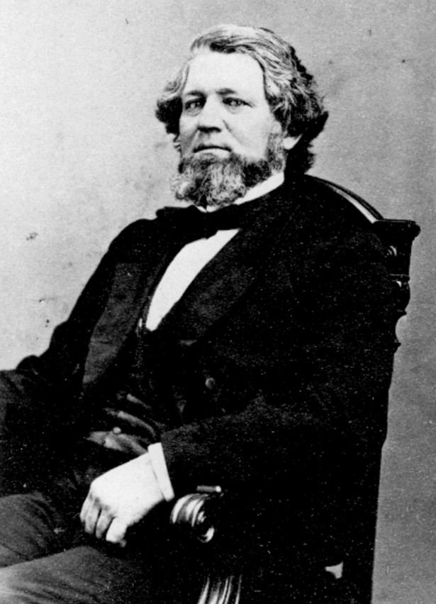
So in 1851, President Millard Fillmore appointed Oregon Territory's first Surveyor General, John B. Preston, to create a system that would organize the landscape.
On June 4, 1851, surveyors climbed a ridge in Portland's West Hills and placed something incredibly simple:
A cedar stake.
That stake became ground zero for mapping the Pacific Northwest.
The Baseline Point For Oregon And Washington
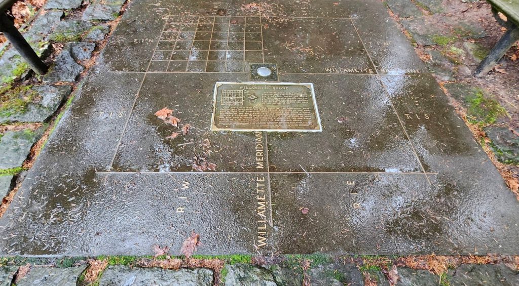
The original cedar marker eventually became known as the Willamette Stone.
From that single point, two important survey lines stretched outward.
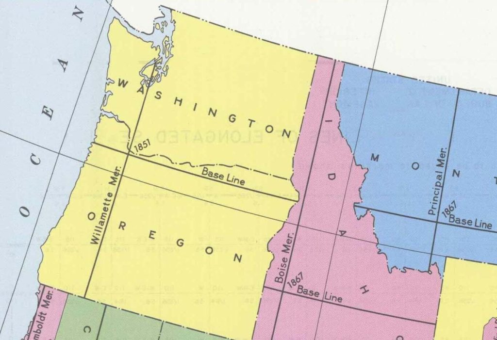
One ran north and south and became known as the Willamette Meridian.
The other ran east and west and became known as the Willamette Baseline.
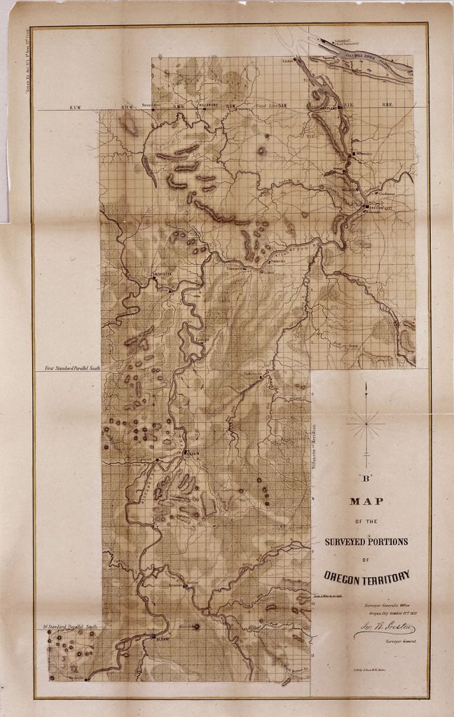
Together, these lines became the framework used to divide land into townships and sections throughout Oregon and Washington.
And this is where things become mind-blowing.
Every property survey. Every section line. Every rural road following an old survey route. Every legal land description in Oregon and Washington can ultimately trace back to this one spot in the woods.
That house sitting on five acres outside Bend?
That farm outside Salem?
That neighborhood in Eugene?
In one way or another, they all connect back to the Willamette Stone.
It's almost like Oregon pressed a giant reset button in 1851 and said:
"Okay, we're starting right here."
Some Roads Still Reveal Its Hidden Influence
Once you know about the Willamette Stone, you'll start seeing clues everywhere.
Ever wonder why some roads are named Meridian Road or Baseline Road?
Those names weren't random.
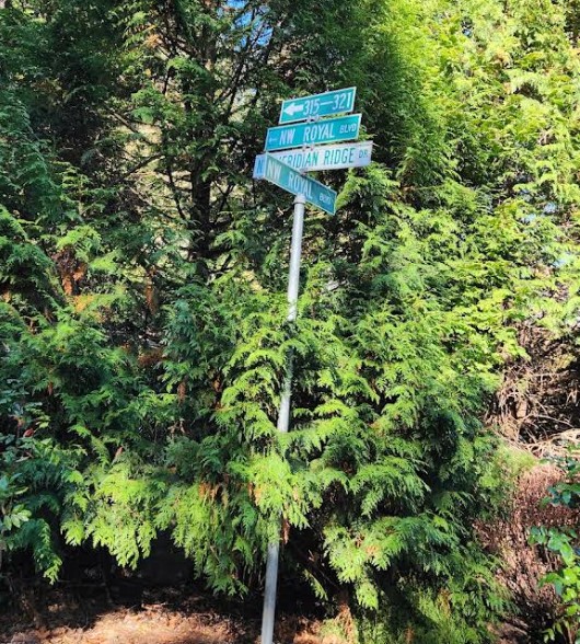
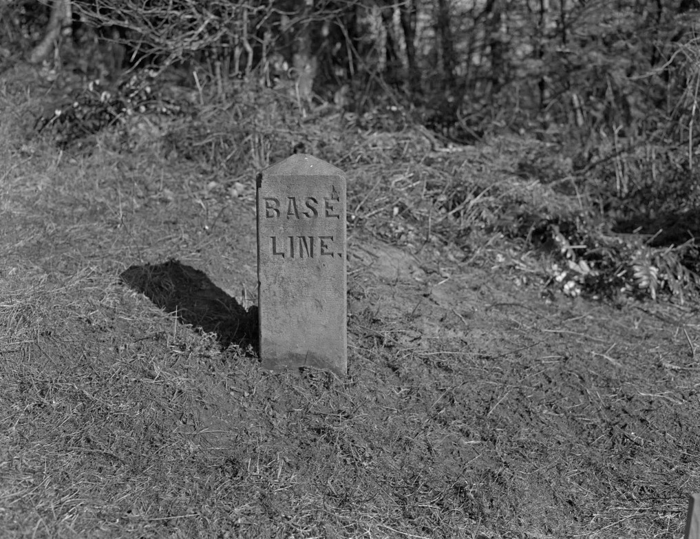
Some roads in Oregon and Washington literally follow the original survey lines created from the Willamette Meridian and Baseline. In Portland, Stark Street itself was once known as Base Line Road because it followed that historic east-west survey route. It even had stone obelisk mile markers, some of which are still around today.
You're driving through history without even realizing it.
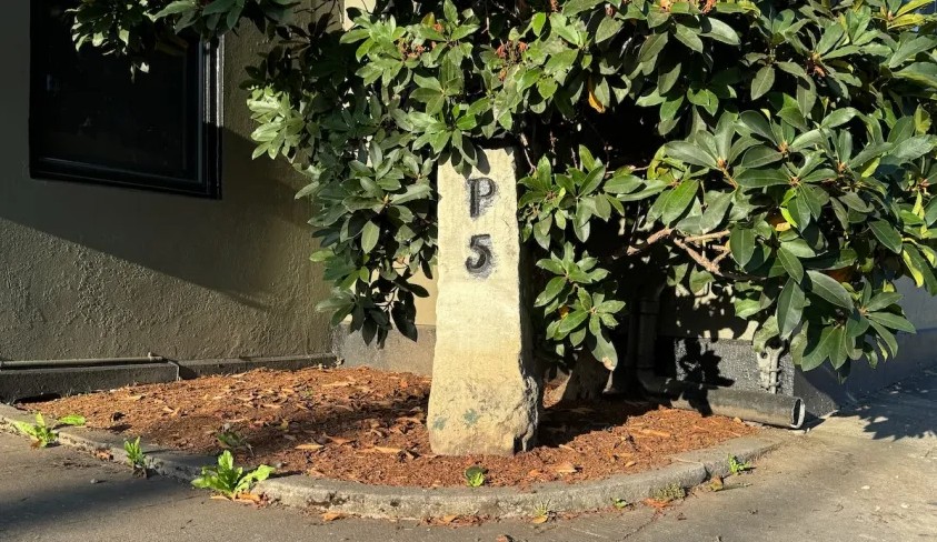
The Original Stone Didn't Survive Untouched
The marker visitors see today isn't exactly the same one surveyors originally used.
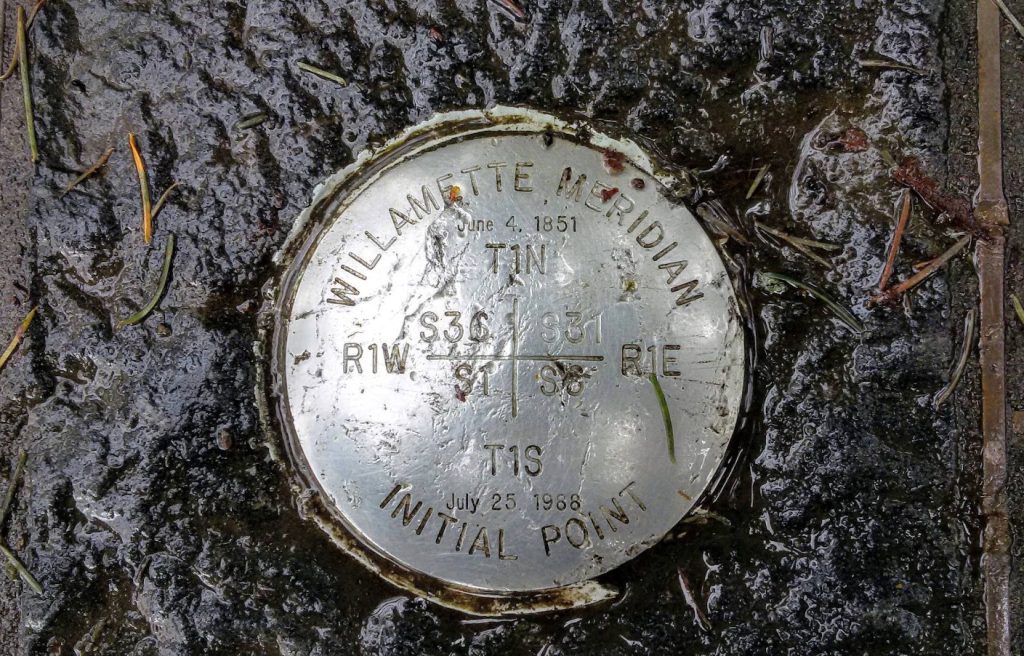
The first marker was only a cedar stake. Later, in 1885, it was replaced with a stone obelisk. Unfortunately, the site became a repeated target for vandalism over the years. By the 1980s, enough damage had occurred that officials replaced it with a stainless steel marker and restored the surrounding area.
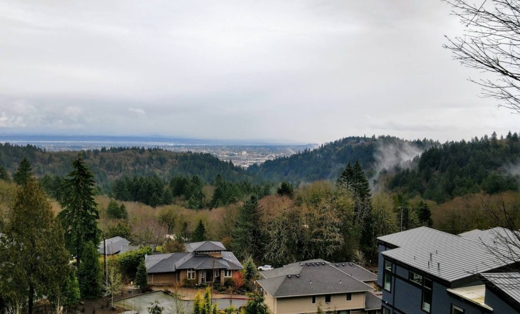
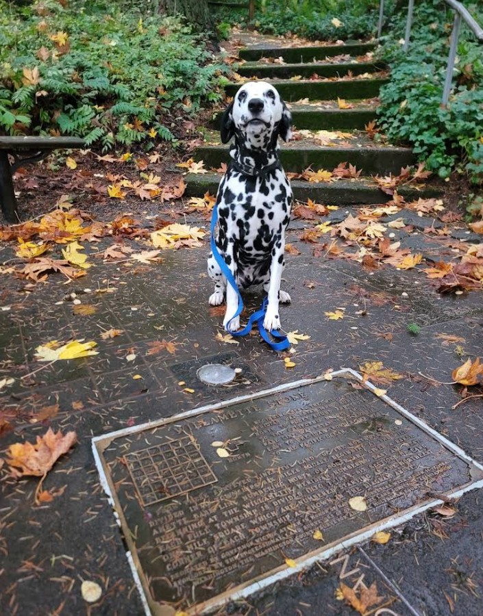
Today the site is preserved as the Willamette Stone State Heritage Site.
It's surprisingly small and surprisingly easy to miss.
No giant visitor center.
No crowds.
No flashy signs announcing you've arrived at one of Oregon's most important historic places.
Just a quiet patch of forest where history quietly changed everything.
Why This Tiny Marker Matters So Much
It's easy to look at the Willamette Stone and think, That's it?
No towering monument.
No dramatic architecture.
No grand staircase.
But maybe that's exactly what makes it special.
The Willamette Stone represents a different kind of Oregon history.
Not battles.
Not politics.
Not famous names.
Instead, it marks the beginning of order on a vast landscape. It helped transform wilderness and territory into communities, farms, roads, and eventually the state millions of people call home.
Without it, Oregon's development would have looked very different.
This tiny stone became the point from which an entire region measured itself.
And to be completely honest, that's pretty incredible.
Know Before You Go To The Willamette Stone State Heritage Site
- Located in the Portland West Hills near Skyline Boulevard
- Roughly 4 miles west of downtown Portland
- Adjacent to Mt. Calvary Cemetery
- Completely free to visit
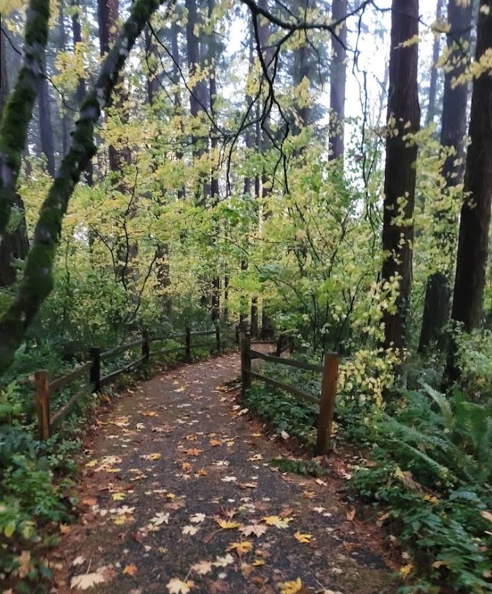
- Short walk through a wooded area to reach the marker
- Small site, perfect as a quick historical stop or add-on adventure while exploring Portland's scenic hills
Next time you're in Portland, you could visit the usual places. The food carts, the bridges, the rose gardens.
Or you could step into the woods and stand on the exact spot where Oregon started drawing the lines.
Because sometimes the places that changed history the most are also the easiest to overlook.