The Cascade-Siskiyou National Monument is an Oregon gem that could take you years to fully explore. Described as an ecological wonderland, this monument features a varied landscape with three different mountain ranges for you to hike, making this a worthy destination for adventure. One of the most popular places to hike in the monument is the historic Pilot Rock, which offers incredible 360 degree views of the monument from the top.
The Cascade-Siskiyou National Monument
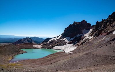
There are so many incredible views to discover in the Cascade-Siskiyou National Monument. Photo by the Bureau of Land Management via Flickr CC2.
Hiking, fishing, snowmobiling, camping and bird watching are just a few of the popular activities in this 112,000 acre national monument. The Cascade-Siskiyou National Monument was established in 2000, and later expanded in 2017.
Back country camping in the Soda Mountain Wilderness in the Cascade-Siskiyou National Monument. Photo by the Bureau of Land Management via Flickr CC2.
The monument sits on the Cascade, Siskiyou, and Klamath mountain ranges on the Oregon-California border, with an elevation range from 2,100 feet to 6,100 feet. Each of these mountain ranges is distinct and special in their own way, and lends to the ecological diversity of the area.
The high deserts of the Great Basin and temperate rain forests of the Pacific Coast converge here, making this the perfect spot to explore.
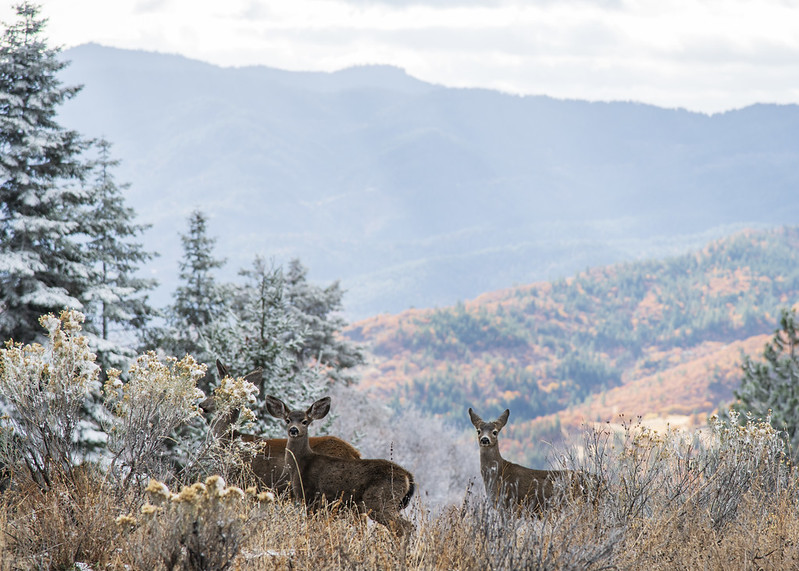
Deer on the hike to Pilot Rock. Photo by Kyle Sullivan on the Bureau of Land Management Flickr CC2.
Some of the wildlife you may see in the monument are deer, mountain lions, eagles, bears, small mammals and songbirds.
Hiking To Pilot Rock - Two Trails You Can Take
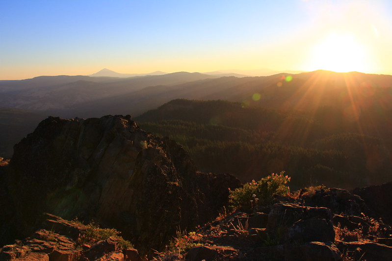
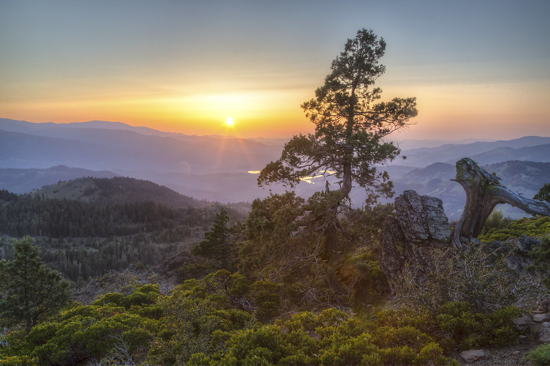
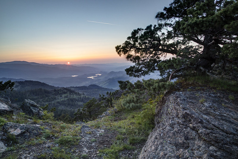
Sunrise from Pilot Rock. Photo by the Bureau of Land Management via Flickr CC2.
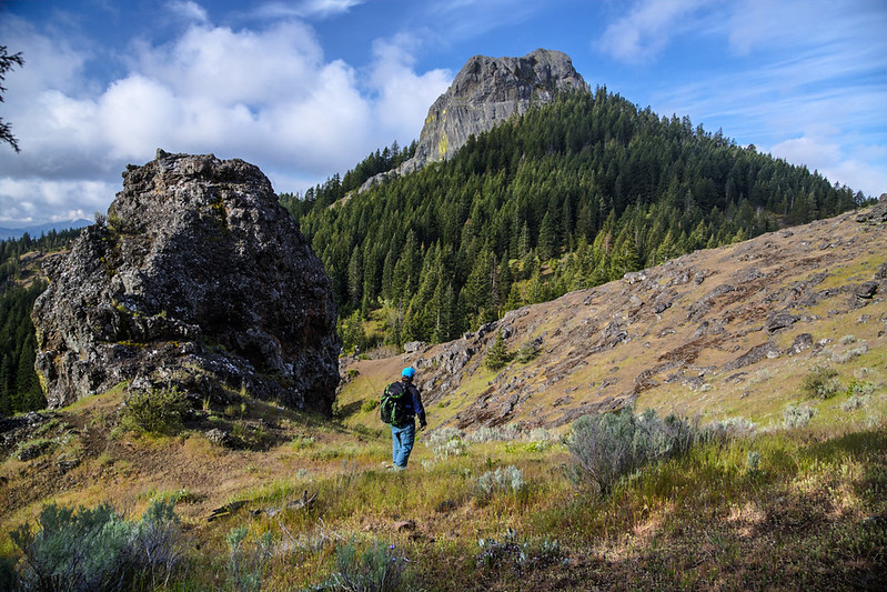
There are two routes you can take to Pilot Rock. The first is the Pacific Crest Trail, which is a longer 8.8 mile hike rated as hard. The second option is to hike in via the Pilot Rock Trail, which is 2.8 miles.
The Pilot Rock trail is moderately trafficked and is an out and back type trail. This trail is rated as hard, mainly because of the climb at the end of the trail to reach the very top of Pilot Rock. Dogs are allowed but should be kept on a leash. It should be noted that dogs will not be able to make the last leg of the trail to the top of the rock.
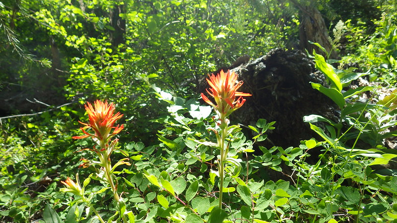
Wildflowers in the Cascade-Siskiyou National Monument. Photo by the Bureau of Land Management via Flickr CC2.
If you want to avoid snow on the trail and road, you should wait until May for the snow to melt. Most people hike the trail from May to October. The trail will have wildflowers from spring to the first part of summer, though it's also an excellent rainy day cold weather hike as long as you aren't planning on climbing to the summit of Pilot Rock. This trail has an 810 foot elevation gain from the trailhead.
Directions To Pilot Rock Trailhead
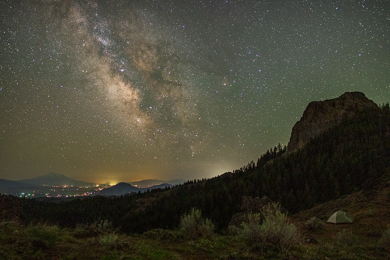
Night time view of Pilot Rock. Photo by Kyle Sullivan on the Bureau Of Land Management Flickr CC2.
To get to the Pilot Rock trailhead, you'll take I-5 south from Medford or Ashland to Exit 6. Heading south follow Old Highway 99 for 2 miles, then turn left onto Pilot Rock Road 40-2E-33. The trailhead will be located two miles east of Old Highway 99. You will stay left. One mile down the road you'll cross the Pacific Crest Trail, but keep going, as the trailhead is two miles down this road.
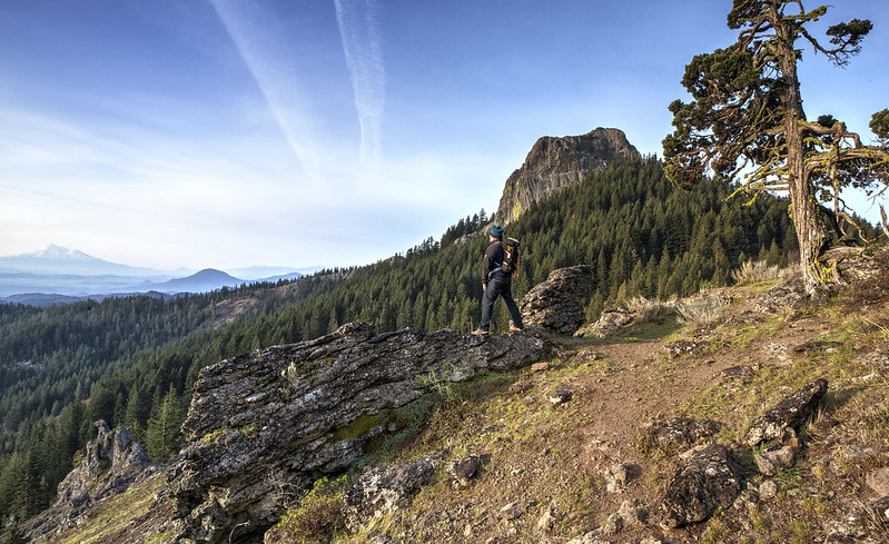
Hiking to Pilot Rock. Photo by the Bureau of Land Management via Flickr CC2.
To reach the trailhead on this road, you'll need a vehicle with higher clearance. Vault Toilets are available at the trailhead.
Hiking The Pilot Rock Trail
Hiking to Pilot Rock. Photo by the Bureau Of Land Management via Flickr CC2.
From the trailhead you'll hike about .8 miles before you intersect the Pacific Crest Trail. Follow the PCT for 300 yards. At this spot you can continue on the PCT or hike to the base of Pilot Rock.
At the base of Pilot Rock there's a gully. People will tell you it's a 'sketchy scramble' to the top of this gully to reach the summit, but it's less of a scramble and more of a climb up a rock face, which is not suitable for children, and not possible if you have a dog with you.
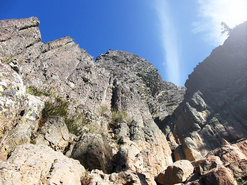
Pilot Rock Scramble to the summit. Photo by the Bureau of Land Management via Flickr CC2.
This area is steep and has loose rock and exposure to the wind and sun. To be clear, we do not recommend climbing to the top as it can be dangerous, however, the views from the top can be tempting, and it's important to know which path to take if you do climb to the top. One path looks less sketchy but will lead you to a dangerous ledge. The video below shows you exactly which of the two paths you should take to get to the top of Pilot Rock:
Pilot Rock History
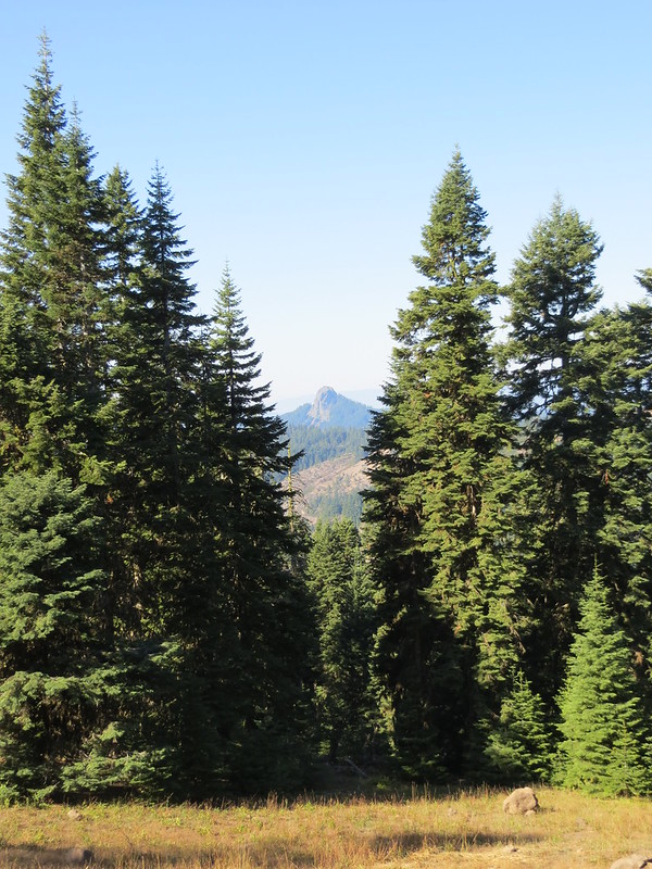
Pilot Rock is easily spotted from the distance, making it the perfect waymark for pioneers traveling the Applegate Trail. Photo by the Bureau of Land Management via Flickr CC2.
Pilot Rock is a volcanic plug, meaning it's what remains of a volcanic feeder vent after the volcano itself has eroded away.
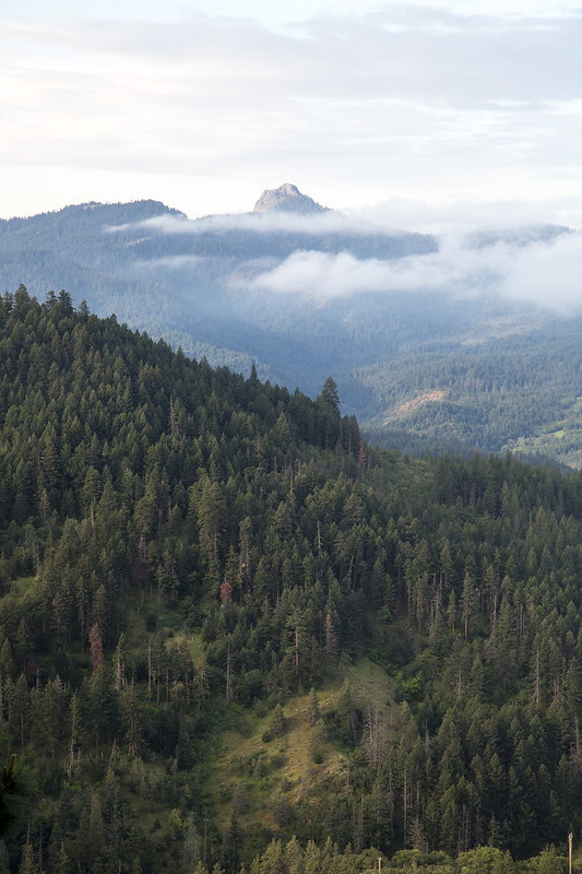
Pilot Rock towers in the distance. Phot by the Bureau of Land Management via Flickr CC2.
The Takelma people called Pilot Rock "Tan-ts'at-seniptha" or "Stone Standing Up." Later on a U.S. Navy Lieutenant named it "Emmons' Peak" after himself in 1841. Finally the volcanic plug became commonly known as Pilot Rock by emigrants on the Applegate Trail in the 1850's as it was an easily recognizable feature towering over the landscape, and could 'pilot' them in the right direction to Siskiyou Pass.
Cascade-Siskiyou National Monument And Pilot Rock Information And Tips
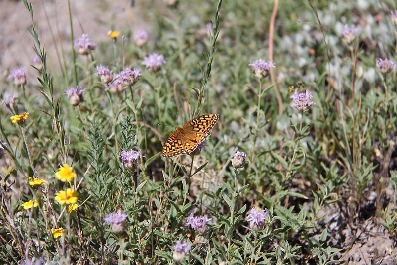
Butterflies and wildflowers in the Soda Mountain Wilderness. Photo by the Bureau of Land Management via Flickr CC2.
- When hiking to Pilot Rock, please follow the seven principles of Leave No Trace to keep Oregon's natural wonders and trails beautiful and pristine. In recent times hikers have littered, left human or dog waste on the side of many trails in Oregon, or vandalized natural formations. This has caused the state to require permits into various wilderness areas, or close some trails off entirely. By following Leave No Trace, you can help keep public lands open for hiking.
- Hiking and climbing are at-your-own-risk activities.
- Take all the food and water you need.
- Let someone know where you're going and when you plan to return. Hike with a friend when possible.
- Never hike or climb beyond your abilities.
- Plan for inclement weather. At high elevations, even on a nice day you can get low temperatures and snow. Always wear appropriate clothing and shoes for hiking and inclement weather.
- Thoroughly research your trail and destination before you go and be sure it's open before you make the trip.
Views of the Cascade-Siskiyou National Monument. Photo by the Bureau of Land Management via Flickr CC2.
For more information about the Cascade-Siskiyou National Monument, see the official BLM page here.
For more information on the Pilot Rock Trail, see the BLM PDF here, and the Pilot Rock All Trails here.
Have you hiked to Pilot Rock in southern Oregon? What's your favorite trail to hike in the Cascade-Siskiyou National Monument? Let us know and tag the friends and family you want to go with!