Most Oregonians know the name of at least one volcano in our state: Mt. Hood, Mt. Mazama (Crater Lake National Park), or perhaps Newberry Volcano in Bend. One nearby you may not have heard about is Axial Seamount, a huge underwater volcano 300 miles off the coast of Oregon. Scientists have been studying Axial Seamount for years, but this summer they took a voyage out to sea to 3D map the volcano in all its glorious detail.
Axial Seamount - One Of The Most Studied Submarine Volcanoes On Earth
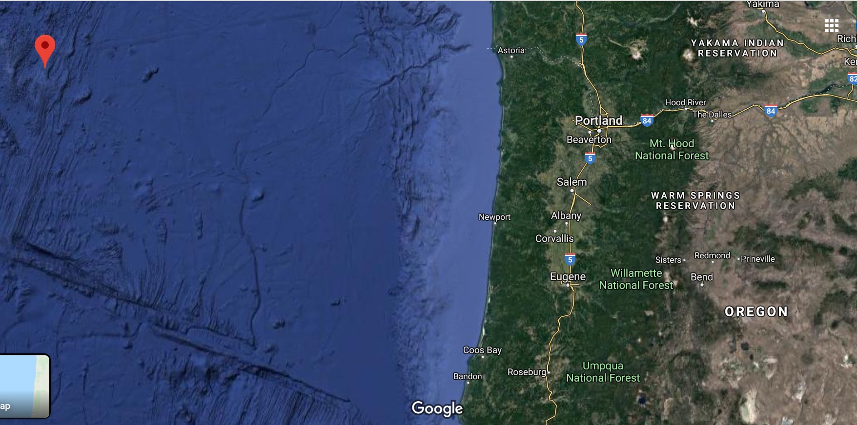
Axial Seamount is pinpointed in red on this Google Map.
Because Axial Seamount is so close to land (though far enough away that when it does erupt again it poses almost zero threat to people), it's become one of the most studied underwater volcanoes on earth. Scientists study Axial Seamount in hopes of being able to predict when it will erupt, but also to help understand other volcanoes that are closer to populated areas that do pose a threat.
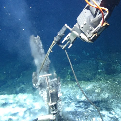
ROV Jason sampling a hydrothermal vent inside Axial's caldera. Photo via PMEL Earth-Ocean Interactions Program
Axial Seamount is currently the most active submarine Volcano in the North East Pacific Ocean. It sits on the mid-ocean ridge separating the Juan de Fuca plate and Pacific Plate, and rises to 1,400 meters below sea level. It has recorded eruptions in 1998, 2011, and 2015. Axial Seamount's base is large enough to cover Austin Texas and it's main magma reservoir is two-thirds the length of Manhattan.
The World's First Underwater Volcano Observatory
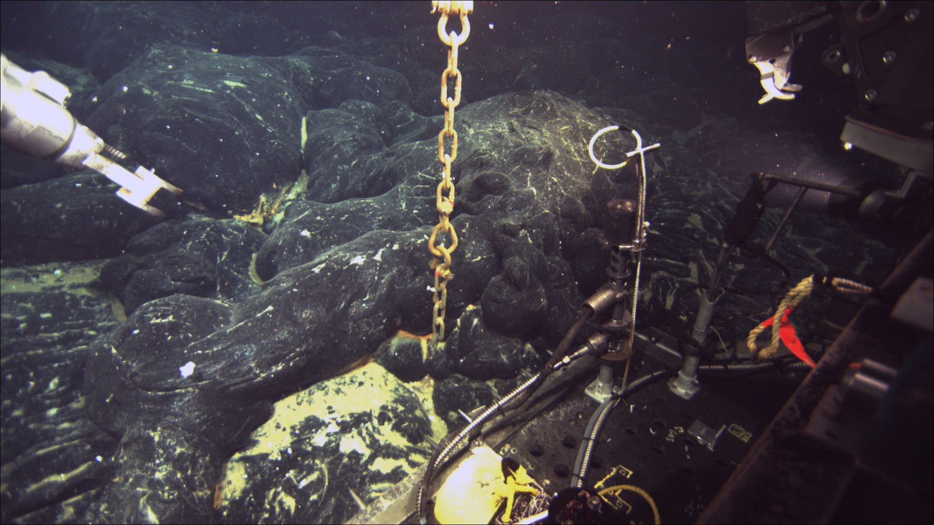
A chain still attached to an ocean-bottom hydrophone comes directly out of the seafloor at Axial Seamount where a lava flow erupted in 2011 has buried the instrument 5 feet below once molten rock. Image credit: Bill Chadwick, Oregon State University, Copyright Woods Hole Oceanographic Institution. Photo via the Oregon State University Flickr CC2.
Axial Seamount is home to the world's first underwater volcano observatory, which is called NeMo (New Millennium Observatory). NeMo studies the interactions between submarine volcanic activity and seafloor hot springs, and assesses the impact of eruptions and documents ongoing changes in Axial's summit caldera.
Axial is also a key node on a new Cabled Array, which provides power and bandwith as well as two-way communication to scientific sensors and arrays on the seafloor and throughout the water column. The Cabled Array has a shore station in Pacific City Oregon.
A Month Long Journey At Sea
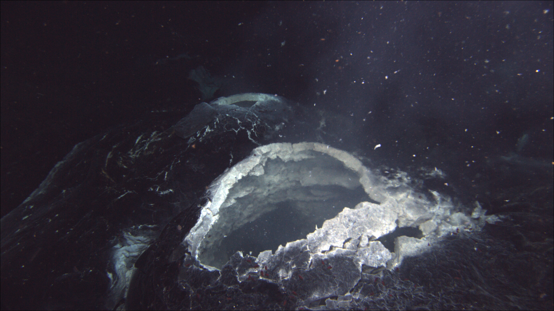
A hydrothermal vent spews hot water and bacteria that are blooming in the chemical-rich hot-spring water, showing that the lava flow that erupted in 2011 at Axial Seamount is still cooling a year later. Image credit: Bill Chadwick, Oregon State University, Copyright Woods Hole Oceanographic Institution. Photo via Oregon State University Flickr CC2.
In July and August of this year (2019), the National Science Foundation sent a 235-foot research vessel named Marcus G. Langseth out to sea to study and 3D map Axial Seamount. The ship was operated by Columbia University's Lamont-Doherty Earth Observatory. Scientists spent 33 days charting Axial Seamount's interior to improve scientists understanding of submarine volcanoes.
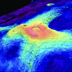
3D image of Axial Seamount bathymetry. Photo via PMEL Earth-Ocean Interactions Program.
A lot was at stake since it was an expensive expedition. The ship towed long cables with instrument clusters behind it, and those cables could tangle, drift, or even snap off if the ship wasn't steered carefully or stopped too abruptly. Tangled or broken lines or lost instruments could mean the end of the expedition. While there were some instrument and cable malfunctions and other setbacks, the trip was a success, and the volcano was successfully mapped. You can read an in-depth report on the research trip reported on by the NY Times here.
The volcano is predicted to erupt again between 2020 and 2024. There's an eruption forecast blog here. You can also learn more about Axial Seamount from the PMEL Earth-Ocean Interaction Program here.