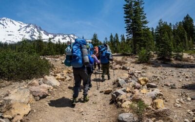
There is a moment on the hike toward Broken Top when Central Oregon seems to change worlds.
The familiar forest begins to thin. Meadows open beneath an enormous sky. The ground becomes lighter, dustier, and increasingly volcanic. Ahead, the mountain rises in jagged layers of rust, charcoal, purple, and faded red.
Then, after one final climb over loose rock, the lake appears.
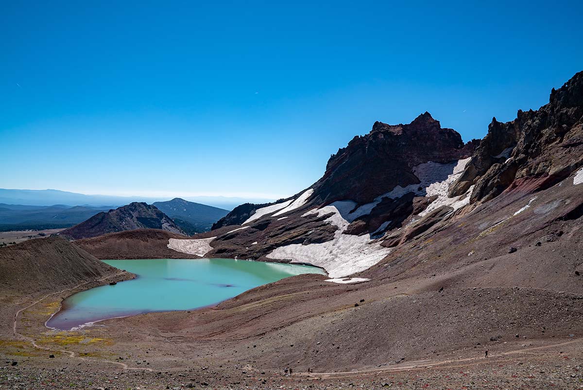
No Name Lake rests inside the eroded bowl of Broken Top, surrounded by steep volcanic walls and lingering patches of snow. Its water can glow pale turquoise, milky green, or robin’s-egg blue depending on the light, the season, and how much ice remains above it.
It is one of those Oregon landscapes that looks almost impossible in person.

Do you love Oregon?
Sign up for monthly emails full of local travel inspiration and fun trip ideas. In each newsletter we'll share upcoming events, new things to do, hot dining spots and great travel ideas.
The lake is beautiful enough to be the final destination, but the journey there is every bit as memorable. Depending on the route, hikers may pass Todd Lake, shaded forest, open grasslands, wildflower meadows, small creeks, waterfalls, whitebark pines, pumice fields, snowbanks, and broad views toward Mount Bachelor and the Three Sisters.
Broken Top is also a hike that demands planning.
There are two primary starting points, and they offer completely different experiences. The easier drive produces a long and demanding day on foot. The shorter hike requires traveling over a rough Forest Service road that can punish vehicles and may remain inaccessible well into summer.
Permits are required during the busiest season. Snow can linger late. Smoke may arrive before fall. Trail junctions can be confusing, and the final approach becomes steep, exposed, and loose underfoot.
This is not a casual stroll to a roadside lake.
For hikers who prepare carefully, however, Broken Top delivers one of the most distinctive adventures in the Oregon Cascades.
The original guide described a roughly 15.2-mile round trip from Todd Lake with about 2,880 feet of elevation gain, or a much shorter trip of approximately 5.5 miles from the upper Broken Top Trailhead. Actual mileage can vary with the route, GPS recording, parking location, and whether hikers continue beyond No Name Lake to the higher ridgeline viewpoint.
Broken Top Hike at a Glance
Location: Three Sisters Wilderness west of Bend, near the Cascade Lakes Scenic Byway.
Main destination: No Name Lake beneath the eastern side of Broken Top.
Long route: Approximately 15 miles round trip from the Todd Lake area.
Short route: Approximately 5.5 to 6 miles round trip from the upper Broken Top Trailhead.
Difficulty: Challenging from Todd Lake due to distance, elevation, exposure, and loose terrain. Shorter from the upper trailhead, but still steep and rugged.
Permit season: June 15 through October 15 for quota-controlled day use at both the Todd and Broken Top trailheads. Current day-use permits are released at 7 a.m. Pacific Time through rolling 10-day and two-day booking windows.
Best general season: Usually late July through early October, depending on road access, snow, wildfire conditions, and autumn weather.
Important vehicle warning: Recreation.gov states that the Broken Top and Crater Ditch trailheads may not become accessible by vehicle until late July or early August. The approach roads require four-wheel drive and high clearance.
A Mountain That Looks Like It Has Been Broken Open
Broken Top does not have the smooth, symmetrical profile people often associate with Cascade volcanoes.
That is part of what makes it so striking.
The mountain is an ancient, heavily eroded stratovolcano southeast of the Three Sisters. Glaciers carved deeply into it, removing much of its original cone and exposing colorful layers that once existed inside the volcano.
Those layers help create the unusual scenery around No Name Lake.
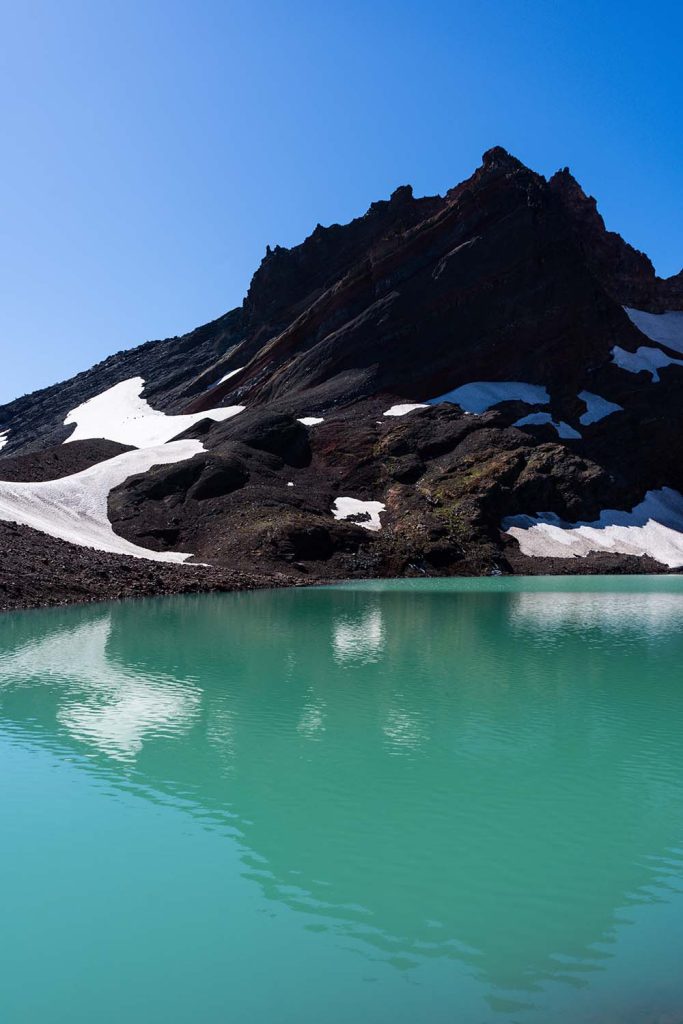
Instead of a simple wall of gray stone, hikers see bands of red, purple, brown, black, orange, and pale volcanic material. Snowfields cling to gullies. Dark ridges cut across lighter pumice slopes. The entire crater looks unfinished, as though erosion has opened the mountain for inspection.
Broken Top rises to 9,177 feet, but most people completing the popular No Name Lake hike are not climbing to the true summit. Broken Top’s actual summit routes involve serious exposure and advanced scrambling or climbing, with sections commonly described as Class 4 or lower Class 5 terrain. That is a mountaineering objective, not an ordinary extension of the lake trail.
The hike described here leads to No Name Lake and, for prepared hikers, a higher saddle or ridgeline overlook beyond the water.
That distinction is important.
Reaching the lake is a difficult hike. Continuing to the popular overlook adds loose terrain, exposure, and elevation. Neither should be confused with summiting Broken Top itself.
Why No Name Lake Has Become So Popular
Central Oregon has no shortage of mountain lakes, but No Name Lake feels different.
It is not tucked beneath a quiet wall of evergreen forest. There are no gentle beaches, developed picnic sites, or easy parking areas beside the water.
The lake sits high in an austere volcanic basin where the landscape feels raw and exposed.
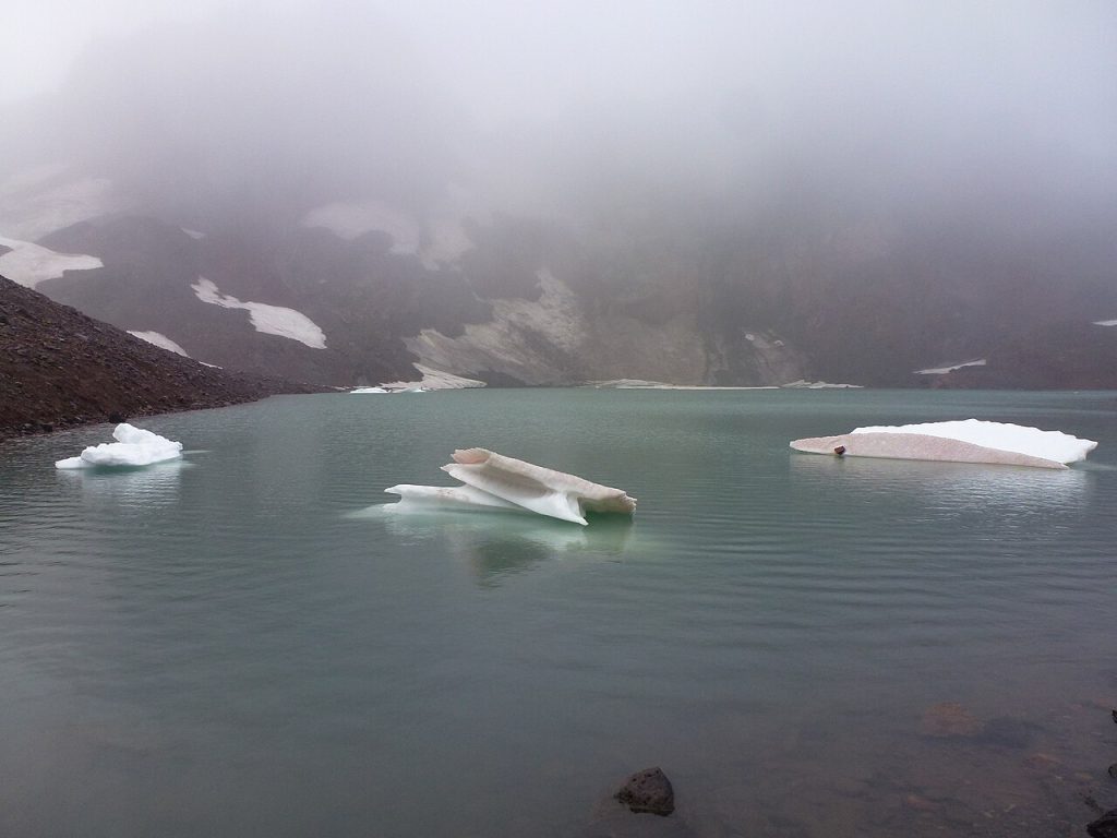
Its color is the first thing most hikers notice. Fine glacial sediment suspended in the water can create shades ranging from pale green to luminous blue. When snow and ice remain in the basin, pieces may break free and float across the surface during summer.
Above the lake, the shattered remains of Broken Top rise dramatically. Below it, Central Oregon opens into an enormous sweep of forest, lava, buttes, lakes, and distant mountains.
The setting offers the kind of visual contrast photographers dream about.
Blue water meets red volcanic rock. White snow lies beside black scree. Green alpine plants cling to ground that otherwise appears barren.
It is easy to understand why images of the lake spread quickly online.
Popularity, however, comes with consequences.
The Three Sisters Wilderness now uses a quota permit system at heavily traveled trailheads to reduce damage and manage visitation. Recreation.gov explains that the system was established to protect alpine meadows, lakes, old-growth forest, streams, and other sensitive wilderness landscapes for the future.
No Name Lake may look resilient beneath its fortress of rock, but alpine environments are fragile. Plants grow slowly, soils recover poorly from repeated trampling, and waste left behind can remain far longer than visitors expect.
The privilege of seeing this place comes with an obligation to treat it carefully.
Two Ways to Reach Broken Top
Planning the Broken Top hike begins with a decision.
Would you rather endure a long hike or a brutal road?
The Todd Lake approach offers a relatively straightforward drive from the Bend area followed by a full day of hiking. It is the better choice for most ordinary passenger vehicles and for hikers who want the complete journey through forest and meadows.
The upper Broken Top Trailhead cuts many miles from the walk, but reaching it requires driving rough, unmaintained Forest Service roads. High clearance and four-wheel drive are not casual suggestions here. Current federal permit information specifically warns that Roads 4600-370 and 4600-380 require both.
The short route may look dramatically easier when comparing mileage, but the road can be slow, stressful, and damaging to an unsuitable vehicle.
There is no perfect option.
One route tests your legs.
The other tests your suspension.
The Long Route From Todd Lake
For many hikers, Todd Lake is the most practical starting point.
The trailhead is reached from the Cascade Lakes Highway west of Bend, beyond the Mount Bachelor area. From the parking area, hikers begin near Todd Lake before following a connected network of trails toward Broken Top.
The traditional route uses Todd Trail #34, Soda Creek Trail #11, and Broken Top Trail #10 before leaving the maintained trail system for the well-traveled path leading toward No Name Lake.
The source route begins with about 2.4 to 2.5 miles on Todd Trail. At the junction, hikers turn onto Soda Creek Trail and continue through open terrain before connecting with the official Broken Top Trail. Farther along, the route reaches the path used by hikers arriving from the upper trailhead.
The first several miles can feel deceptively gentle.
Forest shade surrounds the early trail. The terrain rolls rather than climbs aggressively. Small streams cross the route, often with rocks positioned for careful steps.
As the trees begin to open, the scenery changes.
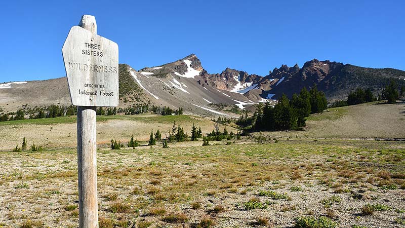
Dry meadows stretch beneath the Cascade peaks. Mount Bachelor becomes increasingly prominent behind the trail, while Broken Top grows larger ahead. During a good wildflower season, the open country can be filled with lupine, paintbrush, asters, and other high-elevation blooms.
This middle portion of the hike is one reason to choose the longer route.
Driving to the upper trailhead may save time, but it also skips much of the gradual transition from forest to volcanic alpine terrain.
From Todd Lake, the mountain reveals itself slowly.
The trail gives you time to watch the landscape change.
Do Not Underestimate the Return Trip
A 15-mile mountain hike is demanding even when much of the outward journey feels moderate.
The final climb to No Name Lake consumes a significant amount of energy. Hikers then face the same miles back to Todd Lake, including long stretches that may feel surprisingly different late in the afternoon.
Feet begin to ache. Water supplies shrink. The pleasant meadow crossing from morning can become hot and exposed after the sun has moved overhead.
This is why an early start matters.
Beginning around sunrise provides more time for rest, navigation, photography, lunch, and unexpected delays. It also reduces the chance of finishing in darkness or getting caught high on the mountain during afternoon weather.
Hikers should honestly evaluate how they handle long-distance days.
A person who regularly completes six-mile hikes may be physically fit, but 15 miles at elevation over loose volcanic ground is a different experience. The distance alone makes the Todd Lake route a serious undertaking.
The lake should be treated as the halfway point, not the finish.
Reaching the water feels triumphant. Your vehicle is still many miles away.
The Short Route From the Upper Trailhead
The upper Broken Top Trailhead dramatically reduces the walking distance.
From there, the route begins among pumice, sparse trees, and open volcanic country. Broken Top is already close enough to dominate the horizon.
The appeal is obvious.
Instead of spending hours walking from Todd Lake, hikers begin near the point where the longer route finally starts climbing in earnest. This makes it possible to reach No Name Lake more quickly and leaves more time for exploring the basin or continuing to the higher overlook.
The tradeoff is Road 370.
Older Oregon hiking guides have described it in legendary terms, and not affectionately. The road is rocky, rutted, narrow, and slow. Conditions can change after winter snow, runoff, fallen trees, maintenance work, or heavy summer use.
Current federal guidance warns that the upper trailhead may remain inaccessible until late July or early August. Seasonal snowpack determines when the road opens, and some early-season permits may not be offered when access remains blocked.
A standard sedan should not be treated like a high-clearance four-wheel-drive vehicle because the hike looks appealing.
Turning around after reaching the roughest section may be difficult. Vehicle damage this far from pavement can transform an enjoyable adventure into an expensive recovery problem.
Even with an appropriate vehicle, expect the road to take time.
Drive slowly. Give oncoming vehicles room when possible. Avoid creating new tracks around obstacles, which widens the road and damages surrounding vegetation.
The short hike is earned before anyone steps onto the trail.
The Trail From the Upper Starting Point
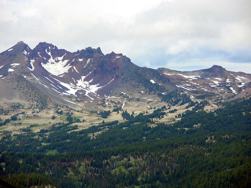
From the upper trailhead, the route crosses open pumice country dotted with wind-shaped trees.
A major junction appears relatively early. The Green Lakes direction continues one way, while the commonly used route toward No Name Lake climbs toward Broken Top.
Some portions of the route are unofficial and may not be signed clearly.
That is one reason downloading an offline map is essential. Cell service should not be expected, and social paths can make the correct direction less obvious than photographs suggest.
The trail crosses a creek and passes small waterfalls spilling over exposed rock. Whitebark pines appear higher on the mountain, shaped by wind, snow, and a short growing season.
The scenery becomes more rugged with each step.
Soil gives way to loose stone. Meadows narrow. Snowfields may linger against slopes even when Bend is enduring summer heat.
Eventually, the route reaches the moraine beneath the crater. The final approach follows the lake’s outlet and climbs through increasingly loose volcanic material.
This is where the hike stops feeling gentle.
The grade steepens. Dust and small rocks slide beneath boots. Progress slows, especially for hikers already carrying fatigue from the Todd Lake route.
Then the water finally appears.
Arriving at No Name Lake
The first view of No Name Lake can stop a conversation immediately.
After miles of forest, meadow, dust, and climbing, the brilliant water seems almost unreal.
Broken Top surrounds the basin in a semicircle of jagged cliffs. Eroded volcanic layers color the slopes above. Snow may cling beneath the darker walls, and pieces of ice sometimes remain near the shoreline well into summer.
The lake changes throughout the season.
Early visitors may encounter a basin still dominated by snow and ice. During midsummer, floating chunks can remain on the water. By early fall, much of the seasonal snow may have disappeared, revealing more of the colored rock and loose moraine.
Wind is common.
A warm day below can feel cold beside the lake, particularly when gusts move across the basin. Sweat from the climb cools quickly once hikers stop moving.
This is the moment to put on a layer, eat, drink, and assess the conditions honestly.
The lake is a worthy turnaround point.
Nobody should feel obligated to climb higher simply because other hikers continue around the shore.
The Ridgeline View Beyond the Lake
Prepared hikers often follow the path along the right side of No Name Lake and climb toward the saddle or ridgeline above the basin.
This extension is relatively short compared with the full approach, but it should not be treated casually.
The path gains several hundred feet over loose and exposed terrain. Wind can become stronger. Snowfields may cross the route. A slip can have more serious consequences than it would on the lower trail.
The reward is one of the broadest mountain views in Central Oregon.
From the high point, hikers can look back toward No Name Lake and into Broken Top’s eroded crater. In other directions, the horizon opens toward South Sister, Middle Sister, North Sister, Mount Washington, Three Fingered Jack, Mount Jefferson, Mount Bachelor, and miles of the surrounding Cascades when visibility is clear.
The landscape becomes easier to understand from above.
No Name Lake is revealed as one small piece of a much larger volcanic complex. Ridgelines, lava flows, glaciers, lakes, and forests stretch across the horizon.
This popular overlook is sometimes casually called a summit in older descriptions, but it is not the true summit of Broken Top.
The actual summit is a technical climbing objective with significant exposure. Ordinary hikers should turn around at the established ridgeline viewpoint rather than continuing onto terrain requiring mountaineering judgment and skills.
Broken Top Permit Requirements
Permits are not an optional detail for this hike.
Day-use permits are required at both the Todd Trailhead and Broken Top Trailhead from June 15 through October 15.
Recreation.gov currently releases day permits at 7 a.m. Pacific Time through two rolling windows, one 10 days before the hiking date and another two days before. Permits are valid only for the trailhead and date shown. They are non-transferable, and the named group leader must remain with the group. A digital PDF is acceptable as proof, but downloading it before leaving service is wise.
Overnight trips use a separate permit.
Central Cascades Wilderness overnight permits are required for all overnight visitors in the Three Sisters, Mount Washington, and Mount Jefferson wilderness areas from June 15 through October 15. A portion of the overnight quota becomes available on the first Tuesday in April, while the remaining spaces are released seven days before the trip. Recreation.gov lists a nonrefundable $6 reservation fee for an overnight permit.
A day permit does not authorize camping.
An overnight permit does not need to be paired with a separate day permit.
Permit rules, booking windows, fees, and trailhead access can change, so hikers should confirm the latest details before every trip rather than relying on an old screenshot or saved article.
The Best Time to Hike Broken Top
Broken Top has a much shorter practical hiking season than the warm weather in Bend might suggest.
July through early October generally provides the best opportunity, but each part of that window has advantages and complications.
July
July brings long daylight and fresh alpine scenery, but snow can linger across the upper route. The Forest Service warns that the road to the Broken Top Trailhead may not become passable until late July or early August.
Creek levels may be higher, snowfields may obscure the path, and the final climb can require more careful route-finding.
August
August often provides the clearest access to the upper trailhead and the warmest conditions. Wildflowers may still fill sections of the meadows, particularly earlier in the month.
This is also prime wildfire and smoke season.
Hot weather below does not guarantee warmth beside the lake, and afternoon thunderstorms remain possible in mountain country.
September
September can be an excellent time for Broken Top.
Mosquitoes are often less troublesome, daytime temperatures become more comfortable, and the air can feel crisp and clear.
The disadvantages are shorter daylight, colder mornings, stronger wind, and the possibility of an early snowstorm.
Early October
Early October can bring beautiful light, quieter trails, and dramatic fall weather. It can also bring ice, snow, road closures, and rapidly changing conditions.
Anyone hiking late in the permit season should be prepared for winter-like weather at elevation even when conditions remain mild in Bend.
The original guide recommended roughly July through mid-October while emphasizing that snow frequently remains at higher elevations outside the heart of summer.
Wildfire Smoke Can Change the Entire Experience
Central Oregon’s fire season overlaps with the best hiking season.
A trail can remain technically open while smoke makes the hike unpleasant or unhealthy.
Broken Top is especially vulnerable to reduced visibility because its expansive mountain views are a major part of the experience. On a smoky day, the Three Sisters may disappear behind haze. The crater walls may look muted, and exertion can become far more difficult.
Check active fires, air quality, smoke forecasts, road conditions, and Forest Service alerts before leaving.
Do not assume conditions in Bend will match the wilderness.
Smoke can settle unevenly across the mountains. Wind may clear one area while pushing thick haze into another. Conditions can also change during the day.
The Recreation.gov permit pages warn that closures and partial access restrictions may affect wilderness travel. Visitors are responsible for reviewing current Forest Service alerts before using a permit.
A permit is not a guarantee that the hike will be safe or enjoyable.
Sometimes the right decision is to save Broken Top for another day.
Weather Changes Quickly Above the Trees
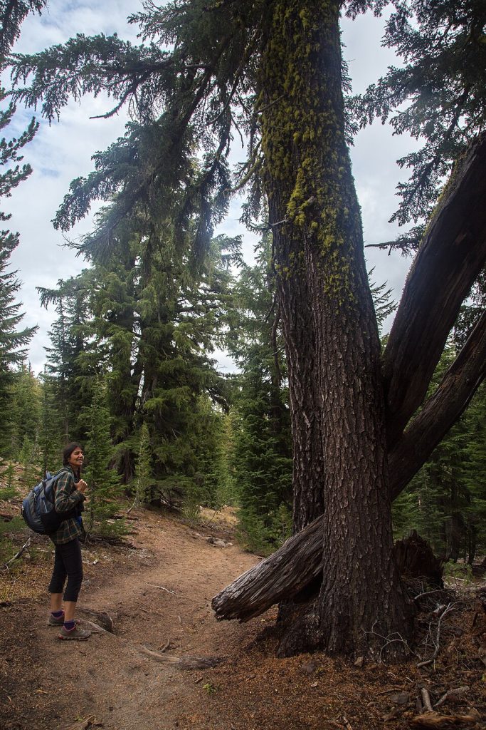
The route to No Name Lake becomes increasingly exposed.
Once hikers leave the forest, there is little protection from sun, wind, rain, hail, or sudden temperature changes.
Central Oregon is known for blue skies, but mountain weather does not always respect the forecast below.
A clear morning can become cloudy. Warm meadows can lead to a freezing ridgeline. Wind can turn a comfortable lunch stop into a shivering one.
Carry more clothing than the parking-lot temperature seems to require.
A lightweight insulating layer and wind-resistant shell can make an enormous difference. Gloves and a warm hat are reasonable additions, particularly in September and October.
Thunderstorms present another concern.
No Name Lake and the ridgeline above it offer little shelter. If dark clouds begin building, thunder is heard, or lightning becomes visible, do not continue upward simply because the destination appears close.
The mountain will still be there another day.
Water, Sun, and High-Elevation Exposure
The Broken Top route includes creek crossings, but natural water should never be assumed safe to drink untreated.
Carry enough water for a long, exposed day or bring a reliable filtration or purification system. Remember that small seasonal sources can shrink or disappear later in summer.
The Todd Lake route is long enough that many hikers will need more water than they normally carry for a shorter day hike.
Sun exposure is equally important.
Open meadows, pale pumice, snowfields, and high elevation increase the amount of sunlight reaching your skin and eyes. Sunscreen, sunglasses, and a brimmed hat should be considered essential rather than optional.
Reapply sunscreen during the day.
A cool mountain breeze can disguise how much sun you are receiving.
The original guide emphasized that shade becomes limited after the early miles and recommended carrying more water than expected.
Navigation Is More Complicated Than It Looks
Broken Top is popular, and portions of the route may have a visible path.
That does not make navigation foolproof.
The Todd Lake approach uses several trail junctions before reaching the route toward No Name Lake. The upper approach also encounters forks and unofficial paths.
Snow can hide tread. Dusty social trails may lead toward viewpoints or campsites. A group ahead of you may be lost too.
Download an offline map before leaving home. Carry a charged phone or GPS device, but do not rely on electronics alone. A paper topographic map and basic navigation knowledge provide valuable backup.
Mark the trailhead location before beginning.
Pay particular attention when the Todd Lake route joins the Broken Top Trail and when leaving maintained trail for the path toward the lake.
On the return trip, familiar terrain can look surprisingly different.
Fatigue also makes navigation mistakes more likely. Check your location before uncertainty becomes a problem rather than walking farther and hoping the route becomes obvious.
What to Wear on the Broken Top Trail
Footwear needs to handle dust, rock, creek crossings, loose scree, and potentially snow.
Supportive hiking shoes may work during dry late-season conditions, but boots can provide greater protection and stability on rough terrain. Waterproof footwear is particularly useful when snow or creek levels remain high.
Trekking poles are extremely helpful.
They reduce strain during the long return to Todd Lake, improve balance on creek crossings, and provide stability on the loose climb below No Name Lake.
Microspikes may be appropriate when snow or ice remains, but they are not a substitute for judgment or mountaineering skills. Conditions can vary from soft snow to hard morning ice.
Wear clothing in layers rather than relying on one heavy garment.
A practical kit might include a moisture-wicking base layer, insulating fleece or light puffy jacket, wind or rain shell, hat, gloves, sunglasses, and sun protection.
Avoid cotton for cold or wet mountain conditions.
Once damp, it can remain uncomfortable and provide little warmth.
Hiking With Dogs
Dogs are allowed in much of the surrounding wilderness, but seasonal leash requirements apply on several popular Three Sisters trails.
Dogs must be leashed on the Todd Lake, Soda Creek, Green Lakes, Moraine Lakes, South Sister, and Crater Ditch trails from July 15 through September 15.
Even outside mandatory leash periods, owners should consider the terrain, crowds, wildlife, heat, sharp volcanic rock, and their dog’s conditioning.
A 15-mile hike over abrasive ground can damage paws. Dogs also require their own food, water, waste bags, and emergency supplies.
No Name Lake is not a good place to assume a dog can simply drink freely. Glacial water, sediment, animal waste, and other contaminants can present risks.
Keep dogs from chasing wildlife, digging, disturbing other hikers, or trampling vegetation near the lake.
Pack out all pet waste.
Camping Near Broken Top
An overnight trip can make the long Todd Lake approach more manageable, but camping comes with additional rules and responsibilities.
A valid overnight Central Cascades Wilderness permit is required during the quota season. The wilderness has no facilities, and visitors must pack out all trash while properly managing human and pet waste.
The source guide notes that camping is prohibited within one-quarter mile of No Name Lake. Hikers planning an overnight trip should confirm the current restriction boundary and choose a durable, legal campsite well away from the shoreline.
Do not build fire rings or attempt a campfire near the lake.
Current Central Cascades permit information states that campfires are prohibited above 5,700 feet, along with additional restricted destinations at lower elevations.
A backpacking stove is the practical choice for cooking.
The goal is not to find the campsite with the most dramatic Instagram view. The goal is to camp legally on a durable surface without damaging fragile vegetation or affecting other visitors.
Protecting No Name Lake
Broken Top has become a highly photographed destination, but it is still wilderness.
Stay on established and durable surfaces whenever possible. Do not cut across meadow vegetation to shorten a switchback or reach a better camera angle.
Do not move rocks to build seats, wind shelters, or campsite borders.
Do not pick wildflowers.
Do not leave food scraps, fruit peels, toilet paper, dog waste, or “biodegradable” products behind.
Swimming may look irresistible on a hot day, but remember that the water is extremely cold and the basin can be windy. Entering alpine water also disturbs a sensitive environment and can introduce sunscreen, lotion, and other substances.
Human waste requires planning. Recreation.gov states that there are no restroom facilities inside these wilderness areas and specifically reminds visitors to dispose of human and pet waste properly.
Learn the current recommended method before the hike and carry the supplies needed to follow it.
Leave No Trace is not simply a slogan here.
It is the reason places like No Name Lake have a chance to remain beautiful despite growing visitation.
A Realistic Broken Top Packing List
Every person’s kit will differ, but this hike calls for more than a small water bottle and a phone.
Carry your permit, offline map, paper map, water, filtration method, high-energy food, sunscreen, sunglasses, hat, insulating layer, weather shell, headlamp, first-aid supplies, emergency blanket, whistle, fire starter appropriate for emergencies, repair items, and a fully charged navigation device.
Add trekking poles for the loose descent.
Carry traction when snow or ice conditions warrant it.
A satellite communication device provides valuable security on a long wilderness route where cell coverage may be unreliable.
Bring a headlamp even when planning to finish well before sunset. Injuries, navigation errors, road delays, photography stops, and fatigue can all extend the day.
For the Todd Lake route, pack enough food to support many hours of steady movement.
This is not the place to discover that one granola bar was optimistic.
Planning the Day From Bend
Broken Top is close enough to Bend that it can look like a simple day trip.
Treat it like a full mountain outing instead.
Prepare your food, water, permit, offline map, and clothing the night before. Check the weather, air quality, wildfire map, road conditions, and Forest Service alerts again in the morning.
Leave early.
The drive along the Cascade Lakes corridor is beautiful, but wildlife, darkness, construction, and seasonal traffic can slow travel.
For the Todd Lake route, an early start provides the time needed for a 15-mile round trip without rushing.
For the upper trailhead, budget far more driving time than the mileage suggests. Rough-road travel can be extremely slow, and meeting another vehicle may require backing to a wider section.
Tell someone where you are going, which trailhead you plan to use, your vehicle description, and when you expect to return.
Do not change trailheads at the last minute without updating that person. Your permit is also valid only for the listed entry point.
Is Broken Top Appropriate for Beginners?
A determined beginner with good fitness, proper preparation, favorable conditions, and an experienced companion may be capable of reaching No Name Lake.
That does not make it an ideal first hike.
The Todd Lake route is long. The upper route involves difficult vehicle access. Both require navigation, high-elevation awareness, loose-terrain travel, and the ability to respond to changing weather.
Beginners should build experience on shorter Central Oregon trails before attempting Broken Top.
Learn how your body responds to eight or 10 miles before committing to 15. Practice using offline maps. Test footwear and packs on real hikes. Learn basic wilderness safety and Leave No Trace practices.
There is no prize for making Broken Top your first major trail.
Experience will allow you to enjoy the scenery instead of merely surviving the distance.
What Makes This Hike Worth the Work
Broken Top asks a lot from hikers.
The permit requires advance planning. The long route consumes most of a day. The short route requires an appropriate vehicle and patient driving. The final climb is loose, steep, and tiring.
Then the lake comes into view.
The fatigue does not disappear, but it suddenly feels connected to something.
You have walked from forest into meadow, from meadow into pumice, and from pumice into an ancient volcanic crater. Every mile has carried you farther from the familiar Central Oregon landscape and deeper into one of its strangest corners.
No Name Lake is not beautiful despite its harsh surroundings.
It is beautiful because of them.
Its color stands out because the slopes are so barren. The remaining snow looks brighter against red and black rock. The fragile plants seem more remarkable because they survive in such an unforgiving place.
Broken Top offers something more than a scenic lake.
It offers a journey through the layers of Oregon itself.
Forest, fire, ice, water, erosion, and volcanic stone all meet in one basin beneath the open Cascade sky.
Plan Your Broken Top Hike
Broken Top and No Name Lake are located in the Three Sisters Wilderness west of Bend.
Choose the Todd Lake route for easier vehicle access and a longer wilderness journey. Choose the upper Broken Top Trailhead only with a genuinely suitable four-wheel-drive, high-clearance vehicle and current confirmation that the road is open.
Secure the correct permit for your trailhead and date.
Check wildfire smoke, weather, snow, closures, and road conditions before departure.
Start early, carry navigation tools, bring more water and clothing than a casual day hike would require, and leave enough energy for the return.
Most importantly, remember that No Name Lake is not a roadside attraction.
It is a fragile alpine destination reached through demanding mountain terrain. Treat it with the care such a place deserves.
If you arrive prepared, the moment that turquoise water appears beneath the broken walls of the volcano may become one of your favorite memories in Oregon.