")
Windswept cliffs, forested ridges, and haunting ocean views are hallmarks of the Oregon coast. Experience four coastal hikes in Oregon that stir the soul and linger in memory long after the trail fades.
There’s something magnetic about the edge of the world. Where forest meets sea, Oregon’s coast offers a kind of wild beauty that can’t be contained in photographs. It’s in the salt-thick air, the glint of sunlight off waves, and the hushed reverence of old-growth trees clinging to sheer cliffs. The trails here are more than just hikes, they’re experiences you carry with you long after your boots come off back at home. From dizzying viewpoints to lush meadows brushing up against the ocean’s edge, these four unforgettable hikes capture the drama and wonder of the Oregon Coast.
God’s Thumb - An Iconic Cliffside Marvel In Lincoln City
A Trail Through Forest, Meadow, And Mist
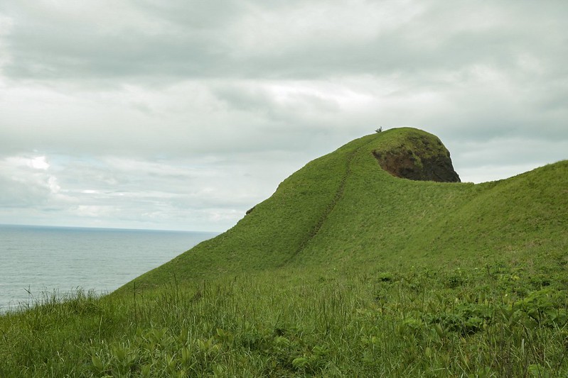
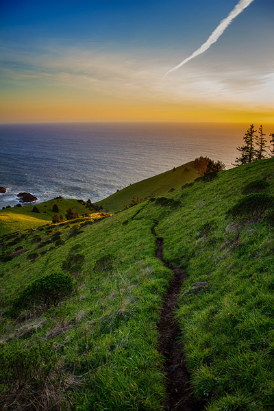
Tucked at the northern end of Lincoln City, the path to God’s Thumb winds through dense forest and windswept meadow, eventually leading to one of the coast’s most distinctive natural landmarks. This once-secret spot, long hidden behind private land, is now publicly accessible thanks to local efforts to open it to hikers seeking something a little off the radar.
The trail begins at the end of NE Devil’s Lake Blvd, where an unassuming cul-de-sac marks the only legal parking area. The hike starts at The Knoll Trailhead, though you won’t find any signage pointing toward God’s Thumb. Instead, follow the winding trail through moss-covered trees and fern-choked undergrowth. On a clear day, ocean views flicker between the branches, teasing what’s to come.
High Meadow Views And A Cliffside Warning
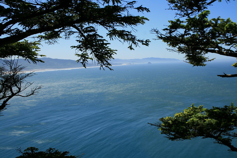
Before reaching the thumb itself, the trail opens into High Meadow, a sweeping field of grass and silence. From here, the dramatic basalt formation known as God’s Thumb juts out toward the Pacific, cloaked in green and set against a deep-blue horizon. It’s an awe-inspiring sight, the kind that catches in the throat.
Do you love Oregon?
Sign up for monthly emails full of local travel inspiration and fun trip ideas. In each newsletter we'll share upcoming events, new things to do, hot dining spots and great travel ideas.
Some choose to continue down the narrow, steep spur trail that hugs the cliff’s edge to reach the very tip of the Thumb. But this section is dangerously exposed, slick in wet weather, and has been the site of serious accidents. High winds, unstable ground, and a sharp drop make it risky, so many hikers opt to admire the view from the safety of the meadow.
The trail spans 4.8 miles round-trip, with an elevation gain of 1,131 feet. It’s rated moderate, but muddy conditions and slippery grass can bump the challenge up a notch, especially after rainfall. Waterproof footwear and trekking poles are helpful, and early mornings during the week offer the best chance at solitude and parking.
At A Glance - God's Thumb
- Distance: 4.8 miles round-trip
- Difficulty: Moderate
- Elevation Gain: 1,131 feet
- Trail Type: Out and back
- Dogs: Allowed
- Best Time to Go: Weekday mornings for easier parking
- Caution: Muddy and slippery after rain; cliffside section near the Thumb is dangerous
- See the detailed God's Thumb Guide here.
Cascade Head - Coastal Grasslands And Wildlife On The Edge Of The Sea
A Preserved Coastal Ecosystem With Stunning Payoffs
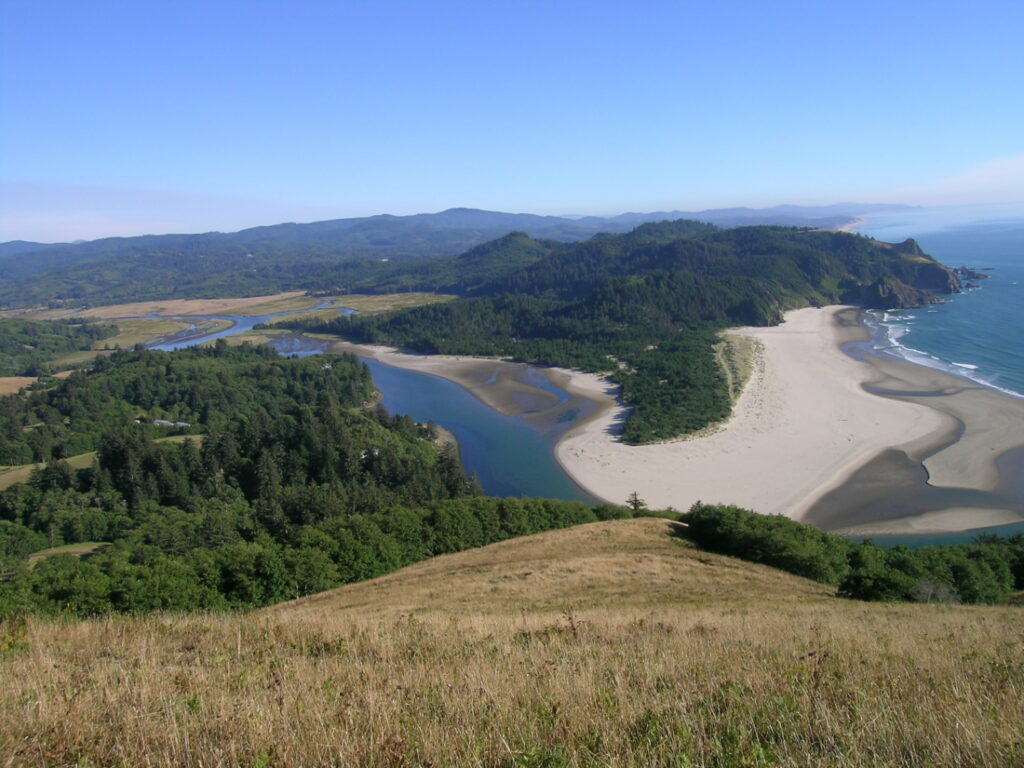
Just north of Lincoln City, Cascade Head rises steeply above the Salmon River Estuary, its ridgeline holding one of the most unique ecosystems in the Pacific Northwest. This is no ordinary coastal trail, it's Oregon's only UNESCO Biosphere Reserve. It's managed by The Nature Conservancy and is home to rare plants, coastal prairie, and the Oregon silverspot butterfly.
The most accessible trail at Cascade Head begins from Knight County Park, taking hikers along the Lower Nature Conservancy Trail for a 4.7-mile out-and-back journey that feels worlds away from the nearby highway. It’s a moderately challenging climb, with around 1,243 feet of elevation gain and enough sweeping views to make every uphill step worth it.
Meadows, Mists, And Important Precautions
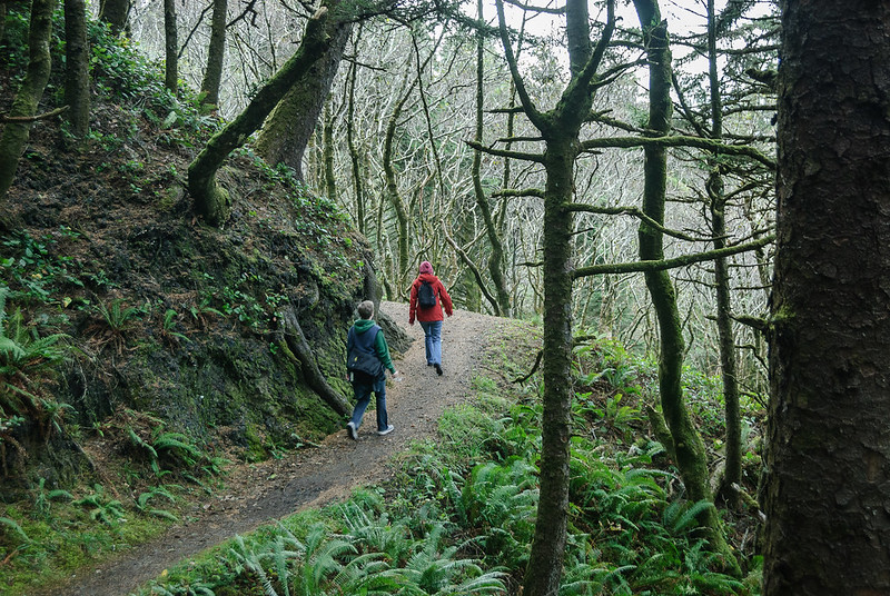
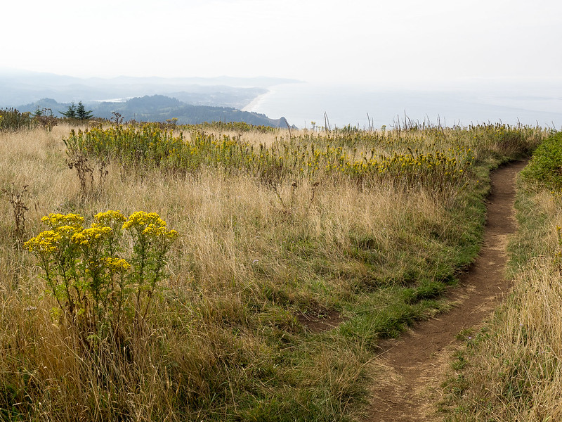
The route winds through mixed forest and across small creeks before opening into a broad meadow with dramatic views south toward the Salmon River and Camp Westwind. On clear days, the entire coastline sprawls beneath you, but fog often swallows the view, turning the trail into something quieter and more introspective.
Ticks are common here, especially in warmer months when long grasses reach across the trail, so it’s a good idea to wear long sleeves and give gear a once-over after the hike. It's also important to note that no dogs are allowed, not even on a leash. This rule is strictly enforced to protect sensitive wildlife and preserve the fragile environment.
For those hiking between July 15 and December 31, the trail continues beyond the upper meadow toward the ridge’s north face, offering a different perspective through timbered forest and flower-dotted undergrowth. But even if sticking to the lower trail, the experience is unforgettable: wild and windblown, with a sense of place that’s hard to match.
At A Glance - Cascade Head (Lower Trail)
- Distance: 4.7 miles round-trip
- Difficulty: Moderate
- Elevation Gain: 1,243 feet
- Trail Type: Out and back
- Dogs: Not allowed
- Best Time to Go: Clear days for best views; July 15–Dec 31 for full trail access
- Caution: Watch for ticks in grassy sections.
- Get up to date trail conditions for Cascade Head here. Make sure it's open before you go.
Clatsop Loop Trail - History And Coastal Views At Ecola State Park
Walk Where The Corps Of Discovery Once Did
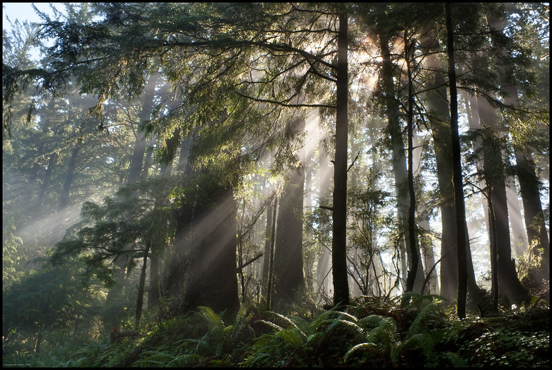
Ecola State Park is steeped in Oregon Coast history, with rugged headlands and mist-draped cliffs that once welcomed Captain William Clark and the Corps of Discovery. The Clatsop Loop Trail, a 3-mile circuit starting from Indian Beach Trailhead, follows their footsteps through a coastal rainforest and past viewpoints that remain just as striking today.
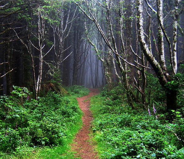
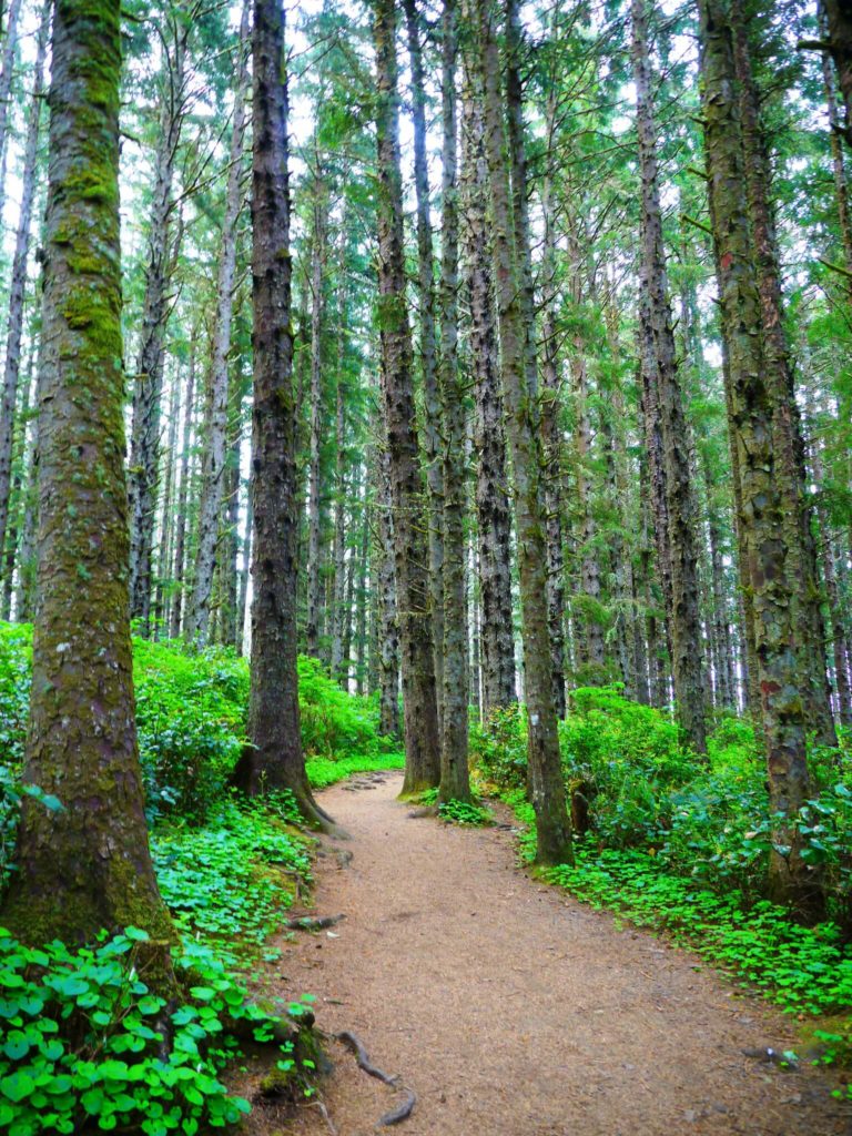
Begin behind the restrooms near Indian Beach and head up the gravel road into the heart of Tillamook Head. It’s an easy-to-moderate loop, gaining about 785 feet in elevation, but the climb is steady. Towering Sitka spruce rise overhead, and sword ferns brush the trail’s edges as the forest swells and dips with the terrain.
Bunkers, Lighthouses, And A Thousand Shades Of Green
Along the way, hikers pass remnants of a World War II radar station and a viewpoint looking out to Tillamook Rock Light, known locally as “Terrible Tilly.” Perched on a wave-battered rock, the now-defunct lighthouse is as dramatic as the story behind its construction.
On the return route, sweeping vistas open south to Cannon Beach and its famous sea stacks. The trail descends past overgrown switchbacks and through bramble-lined stretches, so long sleeves and pants are recommended. It’s not uncommon to spot deer, eagles, or even a gray whale offshore during migration season.
Though popular on summer weekends, this trail maintains a sense of wildness. With fog rolling in and the wind sighing through the trees, it’s easy to imagine this place just as it was centuries ago: untamed and unforgettable.
At A Glance - Clatsop Loop Trail
- Distance: 3 miles
- Difficulty: Easy
- Elevation Gain: 785 feet
- Trail Type: Loop
- Dogs: Allowed
- Best Time to Go: Year-round; weekdays for fewer crowds
- Caution: Narrow overgrown sections, blackberry brambles, and unstable trail edges in spots
- See the Clatsop Loop trail guide here, and our guide to Ecola State Park here.
Cape Lookout Trail - Ocean Vistas From A Forested Peninsula
A Long Walk Through Wind-Bent Spruce And Mist
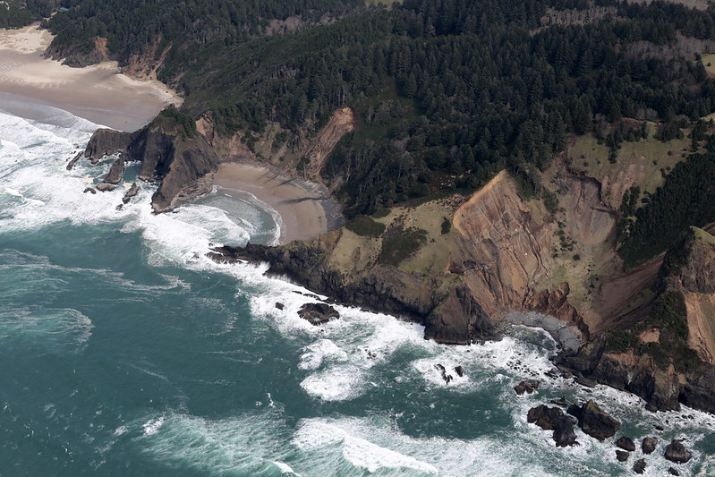
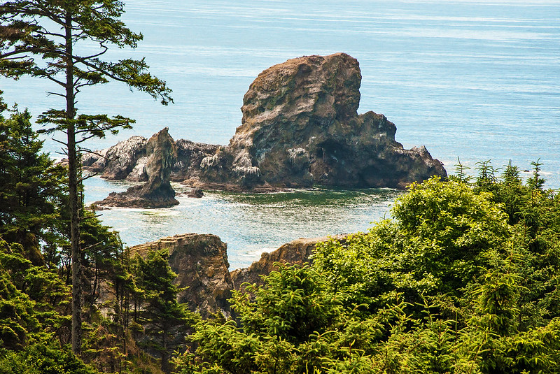
Cape Lookout juts into the Pacific like a great green arm, its cliffs dropping sharply into the sea. The Cape Trail, a 4.7-mile out-and-back hike along this dramatic headland, is one of the best ways to experience the magnitude of Oregon’s coastal wilderness.
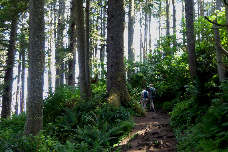
Starting from the Cape Lookout Trailhead, the trail dives into a dense coastal forest filled with Sitka spruce, hemlock, and a tangle of roots and rocks. The hike gains about 810 feet in elevation, weaving between glimpses of ocean and shadowed trees. Cape Lookout State Park has an excellent trail map here.
A Trail Of Mud, Cliff Edges, And Whale Watching
This is a hike where the trail itself becomes part of the adventure. Rain turns sections into muddy bogs, and exposed roots challenge footing. But every step leads closer to one of the most jaw-dropping views on the coast, where the cape narrows and the land drops away, offering a panoramic sweep of shoreline that stretches for miles in both directions.
On clear days, hikers can see as far north as Tillamook Head and south to Cape Foulweather. During whale migration season, this is a great spot for sightings. Volunteers often help visitors locate spouts during designated whale watching weeks.
This hike isn’t recommended for young kids or those with mobility challenges, especially when the trail is slick. But for those comfortable with a bit of mud and a few steep sections, the payoff is immense.
At A Glance - Cape Lookout Trail
- Distance: 4.7 miles round-trip
- Difficulty: Moderate
- Elevation Gain: 810 feet
- Trail Type: Out and back
- Dogs: Allowed on leash
- Best Time to Go: Dry days for easier footing
- Caution: Very muddy in wet weather; exposed roots and steep drop-offs toward the cape’s end
- Get the official hiking guide and map here.
Tips For Hiking On The Oregon Coast
- Check trail conditions before you go to make sure the trail you want to hike is open. Make note of if there's a fee to park or hike, or if a permit is required.
- Check weather conditions before you go, and always prepare for inclement weather, even in the summer. Weather on the coast can change without warning.
- Dress in layers, and keep extra clothes in your car in case you get soaked or muddy. Even days after a rain on the coast, long grasses can be soaking wet, and I've found my shoes, socks, and pants soaked from hiking even on a sunny day.
- Bring snacks, lunch, and plenty of water.
- Use bug spray and check for ticks when you get home. Ticks make their home up and down the Oregon coast, and Lyme disease is no joke. Check out our guide: Everything You Never Wanted To Know About Ticks In Oregon.
- Stay away from cliff edges. From the top you can't see if wind, water and weather have eroded out from underneath the ground you're standing on.
- Never tackle a trail that is too challenging for you or your abilities.
- Tell people where you're going, and when you plan to return.
- To ensure that trails and wild areas in Oregon remain open for future generations to use, please follow the seven easy principles of Leave No Trace.
These Trails Stay With You
What ties these hikes together isn’t just the jaw-dropping scenery, it’s the feeling they leave behind. There’s something almost sacred about these coastal routes, where the wind carries stories and each bend in the trail opens up new wonder. These are places that don’t just show off Oregon’s beauty, they etch it into memory. Out here, the phone stays in your pack, the noise fades, and the only signal worth chasing is the pull of the ocean. And once you’ve hiked them, you'll look at the Pacific Northwest with new eyes.