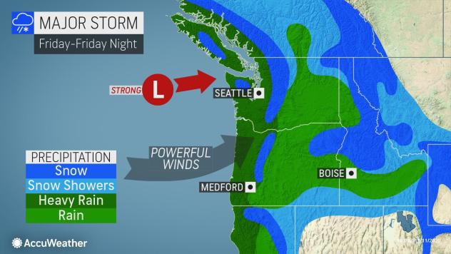
The strongest storm we have seen since last winter is headed for the Pacific Northwest, according to meteorologists with AccuWeather said Wednesday. According to The Oregonian, by Friday afternoon the powerful storm has the potential to bring down trees, clog storm drains, and cause power outages in northwest Oregon.
But first, a word from our favorite weatherman Frankie MacDonald. Make sure to follow him on Youtube for the latest!
With wind gusts up to 55 mph and ocean swells reaching 30 feet, we could see up to an inch of rain in and gusts up to 35 mph around the Portland metro area.
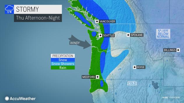
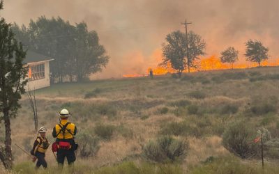
In the Cascade Range, The Statesman Journal is reporting more than a foot if snow is in the forecast while heavy rain and high winds. In early November the mountains are already seeing snowfall. Forecasters said total snow accumulations of 10 to 20 inches are forecast, with wind gusts of 50 to 70 miles per hour possible at higher elevations.
"This system has been shifting around the last couple of days, which means that we still have quite a bit of uncertainty about exactly where it will set up and be most intense, but we do expect some very active weather on Friday and Saturday especially," National Weather Service meteorologist Rebecca Muessle told The Statesman Journal.
Local KVAL Eugene reports what's expected for the Oregon Coast:
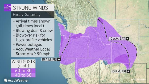
The National Weather Service has issued a High Wind Watch for Florence and other coastal communities, as well as the central Coast Range. The Watch is in effect from late Thursday night through Friday afternoon.
"Damaging winds could blow down trees and power lines. Widespread power outages are possible. Travel could be difficult, especially for high profile vehicles," forecasters said.
The National Weather Service went over the outlook Wednesday in the forecast discussion:
"Latest model guidance indicates that a low moving along the front will slow its inland progress and stall the front over the Oregon Cascades Friday morning where it will merge with the next warm front. 24-hour snow totals of 6 to 12 inches are expected above 4000 feet between Thursday 10 am and Friday 10 am. 24-hour rain totals for the expected for the same time period are 1 to 2 inches for the coast, coast range and Cascades below 4000 feet, and around 0.5 inch for the Willamette Valley and adjacent low lands.
Models are still struggling with the details of the Friday weather system, and have changed the strength and track of the lows between the different models. This continues uncertainty on the details of the hazards (...) There is fair confidence that strong winds will impact the coast Friday morning or early afternoon and inland Friday afternoon or evening. The current forecast suggests that the winds in the interior could be some of the strongest south winds that the area has seen in a good while, and widespread tree and power issues are possible."
"If you must travel, keep an extra flashlight, food, and water in your vehicle in case of an emergency," forecasters advised.