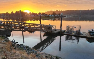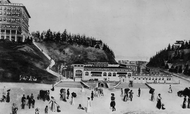
On a windswept peninsula between Tillamook Bay and the Pacific Ocean, an ambitious Oregon resort once promised a grand life by the sea. Bayocean had a hotel, paved streets, a school, shops, a natatorium with a heated saltwater pool, and a vision big enough to earn comparisons to a coastal resort city.
Today, almost all of it is gone. The community known as Bayocean was slowly consumed by erosion after changes at the entrance to Tillamook Bay reshaped the shoreline. Its story is one of Oregon’s most remarkable lost places—and a vivid reminder that the coast is never still.
A Resort Built Between the Bay and the Ocean
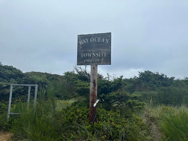
Development at Bayocean began in 1906, when the Potter family recognized the potential of the narrow sand spit west of Tillamook Bay. The resort was promoted as Bayocean Park, a destination where visitors could enjoy both the Pacific beach and the sheltered bay.
At its height, the community included a hotel, dance hall, post office, general store, school, bowling alley, tennis court, and a large heated saltwater swimming facility. Reaching Bayocean was part of the adventure: early visitors arrived by boat, and the community remained separated from the mainland by water until a road connection was completed in 1928.
How the North Jetty Changed Bayocean
The entrance to Tillamook Bay was notoriously difficult for vessels. To improve navigation, the U.S. Army Corps of Engineers built the north jetty at the bay entrance between 1914 and 1917, then reconstructed and extended it in 1931.
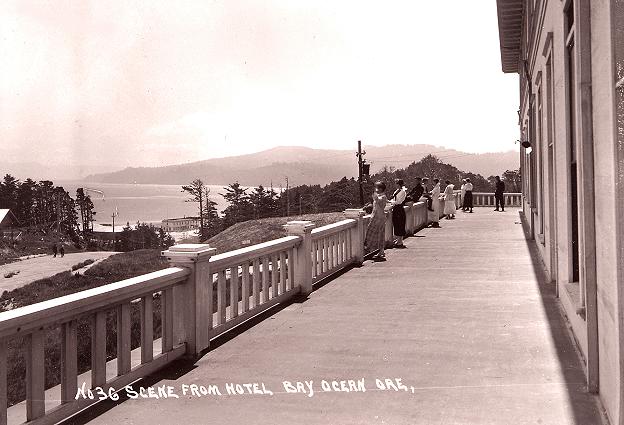
The structure helped make the inlet more navigable, but it also changed local wave patterns and the movement of sand along the coast. The ocean-side beach at Bayocean began to erode. What had been a broad protective beach narrowed year after year, leaving homes and public buildings increasingly exposed.
The Army Corps of Engineers’ history of Tillamook Bay documents the north jetty’s construction and later repairs. The broader history of Bayocean is also well covered by the Oregon Encyclopedia, which traces how the shifting shore transformed the resort.

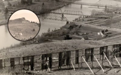
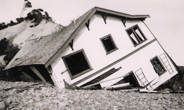
- Bayocean after the shoreline began to disappear. Photograph: Tillamook County Pioneer Museum.
A Town Lost to the Sea
By the late 1920s, erosion was already claiming the ocean-facing side of Bayocean. During the 1930s, storms and shoreline retreat damaged homes and the natatorium. Residents moved buildings when they could; others watched structures collapse into the surf.
In 1952, storm waves breached the peninsula, turning Bayocean into an island. A dike reconnected the spit in 1956, but the town itself was not saved. The post office had closed in 1953, and the last house fell into the ocean in 1960.
Years later, construction of a south jetty began in 1969; its first segment was completed in 1971. Sand eventually began to build back along the spit, but the resort that once stood there was already gone.
The Schoolhouse That Escaped the Sea
Not every part of Bayocean vanished. Before the 1952 breach, residents moved the town’s elementary school to nearby Cape Meares. The building still stands at 5690 4th Street NW as the Barbara Bennett Community Center, named in 2020 for former Bayocean student and longtime community steward Barbara Bennett.
The Oregon Encyclopedia documents the school’s rescue and move to Cape Meares. It is now a community gathering place for events, classes, reunions, and celebrations—a rare physical link to a town otherwise claimed by the sea.
Can You Visit Bayocean Today?
Yes. Bayocean Peninsula is now a Tillamook County heritage and recreation area, offering beach access, birdwatching, hiking, fishing, bicycling, and access toward the south jetty. The landscape is quiet, open, and beautiful—but the interpretive signs and the shape of the shoreline make its history easy to feel.
The Bayocean Spit loop hike is about 7.5 miles, traveling out along the bay side and returning by the ocean beach. Shorter routes cross the peninsula through shore pine and dunes. Before you go, check the weather and tide conditions, and respect seasonal protections for western snowy plovers. From March 15 through September 15, designated Bayocean beach areas have restrictions; visitors on foot should stay on wet, hard-packed sand. See the current guidance from Oregon State Parks.
Planning a wider North Coast trip? Explore our Oregon Coast Travel Guide for beaches, towns, scenic drives, and trip-planning ideas.
Bayocean is not a ghost town in the usual sense—there are no abandoned storefronts to wander through. Its absence is the point. Stand on the peninsula today, with Tillamook Bay on one side and the Pacific on the other, and you are standing where one of Oregon’s most unusual communities once stood.