After weeks of cooler spring weather, western Oregon is about to get a quick taste of summer.
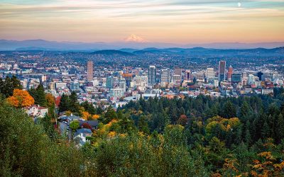
A strong ridge of high pressure is moving into the Pacific Northwest, setting the stage for a dramatic warmup Monday and Tuesday. Forecasters say temperatures across much of the Willamette Valley could climb into the upper 80s Tuesday, with some spots flirting with the 90 degree mark.
That’s roughly 15 to 20 degrees warmer than what’s typical for mid May.
Sunny skies and offshore winds are expected to help fuel the sudden burst of heat. Cities across western Oregon, including the Portland metro area, could see some of the warmest weather of the year so far as the brief two day warm spell peaks Tuesday afternoon.
But don’t pack away the rain jackets just yet.
Meteorologists say the heat won’t last long. By midweek, the weather pattern is expected to shift once again as cooler air pushes back into the region. That change could bring unstable conditions Tuesday evening, especially near the Cascades, where isolated thunderstorms may develop.
While severe weather is not expected, any storms that form could still produce lightning, gusty winds, and small hail.
There’s also a chance showers could drift into valley locations by Wednesday as temperatures cool back down. Forecast models currently suggest the Portland area could pick up around a half inch of rain through the middle of the week, ending a dry stretch that has lasted close to 20 days.
The wetter pattern may stick around through the rest of the work week before another ridge of high pressure potentially returns heading into the weekend.
For now, Oregon residents may want to enjoy the sunshine while it lasts because this quick shot of summer heat looks more like a brief preview than the real thing.