Dive into the wild heart of the Oregon Coast, where thunderous waves carve secrets into sea caves, mist drapes ancient forests, and every cliff holds a legend waiting to be discovered. This road trip is your gateway to nature’s most powerful oceanfront moments, and is perfect for explorers seeking raw beauty and unforgettable seaside experiences.
From volcanic blowholes to hidden coves, we've put together this guide to show off ten of our favorite jaw-dropping natural wonders along the Oregon Coast. Each destination includes the best highlights and clear directions so you can hit the road ready and experience it all firsthand.
Your Guide To The Best Dramatic Wonders Along The Oregon Coast
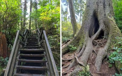
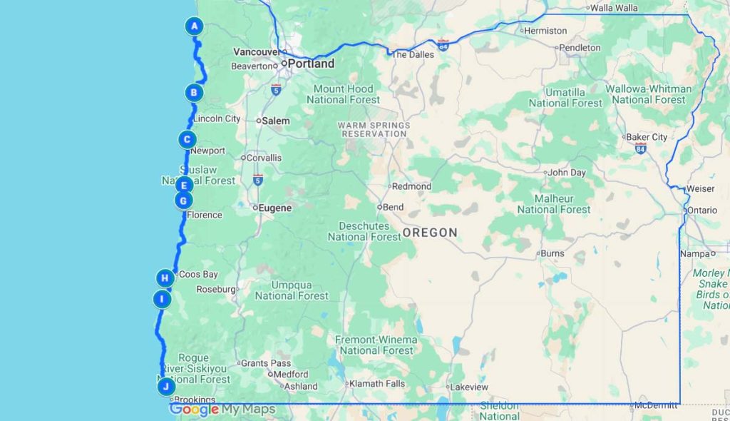
The adventurous at heart (and those that don't mind long days of driving), might be tempted to do this entire road trip in one day. You could definitely do all the driving in one day, but you wouldn't be able to take the time to stop and appreciate each spot on our list, or to take breaks for lunch and dinner. For this road trip we recommend at least two days, (and even better, three), so that you can take your time without being rushed, and stop to explore some of the cool small coastal towns along the way. There are a lot of campgrounds up and down the Oregon coast, so camping in a tent or trailer is a great option if you'll be spending two or more days on this trip.
Pro Tip: There are also hotels up and down the coast, though if you're doing this trip during the summer, you should definitely figure out where you're staying ahead of time and book your stay in advance to ensure you have a place to sleep each night.
Haystack Rock – Cannon Beach, Oregon
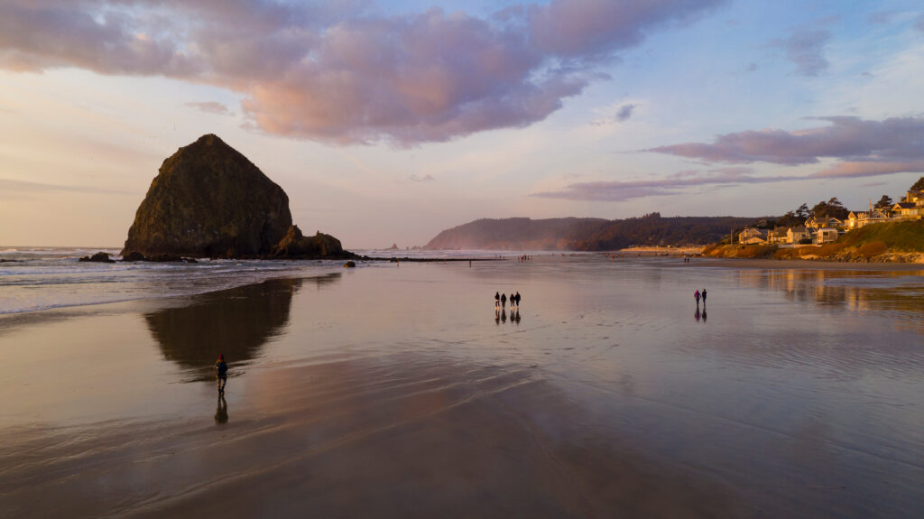
If you're doing this trip in it's entirety from north to south, then your first stop is Haystack Rock at Cannon Beach. And if you're doing the trip from south to north, then start at the bottom of this list and work your way up.
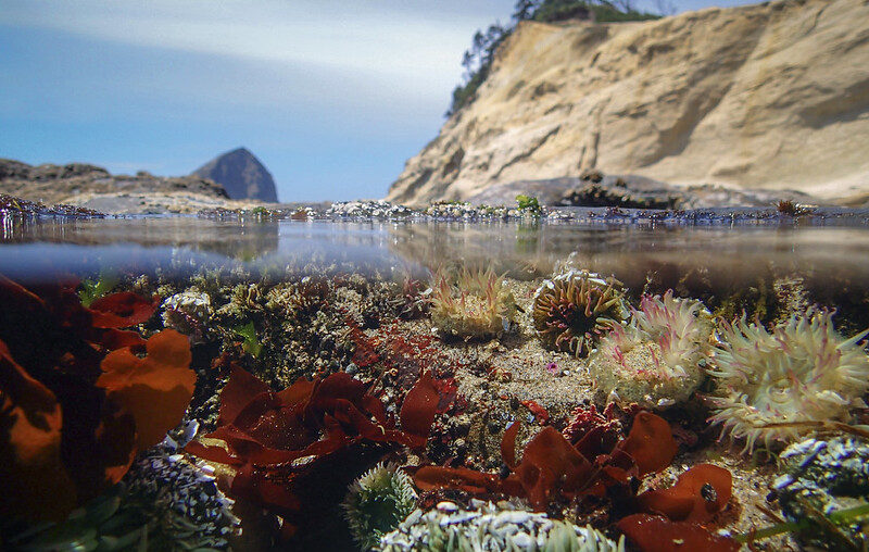
Rising 235 feet from the shoreline, Haystack Rock is a stunning sea stack that draws visitors year-round. At low tide, the base becomes accessible, revealing vibrant tidepools filled with anemones, sea stars, and crabs. It's also a nesting site for puffins during the spring and summer.
Directions: From Highway 101, take Sunset Blvd to Hemlock Street. Turn south on Hemlock to the Cannon Beach Access. This beach is right across from Haystack Rock.
Tip: Check the tide tables in advance for the best tidepool viewing and to ensure safe walking. Be sure to leave sea creatures where you find them, and do not attempt to climb the rock.
Cape Kiwanda – Pacific City, Oregon
Heading south, our next stop on the trip is Cape Kiwanda. Cape Kiwanda is a dramatic sandstone headland located on the Three Capes Scenic Route. With its sweeping dunes, sculpted cliffs it's a favorite for hikers, photographers, and thrill seekers. Along with the cliffs comes the massive offshore rock known as Chief Kiwanda Rock (but to locals known as, are you ready for this? Haystack Rock. Yes, there's not one, not two, but three Haystack Rocks off the coast of Oregon.
Directions: To reach Cape Kiwanda, take Highway 101 south from Tillamook and exit west onto Brooten Road toward Pacific City. Take a left on Pacific Ave and cross over the Beachy Bridge. Then turn right on Cape Kiwanda Drive and follow signs for Cape Kiwanda and Pacific City Beach.
The nearby Pelican Brewing offers food and drinks right on the sand, and you might catch dory boats launching into the surf, which is a longstanding Pacific City tradition.
Otter Rock and Devil’s Punchbowl – Between Newport and Depoe Bay
Our third stop on this awesome scenic road trip is Devil's Punchbowl. Otter Rock is a small but scenic bluff area with panoramic views and an offshore rock formation. Nearby is the Devil’s Punchbowl, a collapsed sea cave that fills with seawater and churns wildly with each wave. The surrounding area is popular with surfers, especially at nearby Beverly Beach.
Pro tip: Expect wind and bring a hoodie or a waterproof coat.
Directions: Heading south from Depot Bay, turn west on Otter Crest Loop, and then west onto 1st street. Follow signs to Devil’s Punchbowl State Natural Area. There is parking near the overlook, and a little trail that gives an overhead view of the punchbowl rock formation. The punchbowl is best viewed during high tide when the water is at its most dramatic.
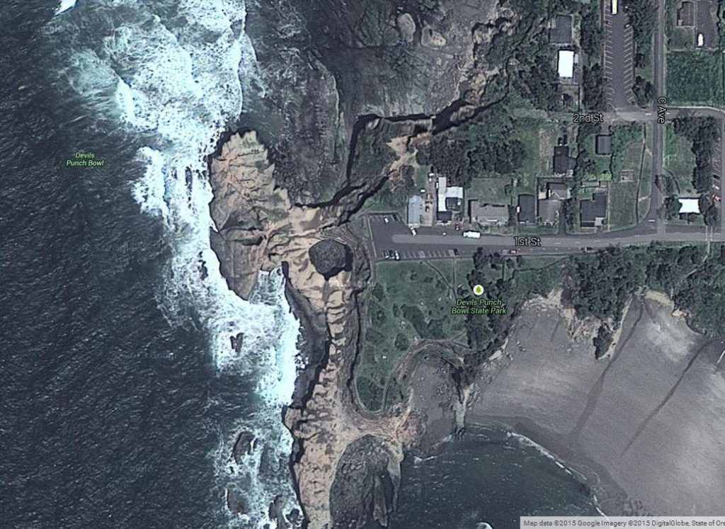
Safety note: It is not safe to climb over fences and rails, and it is also not safe to try to go into the punchbowl at low tide.
Right off of the parking area there's a little building that houses Mo's Seafood and Chowder. It will be busy, and can be expensive for a bite to eat (but many love Mo's chowder and think it's worth it). If you're planning on feeding a carload of people or trying to do this trip on the cheap, then you may want to plan to bring your own food for a picnic, or wait until you get south to Newport to stop for a bite to eat. Though we can't guarantee that the major seafood restaurants in Newport will be any cheaper.
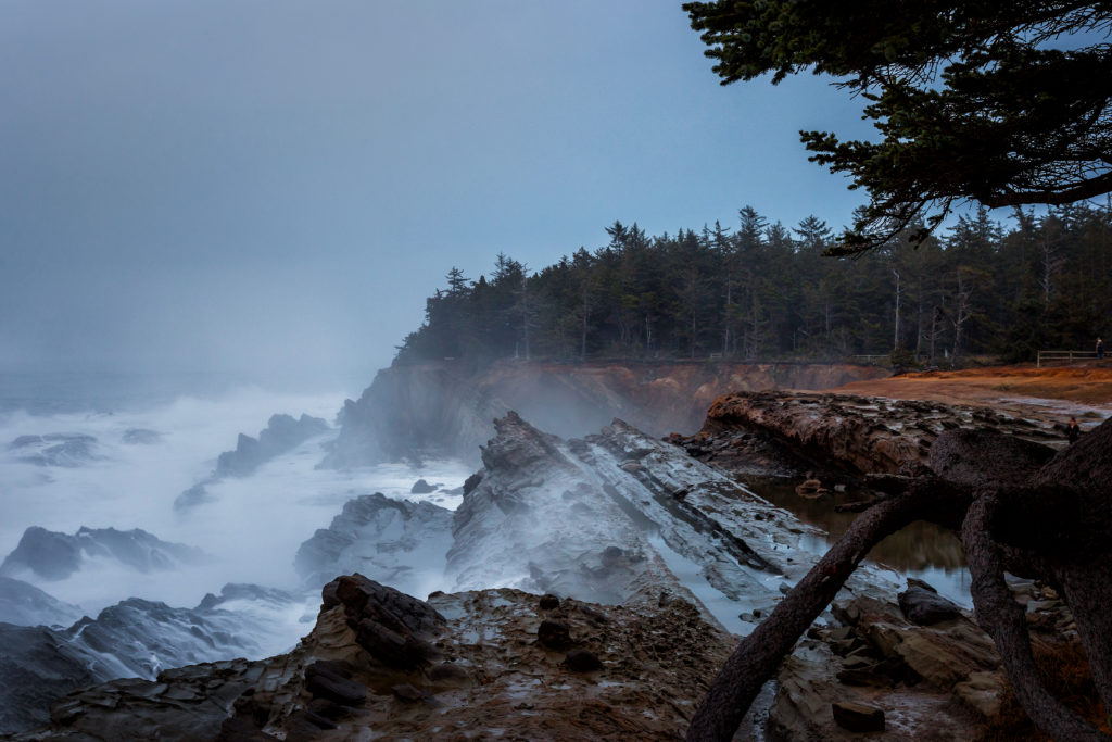
Devil’s Churn – Cape Perpetua Scenic Area
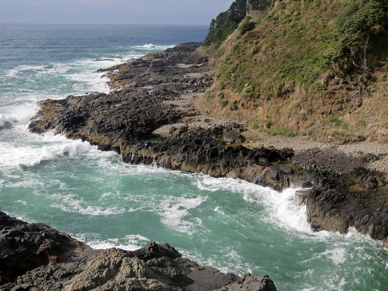
Next up on our list is Devil’s Churn, a narrow volcanic inlet that acts like a natural amplifier, turning even small waves into explosive displays of water and sound. During storms, the ocean violently surges into the chasm, creating geysers of foam and spray that rise up to 200 feet into the air.
Directions: To visit Devil’s Churn, continue south on Highway 101 from Yachats and watch for signs directing you to the Devil’s Churn Day Use Area.
Like many spots along the Oregon coast, a day use fee is required to park or hike here. Five dollars will get you access to the paved .4 mile trail which follows the coastline, and will score you views of cool volcanic tidepools and crashing waves. There's potable water and a restroom at the day use area.
Pro Tip: Sturdy shoes and weather protection are highly recommended, especially if the surf is active. Dress in layers and take a hoodie and a waterproof layer with a hood, because even on a clear day you can end up soaked. If you don't have waterproof layers to wear, make sure to have dry clothes and shoes to change into back in your car.
Thor’s Well – Yachats, Oregon
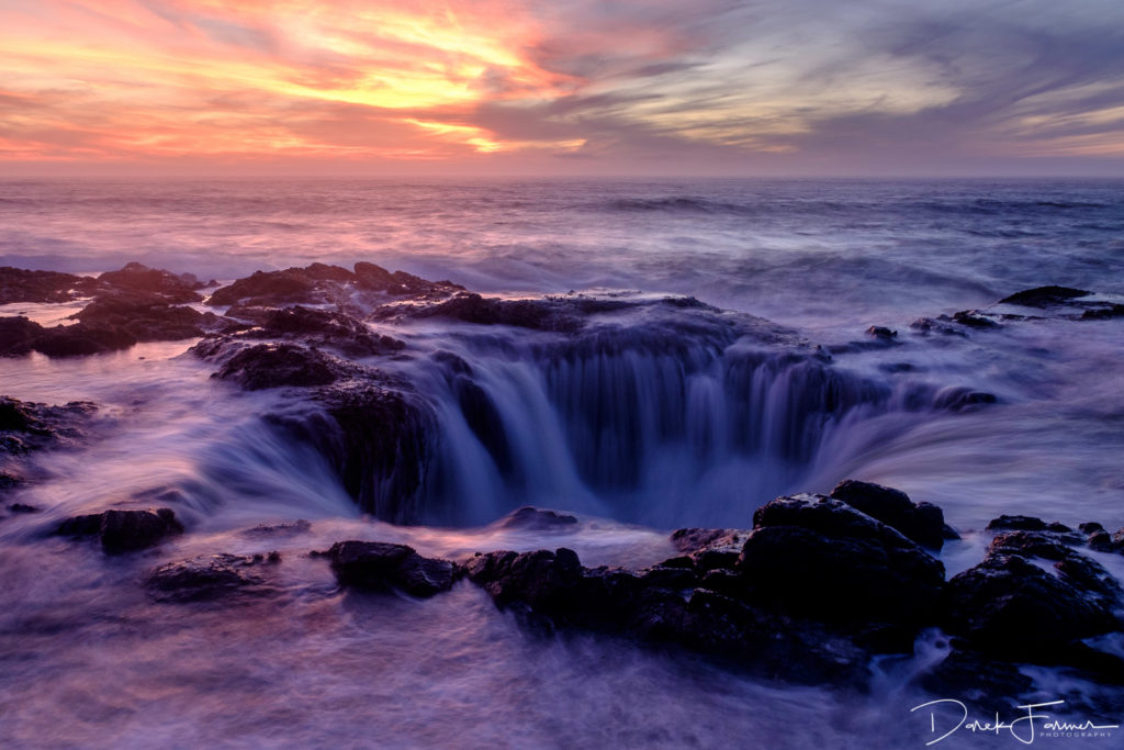
Few places along the coast capture nature’s fury like Thor’s Well. Often called the “Drainpipe of the Pacific,” this gaping hole in the basalt rock appears to swallow the ocean itself, especially at high tide or during storms. The well is actually a collapsed sea cave, and when the waves are right, seawater erupts upward and then cascades dramatically back into the pit.
Directions: Thor's Well is only half a mile south (or a 1 minute drive) from Devil's Churn. You can park at the trailhead and hike down, or a little further south, park at the overlook. Either way, bring binoculars to get an up close look.
Safety Note: This is one of the more photographed spots along the Oregon coast, however, some photographers climb out onto the rocks for their shot and risk being swept away by the waves and into the ocean. Stay up at the viewpoint, or park in the trailhead parking for the Captain Cook Trail just north of the overlook, and stay on the trail. Be extremely cautious around the edges of Thor's Well. Slippery rocks and unpredictable waves can be dangerous, especially during high surf, stormy or windy weather.
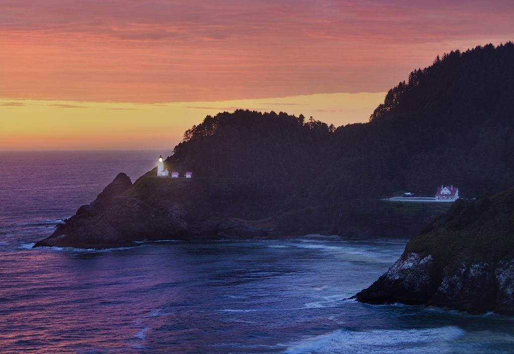
Heceta Head Lighthouse – Near Florence, Oregon
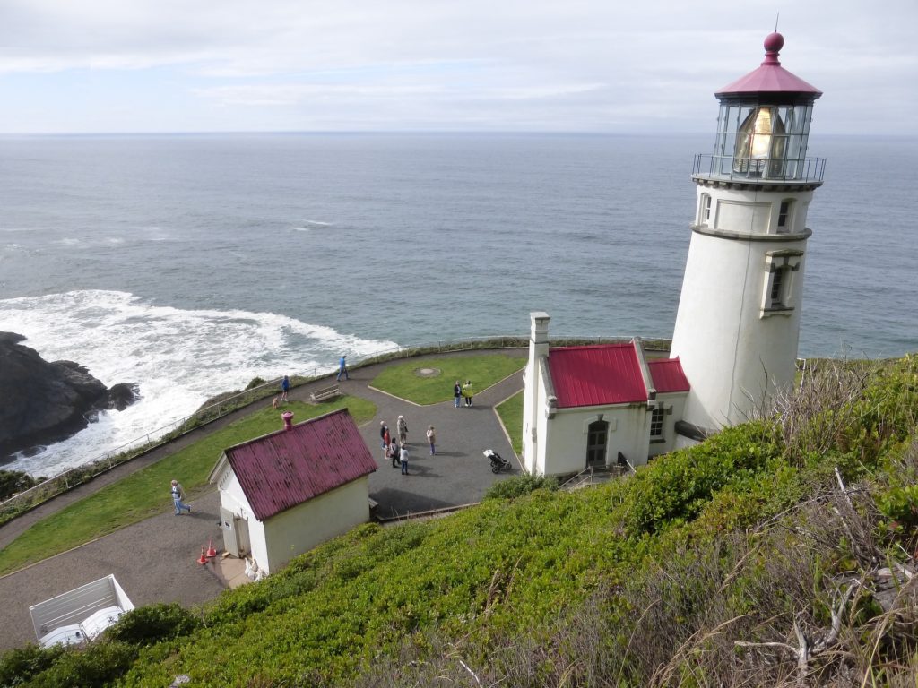
Heceta Head Lighthouse is one of the most iconic and photographed spots on the Oregon Coast. Built in 1894, the lighthouse still operates today, standing 206 feet above the ocean and casting light 21 miles out to sea. The trail leading to the lighthouse offers views of the rugged coastline, and just below lies a small beach cove popular with picnickers and tidepool explorers.
Directions: Heceta Head Lighthouse is fifteen minutes south of Thor's Well. Look for signs for the RV parking lot, and the parking for Heceta Lighthouse and Beach.
Sea Lion Caves – Florence, Oregon
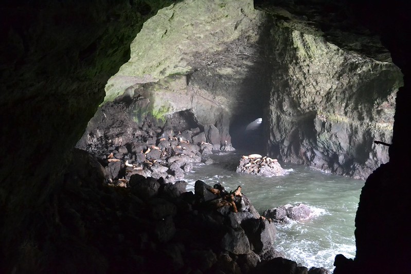
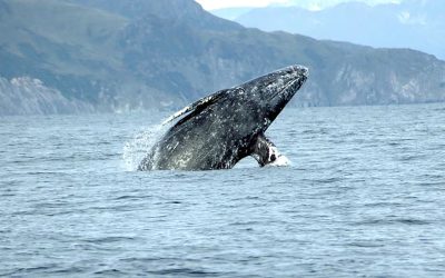
I've been going to the Sea Lion Caves since I was a little kid. The Sea Lion Caves are the largest sea caves in North America and serve as a sanctuary for hundreds of Steller sea lions. An elevator transports visitors more than 200 feet down into the cave where the booming calls of the sea lions echo off the stone walls. From the cliffside, you might spot gray whales and nesting seabirds depending on the season. In the near distance on a clear day, you should also be able to see Heceta Head Lighthouse.

Directions: About 12 miles south of Thor's Well down Highway 101 there's a small parking lot right in front of the little building that houses the Sea Lion Caves visitor center and entrance. There's also a larger parking lot on the other side of the highway.
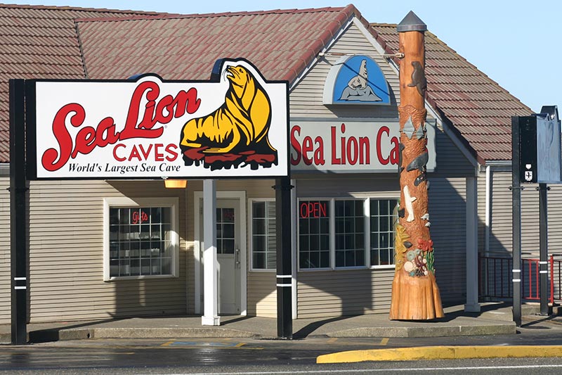
While there is an entrance fee ($18 for adults, $17 for seniors, $12 for children five to twelve, free for children four and under), the chance to observe wildlife in such a unique setting makes it well worth the visit.
Shore Acres State Park – Near Coos Bay, Oregon
Shore Acres State Park offers a unique blend of natural drama and cultivated beauty. Perched atop a sandstone bluff, the park features formal gardens, cliffside viewpoints, and dramatic wave-watching areas. In winter, waves often crash 50 feet into the air. During spring and summer, the rose and rhododendron gardens are at peak bloom.
Directions: To get to Shore Acres, you're going to head south to North Bend, Oregon on Highway 101, and then turn west on Virgina Ave, south on Broadway, and then west onto Highway 540 (Cape Arago Highway). This highway will take you down through Charleston, and then continue west and then south towards Shore Acres State Park. Look for signs for the Shore Acres parking lot.
There is ample parking and the Cape Arago Loop trail offers multiple perspectives on the ocean’s raw power.
Face Rock Scenic Viewpoint – Bandon, Oregon
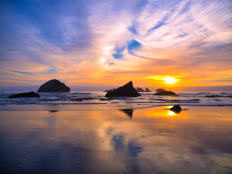
Face Rock is steeped in legend. According to Native American lore, the stone formation is a young princess turned to stone as she looked skyward. The viewpoint offers sweeping views of the sea stacks below, and during low tide the beach opens up to caves, reflective pools, and mysterious monoliths.
Directions: In Bandon, turn west off Highway 101 onto 11th Street, then head south on Beach Loop Road. Face Rock viewpoint has parking and access to stairs leading down to the beach. This park will require a parking permit starting in October of 2025.
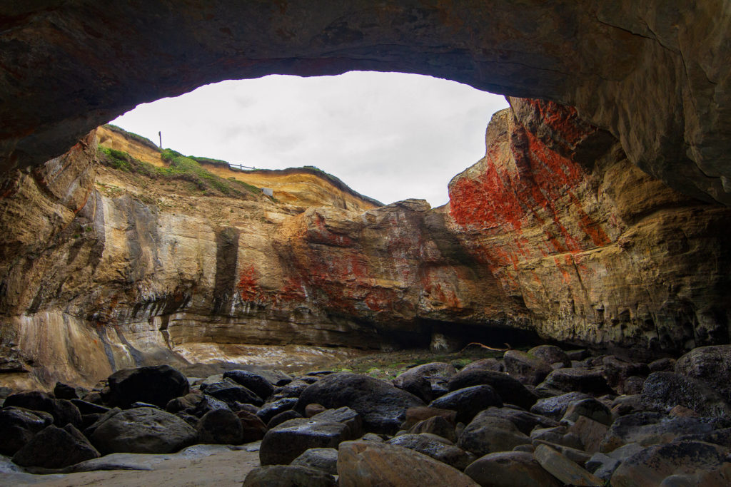
Samuel H. Boardman Scenic Corridor – Near Brookings, Oregon
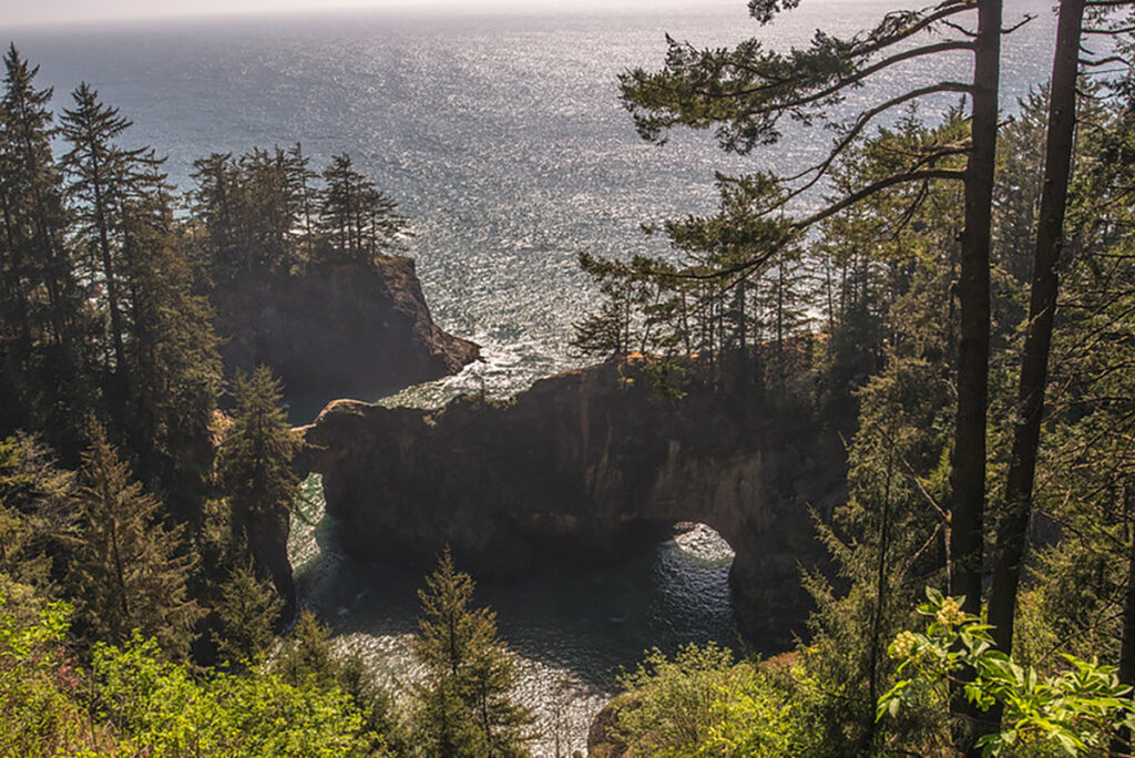
Samuel H. Boardman State Scenic Corridor is a 12-mile stretch of rugged coastline filled with natural arches, hidden beaches, and towering cliffs draped in mossy forest. Key stops include the Natural Bridges, Arch Rock, and Secret Beach. It's one of the most photogenic regions of the entire state.
Directions: When you enter the scenic corridor you'll begin to see signs for its many pullouts.
This is a must-stop area for photographers and hikers, so take your time exploring each pullout.
Please note: We may have listed parking areas and stopping points that require a day use fee. Some hiking trails may require other permits. Always research your destination thoroughly before setting out on your adventure.
The Oregon Coast is a land of rugged beauty, rich legends, and roaring waves. This road trip brings you face to face with some of the most spectacular sights in the Pacific Northwest. From tidepools to towering cliffs and secret beaches, these destinations each offer something uniquely breathtaking.
Dress in layers, bring your camera, and let the rhythm of the ocean guide your adventure. There is no better way to experience the untamed soul of Oregon than by exploring these unforgettable coastal wonders.