Ready for an adventure? Oregon's coast is home to historic lighthouses perched above rugged headlands, river mouths and dramatic stretches of the Pacific. Some remain active aids to navigation, while others have been preserved as museums, viewpoints or privately maintained landmarks. This guide introduces eleven of Oregon's most recognizable coastal lights and what visitors should know before going.
Several of these sites have been restored and offer a fascinating look at Oregon's maritime history. Cleft of the Rock Lighthouse and Pelican Bay Lighthouse are privately built, Coast Guard recognized aids to navigation, while the others trace their stories to federal lighthouse service.
What lighthouses are on the Oregon coast?
Oregon's coastal lights range from remote Tillamook Rock, which cannot be visited, to accessible state and federal sites with trails, viewpoints and seasonal tours.
Public access and tour schedules vary by season, staffing, weather and restoration work. Always check the managing agency's current conditions before making a special trip.
Tillamook Rock Lighthouse
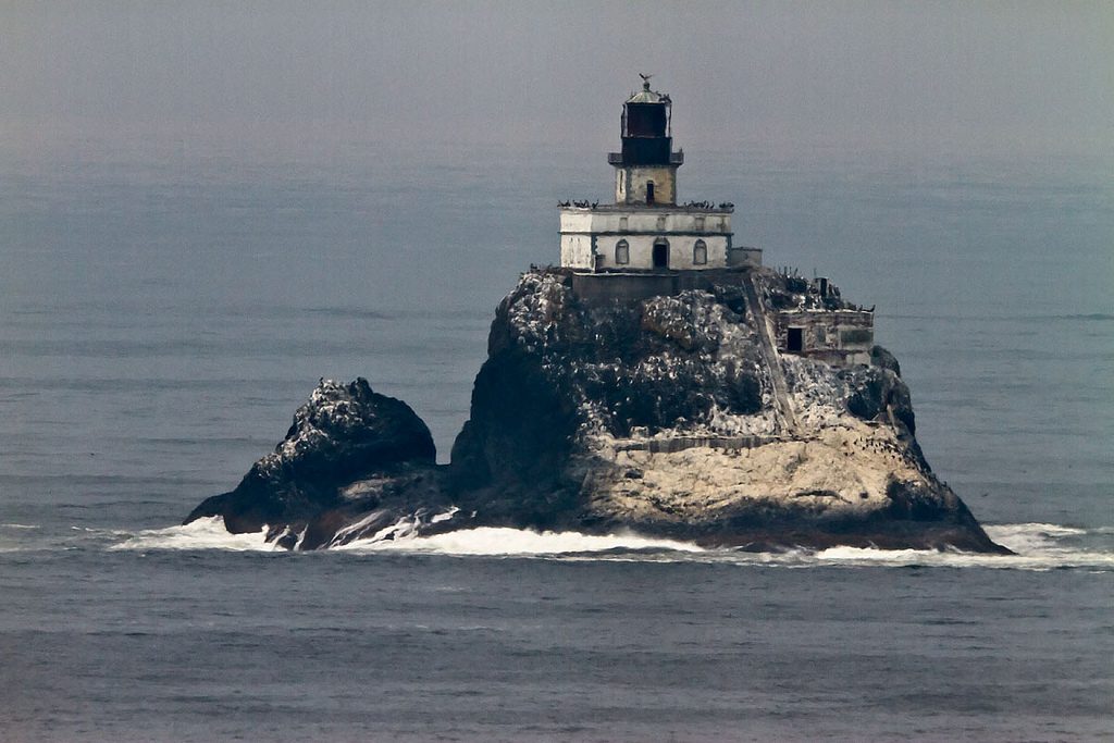
Tillamook Rock Lighthouse, better known as "Terrible Tilly," stands on a small basalt rock about a mile offshore from Tillamook Head. First lit in 1881 and listed on the National Register of Historic Places in 1981, it is one of the most isolated and storm battered lighthouses on the Oregon Coast. The privately owned lighthouse is closed to the public but can be viewed from places such as Ecola State Park.
Construction began in 1878 and was completed in 1881. The lighthouse rises 133 feet above the sea, a height that did not spare it from violent Pacific storms. Waves and wind driven rocks repeatedly damaged the lantern room and made life at the station extremely difficult.
Keepers maintained the light and lived in extraordinary isolation while helping vessels navigate the waters near Tillamook Head. Reaching the rock was so dangerous that crews and supplies sometimes had to be transferred by line from a ship.
Storms repeatedly battered the station, at times breaking lantern glass and damaging equipment. These punishing conditions helped earn the lighthouse its enduring nickname.
The light was automated in 1934 and deactivated in 1957. After decommissioning, the federal government sold the island into private ownership.
Tillamook Rock remains privately owned and is not open for tours or landings. Visitors should view and photograph it only from the mainland.
The lighthouse later served as a columbarium, although access to the rock remained extremely limited. It has never been owned or operated as a visitor attraction by Oregon State Parks.
In 2022, the privately owned lighthouse was offered for sale. Its ownership status may change, but public access remains prohibited.
Cape Meares Lighthouse
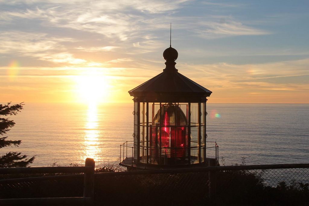
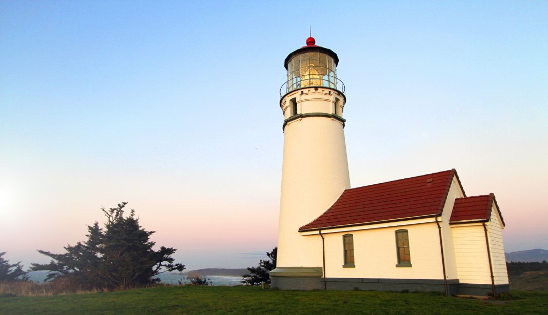
Cape Meares Lighthouse stands at Cape Meares State Scenic Viewpoint near Oceanside and Tillamook. Built in 1889 and first lit on January 1, 1890, it helped guide ships along Oregon's north coast.
At just 38 feet tall, Cape Meares is the shortest lighthouse on the Oregon Coast. Its brick tower is covered with iron plates and holds an impressive first order Fresnel lens that once produced alternating white light and red flashes.
Visitors can follow a short paved path from the main parking area to the lighthouse and surrounding viewpoints. When the lighthouse interior is open, small groups may be allowed into the tower.
In addition to its historical significance, the Cape Meares Lighthouse is known for its rich wildlife. Visitors can often spot various species of birds, seals, and even whales from the vantage point of the lighthouse.
The park is open year round, but lighthouse access is seasonal and can change because of staffing or maintenance. Check Oregon State Parks for current hours and parking requirements before visiting.
Directions: Cape Meares is located on the Three Capes Scenic Loop north of the village of Oceanside and approximately 10 miles west of Tillamook. From Highway 101 in Tillamook follow signs to Cape Meares. There is no charge to see the park or the lighthouse.
Yaquina Head Lighthouse
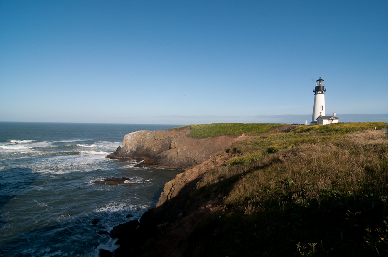
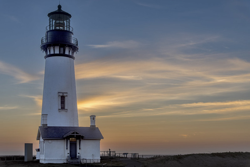
Located on a basalt headland just north of Newport, Yaquina Head Lighthouse was first lit in 1873 and was added to the National Register of Historic Places in 1993. At 93 feet tall, it is Oregon's tallest lighthouse.
Yaquina Head remains an active aid to navigation. A limited number of guided tower tours may be offered, and advance reservations are strongly recommended when available. Tour access depends on staffing, weather and safety conditions.
Building the lighthouse on the exposed headland was a major undertaking. The completed tower used brick and iron construction and was fitted with a first order Fresnel lens.
The light was first illuminated on August 20, 1873. For generations, it has helped mariners navigate the waters off Oregon's central coast.
The station has received numerous upgrades over the years, including electrification and automation, while retaining its historic character.
Yaquina Head Lighthouse is part of the Yaquina Head Outstanding Natural Area, which is managed by the Bureau of Land Management. Visitors can explore paved paths, tide pools, wildlife viewing areas and an interpretive center even when the lighthouse interior is closed.
Directions: Yaquina Head is located about 3 miles north of Newport in the Agate Beach area. Turn at the Yaquina Head Outstanding Natural Area and continue about a mile to the lighthouse.
Yaquina Bay Lighthouse
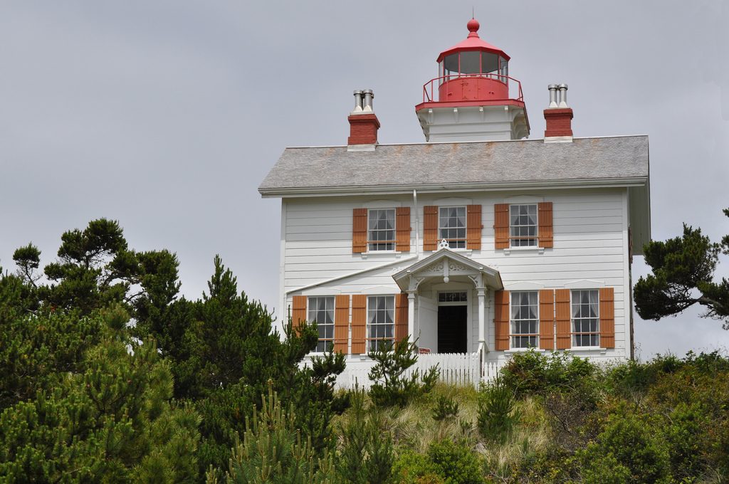
Yaquina Bay Lighthouse was first lit in 1871 and deactivated in 1874 after the more powerful Yaquina Head Lighthouse began operating nearby. Listed on the National Register of Historic Places in 1970, it was relit as a privately maintained aid to navigation in 1996.
Directions: Yaquina Bay Lighthouse sits in Yaquina Bay State Recreation Site at the north end of the Yaquina Bay Bridge in Newport. Exterior access and seasonal interior hours can change, so check Oregon State Parks for current visitor information.
Heceta Head Lighthouse
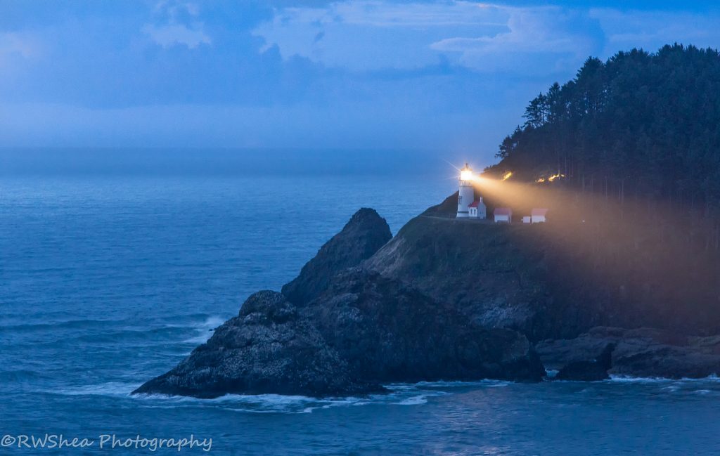
Heceta Head Lighthouse is one of the Oregon Coast's most recognizable landmarks. Its powerful light can be seen about 21 miles out to sea. The 56 foot tower was first illuminated in 1894, and the lighthouse was added to the National Register of Historic Places in 1978.
Directions: Off Highway 101 about 12 miles north of Florence. Turn at Heceta Head Lighthouse State Scenic Viewpoint and park at Devil's Elbow Beach, walk up a trail to the lighthouse, and then continue on about a quarter-mile to the lighthouse.
There is no separate admission charge to view the lighthouse, but a day use parking permit may be required. Tour availability and parking fees can change, so check Oregon State Parks before visiting.
Pelican Bay Lighthouse
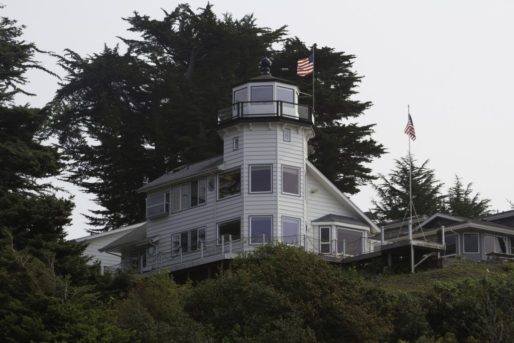
The Pelican Bay Light (or Port of Brookings Light) is a small, privately owned lighthouse in Brookings, Oregon, United States. It overlooks the Port of Brookings Harbor and the mouth of the Chetco River.
The house was built as an addition to an existing home, and Pelican Bay Light is maintained by the Cady family of Brookings, Oregon. First lit in 1999, this lighthouse stands 141 feet above sea level and can be viewed from Brookings Harbor.
Cady family members Bill and JoAnn Cady constructed the Pelican Bay Lighthouse as a private residence. Because this Oregon lighthouse is both a home and a functioning lighthouse, it is not open to the public, but it can be viewed from Highway 101.
Cleft Of The Rock Lighthouse
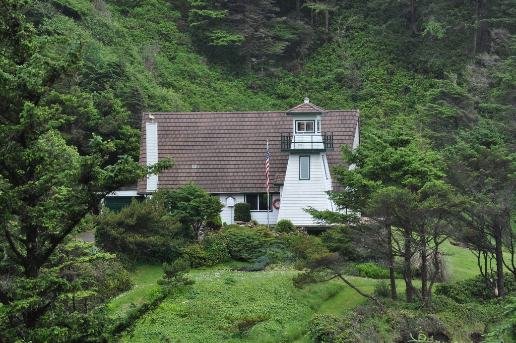
This privately maintained wooden lighthouse sits about a mile south of Yachats. Former Coast Guardsman, lighthouse keeper and author James A. Gibbs built it in 1976 as part of his home.
Cleft of the Rock Lighthouse is not open to the public. Completed in 1976, it was inspired by the design of British Columbia's Fiddle Reef Light and contains a private collection of lighthouse artifacts.
Directions: While it is closed to the public, visitors can see the home from Milepost 166 on Highway 101, about a mile and a half south of Yachats.
Related: Yachats, Oregon – “The Gem of the Oregon Coast” Travel Guide
Umpqua River Lighthouse
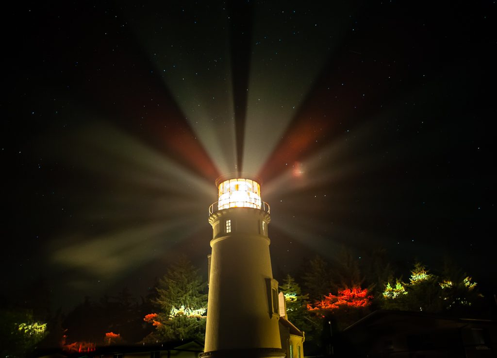
The first Umpqua River Lighthouse was built near the river's entrance and first lit in 1857. Erosion and flooding undermined that original structure, which was abandoned and collapsed in 1863.
Congress approved a replacement in 1888. Construction began at a higher site in 1891, and the present Umpqua River Lighthouse was first lit in 1894.
The current lighthouse stands 65 feet tall. Its tower is white with a green lantern and red roof, while its first order Fresnel lens produces distinctive red and white beams. The nearby museum interprets the lighthouse and local maritime history.
The light helped mariners navigate the dangerous Umpqua River bar, where shifting sands and strong currents made entering the river hazardous. The lighthouse remains an active aid to navigation.
Tours may be available through the Umpqua River Lighthouse Museum, but schedules and prices can change. Contact the museum or check current local visitor information before making a special trip.
Directions: Umpqua River Lighthouse is reached from Umpqua Lighthouse Loop near Winchester Bay, a short drive southwest of Reedsport. Follow signs from Highway 101 toward Umpqua Lighthouse State Park.
Cape Arago Lighthouse
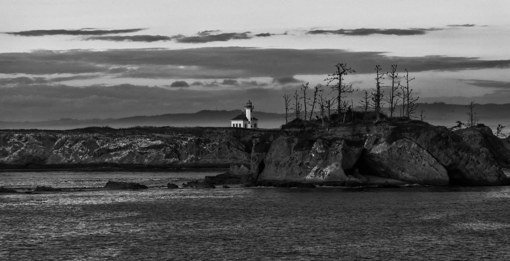
Cape Arago Lighthouse stands on Chief's Island near Charleston. Three different towers served this location, beginning with the first light in 1866. The surviving third tower was completed in 1934.
The station guided vessels approaching Coos Bay for generations. It was deactivated in 2006, and ownership of the lighthouse and island was transferred to the Confederated Tribes of Coos, Lower Umpqua and Siuslaw Indians in 2013. The lighthouse and island are not open to the public.
Viewing: Cape Arago Lighthouse is closed to public access. Distant views may be possible from designated viewpoints near Sunset Bay and Shore Acres, depending on vegetation and weather.
Coquille River Lighthouse
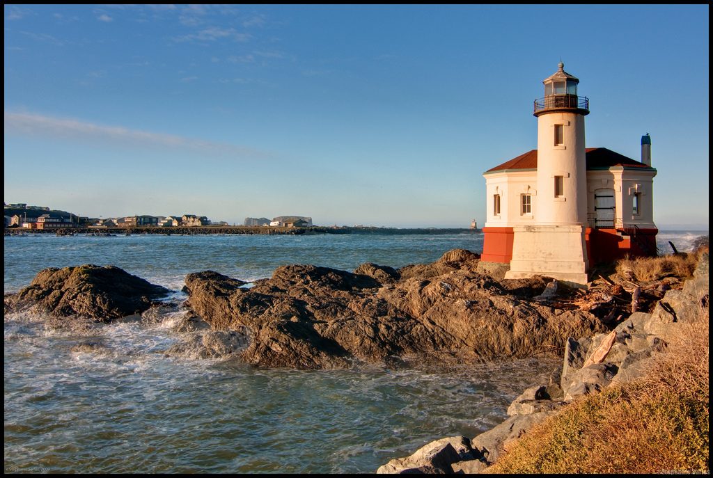
Coquille River Lighthouse, formerly known as Bandon Light, stands near Bandon at the mouth of the Coquille River. Oregon Parks and Recreation Department maintains the structure as part of Bullards Beach State Park.
First lit in 1896, the lighthouse guided mariners past shifting sandbars into the Coquille River and Bandon harbor. It was decommissioned in 1939 after an automated light was installed on the south jetty.
The signal room may open seasonally with volunteer hosts, but the tower is closed for safety. Check Bullards Beach State Park for current hours before visiting.
Directions: Within Bullards Beach State Park. Turn at the state park sign about 2 miles north of Bandon. Follow signs to the lighthouse.
READ MORE: Add Charming Bandon, Oregon to Your Travel List
Cape Blanco Lighthouse
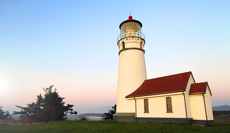
Cape Blanco Lighthouse was first lit in 1870 and is Oregon's oldest continuously operating lighthouse. It stands on a windswept headland near Port Orford with expansive views of the Pacific Ocean and opportunities to watch for migrating gray whales.
The lighthouse was built by the United States government, not the British government. Its tower rises above one of the westernmost headlands in Oregon and remains an active aid to navigation.
Access to the lighthouse and nearby Hughes House can change because of road conditions, restoration work, staffing and seasonal operations. Check Oregon State Parks for current tour information before visiting.
Directions: The Cape Blanco State Park turnoff is about four miles north of Port Orford. Follow park signs and current access notices toward the lighthouse and Hughes House.
Are the lighthouses in Oregon open to the public?
Public access varies widely. Some lighthouse grounds are open year round, while tower interiors may be seasonal, reservation only or closed for safety. Tillamook Rock, Pelican Bay, Cleft of the Rock and Cape Arago are not open to the public. Check the appropriate state park, federal agency or local museum before traveling.
Have you visited any of these Oregon lighthouses recently? Which one is your favorite?