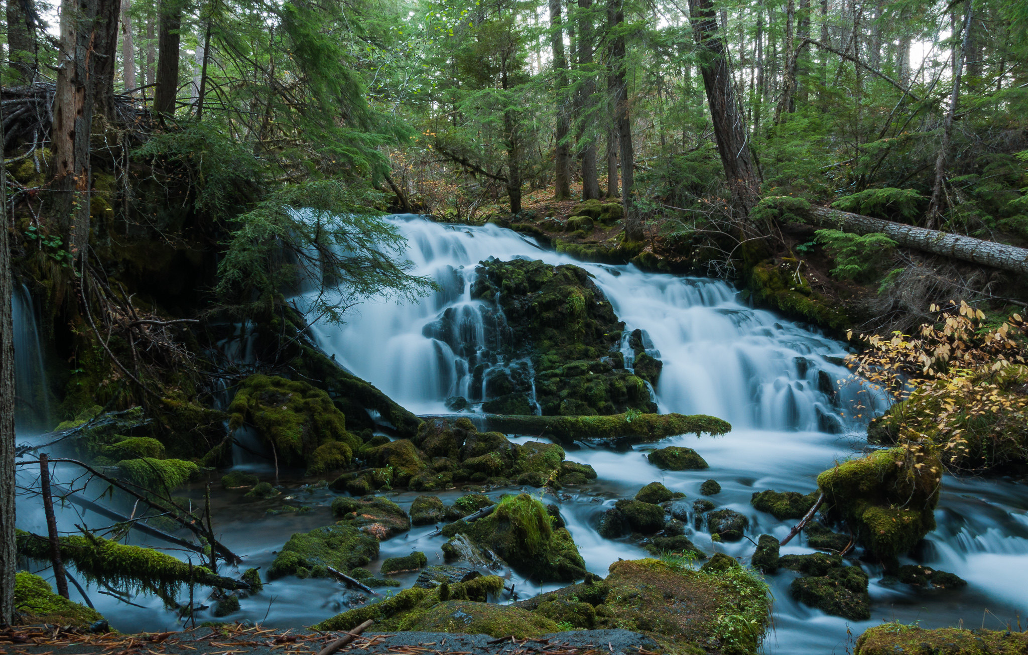
Pearsony Falls is the kind of Southern Oregon stop that surprises you by being exactly as easygoing as it looks. A short walk through cool forest near Prospect leads to a wide, mossy cascade on Mill Creek, and you can turn around there or keep going to the wonderfully oversized Avenue of the Boulders.
The quick answer is that the falls are about 0.2 mile from the trailhead, making the simplest visit roughly 0.4 mile round trip. The longer out-and-back to the Avenue of the Boulders is commonly mapped at about 1.2 to 1.3 miles. It is an easy outing to the waterfall, but the route becomes less forgiving near the gorge viewpoints, where kids and dogs need close supervision.
Pearsony Falls trail quick facts
| Location | Prospect, Jackson County, Southern Oregon |
|---|---|
| Waterfall | About 12 feet tall and roughly 25 feet wide, split into several mossy channels |
| Walk to the falls | About 0.4 mile round trip |
| Longer option | About 1.2 to 1.3 miles round trip to the Avenue of the Boulders viewpoint |
| Difficulty | Easy to the falls; use extra caution beyond it near uneven ground and exposed viewpoints |
| Trail surface | Short paved start, road crossing, then bark, dirt and old roadbed |
| Dogs | Allowed on leash |
| Facilities | Paved day-use parking and a basic trailhead restroom are commonly reported; verify current access before the drive |
| Best time | Year-round when conditions allow, with stronger flow in spring and good color in fall |
You may also see the name spelled Pearsoney Falls. Both spellings refer to this waterfall near Prospect, but “Pearsony Falls” is the form most travelers use when searching for directions and photos.
Why this little waterfall is worth stopping for
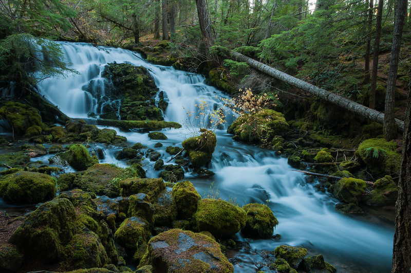
Pearsony Falls is not tall, and that is part of its charm. Mill Creek spreads across a low shelf and breaks around a small island of rock, trees and fallen wood. The result feels less like a dramatic overlook and more like a hidden green room where the creek is doing all the decorating.
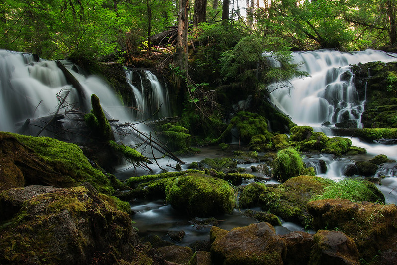
The waterfall is especially fun to photograph because its channels look different from each side. A wide-angle lens helps if you want the whole cascade in one frame, but the smaller details are just as good—water sliding around moss, bright leaves against dark rock and the crooked logs that make the scene feel wilder than its roadside location suggests.
Give yourself at least 30 to 45 minutes for a relaxed falls-only visit. An hour or two is better if you want to continue to the boulder viewpoint, take photos or simply sit quietly beside the creek without turning a tiny hike into a race.
How to hike to Pearsony Falls
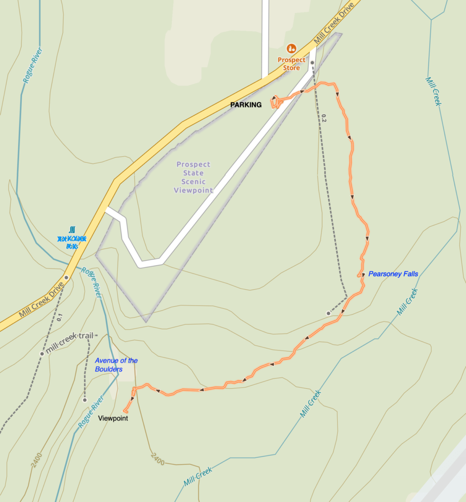
The trail begins at the day-use parking area off Mill Creek Drive in Prospect. Start near the restroom, follow the short paved path, cross the road carefully and continue downhill on the bark-and-dirt path. Old Douglas-firs shade much of the route, and Mill Creek stays close enough that you hear the water before the waterfall comes into view.
The falls are about 0.2 mile from the parking area. That makes this a useful choice for travelers who want a real forest-and-waterfall experience without committing to a long hike. The short distance does not make it fully accessible, however. The surface changes, there is a road crossing, and rain, roots, mud, snow or ice can make even this easy route challenging.
Keep going to the Avenue of the Boulders
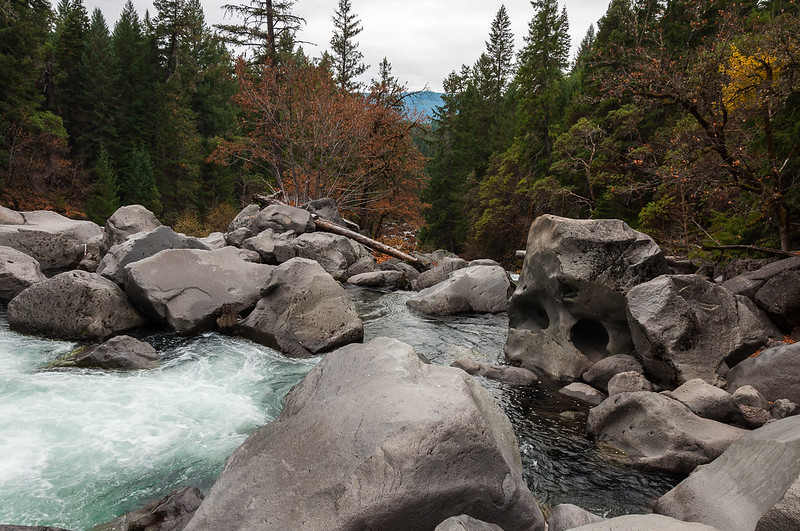
Turning around at Pearsony Falls is perfectly reasonable, but the longer walk adds the strangest part of the outing. Continue downhill toward a clifftop view of the Rogue River and the Avenue of the Boulders, where enormous rounded rocks fill the river corridor.
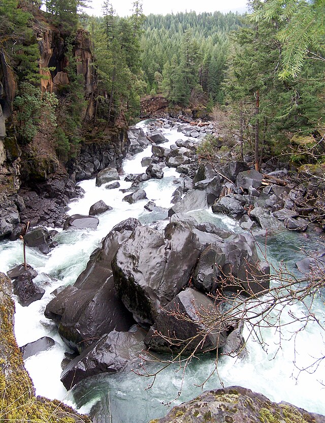
The landscape is tied to the volcanic history of Mount Mazama and Crater Lake. Eruptive material once buried this country; the Rogue River later exposed and smoothed the giant rocks. It is a good place to appreciate the scale of the geology from the established viewpoint, not a place to scramble onto wet boulders or drift toward an unguarded edge.
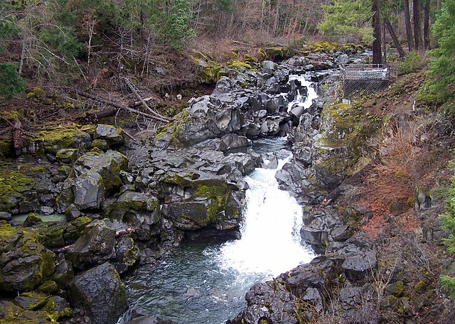
The established out-and-back to the viewpoint is generally described as easy, with roughly 165 to 196 feet of elevation change depending on the map used. Do not continue onto rough user paths along the gorge rim unless you understand the exposure. The easy family outing ends before those sketchier cliffside extensions begin.
Best time to visit Pearsony Falls
Spring usually brings the fullest-looking cascade, fresh green growth and wildflowers. Summer offers shade and an easy add-on to a Highway 62 road trip, though the smaller channel can lose water later in the season. Fall trades some flow for vine-maple color. Winter can be beautiful, but mud, snow and ice may change a simple stroll into a poor idea.
There is no single perfect month. Recent rain, snow, wildfire restrictions and storm damage matter more than the calendar. Check the forecast and road conditions on our Oregon TripCheck guide, then look for any local closure notice before you leave.
Is Pearsony Falls good for kids and dogs
For many families, yes. The waterfall itself is close, the first part of the trail is broad and the payoff comes quickly. Keep children beside you at the road crossing, around the creek and anywhere the route approaches the Rogue River gorge. Dogs should stay leashed, both for their safety and for other visitors.
Leave the water and boulders alone when they are slick or running hard. Cold current, wet rock and hidden drop-offs are a bad combination even when the surrounding trail feels gentle. Pack water, traction appropriate to the weather and a layer for the cooler shaded forest. In warm months, check for ticks after the hike.
Parking and directions
The parking area is off Mill Creek Drive in Prospect, across from the general-store side of town. It is easy to confuse this stop with the separate Mill Creek and Barr Creek Falls trailhead, so save the correct Pearsony Falls trailhead map before you lose service. From Medford, the drive is roughly an hour in normal conditions via Highway 62.
Parking arrangements, restroom availability, gates and trail conditions can change. Treat every old blog post—including this one—as trip-planning context rather than a live status board. A full tank, downloaded directions and a quick conditions check are smart in this part of Southern Oregon.
Make it a Southern Oregon waterfall day
Pearsony Falls works best as the easy, mossy stop in a larger Prospect-area day. Nearby Mill Creek Falls and Barr Creek Falls are taller and more dramatic, but their viewpoints involve more exposure and deserve more time. Use our Oregon Waterfalls Guide to compare them with other falls across the state, or browse the Oregon Hikes Guide when trail length and difficulty matter more than the waterfall alone.
If you are building a broader road trip, the Southern Oregon guide can help connect Prospect with other worthwhile stops without trying to cram the whole region into one day.
Pearsony Falls FAQ
How long is the hike to Pearsony Falls
The waterfall is about 0.2 mile from the parking area, or roughly 0.4 mile round trip. Continuing to the Avenue of the Boulders viewpoint makes the outing about 1.2 to 1.3 miles round trip.
Is Pearsony Falls an easy hike
Yes, the maintained route to the waterfall is short and generally rated easy. Bark, dirt, roots, mud, snow and ice can still affect footing, and the longer option approaches exposed gorge viewpoints.
Can kids visit Pearsony Falls
The short waterfall walk is commonly treated as family-friendly. Adults should keep children close at the road crossing, beside Mill Creek and near every drop-off on the longer route.
Are dogs allowed at Pearsony Falls
Dogs are commonly allowed on leash. Keep them under control near the creek, wildlife, other visitors and exposed terrain, and check posted rules when you arrive.
Is Pearsony Falls open year-round
The trail is generally described as a year-round destination when weather and access allow. Snow, ice, wildfire restrictions, storm damage or temporary maintenance can still affect a visit, so verify current conditions before driving.
Sources and responsible trip planning
Trail figures and visitor details were cross-checked against the Travel Medford Pearsony Falls overview and the Oregon Hikers field guide. Geological context comes from the U.S. Geological Survey’s Mount Mazama overview. Conditions change, so obey posted notices and follow the seven Leave No Trace principles.