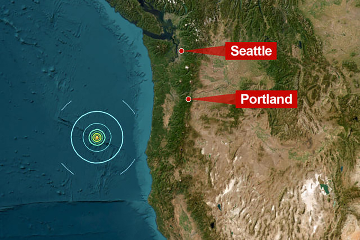
BANDON, Ore. — Oregon’s southern coast experienced a sizable 6.0-magnitude earthquake on Wednesday afternoon. The quake struck at approximately 1:15 p.m., with its epicenter located about 170 miles west of Bandon and 250 miles west-southwest of Salem, according to data from the U.S. Geological Survey (USGS).
Despite the quake's strength, it occurred far offshore and at a depth of about six miles, causing minimal impact to people or structures. The USGS classified the earthquake as “green,” indicating a low risk to life and property. No reports of injuries or damage have surfaced from nearby towns, including Bandon, where staff at the Best Western Inn at Face Rock confirmed that they didn’t feel the tremors.
The quake occurred along the Blanco Fracture Zone, an active fault system near the Juan de Fuca tectonic plate. This area is no stranger to seismic activity; however, earthquakes of this magnitude tend to be uncommon this far offshore. The Juan de Fuca plate is particularly significant in geological circles, as it’s involved in the complex dynamics of the Cascadia Subduction Zone — the very fault line experts have been monitoring for the anticipated “big one,” a megathrust earthquake that could shake the entire Pacific Northwest.
Fortunately, the U.S. National Tsunami Warning Center confirmed that Wednesday’s earthquake did not generate a tsunami threat. With no tsunami expected, coastal residents and businesses were able to breathe a sigh of relief.
In Southern California and other quake-prone regions, residents are familiar with seismic activity as part of life. But in Oregon, a 6.0 earthquake, even offshore, serves as a reminder of the powerful forces at play beneath our feet and the importance of being prepared for when the big one might eventually hit. Experts emphasize that while many of Oregon's earthquakes occur along offshore faults, the release of tension along the Cascadia Subduction Zone is what would likely trigger the more significant quake we’ve all heard about.
Initial measurements placed the quake’s magnitude at 6.1, though the USGS later revised it to 6.0, demonstrating how early assessments often evolve as more data is collected.
For those of us keeping an eye on tectonic activity, the real-time earthquake map available through the USGS remains a valuable tool for monitoring quakes across the Pacific Northwest. And while this offshore earthquake thankfully posed little risk, it is yet another reminder of the powerful geological forces shaping our beautiful state.
Stay tuned for any updates on this developing story, and check back with us as we continue to track earthquake activity in Oregon.


