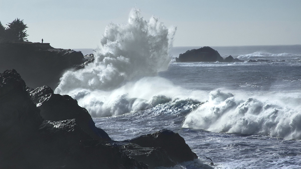
Oregon and southwest Washington are bracing for a dynamic and potentially dangerous combination of weather events as a powerful Pacific storm moves closer to the region. The National Weather Service (NWS) has issued a High Surf Warning, with massive 30-foot waves expected to slam the coastline on Monday, December 23, between 5 a.m. and 10 p.m. These hazardous conditions coincide with a rapidly intensifying "bomb cyclone" brewing over 700 miles offshore, creating a recipe for wild winter weather.
What Is a Bomb Cyclone?
The term "bomb cyclone" refers to a rapidly intensifying storm that experiences a significant drop in atmospheric pressure—at least 24 millibars in 24 hours. This storm system, while less intense than the historic November 19 storm (which hit a central pressure of 942 millibars), is forecast to bottom out at 963-969 millibars late Monday evening. Despite its distance from the coast, its effects will ripple across the Pacific Northwest, bringing fierce winds, heavy rain, and extreme surf.
High Surf Warning: Stay Off the Beaches
The NWS is urging everyone to avoid beaches and jetties in Oregon and southwest Washington during this period of abnormally high surf. Waves of this size pose a serious threat to life and property, with the potential to sweep people off jetties and into the frigid ocean. Additionally, high shoreline run-up, significant beach erosion, and property damage are likely.
“This will likely go down as some of the highest surf this winter, and that means dangerous conditions on Oregon and southwest Washington beaches today,” the NWS warned on social media. “Stay away from logs and debris, and keep your eyes on the waves. Your best bet is to keep a safe distance from beaches and jetties.”
The threat of sneaker waves adds to the danger, with sudden, large waves capable of rushing far up the beach without warning. Logs and other debris can be lifted and rolled by these waves, creating hazards that can injure or kill anyone in their path. For your safety, it’s best to admire the waves from a safe distance rather than venturing onto the shoreline.
Winds and Rain Add to Coastal Challenges
Along the Oregon coastline, southerly winds are expected to reach gusts of 35-45 mph by Monday evening, with isolated areas—particularly in the foothills of the Washington Cascades—experiencing gusts as high as 50-60 mph. These powerful winds could cause localized power outages and damage, especially in exposed areas.
In the Portland metro area, winds will be breezy, peaking at around 30 mph overnight, and will transition from easterly to southerly as the storm moves inland. Although Portland will avoid the brunt of the bomb cyclone’s winds, the region will experience heavy rainfall. Over the next five days, the metro area could see more than three inches of rain, making for a soggy lead-up to Christmas.
What You Need to Know
For residents of the Pacific Northwest, staying informed and prepared is key to navigating this storm safely. Here's what to keep in mind:
- Avoid beaches and jetties: The waves are not only mesmerizing but extremely dangerous. Keep your distance to avoid injury or worse.
- Secure loose outdoor items: Strong winds along the coast and in some inland areas could cause damage to unsecured objects.
- Stay off the roads during peak weather: Heavy rain could lead to localized flooding, and high winds may result in fallen trees or power lines.
- Plan for power outages: Coastal communities, in particular, may experience disruptions to electricity.
A Reminder of Nature’s Power
This storm serves as a reminder of the dynamic and often unpredictable nature of winter weather in the Pacific Northwest. Whether you’re nestled indoors in Portland, braving the winds along the coast, or simply watching the dramatic surf from a safe distance, exercise caution and respect the power of Mother Nature. Stay safe, and keep an eye on the forecast as the storm unfolds.

