Winter in Oregon is usually defined by momentum. Snow builds steadily through December and January, storms reinforce one another, and by February the mountains are locked into a rhythm that carries them through spring. This year, that rhythm never materialized.
As February begins, Oregon’s snowpack sits at historically low levels, placing this winter among the weakest starts in decades. On Mount Hood, snow water equivalent readings as of Feb. 1 ranked as the lowest seen in years, with some measurement sites reporting conditions that rival or exceed the worst seasons on record. Across other parts of the state, including Central Oregon and southern Cascade basins, snow water equivalents were also near record lows for early February.
This is not a matter of being slightly below average. In past challenging winters such as 2015, Oregon entered February with more snowpack than it has now in several key basins. Even during recent inconsistent seasons, January storms typically provided enough cold snowfall to establish a base. This winter failed to do even that.
The primary culprit has been a persistent ridge of high pressure that parked itself over the Pacific Northwest for much of January. That ridge blocked storm systems, pushed temperatures well above normal, and caused precipitation that did arrive to fall as rain rather than snow. January ended significantly drier than normal in Portland, and the same pattern extended into the mountains, where repeated warm spells erased snowfall almost as quickly as it accumulated.
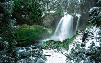
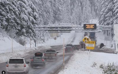
On Mount Hood, the impacts have been impossible to ignore. Ski areas that usually rely on January to build depth and open terrain instead faced repeated setbacks. Timberline leaned heavily on snowmaking and limited offerings, while Meadows and Ski Bowl dealt with thin coverage, exposed hazards, and frequent operational adjustments. Brief snow events offered hope, but those inches were quickly lost to melting as warm air surged back in.
Further south, Willamette Pass has endured one of its most difficult winters in recent memory. Without the benefit of extreme elevation, the resort depends on consistent cold storms to maintain coverage. Instead, warm systems repeatedly raised snow levels, leaving slopes thin and fragile during what is typically peak season.
Central Oregon has not been immune. Mt. Bachelor, known for reliability and long seasons, has struggled to hold snowpack as storm after storm arrived too warm to deliver lasting accumulation. Snow that should have refreshed the upper mountain instead compacted or melted, pushing conditions closer to early-season footing well into midwinter.
Even when Mount Hood resorts picked up a few additional inches of snow over a recent weekend, it was barely enough to keep pace with ongoing melt. Those modest gains were quickly threatened as another strong ridge of high pressure rebuilt over the region, bringing renewed warmth and accelerating snow loss once again.
The concern now is timing. While there is still technically time for recovery, the window narrows with each passing week. February and early March are critical for rebuilding snowpack, and the later the shift arrives, the harder it becomes to make up ground lost earlier in the season.
There is, however, a growing sense of cautious optimism. Forecast models are increasingly aligned in showing the high-pressure ridge weakening and breaking down. A transition toward cooler and wetter weather is expected to begin during the second half of Super Bowl weekend and extend beyond. If that shift holds, colder systems could finally move into the Pacific Northwest, lowering snow levels and allowing precipitation to accumulate as snow rather than rain.
For skiers, that could mean the first real chance this season for sustained mountain snowfall. For water managers and communities downstream, it could help slow snowpack losses and begin rebuilding the natural reservoir Oregon relies on through spring and summer. The key will be persistence. One storm will not fix this winter, but a series of cold systems could stabilize conditions and reduce the severity of impacts later in the year.
Even so, expectations remain tempered. The most realistic outcome is not a return to normal, but damage control. Stabilizing snowpack, improving mountain conditions, and preventing further losses may be the best-case scenario after such a poor start.
This winter will likely be remembered not just for its lack of snow, but for how quickly it exposed the fragility of Oregon’s seasonal balance. The mountains are still waiting, and while the door to recovery has not yet closed, the margin for error has nearly disappeared.