The West Coast is bracing for a powerful bomb cyclone that promises to deliver hurricane-force winds, torrential rain, and feet of snow to Oregon, Northern California, and Washington. This rare weather event is set to unleash its fury beginning Tuesday, November 19, and could have far-reaching impacts, particularly for Oregonians navigating through an already active weather season.
What is a Bomb Cyclone?
A bomb cyclone, also known as "bombogenesis," occurs when a storm’s central pressure drops by at least 24 millibars within 24 hours. This rapid intensification leads to an exceptionally strong storm, often accompanied by extreme winds and heavy precipitation. The storm headed for the West Coast is expected to surpass the minimum threshold for bombogenesis, with forecast models predicting a staggering drop of 50-60 millibars, plunging the system below 950 millibars by Tuesday night.
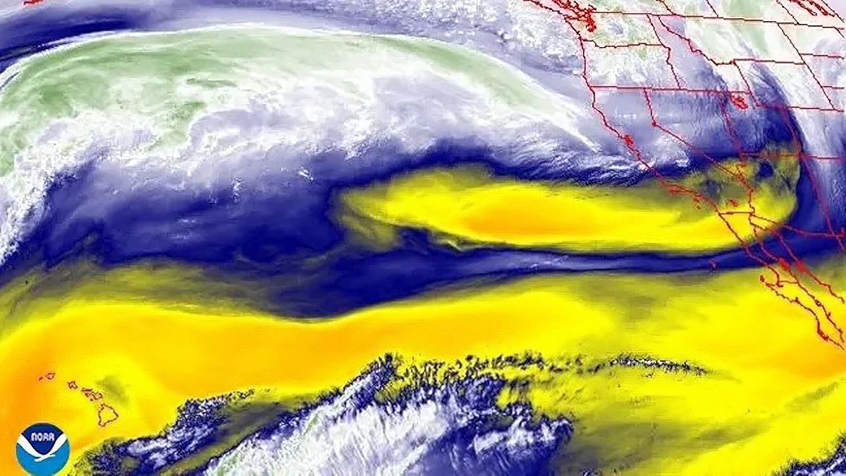
This bomb cyclone will also tap into an atmospheric river—a stream of moisture originating from the tropics—bringing substantial rain, snow, and wind to the region.
Oregon’s Forecast: What to Expect

While the Pacific Northwest is no stranger to stormy weather, this event stands out due to its intensity and potential impacts. Here's what Oregonians should prepare for:
High Winds
- Coastal areas and the Willamette Valley could experience gusts up to 70 mph, with sustained winds of 30-40 mph in some locations.
- Inland areas like Eugene, Salem, and Portland may see gusts ranging from 40-50 mph.
- The Columbia Gorge and Cascade foothills may encounter rare "mountain wave" effects, where gusts could surge to 60 mph or higher in localized areas, potentially causing travel disruptions and power outages.
Heavy Rainfall
- Southwest Oregon, including areas like Medford and the Rogue Valley, is expected to bear the brunt of the atmospheric river, with rain totals exceeding 7 inches in some locations by Thursday.
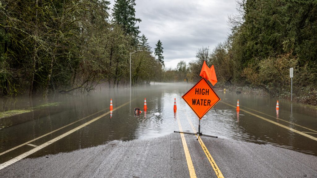
- Flooding risks are elevated, especially in low-lying areas and along rivers, as the ground is already saturated from previous storms.
- Northern Oregon may see slightly less rainfall, with 2-4 inches expected across the Portland metro area and surrounding regions through midweek.
Mountain Snow
- The Cascades are set to receive over 2 feet of snow above 3,500 feet, with some higher elevations seeing totals closer to 3 feet.
- Resorts like Mt. Hood Meadows and Timberline Lodge are celebrating one of the earliest and most substantial starts to ski season in decades, with snowpack levels already at midwinter norms.
- Travelers through mountain passes, including Government Camp and Santiam Pass, should anticipate dangerous conditions with heavy snow, ice, and limited visibility.
Regional Impacts Beyond Oregon
A massive "bomb cyclone" is set to explode off the U.S. West Coast with hurricane force winds, flooding rains, and enormous mountain snow from Category 5 atmospheric river.
— Ryan Maue (@RyanMaue) November 18, 2024
Central pressure will fall almost 70 mb / 24 hours reaching 942 mb -- similar to Category 4 hurricane. pic.twitter.com/lZEKOr9fNb
Northern California
- Areas from Eureka to the San Francisco Bay will see some of the heaviest impacts, including rain rates of 2-4 inches per day and gusts up to 70 mph in exposed areas.
- Mountains in Northern California could see up to 3 feet of snow, with dangerous road conditions likely in the Sierra Nevada.
Washington State
- Winds will hit hard in coastal regions and through the Strait of Juan de Fuca, with gusts near 65 mph expected.
- Lowlands, including Seattle and Bellingham, will experience sustained winds around 35 mph, with rain totals nearing 2-3 inches through Thursday.
Key Hazards to Watch For
Flooding
While Oregon is not expected to see the extreme flooding predicted in Northern California, localized river flooding and flash flooding are possible. Residents in low-lying or flood-prone areas should stay alert for potential evacuation orders.
Mudslides
The combination of heavy rain and steep terrain increases the risk of landslides and mudslides, particularly in southern Oregon and along the coast.
Power Outages
High winds are likely to down trees and power lines, especially in coastal and rural areas. Residents should prepare for potential outages by having flashlights, batteries, and backup chargers ready.
Travel Disruptions
Roads through the Cascades and Coast Range will be treacherous due to snow, ice, and fallen debris. Airline delays are also expected across the Pacific Northwest as the storm intensifies.
Preparing for the Bomb Cyclone
Oregonians should take steps now to prepare for the storm's arrival:
- Secure Outdoor Items: High winds can turn patio furniture, trampolines, and loose debris into hazards.
- Stock Emergency Supplies: Have enough food, water, and medication for several days. Include extra batteries and flashlights in case of power outages.
- Plan for Travel Delays: Avoid unnecessary travel during the storm, especially in mountainous areas.
- Stay Informed: Monitor updates from the National Weather Service and local news outlets for the latest forecasts and warnings.
A Look Ahead
After the storm peaks midweek, its impacts are expected to linger. Additional storm systems could follow, keeping the Pacific Northwest in an active weather pattern through Thanksgiving. Fortunately, this storm is not expected to bring a destructive atmospheric river to the Cascade snowpack, preserving what may be one of the best early ski seasons in over two decades.
This bomb cyclone is shaping up to be one of the most significant weather events of the season, with widespread impacts across Oregon and neighboring states. Whether you're in the mountains, valleys, or along the coast, preparation is key to weathering the storm safely.
Stay safe, stay informed, and check back with That Oregon Life for updates as this storm unfolds.


