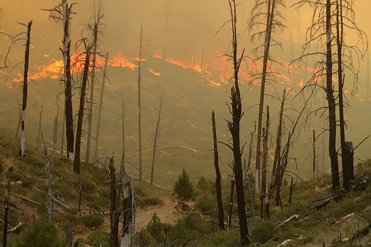
A red flag warning has been issued for the Willamette Valley and the length of Western Oregon due to the increased risk of thunderstorms and lightning igniting new wildfires. The National Weather Service cautioned on Tuesday that "frequent lightning and critically dry fuels may result in numerous fire starts," adding that "thunderstorm outflow winds may result in erratic fire spread."
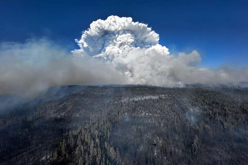
Red flag warnings signify conditions conducive to the ignition and rapid spread of wildfires, though they do not indicate that a fire is imminent. The warning for northwest Oregon remains in effect from 5 p.m. on Tuesday until 8 a.m. Wednesday. This alert comes as Oregon grapples with numerous large wildfires, particularly on the east side of the state.
Wildfire Surge in Oregon
This year, Oregon is experiencing a significant increase in wildfire activity. The Northwest Interagency Coordination Center reports eight large wildfires currently burning across the state, with the largest exceeding 100,000 acres. To date, there have been 22 large wildfires in Oregon, a stark increase from the 12 recorded by mid-July last year. Last week's heat wave, which saw temperatures soar to 110 degrees in some regions, has been a major contributing factor, according to Oregon Department of Forestry spokesperson Andy Dwyer. He also noted that lower humidity levels and high winds have exacerbated the situation.
Current Fire Situations
Do you love Oregon?
Sign up for monthly emails full of local travel inspiration and fun trip ideas. In each newsletter we'll share upcoming events, new things to do, hot dining spots and great travel ideas.
One of the most significant fires, the “megafire,” also known as the Cow Valley Fire, began on July 11, nine miles east of Ironside, and as of July 16, it has spread over approximately 133,408 acres with 16% containment, according to the Oregon State Fire Marshal (OSFM). Over 300 firefighters are working to control the blaze. Crews have been successful in strengthening primary firelines, and aviation support has helped with water and fire-retardant drops. Due to the reduced threat to structures, the Oregon State Fire Marshal’s Red Team is demobilizing its incident management team, though several hundred wildland firefighters remain assigned to the fire. The Oregon State Fire Marshal (OSFM) has confirmed that the Cow Valley Fire was human-caused and is presently the subject of an ongoing investigation.
Meanwhile, the Falls Fire in Grant and Harney Counties has expanded to 64,225 acres and remains uncontained. More than 600 personnel are engaged in battling this fire, which has forced the closure of several areas in the Malheur National Forest, including Emigrant Creek Campground, Falls Campground, Yellowjacket Campground, and Delintment Lake Campground. Level 1, 2, and 3 evacuation orders are in place, and the Harney County Sheriff’s evacuation map provides the most accurate notices.
The Lone Rock Fire in Gilliam County has grown to over 64,000 acres with 1% containment. Level 3 "go now" evacuation orders were issued for this fire east of Condon. For the latest evacuation information, residents are advised to consult the evacuation map provided by local authorities.
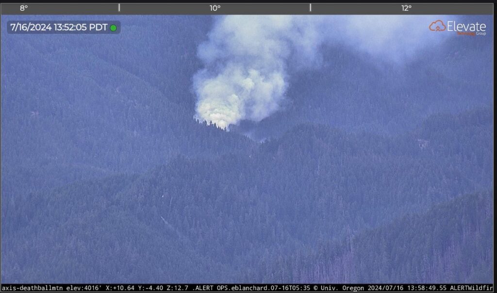
A new wildfire has been reported in the Blue River area east of Eugene and north of Rainbow. This fire appears well established on images from a remote camera on Deathball Mountain, operated by the Oregon Hazards Lab at the University of Oregon. The fire is burning near Willamette National Forest Road 15, north of Blue River Reservoir. A firefighting helicopter and fire crews are heading towards the blaze, according to emergency radio traffic and the wildfire app Watch Duty.
The Larch Creek Fire near Dufur has shown some progress, reaching 18,684 acres with 16% containment. Despite these efforts, the state’s firefighting resources are stretched thin, with out-of-state firefighters being brought in to assist. The Oregon Department of Forestry has deployed over 58 firefighters from several states, including New Mexico, Idaho, and Florida. Hit this link to see the evacuation map.
Governor's Response and Air Quality Concerns
Governor Tina Kotek invoked the Emergency Conflagration Act for the Falls and Lone Rock fires, allowing for additional resources to be allocated for life, safety, and structural fire protection. In response to the growing crisis, the Oregon State Fire Marshal and the Oregon Department of Forestry are collaborating to manage the fires and protect residents.
The air quality in eastern Oregon has deteriorated due to wildfire smoke, prompting the Department of Environmental Quality to issue air quality advisories for six counties, including Baker, Grant, and Morrow. Intermittent smoke is expected in Union and Wallowa counties, with air quality likely to worsen overnight.
Public Safety and Preparedness
As the wildfire season intensifies, officials urge the public to remain vigilant and prepared. Evacuation orders have been issued in several areas, and residents are advised to stay informed through local authorities. The increased frequency of human-caused fires highlights the need for caution in fire-prone areas, with activities such as driving and barbecuing posing potential risks.
The Bodenhamer Road Fire, which brought evacuations near the Eugene Airport on Monday, was mapped at an estimated 115 acres. Although evacuation warnings have been lifted, the fire sent plumes of smoke billowing into the sky, alarming nearby residents. Fire crews managed to control the blaze, which had quickly spread from the intersection of Bodenhamer Road and Green Hill Road in Lane County.
Oregon’s wildfire crisis underscores the urgent need for comprehensive fire management strategies and public awareness to mitigate the impact of these devastating fires. The state continues to mobilize resources and personnel to combat the fires and protect communities across Oregon.

