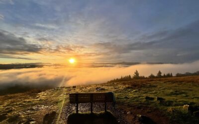
The Elkhorn Scenic Byway offers up one of Oregon’s most breathtaking drives, especially in mid-October when fall colors hit their peak. This 106 mile loop winds through the rugged Elkhorn Mountains, taking you past ghost towns, alpine lakes, and through Northeast Oregon's gold rush history. With changing leaves in autumn painting the landscape in vibrant shades of yellow and orange, it’s a perfect time to explore the beauty of northeastern Oregon.
Drive The Rugged And Beautiful Elkhorn Scenic Byway In Northeast Oregon This Fall
This is more than just a drive, it's an experience, though you can certainly make a day of driving the byway if you want to. To give yourself time to explore all the area has to offer, we recommend planning to spend a couple of days on this journey. If you're going in summer months, there's a wealth of places to camp along the byway. In the fall, we recommend exploring the byway one day, staying overnight in Baker City, and then taking an additional day to explore the nearby historical sites of the Oregon trail.
Start Your Journey Down The Elkhorn Scenic Byway In Baker City
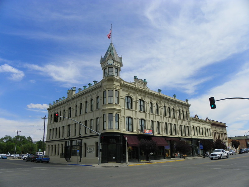
Your journey down the Elkhorn Scenic Byway will begin and end in Baker City, where travelers can soak in the historic charm of this once-thriving mining hub. Downtown Baker City is a great starting point, home to the stunningly restored 1889 Geiser Grand Hotel, which is a symbol of the town's golden past.
While in Baker City you may also want to check out the Baker Heritage Museum.
Off Byway Tip: If you're planning on spending an extra day in Baker City, there's a wealth of Oregon Trail sites to explore nearby! While they're not on the Elkhorn Scenic Byway, they are definitely worth visiting. From Baker City, head out highway 86 to check out the National Historic Oregon Trail Interpretive Center, the Oregon Trail Trailhead (a trail to see some wagon ruts), the Oregon Trail Centennial Obelisk, and the Historical Marker Of The Lone Tree Of The Oregon Trail. See our embedded map at the top of the article and look for the purple markers for nearby sites that don't sit right on the Elkhorn Scenic Byway.
Do you love Oregon?
Sign up for monthly emails full of local travel inspiration and fun trip ideas. In each newsletter we'll share upcoming events, new things to do, hot dining spots and great travel ideas.
Head South On Highway 7 From Downtown Baker City
As you head out on the Elkhorn Scenic Byway, the scenery quickly shifts from ranchlands to the basalt cliffs of Blue Canyon, with the Powder River snaking through pine forests and grasslands.
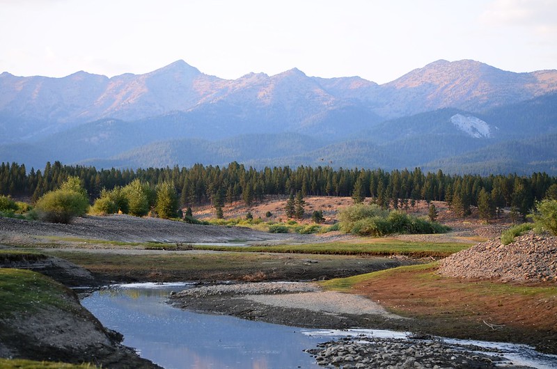
A highlight of this part of the route is Phillips Lake, formed by Mason Dam on the Powder River. Calm waters and hiking trails make it a perfect spot for a picnic, fishing, or just stretching your legs. The North Shore Trail hugs the lakeside, offering plenty of opportunities for hiking, biking, and horseback riding.
Next up on the byway you can choose to stop at the Powder River Tailing's Interpretive Site. This is a quick roadside stop where you can find a display that talks about the area's past gold dredging activity and the unique ecosystem that the tailings at this site formed.
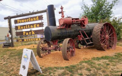
Check Out The McEwen Train Depot And Museum
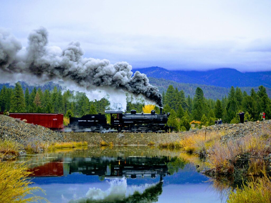
Just down the road from the interpretive site is the McEwen Depot & Museum. If you plan on taking the historic train, which runs between this site and Sumpter, you'll need to plan ahead and buy tickets online in advance as the train only runs on certain days and times. This will also add time to your tour of the scenic byway.
Take Note: Not long after the McEwen Depot, Highway 7 turns south and the scenic byway gets off of Highway 7 and turns north onto Highway 410.
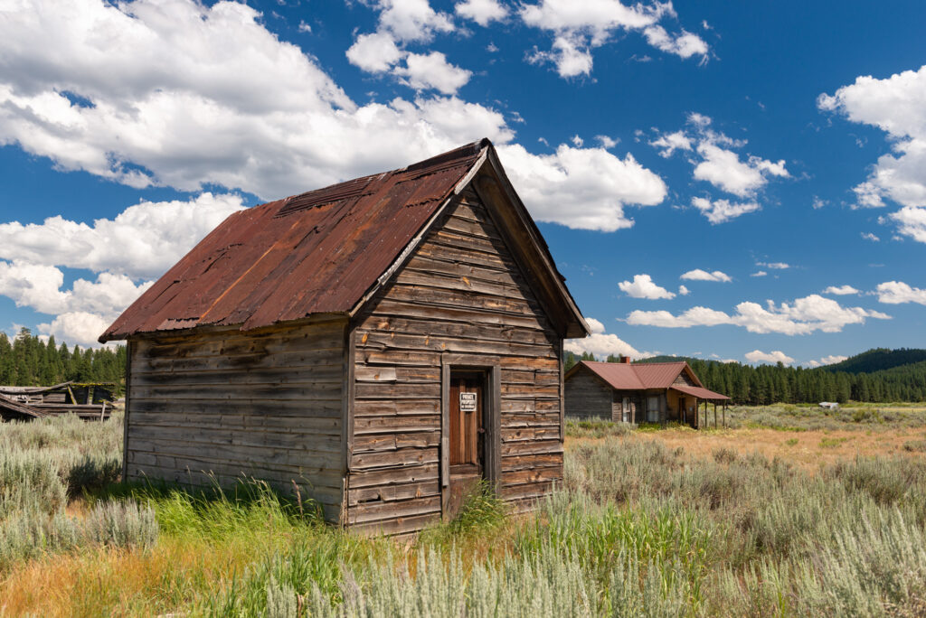
Off Byway Tip: If you have the time, you can continue down Highway 7 to the ghost town of Whitney. From the intersection of Highway 7 and Highway 410, it's a 12 minute (9.8 mile drive).
Head Up To The Historic Mining Town Of Sumpter
Continuing along the byway on Highway 410, you'll encounter more reminders of the area's rich mining history. The town of Sumpter, once bustling with miners and saloons, now feels like taking a step back in time.
The massive Sumpter Valley Dredge, a relic of the gold mining boom, still sits in town and serves as a fascinating museum piece for visitors.
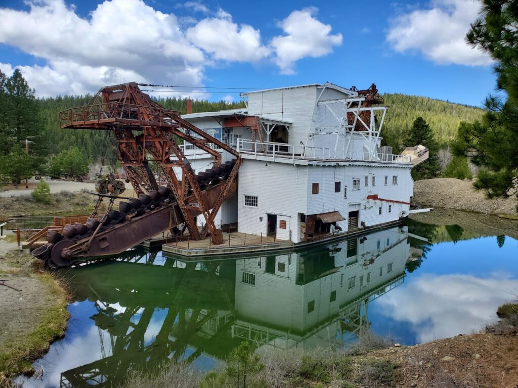
You'll also find the other end of the historic Sumpter Valley Railroad in Sumpter.
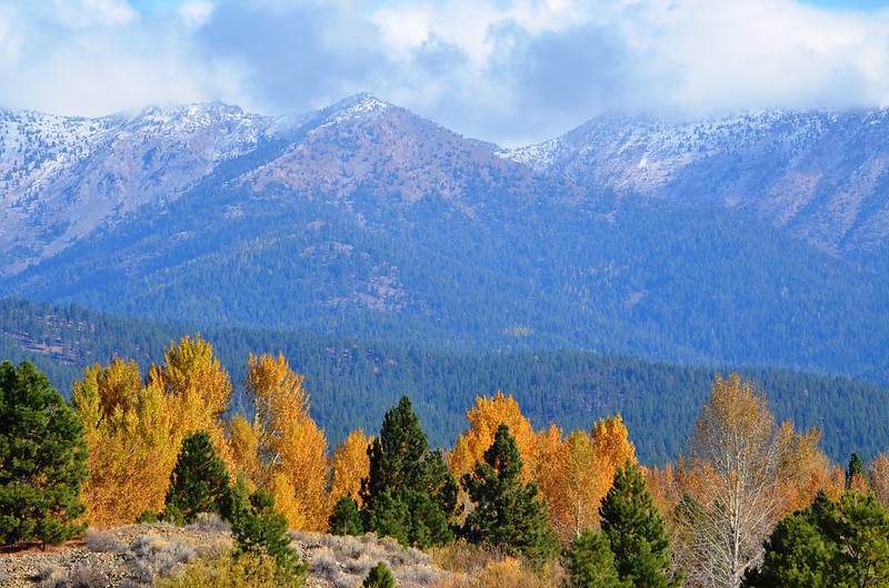
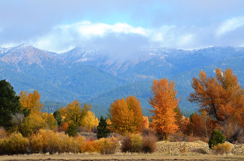
As the byway climbs into the Elkhorn Mountains, the fall foliage really comes alive. Western larch trees here are a major highlight in fall.
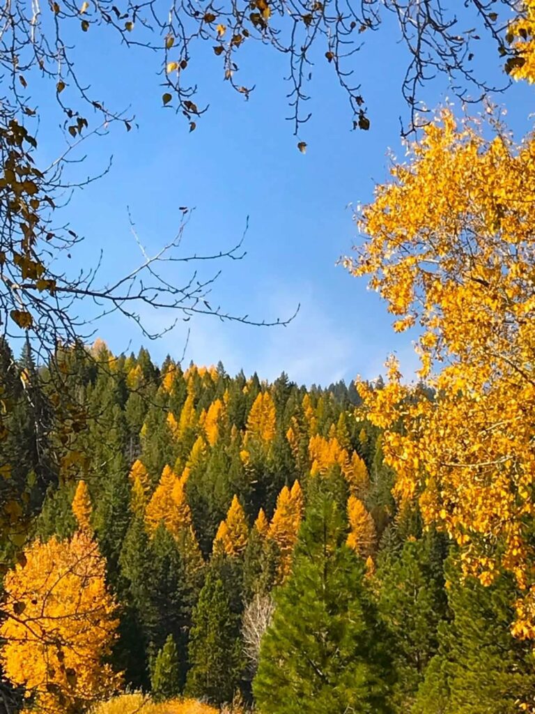
Their needles turn a brilliant golden yellow as the seasons change, creating stunning contrasts against the deep greens of the surrounding pines.
Visit The Ghost Town Of Granite And Check Out Ah Hee Diggings
You'll pass through the ghost town of Granite, and soon after come to the Ah Hee Diggings Interpretive Site. This roadside display talks about Chinese miners in the late 1800's that mined this spot.
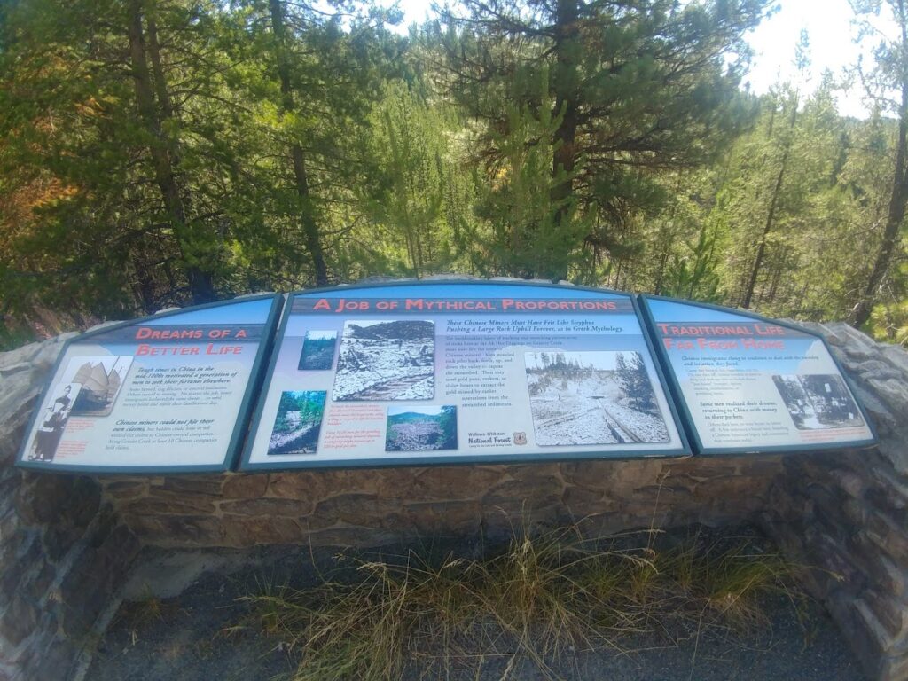
Chinese miners were not allowed to file their own claims, but claims were often leased out or sold to Chinese owned companies. Their efforts at this site using gold pans, sluice boxes, and rockers was truly impressive considering the amount of rock they moved.
Hike The North Fork John Day Trail
After this you'll taking a winding and scenic drive up to the North Fork John Day Trailhead. This 22.9 mile trail follows the wild and scenic north fork of the John Day River. This trail, once established by miners, is considered challenging and opens in late May each year.
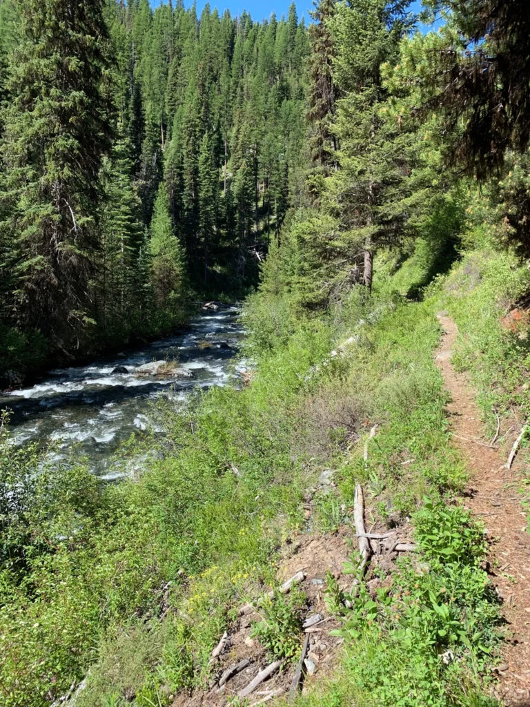
The trail can be brambly and rugged at times, but offers great views of the river and will lead you past old miners cabins and long piles of rocks that resulted from mining in the area. Hiking in this rugged backcountry really gives you a look into just how harsh conditions were for men out gold panning in the rivers and creeks of the region.
Take a gold pan with you and maybe you'll get lucky and find some gold flecks in the river. We highly recommend reading about the history of this trail and what you'll find along the way.
Note: The North Fork John Day Trailhead sits on NF-052, but to continue on the scenic byway you'll need to head east on NFD-73. This portion of the road is full of twists and turns, but leads to numerous trailheads and follows along the North Fork of the John Day.
Stop By Anthony Lakes And Hike The Elkhorn Crest Trail
Your next stop is the Anthony Lakes Campground and then the Elkhorn Crest Trailhead. At the campground you'll get good views of Gunsight Peak and the Elkhorn Mountains. You can canoe, fish, go hiking, take some pictures, or just sit back and relax for a while. If you plan on camping, make sure to make a reservation ahead of time. This campground is only open from July - September, so if you're traveling the scenic byway later in fall, you'll need to make other arrangements.
The Elkhorn Crest Trail is gorgeous. It's the highest trail in the Blue Mountains and was established as a National Recreation Trail in the late seventies.
From the trail you'll be able to take in sweeping views of Baker Valley, spy the Wallowa's in the distance, and get great views of the Blue Mountains. Craggy peaks, herds of elk, and six high mountain lakes are also popular sights along the trail. This trail is considered difficult, and there is scarce drinking water available. All water on the trail will need to be treated. Note: There's a five dollar parking fee for vehicles parking at the Elkhorn Crest Trailhead.
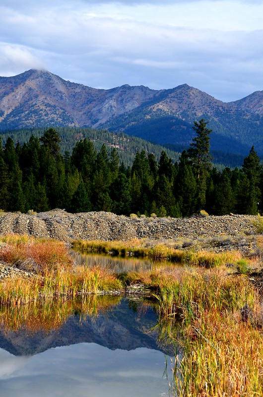
Another great spot along the byway to take in fall color is along Forest Road 73 near the North Powder River. Here, you’ll find vibrant cottonwood trees lining the river, adding splashes of bright yellow amongst the rugged scenery.
Once you make your way back down out of the mountains, stop by the Eastern Oregon Museum in Haines, then travel back down Highway 30 to Baker City. Your journey on the Elkhorn Scenic Byway is now complete. Check out page 46 of the Oregon Scenic Byway brochure for more information on the byway.
Is the Elkhorn Scenic Byway open in winter? It's important to note that while this drive is magical in the fall, the route isn't plowed after the snow arrives, making it impassable in winter. Plan to visit before the snow hits to fully enjoy the splendor of this autumn wonderland.
How long does it take to travel the entire scenic byway? If you're planning to just drive it, and not make any stops, plan on five to six hours of driving. We recommend starting out from Baker City early in the morning.
Tip: Make sure to start your journey with a full tank of gas, and to gas up whenever possible. Take plenty of water and snacks with you (you might even want to pack a full picnic lunch and a full picnic dinner as well). You may want to bring a camera and binoculars.
Tip: Many of the museums have a fee associated with visiting, so plan ahead for the places you'd like to visit. You may also want to grab breakfast or dinner in Baker City, so bring funds for that as well.